Bedwell Lake hike
View Photos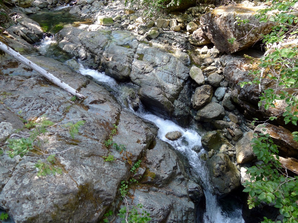
Bedwell Lake hike
Difficulty Rating:
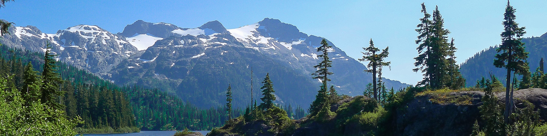
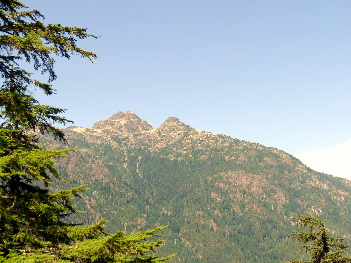
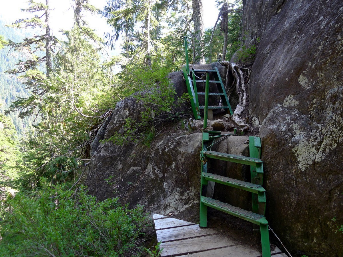
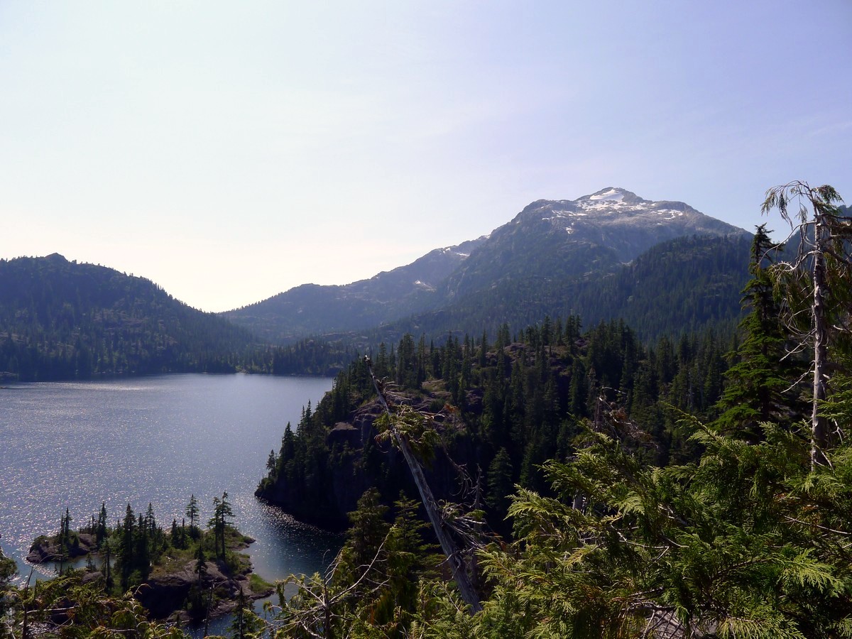
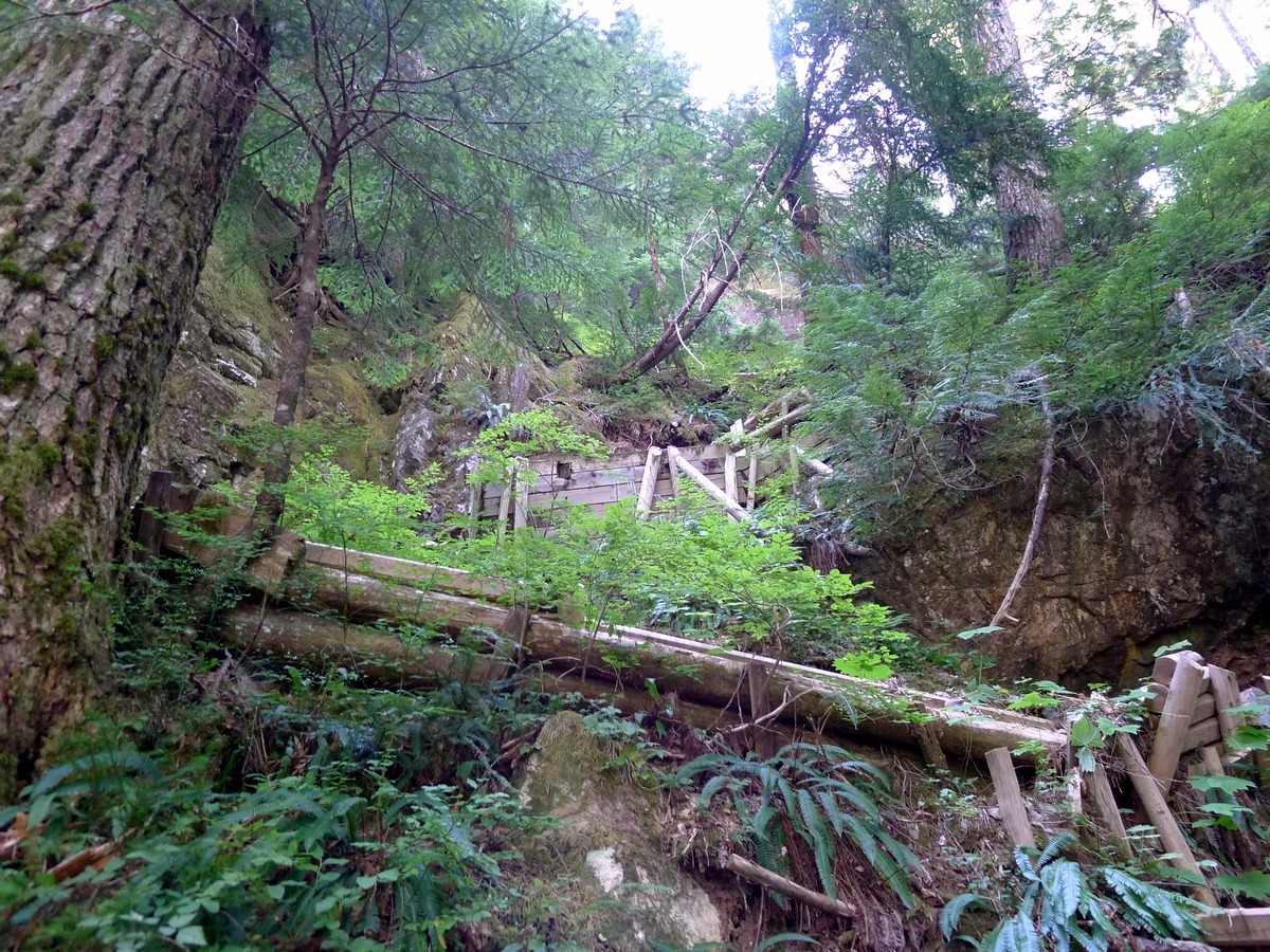
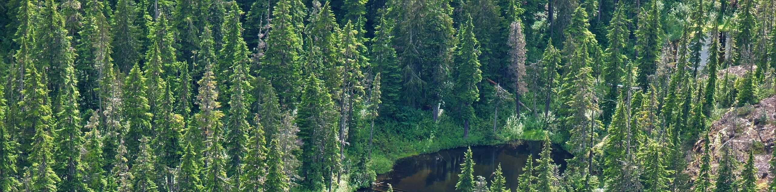
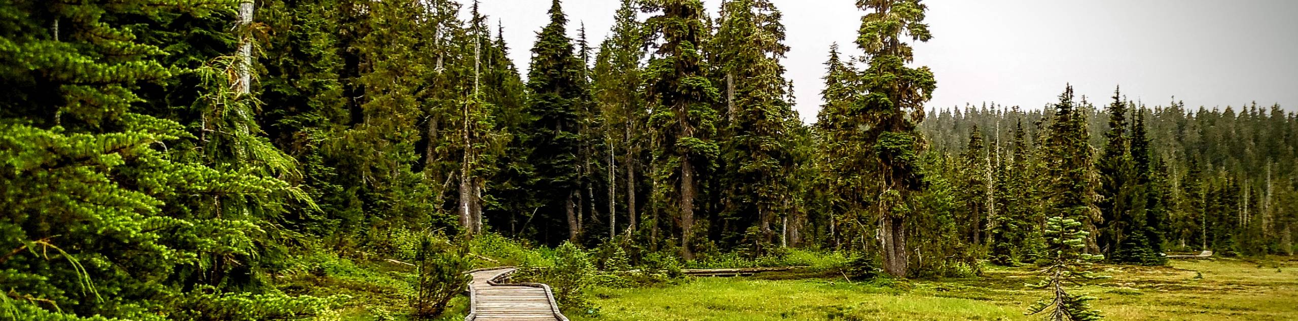
The hike to Bedwell Lake is one of the best maintained trails in Strathcona Provincial Park. The hike up to Baby Bedwell and onto Bedwell Lakes is made easier by the highly engineered bridges, staircases and boardwalks. The views of Big Interior Peak and Mt Tom Taylor amidst the stunning ambiance of Bedwell Lakes is nothing short of fantastic. This is a great hike!
Getting there
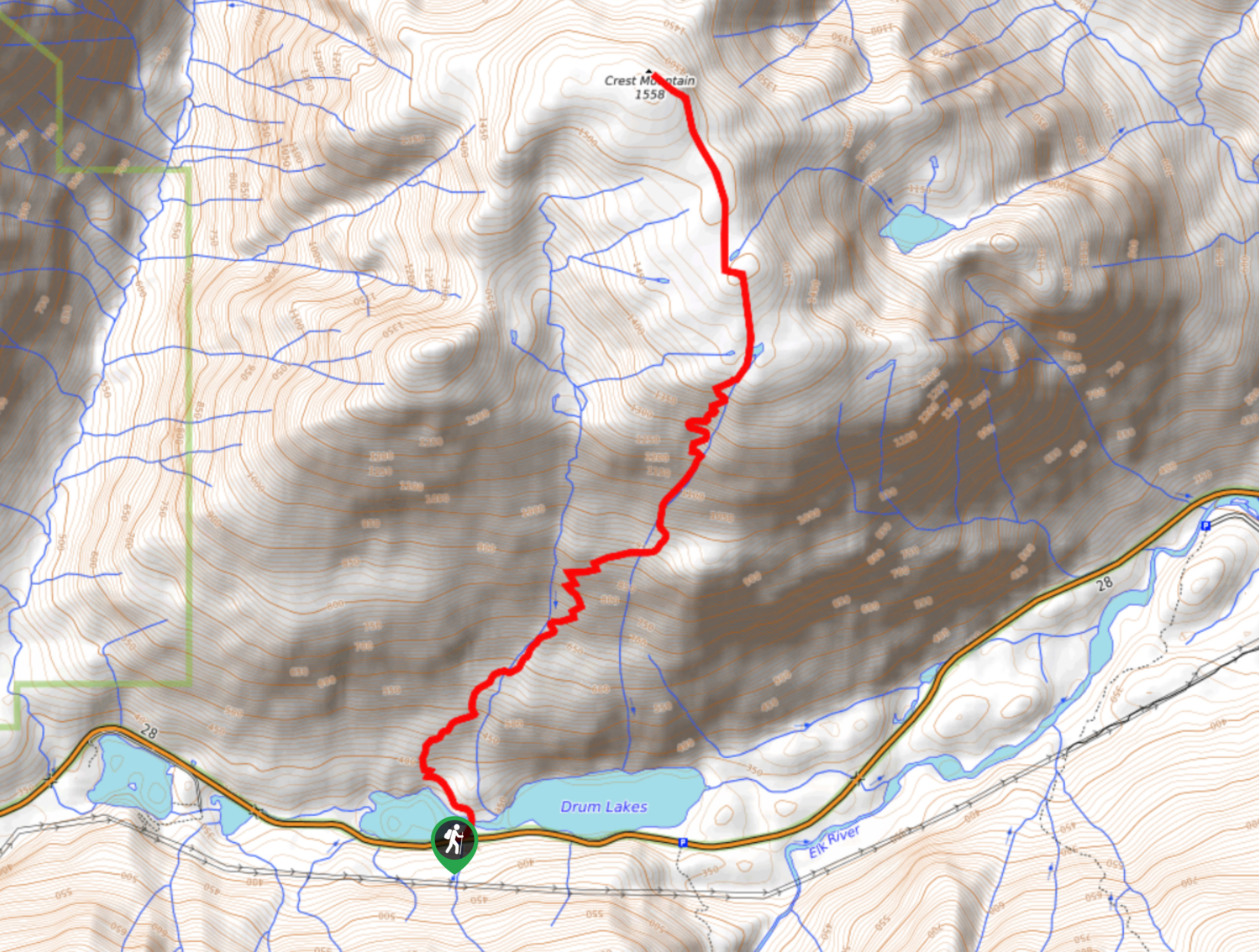
From Campbell River head west along BC-28 W towards Gold River for 29.4mi. A few km’s past the entrance to Strathcona Park you will reach a junction where you will continue strait towards Westin Mines on Westmin Rd. Follow this road for just under 21.7mi. Right after passing the very southern end of Buttle Lake, follow signs for Bedwell Lake Trailhead and turn left onto Jim Mitchell Lake Rd. Follow this road for 4.0mi until you reach the signed trailhead parking lot.

About
| When to do | July - October |
| Backcountry Campsites | At Baby Bedwell and Bedwell Lakes |
| Toilets | At trailhead, Baby Bedwell Lake and Bedwell Lake campsites |
| Family friendly | No |
| Route Signage | Average |
| Crowd Levels | Moderate |
| Route Type | Out and back |
Bedwell Lake
Elevation Graph
Weather
Route Description for Bedwell Lake
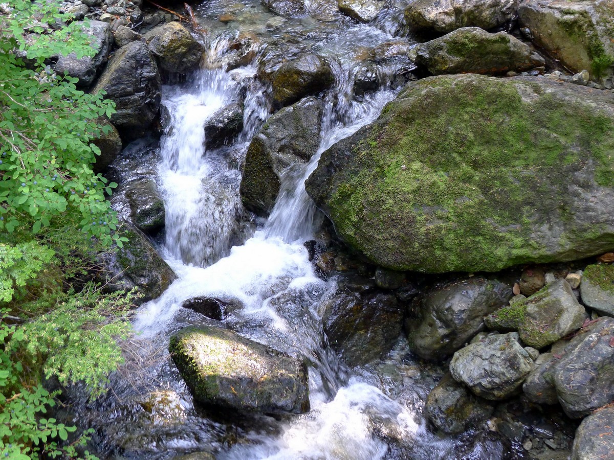
From the parking area follow signs to continue along Jim Mitchell Lake Rd for 656ft before turning off to the left onto the Bedwell Trail. Descend two switchbacks then begin traversing the valley floor. After just under a kilometre you will cross over Thelwood Creek along a cool suspension bridge!
After another shorter creek crossing – this time on a regular wooden bridge – you will begin the climb to Bedwell Lake. The trail goes switch-backing up a narrow gully. While hiking here you will see how the trail maintenance has paid off. Being so steep, the numerous anti-erosion measures are clearly necessary, considering how well used this trail is.
After quite a bit of elevation gain you will cross several more creeks before climbing several of the classic wooden steps. Soon you will make a big switchback to the southeast and finally gain the plateau that holds Baby Bedwell Lake. Traverse the plateau and arrive at the northeast end of Baby Bedwell.
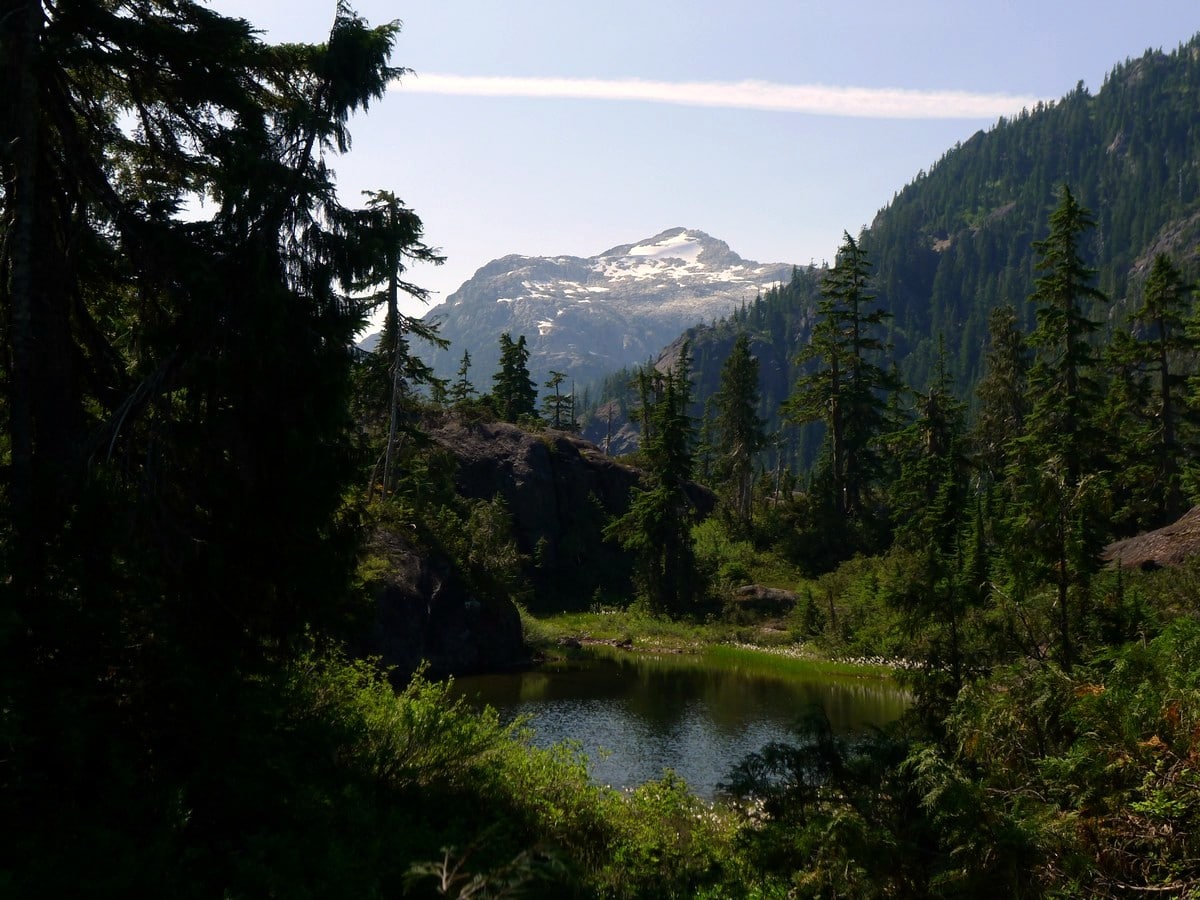
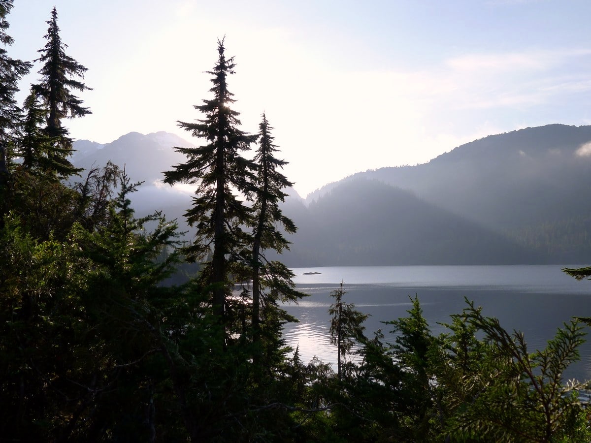
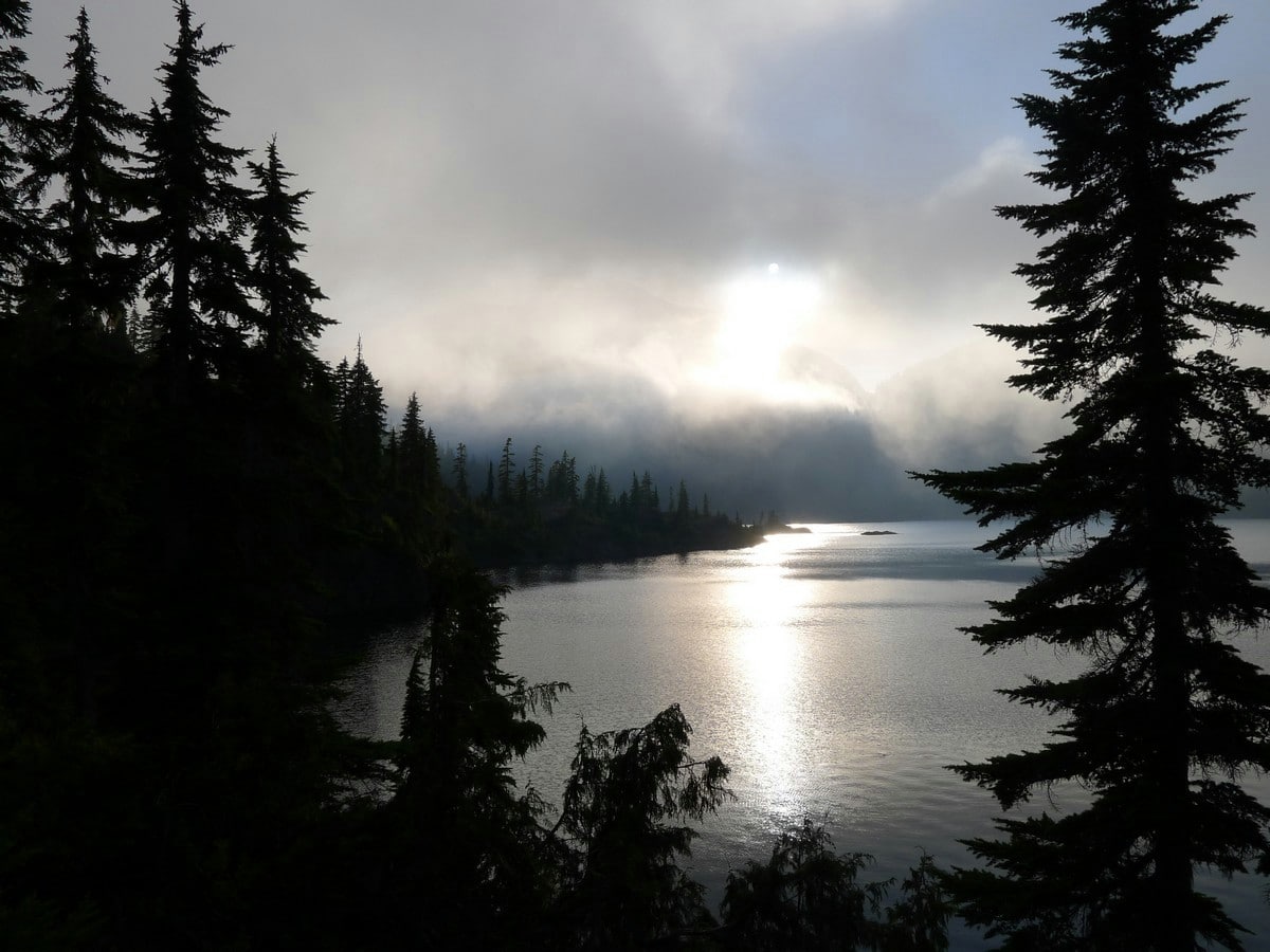
The calm waters of Baby Bedwell offer the perfect spot for a quick rest before the final bit of trail on the hike to Bedwell Lake. Here you will get your first major view, up to the snow-capped east shoulder of Mt Tom Taylor.
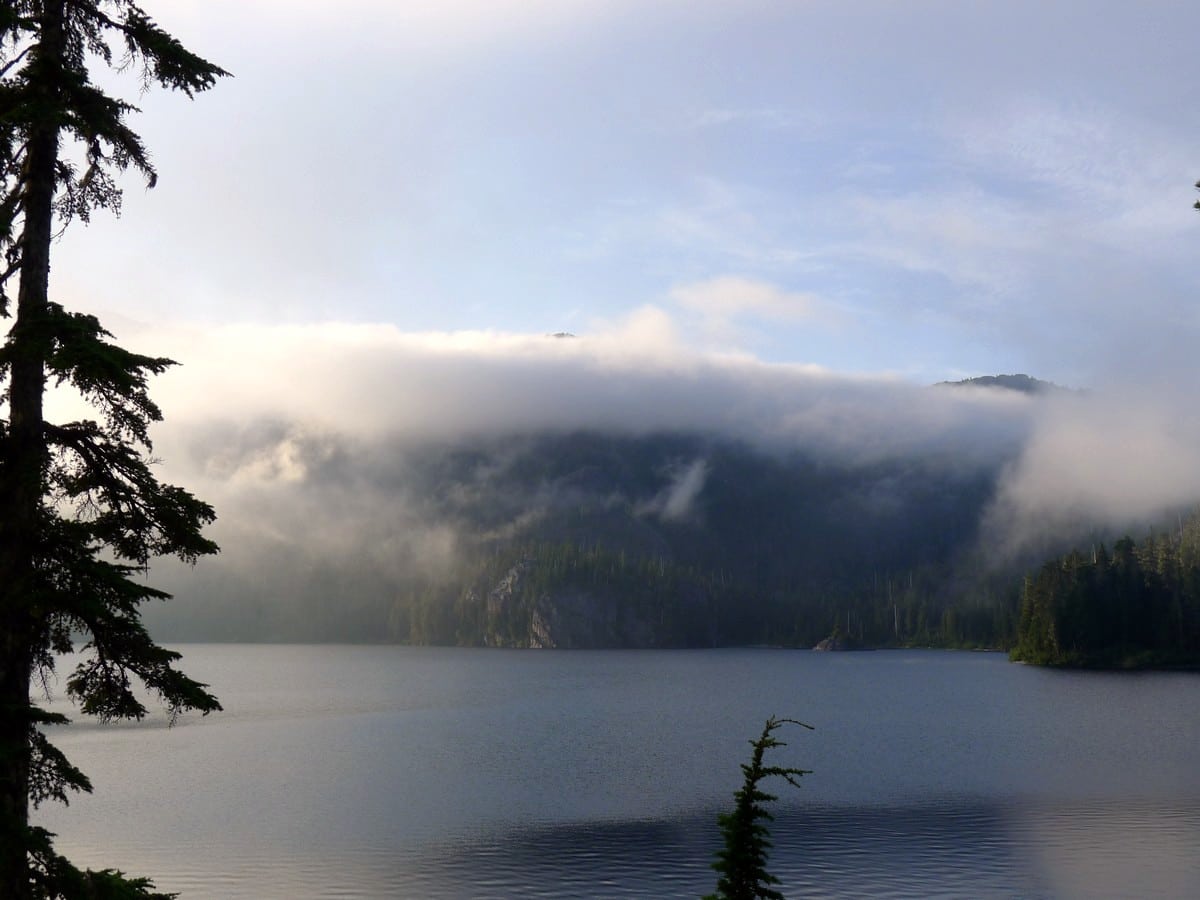
Contour around the east side of Baby Bedwell and climb the notch separating the two lakes. At the top there will be a sign pointing towards a viewpoint. Here you will get the best view of the hike, across the massive Bedwell Lake with Big Interior Mountain and its massive glacier on the left, and the east shoulder of Tom Taylor on the right. Truly a stunning view.
Honestly for most day hikers this is a suitable turnaround point as it saves gaining the notch on the way back. However, for those who want the full experience of hiking to Bedwell Lake (or for those planning on camping at Bedwell Lake) continue down the south side of the notch to Bedwell Lake.
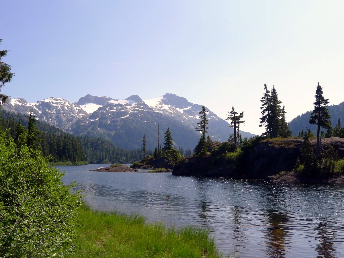
Follow the trail as it contours around the east side of Bedwell Lake, eventually arriving at the campsites. After enjoying the splendid view across the waters and up to Tom Taylor, return the way you came.
Insider Hints
Part of the road to get to the trailhead is dirt and is only graded every so often. Depending on how recently the grader has gone through it can be challenging to drive. Sedans typically have a tough time going up one section of the road, however SUVs with at least a little clearance typically have no problem.
Swimming opportunities exist at both Baby Bedwell and Bedwell Lakes.
This hike to Bedwell Lakes is also a great one-night backpacking trip!

Similar hikes to the Bedwell Lake hike
Crest Mountain Trail
The Crest Mountain Trail is an 7.1mi out-and-back hiking route in Strathcona Provincial Park that climbs up a…
Cruikshank Canyon Lookout
The hike to the Cruikshank Canyon Lookout is a lengthy 12.7mi out-and-back journey that will take you past…
Paradise Meadows Trail
The Paradise Meadows Trail is an 5.3mi loop trail in Strathcona Provincial Park that passes through a beautiful…
AnnSue 4 years ago
I liked how the trail was kept in good condition. It made the hike easier. The Bedwell lake was nice but it was already dusk by the time we got there.
YukihiroSato 4 years ago
"Two roads diverged and I took the one less traveled by, and that has made all the difference" The journey to the top of the bed well lake was definitely a challenge, but it had a golden silver lining. I saw nature at it's best.
Peter Wilson 4 years ago
What a luxurious little trip this is. The bridges and staircases made me feel all fancy out here in the wilderness! Loved it. Not too hard.
Hiking-eh 4 years ago
This hike was interesting for every step. Beautiful scenery and plenty of wildlife to see.
Brandon Houston 4 years ago
The elevation gain was more bearable, but the switchbacks were crazy! Great views and outstanding scenery and I'm totally recommending it!
Rowan Sanders 4 years ago
Waterfall heaven ! Such a beautiful hike . Lots of snow still , starts roughly after a hour up. Amazing views!
Tara Green 4 years ago
My friends and I were there last year and definitely it's a must thing to do. Also, check out Myra falls, it was gorgeous
Meighan 4 years ago
So many breathtaking views along the way, you may want to take your time while hiking here.
SophieM. 4 years ago
Bedwell Lake is spectacular! I appreciate the well-maintained trails a lot. It adds up to the great experience!
Olivia P. 4 years ago
All around are natural wonders! Such a remarkable hike to visit!