Anif Peak
View Photos
Anif Peak
Difficulty Rating:
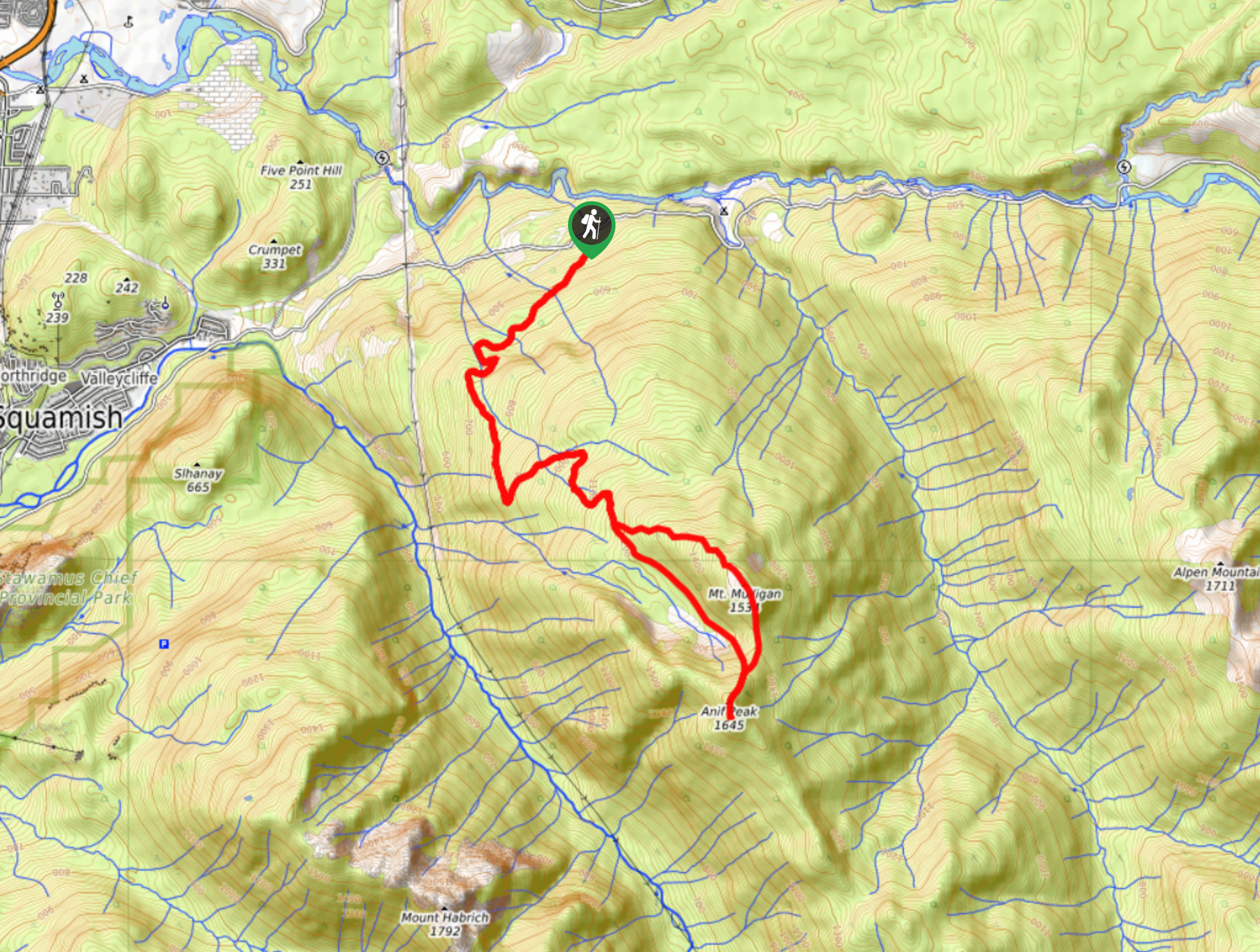
The Anif Peak trail is a hiking route to the southeast of Squamish that will take you on a 10.7mi journey to the summit of Anif Peak and Mount Mulligan. Along the route you will experience a beautiful woodland setting and capture amazing mountain views. The terrain on this hike isn’t too challenging, which makes it a great option for anyone looking to build their way up to completing longer hiking routes without added difficulty.
Getting there
To reach the trailhead for the Anif Peak Trail from the Sea to Sky Gondola, drive north along BC-99 for 1.0mi and turn right onto Mamquam River FSR. Continue on for 4.3mi and go right at the fork to arrive at the trailhead.

About
| When to do | Year-round |
| Backcountry Campsites | No |
| Pets allowed | Yes - On Leash |
| Family friendly | No |
| Route Signage | Average |
| Crowd Levels | Low |
| Route Type | Lollipop |
Anif Peak
Elevation Graph
Weather
Anif Peak Trail Description
The hike up to Anif Peak is a steep uphill climb that will take you through some dense stretches of forest to arrive at the scenic lookout atop the summit. This area is perfect for winter activities including skiing and snowshoeing, however, it is just as enjoyable to complete it as a hike. Although the route is fairly steep and has an elevation gain of 4475ft, the terrain isn’t overly difficult, making this a moderately challenging hike.
The route utilizes a wide logging path for the lower portion of the hike before transitioning into more of a trail as you get further up the mountain. Along the way you will pass through beautiful stretches of forest and catch nice views across the valley. When you reach the summit of Anif Peak, you will be inundated with beautifully scenic views that overlook the rugged mountain peaks to the south, including Mount Harbich and Sky Pilot Mountain. For the downhill journey, follow the alternate path to the right that will take you over the summit of Mount Mulligan before reconnecting with the main trail and following it back to your parked vehicle below.
Similar hikes to the Anif Peak hike
Four Lakes Trail
The Four Lakes Trail is a 4.5mi hiking route that travels through Alice Lake Provincial Park on a…
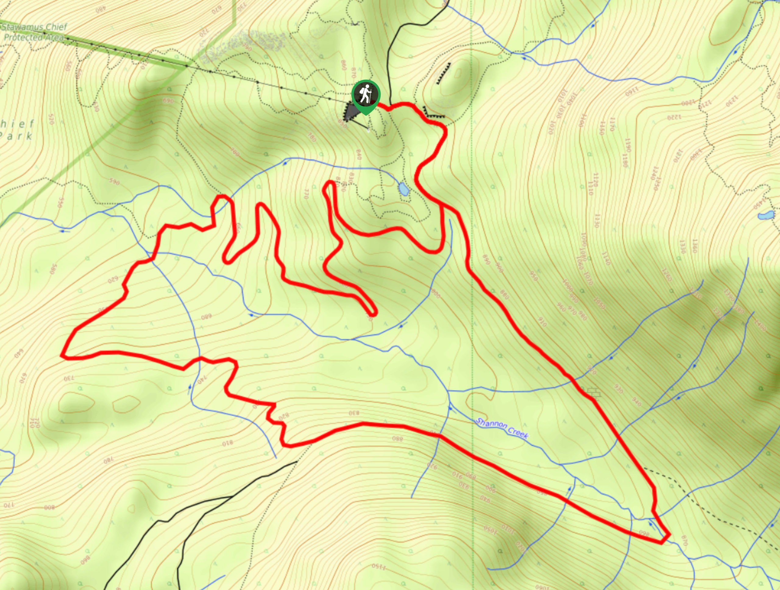
Shannon Basin Loop
The Shannon Basin Loop is a 5.9mi lollipop trail near Squamish, BC, that sets out from the top…
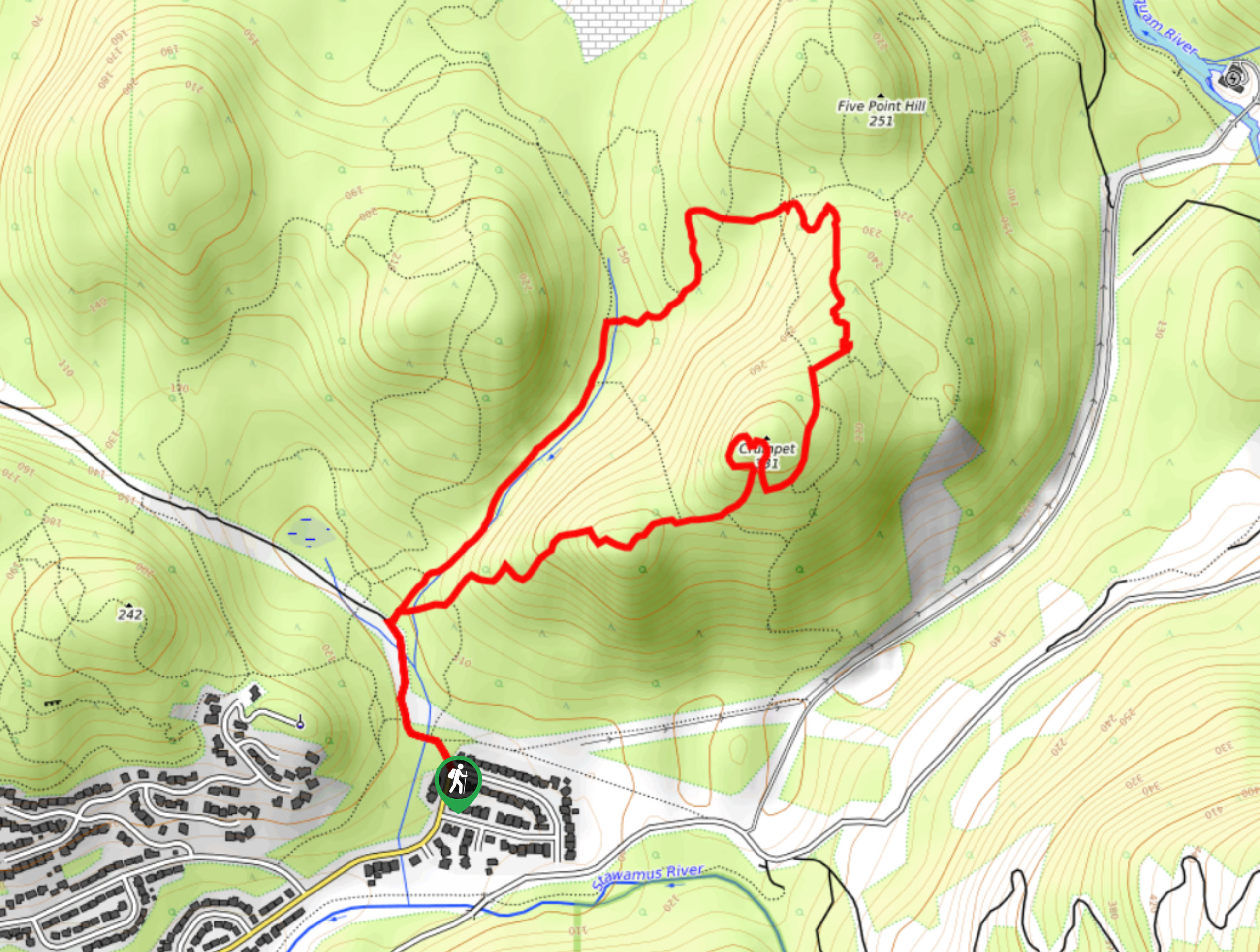
Mount Crumpit Trail
If you are into short hikes that will get your heart pumping and also have amazing mountain views, then the…
Comments