
Al’s Habrich Ridge hike
View Photos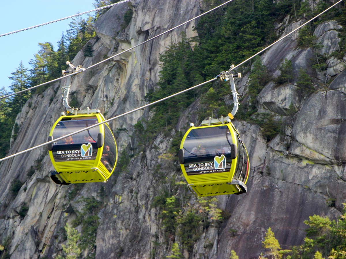
Al’s Habrich Ridge hike
Difficulty Rating:
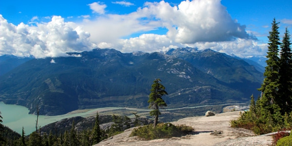
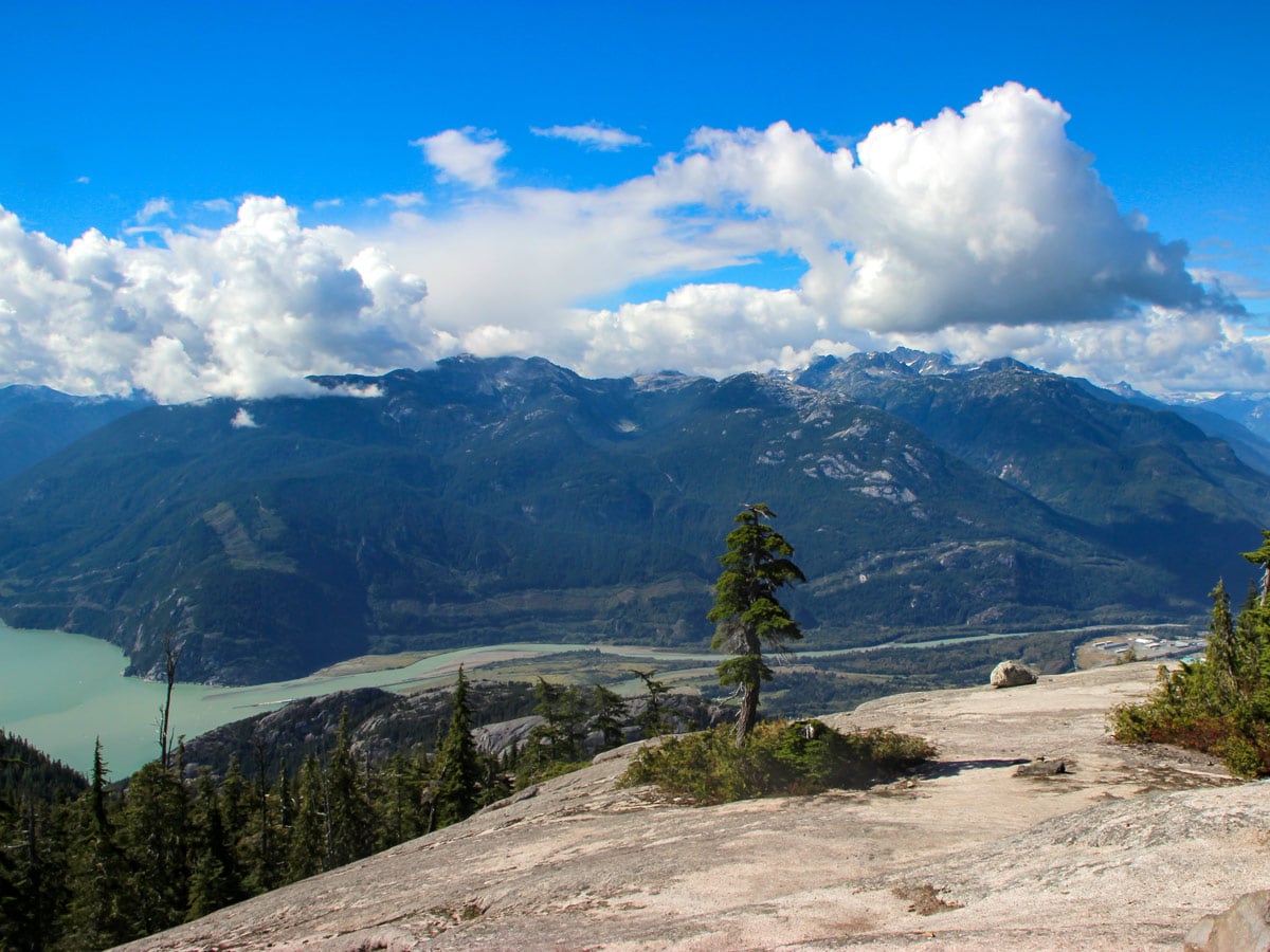
Head up the Sea to Sky Gondola for one of the most popular hikes at the top of the ridge—Al's Habrich Ridge. With stunning panorama views from the top of the mountain, it’s worth the ride up.
Getting there
Take Highway #99 heading north past Horseshoe Bay towards Squamish. As you near Squamish, watch for the signs for Shannon Falls and the Sea to Sky Gondola (they’re hard to miss), and simply pull into the lot right off the highway.

About
| When to do | July – October |
| Backcountry Campsites | No |
| Pets allowed | No |
| Family friendly | No |
| Route Signage | Average |
| Crowd Levels | Moderate |
| Route Type | Out and back |
Al’s Habrich Ridge
Elevation Graph
Weather
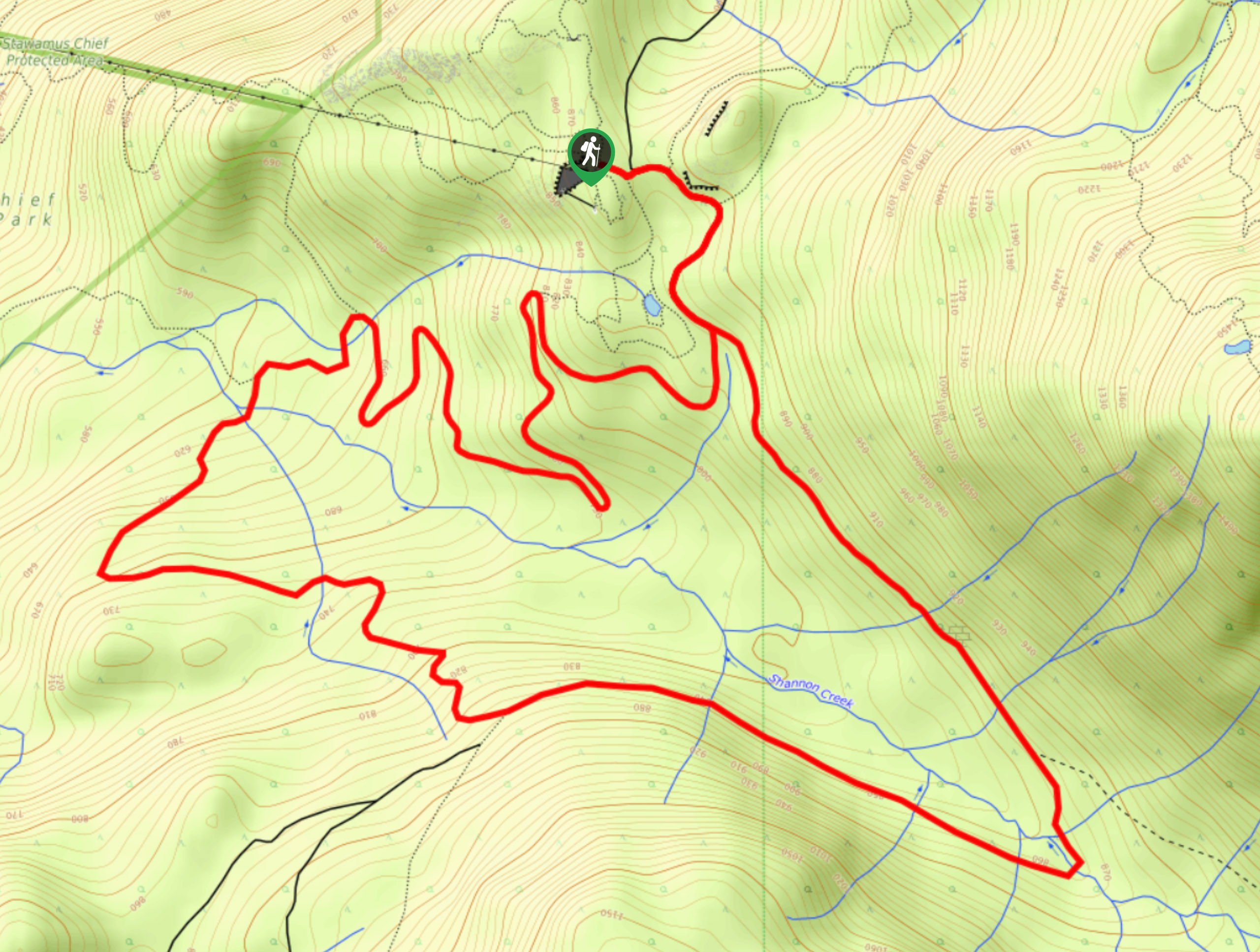
Route Description for Al’s Habrich Ridge
The Al Habrich Ridge Hike requires you to take the Sea to Sky Gondola to the start of the hike. If you want an even better workout, you can hike the Sea to Sky Hike, but most people take the Gondola.
Before you set out on the Al’s Habrich Ridge hike, it’s important to take note of the gondola time to make sure you catch a ride back down! Trust us, you don’t want to miss that last gondola down! From the Sea to Sky Gondola platform, walk towards the park map. Find a sign for the Wonderland Loop and follow the direction towards a gravel trail (called Backcountry Access Road) Walk down a gentle hill, then keep an eye for the Al’s Habrich trail marker. Walk past a water reservoir, heading back uphill, until you come across another Al’s Habrich Trail marker leading you into a forested area.
Here, the trail should turn into a single-track, following it onwards with pink markers lining the trees. You’ll also notice large, diamond-shaped markers which guide you along the path, ending at Neverland Lake.
The trail is relatively even, with a few bumps. Press onwards until you reach a large rock wall on the right and a partial Squamish view to the left. Stop for a quick photo, then continue to follow the clearly marked trail, ascending a few wooden stair sections.
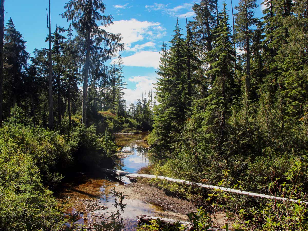
Come to a creek crossing, where a rope can be found to help you cross. If you hike during the height of summer, the creek will be dry and easy to cross. From here, the trail slightly inclines, but not by much.
For the next steep sections of trail, use the ropes provided to help you scramble up. When you come to an exposed ridge, cross over and continue to climb upwards. This section of trail isn’t overly well-marked so watch for any pink tape. At the 1.2mi mark, the trail will begin to descend. At the bottom of the descent on the other side of the ridge, the trail ducks back into the trees to your right. There is a trail marking and some ribbon at this spot – which might be hard to find at first. Once you’ve found the trail, it goes back into the trees and drops down a bit.
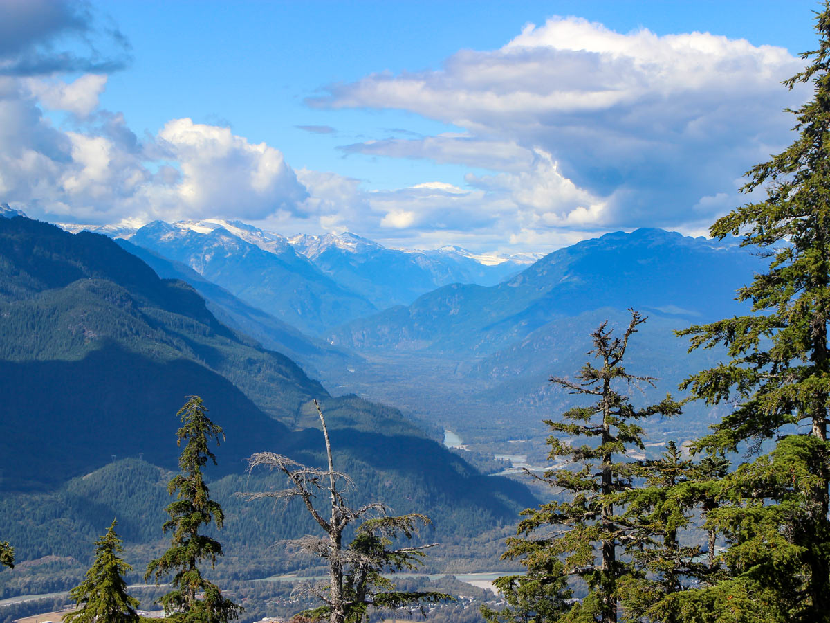
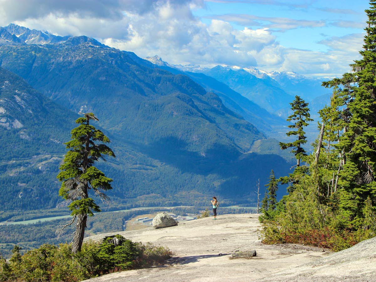
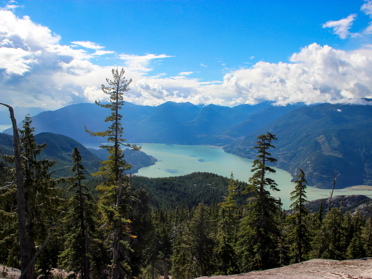
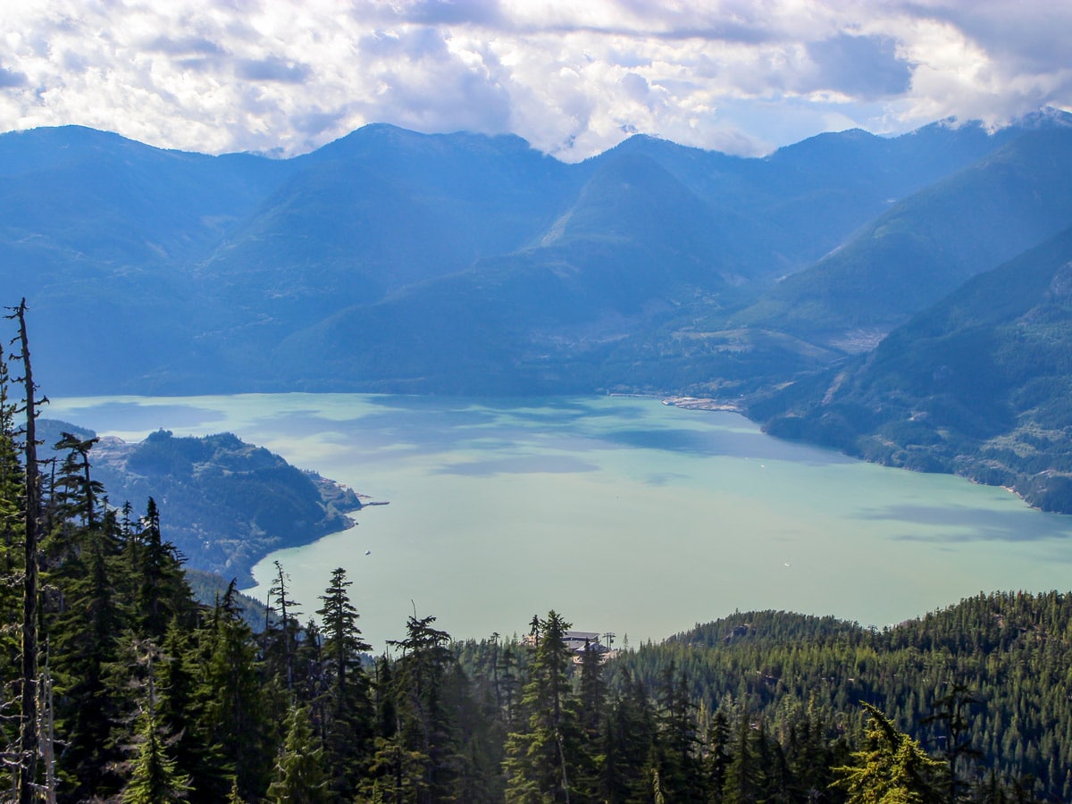
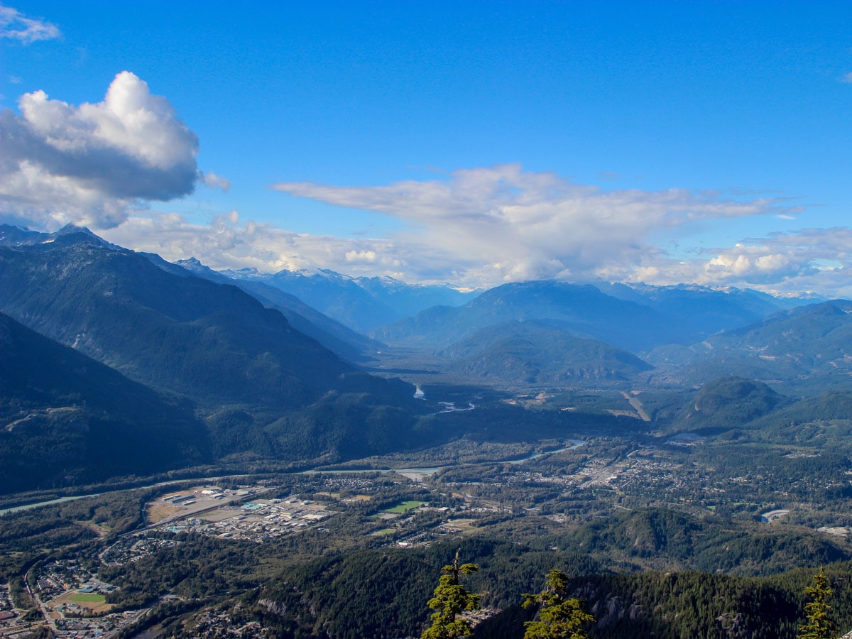
Continue until you hit a junction for Yuko’s Pond. You’re almost at the viewpoint for Al’s Habrich Ridge! Keep right at the next split in the road and you’ve arrived at the summit. For a spectacular view, scramble up the exposed rock on the right, you should be able to follow the grooves carved out by other hikers. From here, you can see the Sea to Sky Gondola lodge, The Stawamus Chief, Sky Pilot mountain and Howe Sound. To the north, you can see Mount Garibaldi and Garibaldi Provincial Park.
Enjoy a rest before proceeding to Neverland Lake. Head to a small trail along the ridge, now heading south into the forest.
Cross a small creek and soon you should stumble up a junction on your left for Neverland Loop and the Neverland Falls. This is a 30-minute detour to a pretty waterfall, though nothing too spectacular.
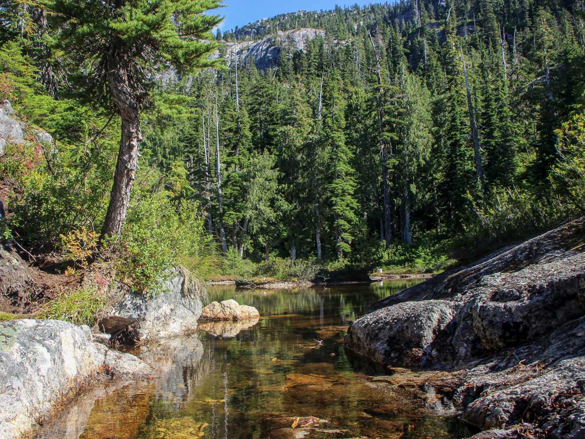
If you choose instead to stay right, the trail will bring you to Neverland Lake. It isn’t very large, but it is very scenic.
Regardless of which path you visited, head back to the junction, retracing your route to the gondola for a restful ride back to the parking lot.
Insider Hints
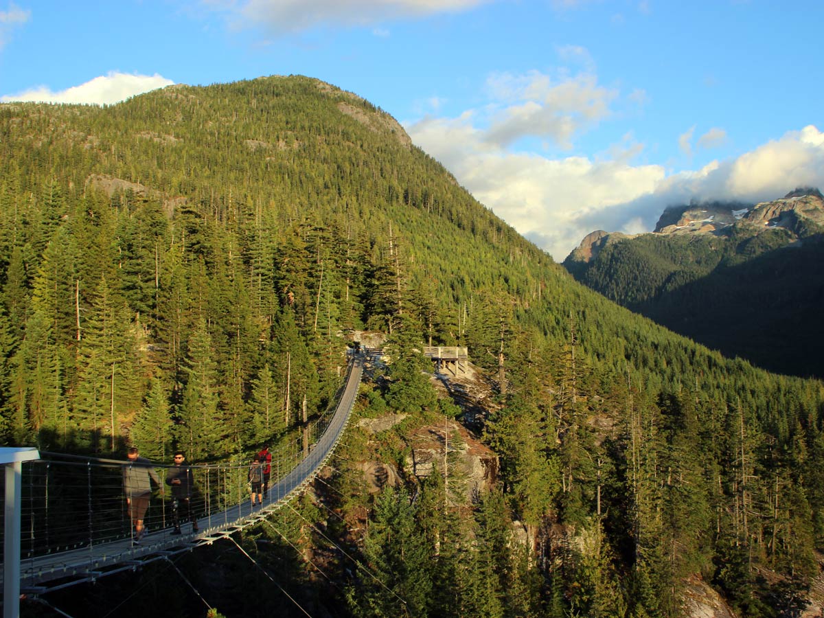
The extra perk of this hike is the amenities at the Sea to Sky Gondola lodge. After your hike is over you can enjoy a drink and some food on a beautiful patio, before downloading back down to the parking lot.

Similar hikes to the Al’s Habrich Ridge hike
Four Lakes Trail
The Four Lakes Trail is a 4.5mi hiking route that travels through Alice Lake Provincial Park on a…
Shannon Basin Loop
The Shannon Basin Loop is a 5.9mi lollipop trail near Squamish, BC, that sets out from the top…
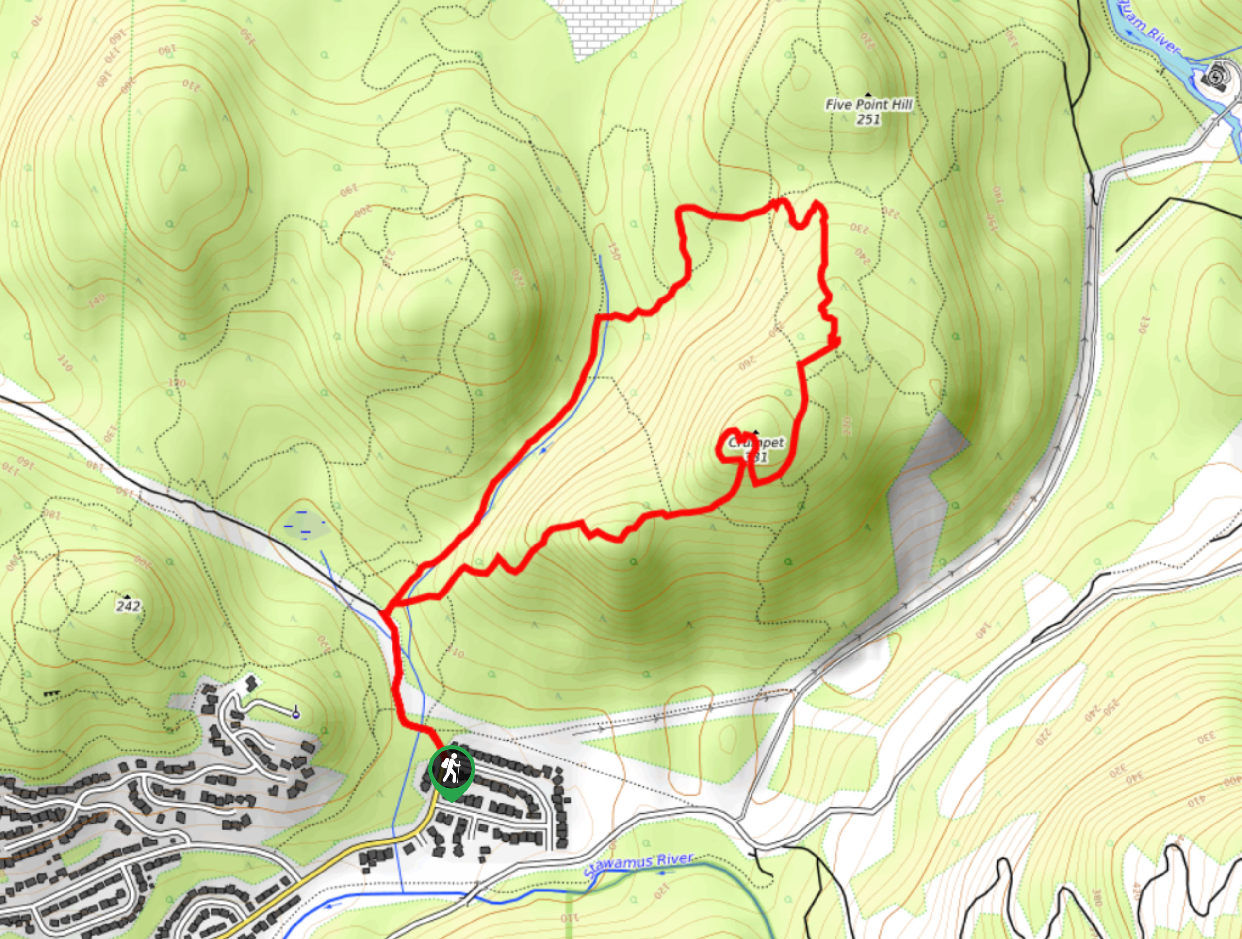
Mount Crumpit Trail
If you are into short hikes that will get your heart pumping and also have amazing mountain views, then the…
Gino R. 4 years ago
This hike was slightly challenging. There are two big rocks with ropes that you need to climb. Either way, I really enjoyed this hike.
Fur Dates 4 years ago
Very nice hike, the trail was a bit muddy, but it is well marked and easy to follow. We didn't come across a small lake during the loop but did find a small waterfall. Great hiking adventure..
Florian L. 5 years ago
Stunning wide-ranging beauty at the summit! You will need to cross the creek and climb through two rope sections in this trail. The view was awesome, which is similar to the Chief but at a higher elevation. Bug spray helped a bit, but the bugs were still quite annoying.
EthelB. 5 years ago
A very nice and easy trail with beautiful views from the gondola.
genevaoftheeast 5 years ago
Stunning views from the top. The dirt path was a bit slippery and muddy.
metamorphiks 5 years ago
There were tons of mosquitos and bugs so bring a bug spray with you. Crossing the creek and climbing through two rope sections made this trail fun. Tagging along with your friends will make it more exciting and fun.
Carissa Alvarado 5 years ago
This is a fairly nice hike. The trail was a bit muddy, but it is well marked and easy to follow. Bring bug sprays because there's a lot of mosquitoes.