
Squamish Smoke Bluffs hike
View Photos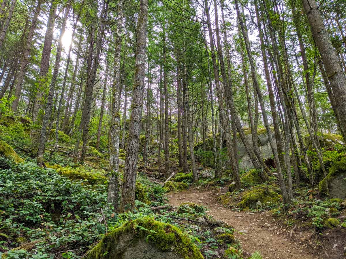


Squamish Smoke Bluffs hike
Difficulty Rating:
Find over 400 granite climbing routes and peaceful trails at Squamish Smoke Bluffs Park. Set out on a hike that is ideal for a family-fun outing, with views overlooking Squamish and Howe Sound. With multiple trails to choose from, you can make your adventure as long or short as you’d like!
Getting there
At the main intersection at downtown Squamish, take a right onto Loggers Lane. Follow Loggers Lane until you come to a crosswalk and a sign for Smoke Bluffs Park. Turn right, into the parking lot, and you’ll be able to find the trailhead.

About
| When to do | All-seasons |
| Backcountry Campsites | No |
| Pets allowed | Yes - On Leash |
| Family friendly | Yes |
| Route Signage | Average |
| Crowd Levels | Moderate |
| Route Type | Circuit |
Squamish Smoke Bluffs
Elevation Graph
Weather
Route Description for Squamish Smoke Bluffs
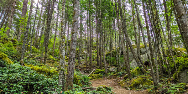
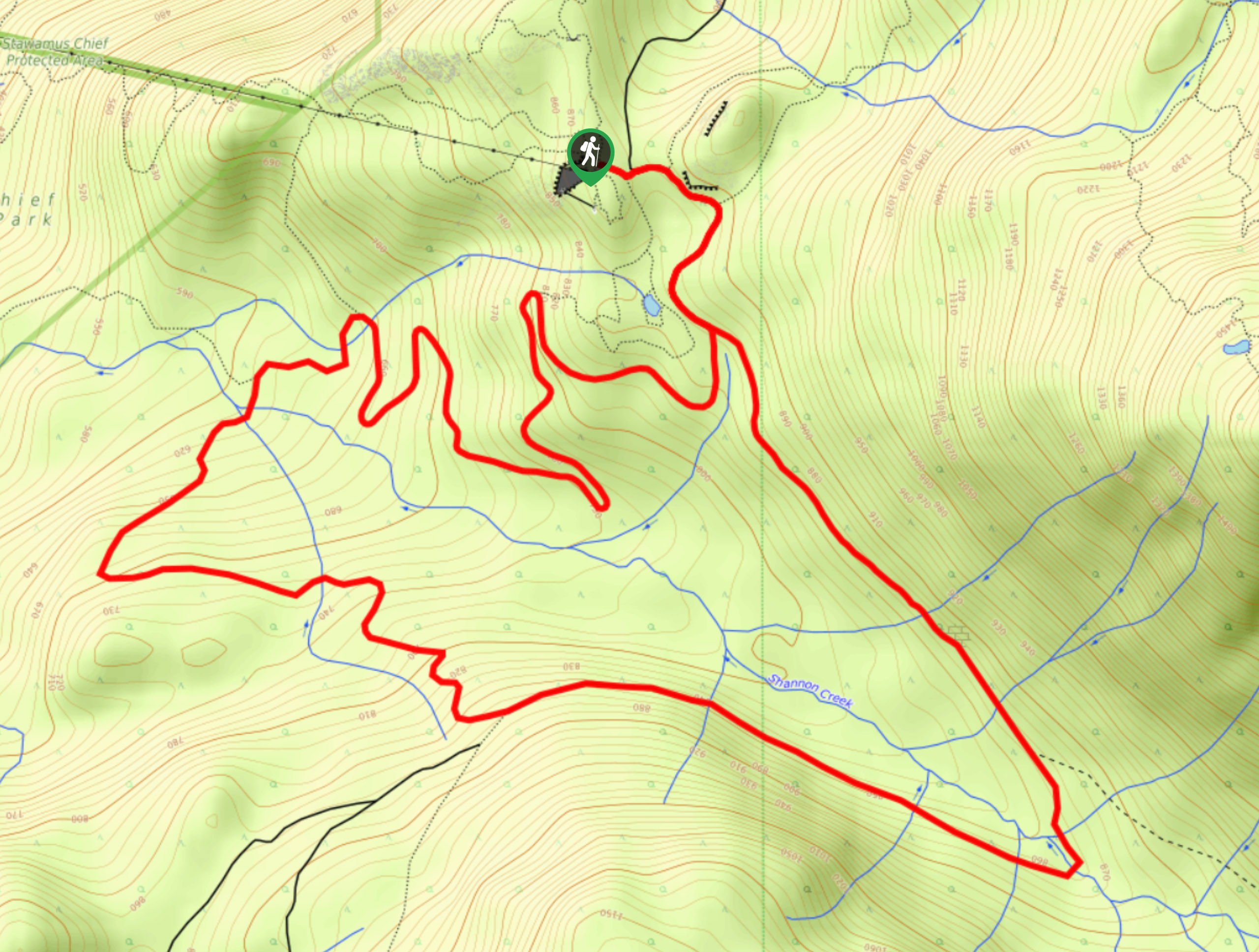
Set out on the Squamish Smokes Bluff hike with the whole family from the parking lot. You’ll find a marked trail for Smoke Bluffs, follow it and on your left, you’ll soon spot a rock wall. Follow the main trail past many more small paths leading towards the rockface, where you’ll likely spot climbers scaling the wall. Head left at a junction separating hikers and bikers, heading onto a gravel path heading uphill
In about 1969ft, you’ll arrive at a playground, where little ones can stop and have some fun.
From here, follow the green signposts, marked the Loop Trail, heading left.
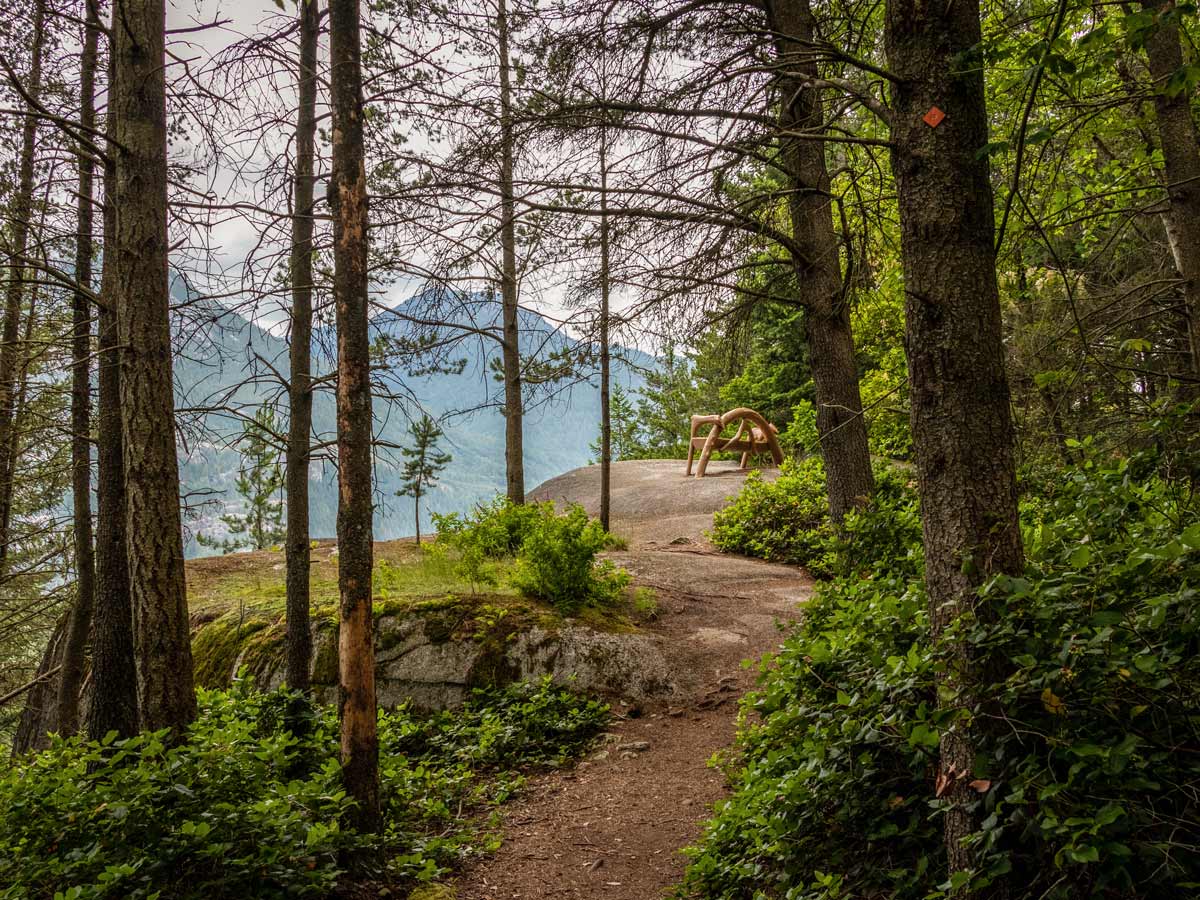
Climb uphill for a few minutes, until you reach the next junction. We’re going to veer off for a little detour towards Viewpoint Trail. Keep following markers for this trail, as it leads over a slightly rocky part of the path.
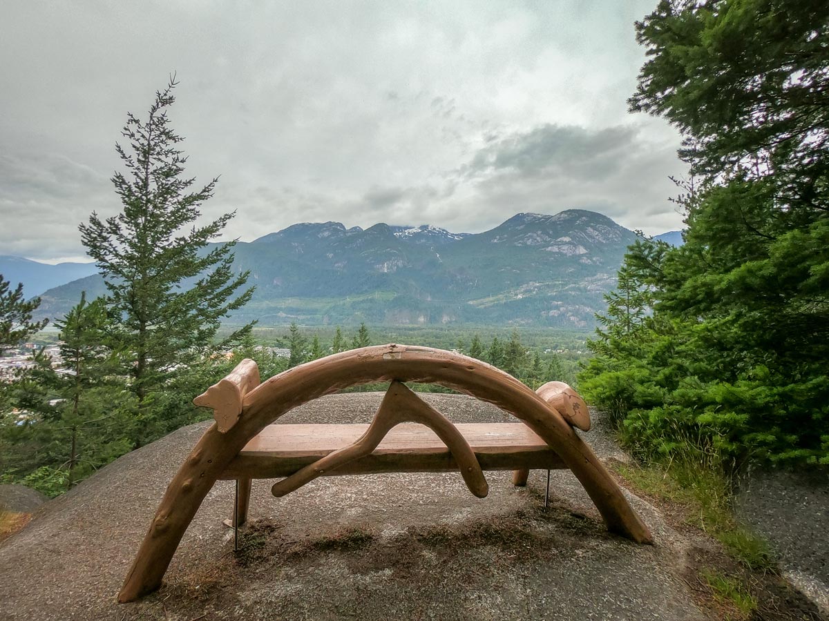
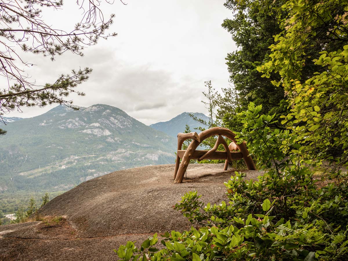
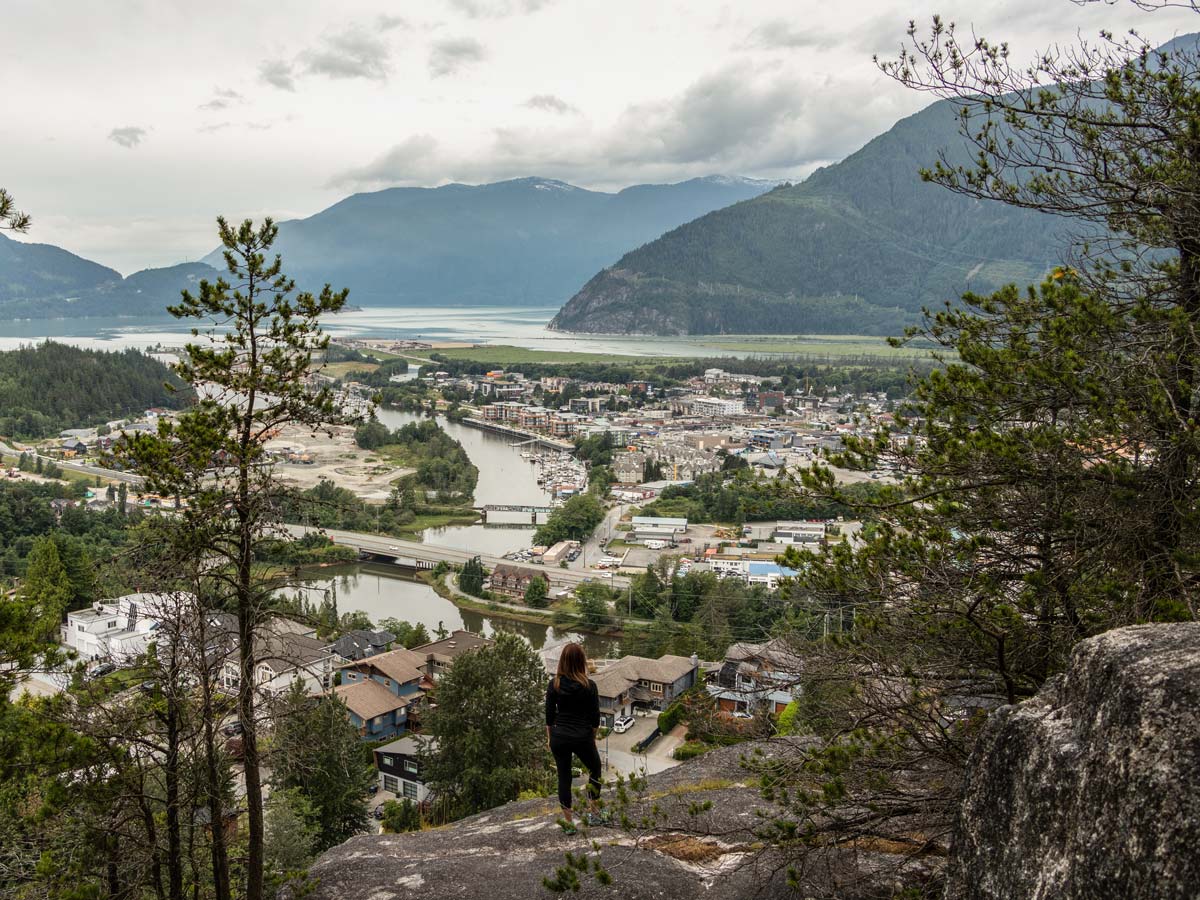
You will come to another split. Head away from the rock wall, to the right, and you’ll arrive at the first lookout over Squamish and Howe Sound.
Across the valley, you can see the southern end of the Tantalus Range, including Mount Murchison and Mount Lapworth.
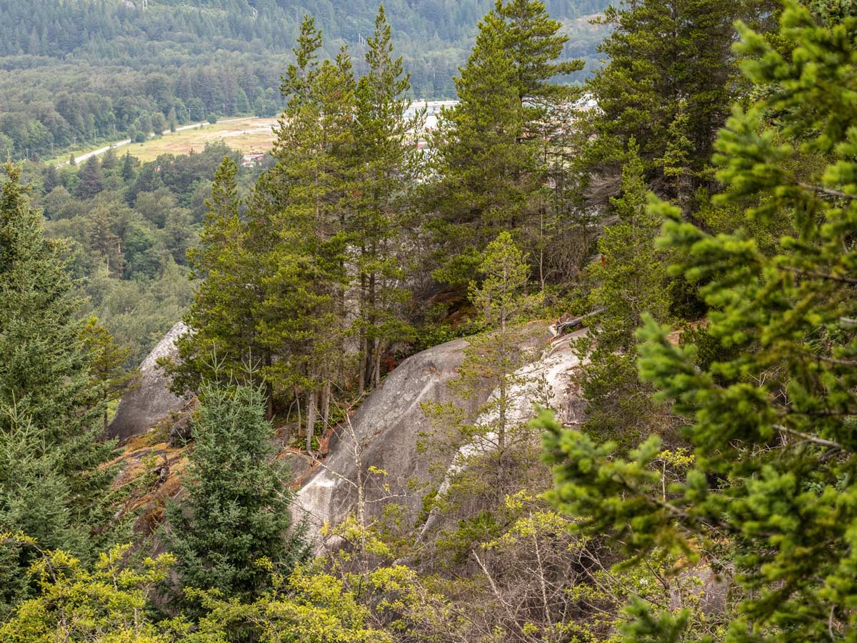
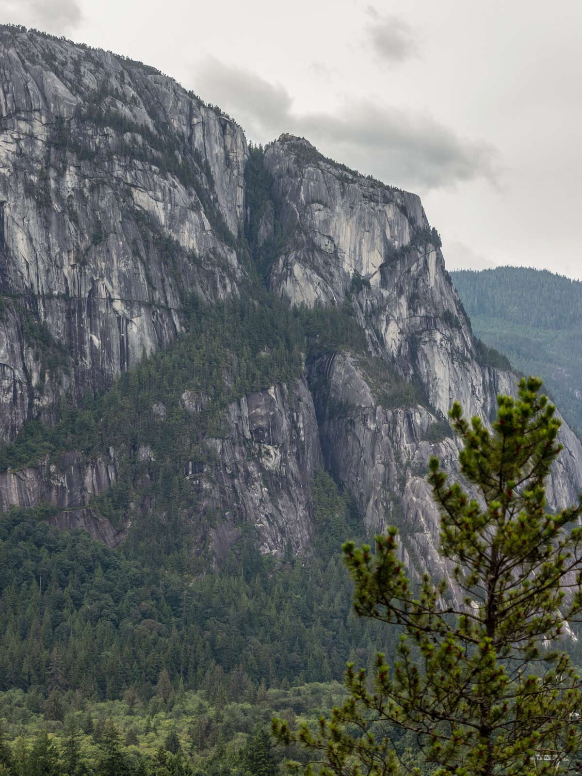
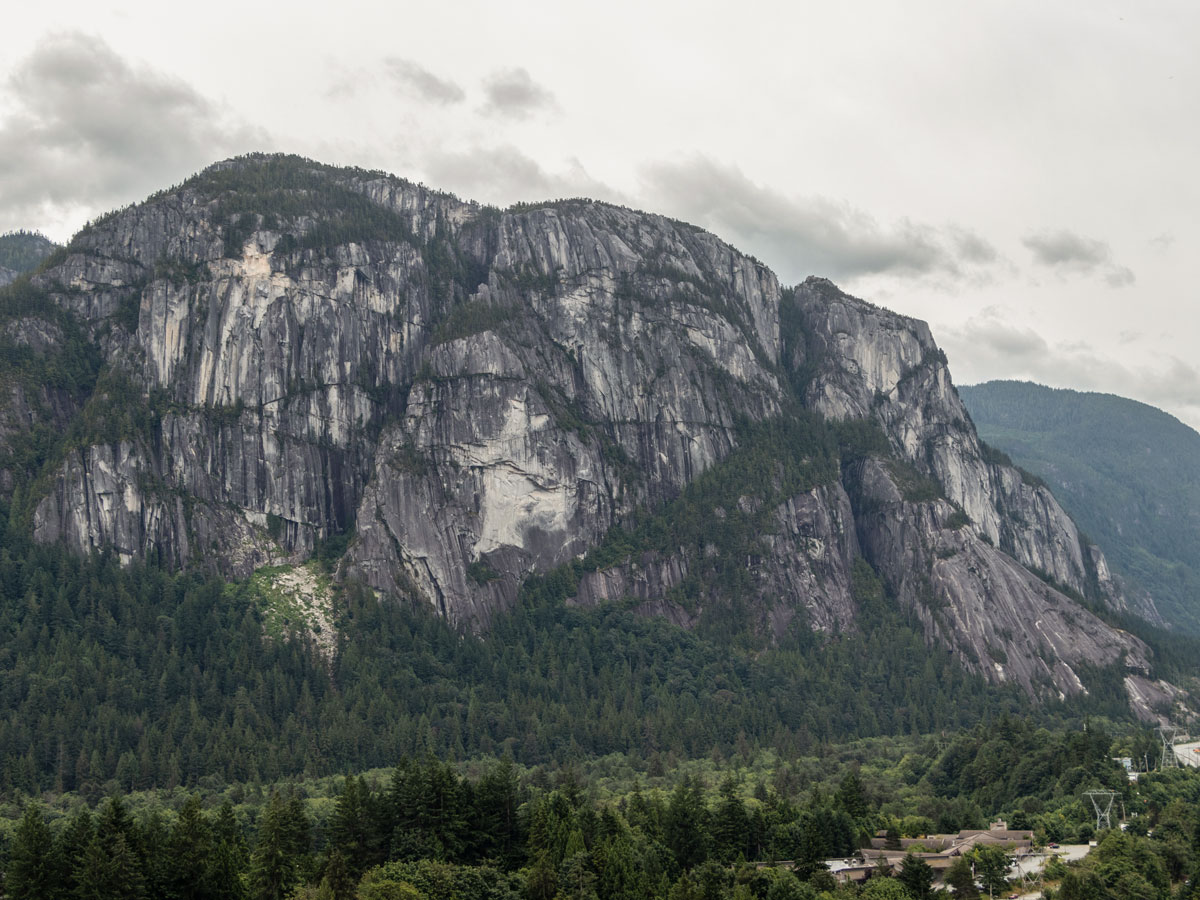
If you continue along the trail, you’ll come to a second lookout. The views here are slightly better, with less tree growth and you can even spot The Chief from here.
Press forward, reaching a third lookout with the clearest view of The Chief and the surrounding neighborhoods.
Next, you’ll come to a marker in a tree that directs you to Ronin’s Corner, Penny Lane, and the Viewpoint Trail Loop to Pink Cliff. Keep following the trail to make a loop to where the Viewpoint Trail began.
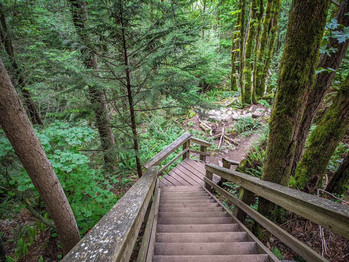
Continue past yet another rock wall (there are a ton of them!). At the split, head right up a set of stairs, then immediately left heading back towards the rock wall and Loop Trail.
Once you reach the Loop Trail junction, go right and carry along the Loop Trail towards Octopus Garden
The kids will have fun racing up a small series of switchbacks, that zig zag as you approach the Octopus Garden. There’s a series of small, short switchbacks as the trails zigzags up. This is the steepest part of the hike as you approach the Octopus Garden.
There will be a few more junctions, but they are well-marked for the Loop Trail. When you hit one separating into the Upper and Lower Loop Trail, stay left onto the Upper Loop Trail, or you can go right if you want to shorten your hike a little.
Follow the Upper Loop Trail around Octopus Garden until it starts dropping back downhill. As long as you are heading downwards towards the playground, you’re headed the right way.
When you reach a major open area overlooking The Chief, head right down a set of wooden stairs.
At the bottom of the stairs, look for the large sign. From here, head right, once again taking the Loop Trail, which is more level.
Once you hit a residential area, keep on the gravel trail to the right, passing a cul-de-sac on your left.
Finally, you’ll arrive back at the playground where you can retrace your footsteps to the parking lot. 4
Insider Hints
On the Squamish Smoke Bluff hike, you’ll encounter a lot of wooden stairs. While this hike is family-friendly, it is not stroller friendly, so ensure your little ones can walk awhile.

Similar hikes to the Squamish Smoke Bluffs hike
Four Lakes Trail
The Four Lakes Trail is a 4.5mi hiking route that travels through Alice Lake Provincial Park on a…
Wonderland Lake Loop
The Wonderland Lake Loop is a short trail that sets out from the top of the Sea to Sky Gondola…
Shannon Basin Loop
The Shannon Basin Loop is a 5.9mi lollipop trail near Squamish, BC, that sets out from the top…
Gino R. 4 years ago
It has a well-maintained hiking trail that loops around the park. It's also an amazing scenic hike with overlooking views of Squamish and Howe Sound.
Gino R. 4 years ago
Quiet, amazing varied terrain with good elevation gains. There are also lots of incredible viewpoints overlooking Squamish.
Molly Pineda 5 years ago
Super fun, easy terrain with stunning cliffs and mountain views. Quiet and beautiful varied terrain with good elevation, and lots of nice viewpoints overlooking Squamish. Not the best marked as there are a lot of off-road trails you can take.
Kat Colada 5 years ago
The trails are mostly easy with a few steep sections. The weather was perfect, and the views were fantastic considering how little effort we spent to get there. Overall It's a very enjoyable place to explore with family!
EthelB. 5 years ago
Impressive loop. Great place for family bondings.
genevaoftheeast 5 years ago
Nice and beautiful walk with series of small switchbacks.
hoshiuemura 5 years ago
This hike has it all. It's super fun and easy. It also has beautiful terrain with stunning cliffs and mountain views.
Carissa Alvarado 5 years ago
It's my first time hiking here and I really enjoyed the hike. Overall, this trail is good for putting your legs into work.
Jessie Illumin 5 years ago
Great hike with two to three uphill grinds and some steep stair sections. Overall It's quite easy and should be suitable for most hikers.