
Viola Falls Hike
View Photos
Viola Falls Hike
Difficulty Rating:
Hiking the Viola Falls Trail makes for an unforgettable experience. Those seeking a scenic and secluded adventure will appreciate the tranquility of this backcountry adventure. Pack a picnic and spend the day alongside the mesmerizing cascade.
Getting there
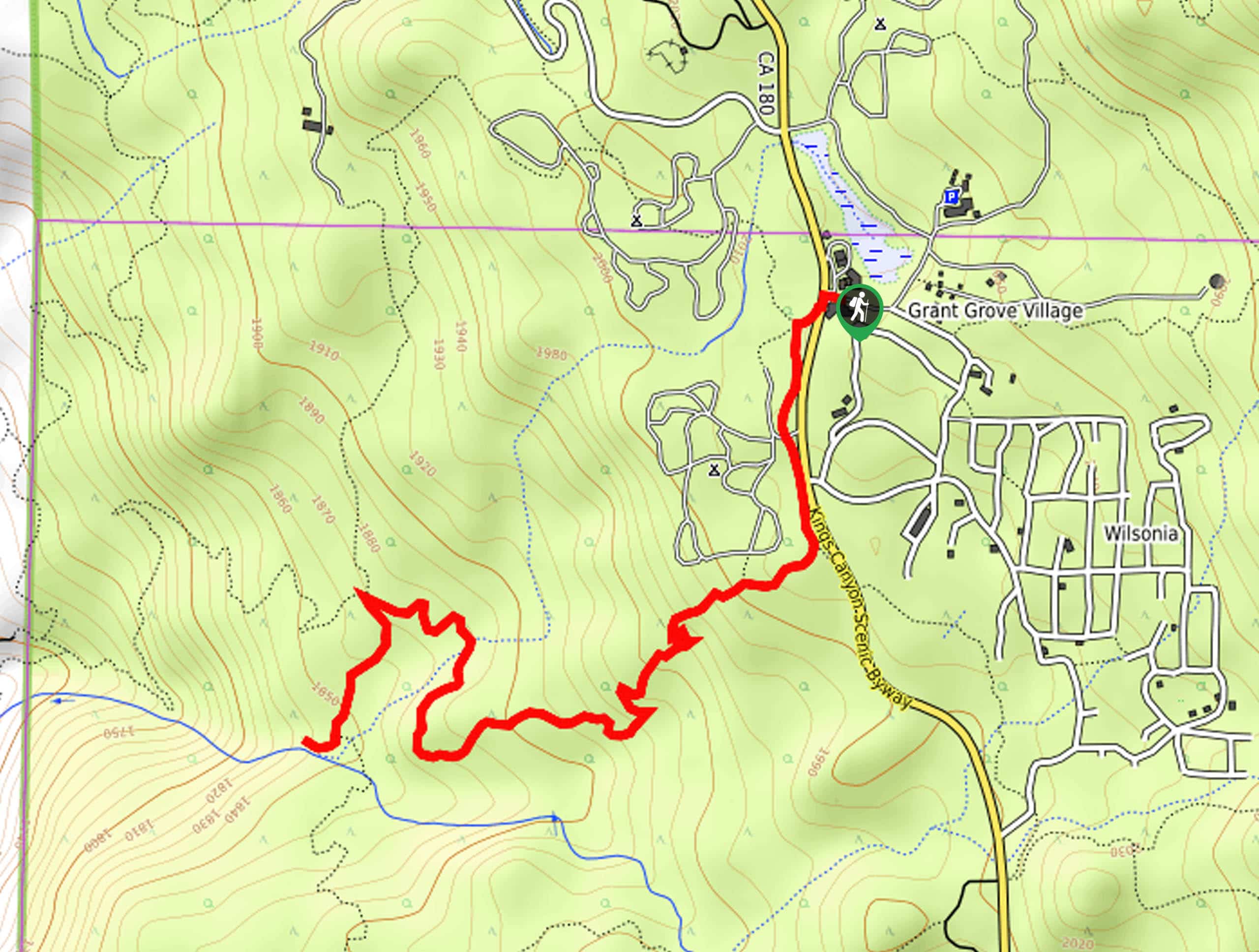
The Viola Falls Hike departs from the Grant Grove Visitors Center off the Kings Canyon Scenic Byway.

About
| Backcountry Campground | No |
| When to do | May-October |
| Pets allowed | No |
| Family friendly | Yes |
| Route Signage | Average |
| Crowd Levels | Moderate |
| Route Type | Out and back |
Viola Falls Hike
Elevation Graph
Weather
Viola Falls Hike Description
The Viola Falls Hike is a beautiful trail that explores the postcard-perfect wilderness adorned with a variety of flora and fauna. Enjoy the shade of looming sequoias bound by carpets of vibrant ferns and colorful wildflowers as you make your way to the charming waterfall. Though this route is accessible year-round, we encourage you to head out in the spring when the waterfall is the fullest! Note entrance to the park costs $35USD per vehicle or $20USD per person for pedestrians or cyclists.
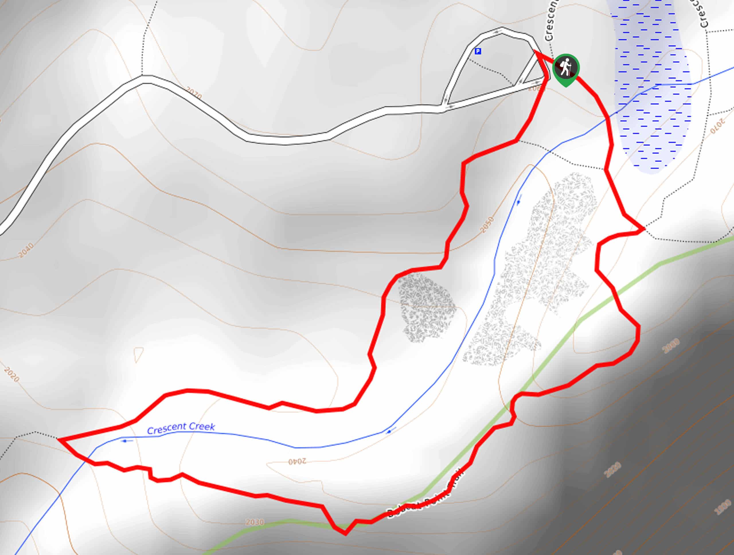
Head out on your journey along the Viola Falls Hike from the Grant Grove Visitors Center. Setting out from here, you will be led across the Kings Canyon Scenic Byway and onto the leftmost South Boundary Trail. This route runs parallel to the road to a junction where you will turn right onto the Sunset Trail, escaping into the wilderness. Hike west down into the wilderness, and you will eventually reach an intersection signposted for the Viola Falls, keep left.
Wander this path south down to the Viola Falls. Enjoy the mesmerizing views and relaxing sounds of the cascading water. Dip your tired feet in the chilly waters, then head back the way you came to the trailhead.
Similar hikes to the Viola Falls Hike hike

Eagle and Bobcat Loop Hike
The Eagle and Bobcat Loop Hike is an amazing adventure that the whole family can enjoy. Wander through luxuriant meadows…
Bobcat Point Loop Hike
Seeking incredible vistas of the Sierra Nevada Mountain Range? The Bobcat Point Loop Hike is an incredible adventure in the…

Huckleberry and Alta Loop Hike
The Huckleberry and Alta Loop Hike is a beautiful adventure that offers a wealth of incredible scenery for hikers to…
Comments