Road’s End to Bailey Bridge Hike
View Photos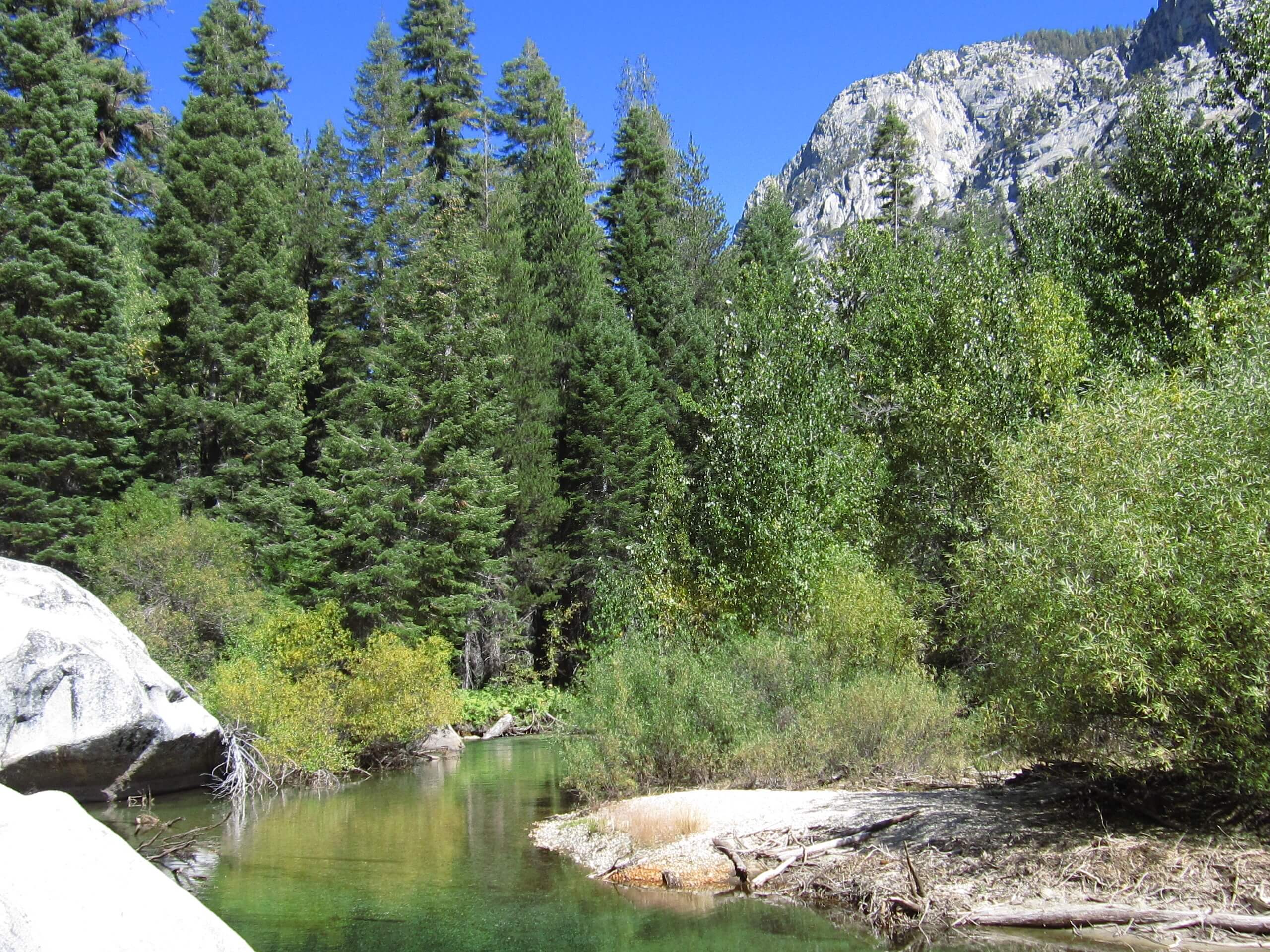
Road’s End to Bailey Bridge Hike
Difficulty Rating:
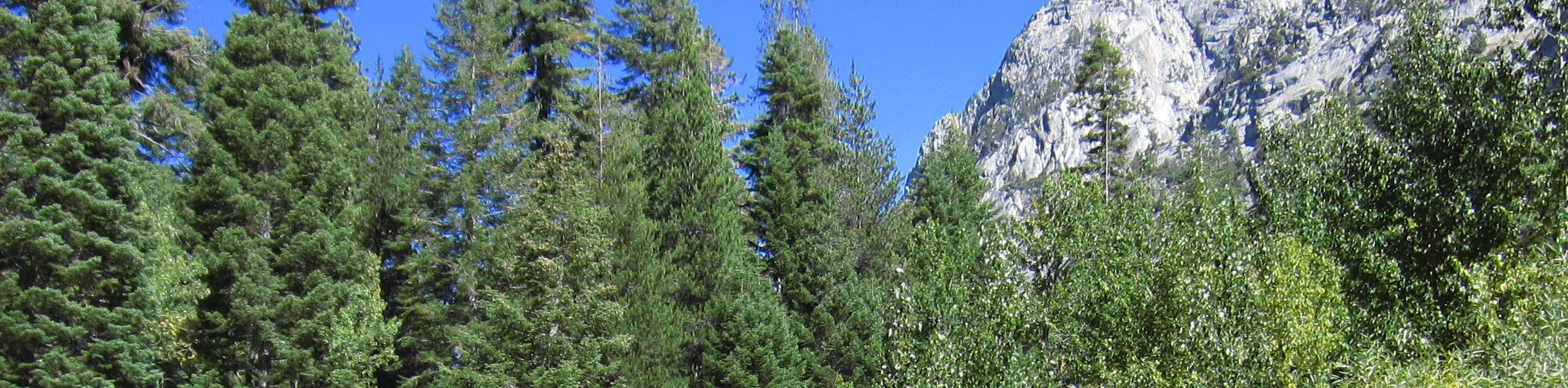
The Road’s End to Bailey Bridge Hike is an enchanting adventure that explores Kings Canyon. Hike along the South Fork of the Kings River amid lush meadows and forests that boast incredible views of the peaks that bound the canyon.
Getting there
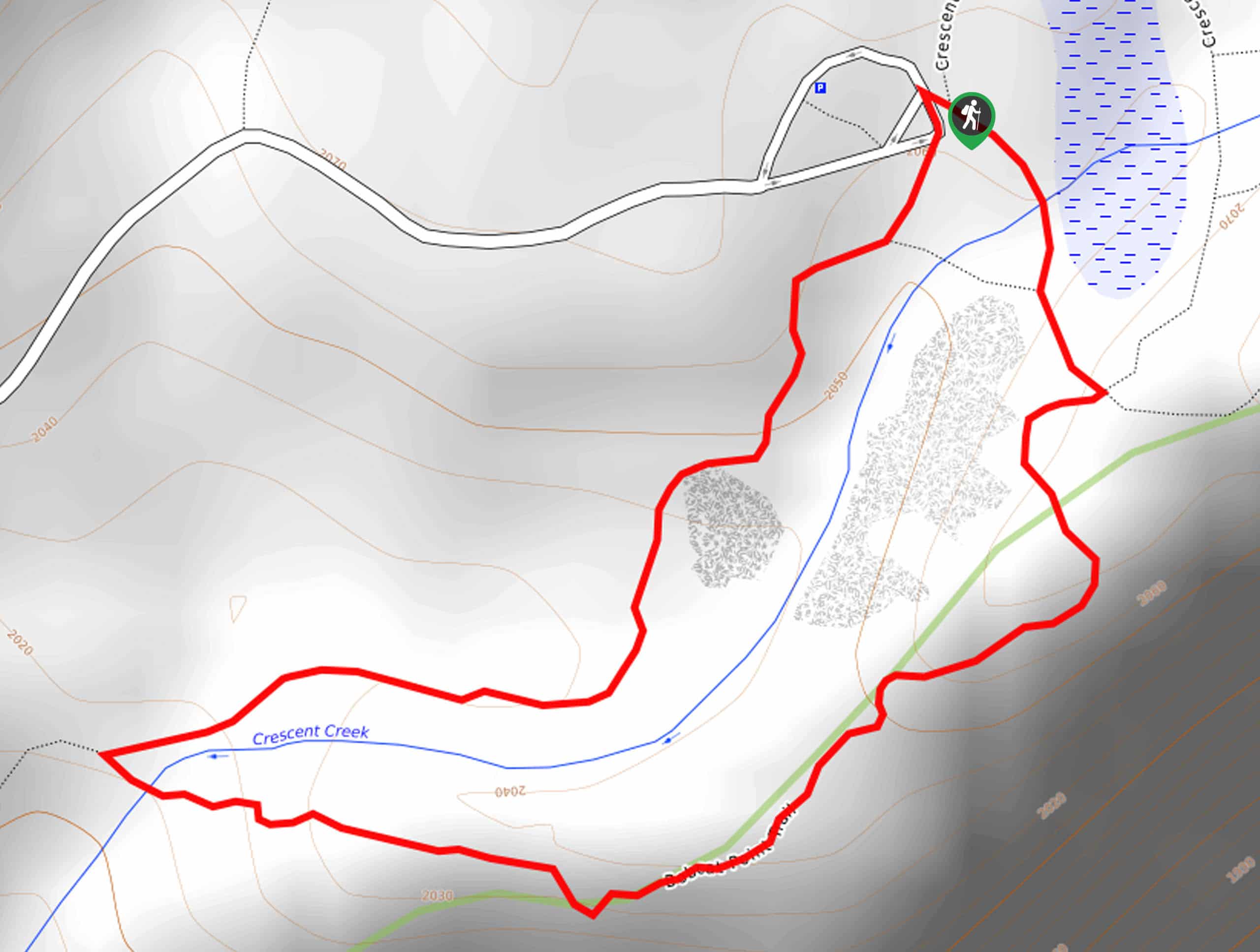
The Road’s End to Bailey Bridge Hike departs from the River Trailhead off the Kings Canyon Scenic Byway.

About
| Backcountry Campground | No |
| When to do | March-October |
| Pets allowed | No |
| Family friendly | Yes |
| Route Signage | Average |
| Crowd Levels | Moderate |
| Route Type | Circuit |
Road’s End to Bailey Bridge Hike
Elevation Graph
Weather
Road’s End to Bailey Bridge Hike Description
The Road’s End to Bailey Bridge Hike is a short and scenic adventure in the Kings Canyon National Park that the whole family can enjoy. Wander through the granite framed corridor through lush meadows and forests. Be sure to charge your camera before heading out; the scenery is unparalleled. Note that bears frequent the area—so keep an eye out and keep your distance. The park charges an entrance fee of $35USD per vehicle or $20USD per person for pedestrians or cyclists.
From the trailhead, the Road’s End to Bailey Bridge Hike can be completed in either direction, but for clarity’s sake, we ventured clockwise. Follow the Paradise Valley Trail east, through the mixed-conifer woodlands that reveal breathtaking views of the looming granite monoliths that bound the valley. Eventually, you will reach a junction; veer right here onto the Bubbs Creek Trail, which will guide you over the Bailey Bridge. Enjoy the postcard-worthy view of King River bisecting the valley, then turn right onto the Kanawyer Loop Trail tracking west.
Gently undulating through the canyon, you will ultimately reach the trail’s end. Take a sharp right here and follow the River Trail back to the trailhead.
Similar hikes to the Road’s End to Bailey Bridge Hike hike

Eagle and Bobcat Loop Hike
The Eagle and Bobcat Loop Hike is an amazing adventure that the whole family can enjoy. Wander through luxuriant meadows…
Bobcat Point Loop Hike
Seeking incredible vistas of the Sierra Nevada Mountain Range? The Bobcat Point Loop Hike is an incredible adventure in the…

Huckleberry and Alta Loop Hike
The Huckleberry and Alta Loop Hike is a beautiful adventure that offers a wealth of incredible scenery for hikers to…
Comments