Panoramic Point Trail
View Photos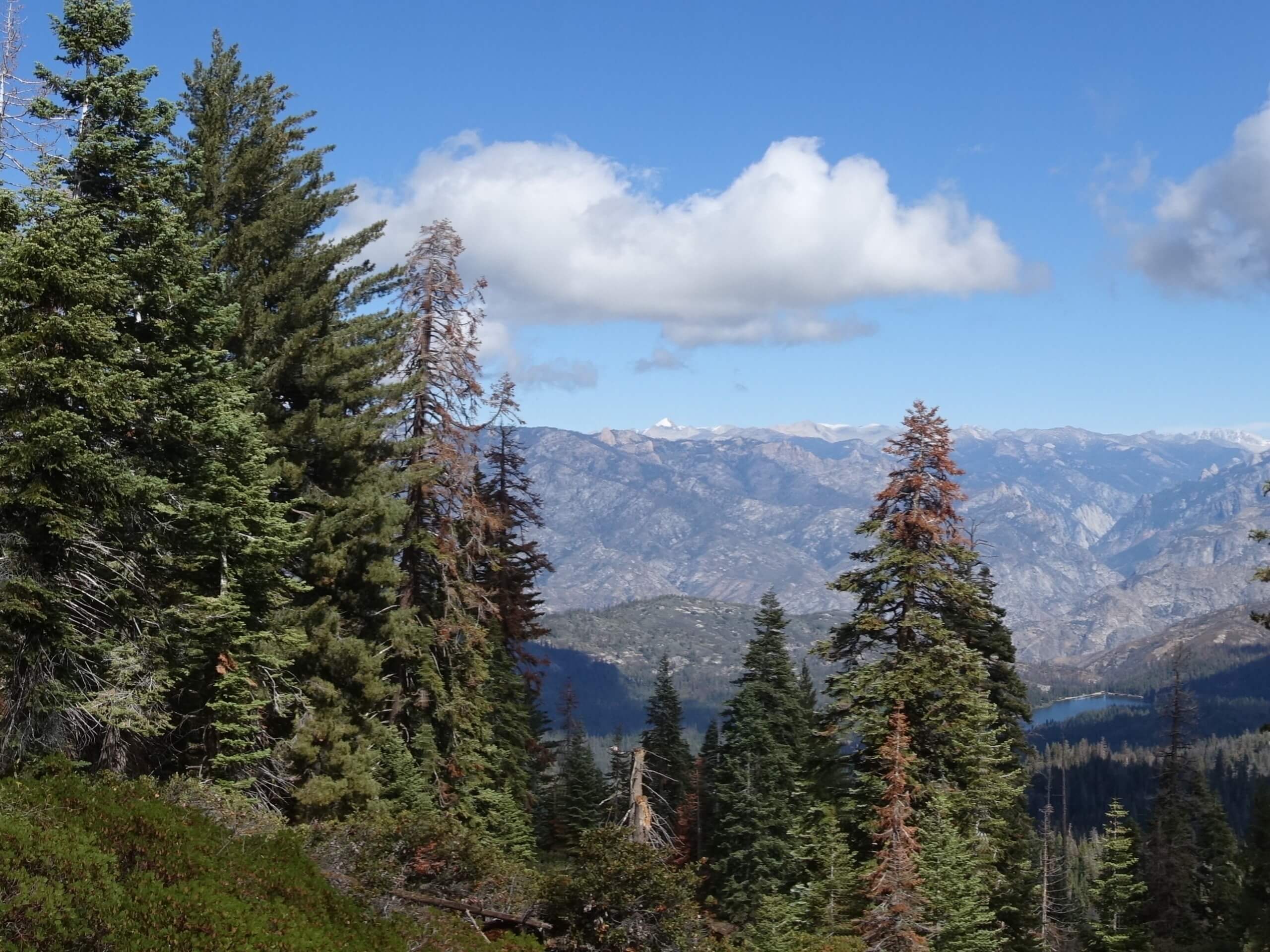
Panoramic Point Trail
Difficulty Rating:
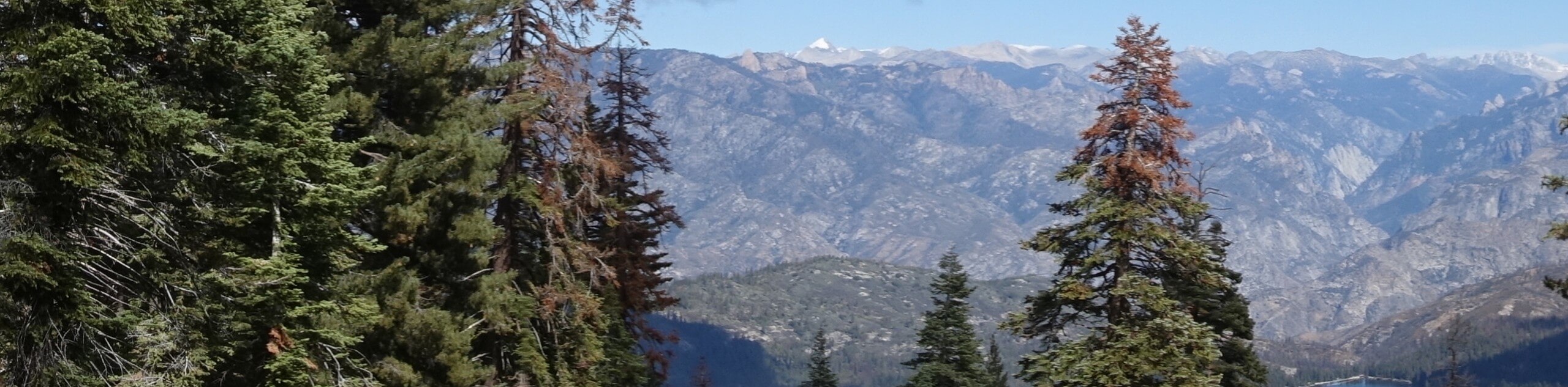
Offering unrivalled views of the Great Western Divide, Hume, and Kings Canyon, the Panoramic Point Trail is a must add to your adventure itinerary. Easy going and quick, this route can be enjoyed by the whole family. Wander through the mixed woodlands up to the scenic overlook and revel in the grandeur of the wilderness.
Getting there
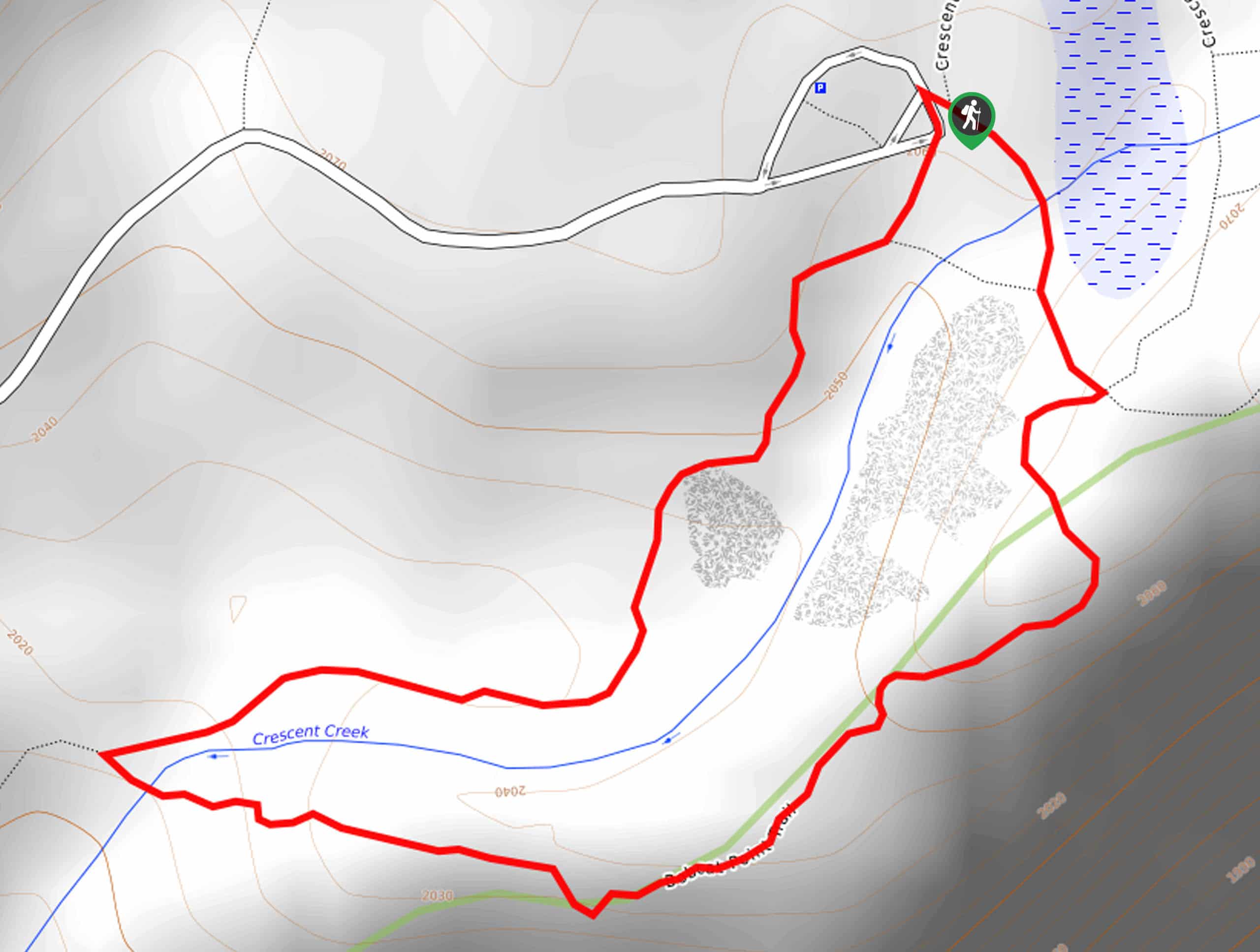
Access this hike via the Park Ridge Trailhead off Panoramic Point Road.

About
| Backcountry Campground | No |
| When to do | April-October |
| Pets allowed | No |
| Family friendly | Yes |
| Route Signage | Average |
| Crowd Levels | Moderate |
| Route Type | Lollipop |
Panoramic Point Trail
Elevation Graph
Weather
Panoramic Point Trail Description
Compared to many routes in the Kings Canyon National Park, the Panoramic Point Trail boasts a tranquil experience, notably in the early morning and late evenings. For the best views head out on a clear day to appreciate the grandeur of the mountainous landscape. Note entrance to the park costs $35USD per vehicle or $20USD per person for pedestrians or cyclists.
Setting out from the Park Ridge Trailhead, the Panoramic Point Hike travels southeastwardly, gradually climbing through the mixed woodlands. Soon after your departure from the trailhead you will encounter an intersection, keep left here. This section of the path will redirect you northeast before curving south and climbing up to the overlook. Admire the panoramic views from Panoramic Point, then continue south to the following junction.
At this point, you will want to turn right and the Park Ridge Trail will lead you back down the ridge. Soon you will reconnect with the initial segment of trail—retrace your steps along this route back to the trailhead.
Similar hikes to the Panoramic Point Trail hike

Eagle and Bobcat Loop Hike
The Eagle and Bobcat Loop Hike is an amazing adventure that the whole family can enjoy. Wander through luxuriant meadows…
Bobcat Point Loop Hike
Seeking incredible vistas of the Sierra Nevada Mountain Range? The Bobcat Point Loop Hike is an incredible adventure in the…

Huckleberry and Alta Loop Hike
The Huckleberry and Alta Loop Hike is a beautiful adventure that offers a wealth of incredible scenery for hikers to…
Comments