Lost Grove Trail
View Photos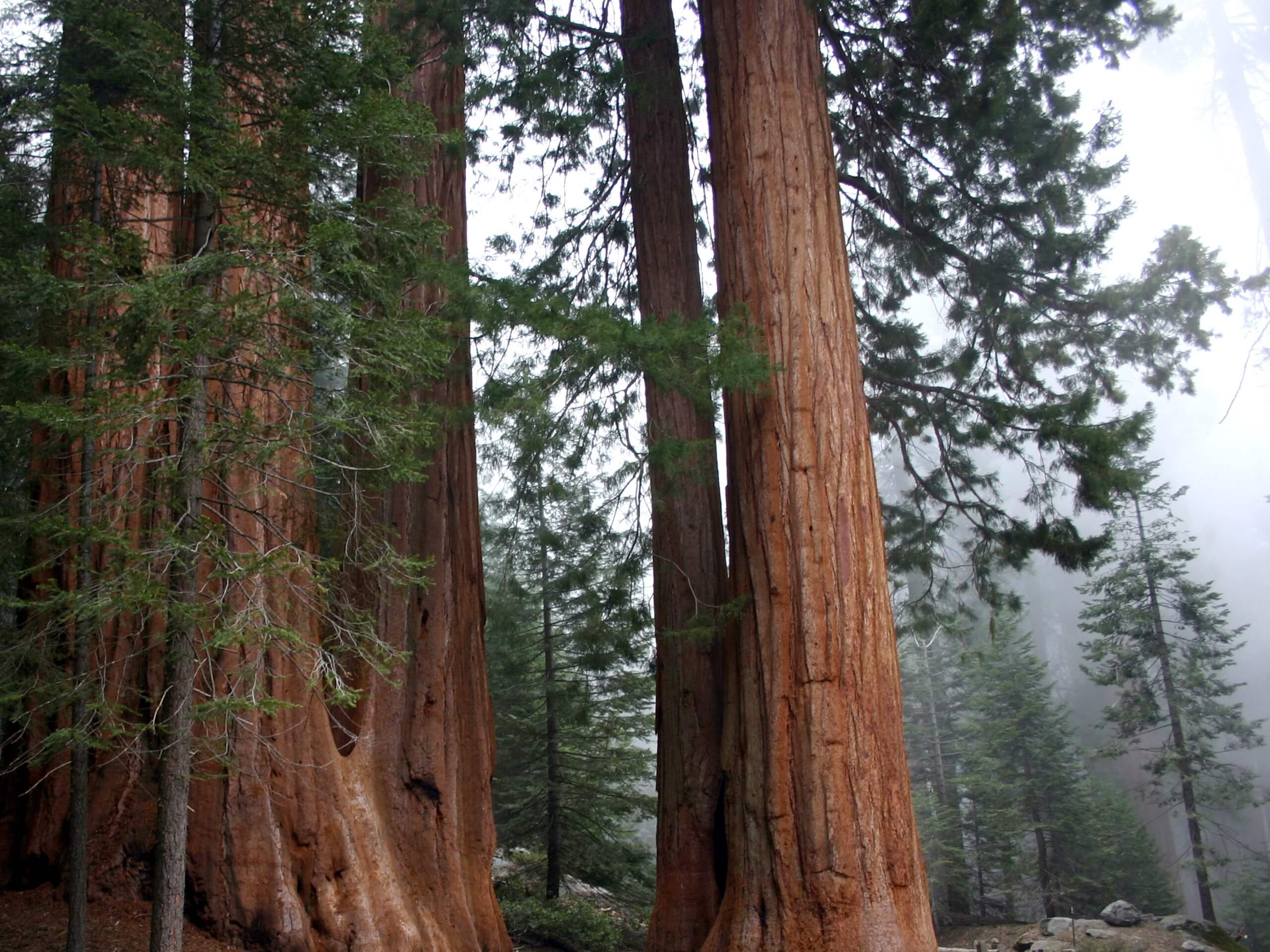
Lost Grove Trail
Difficulty Rating:
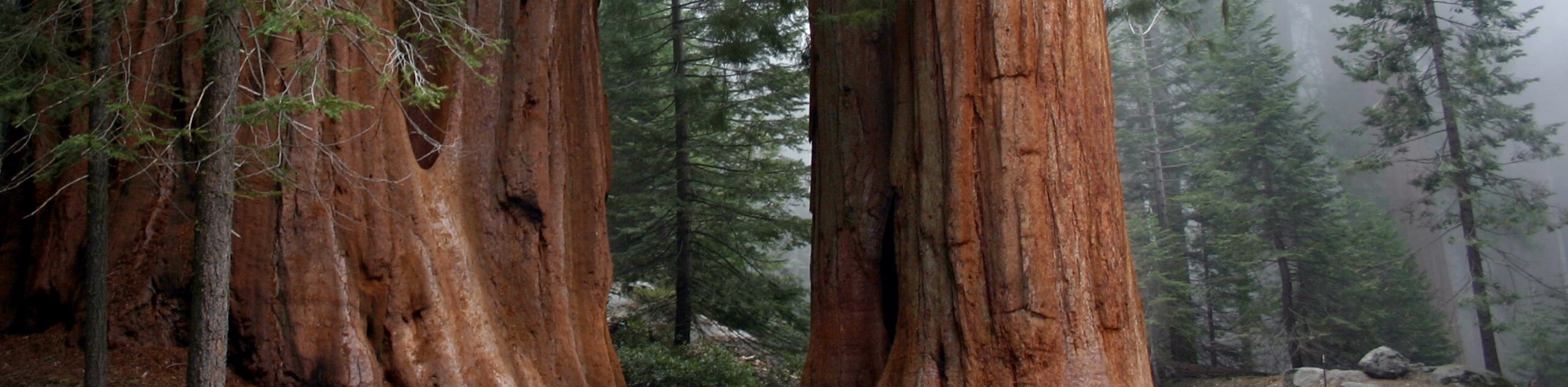
The Lost Grove Trail is not lost in our hearts. This amazing adventure in the Kings Canyon National Park travels through a dense community of sequoias, lush meadowlands, and alongside a meandering creek. This scenic trek would make a great addition to your adventure itinerary.
Getting there
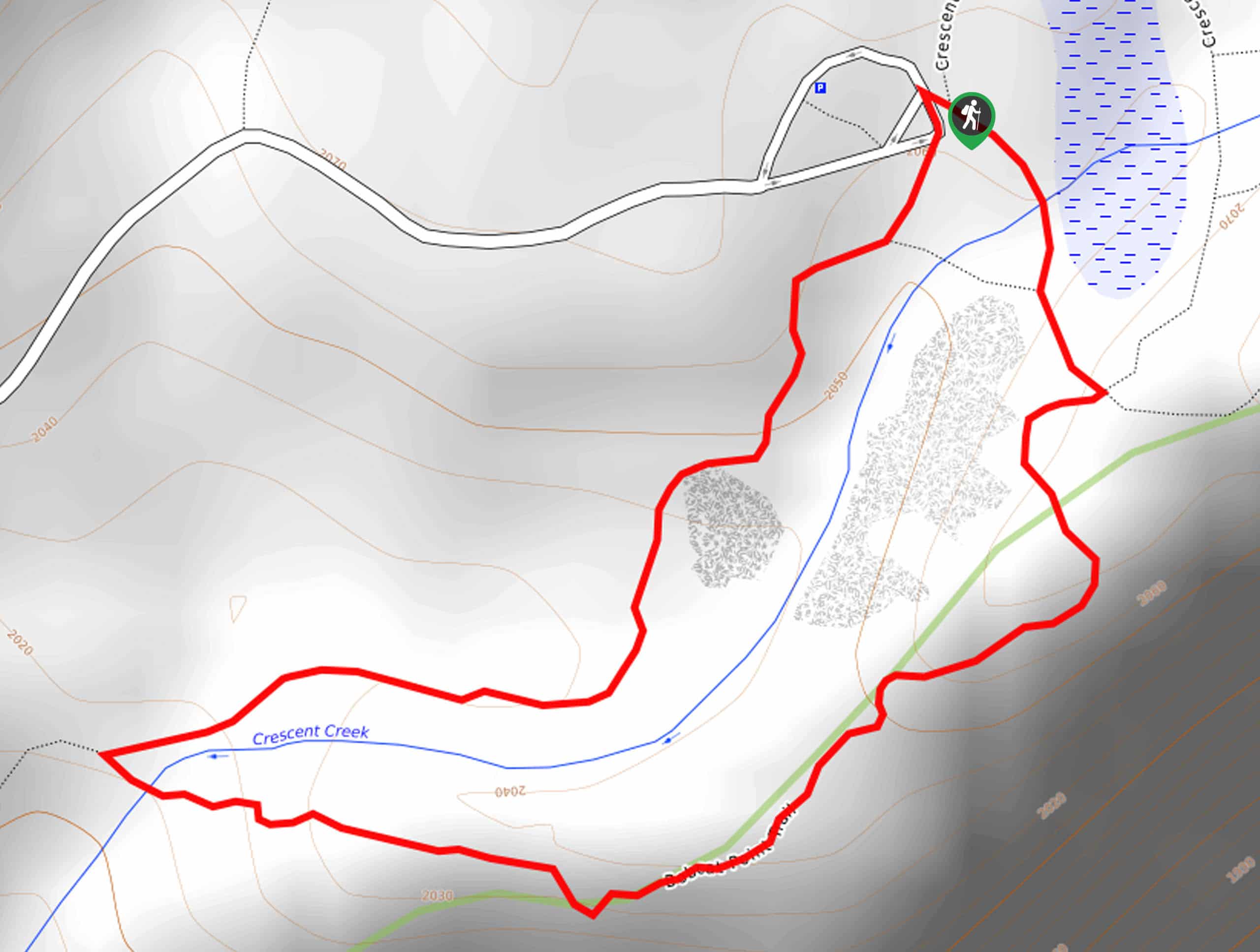
The Lost Grove Trail departs from the trailhead in the Dorst Creek Campground off Generals Highway.

About
| Backcountry Campground | No |
| When to do | April-October |
| Pets allowed | No |
| Family friendly | Yes |
| Route Signage | Average |
| Crowd Levels | Moderate |
| Route Type | Out and back |
Lost Grove Trail
Elevation Graph
Weather
Lost Grove Trail Description
There is nothing more peaceful and beautiful than a forested trail—and the Lost Grove Hike delivers just that. This wonderful trail explores sequoia stands adorned with carpets of lush ferns and blooming wildflowers. Reconnect with nature and escape the stressors of the real world along this tranquil route. Those seeking more seclusion are encouraged to head out in the early morning or late evening to avoid the rush! Note entrance to the park costs $35USD per vehicle or $20USD per person for pedestrians or cyclists.
Your journey along the Lost Grove Trail begins from the trailhead found within the Dorst Creek Campground. Setting out from the trailhead, you will be led north along the Dorst/Lost Grove Trail. Gently descending through the woodlands, the path will soon intersect with Dorst Creek—at this point, the trail will reroute you west. Enjoy the sounds of the meaning creek that bisects the sequoia grove. Be sure to keep an eye out for wildlife as you progress through the wilderness!
Eventually, the path will guide you through a swathe of meadows before climbing up to the trail’s end on Generals Highway. From here, turn around and head back the way you came to the trailhead.
Similar hikes to the Lost Grove Trail hike

Eagle and Bobcat Loop Hike
The Eagle and Bobcat Loop Hike is an amazing adventure that the whole family can enjoy. Wander through luxuriant meadows…
Bobcat Point Loop Hike
Seeking incredible vistas of the Sierra Nevada Mountain Range? The Bobcat Point Loop Hike is an incredible adventure in the…

Huckleberry and Alta Loop Hike
The Huckleberry and Alta Loop Hike is a beautiful adventure that offers a wealth of incredible scenery for hikers to…
Comments