Hanging Rock Trail
View Photos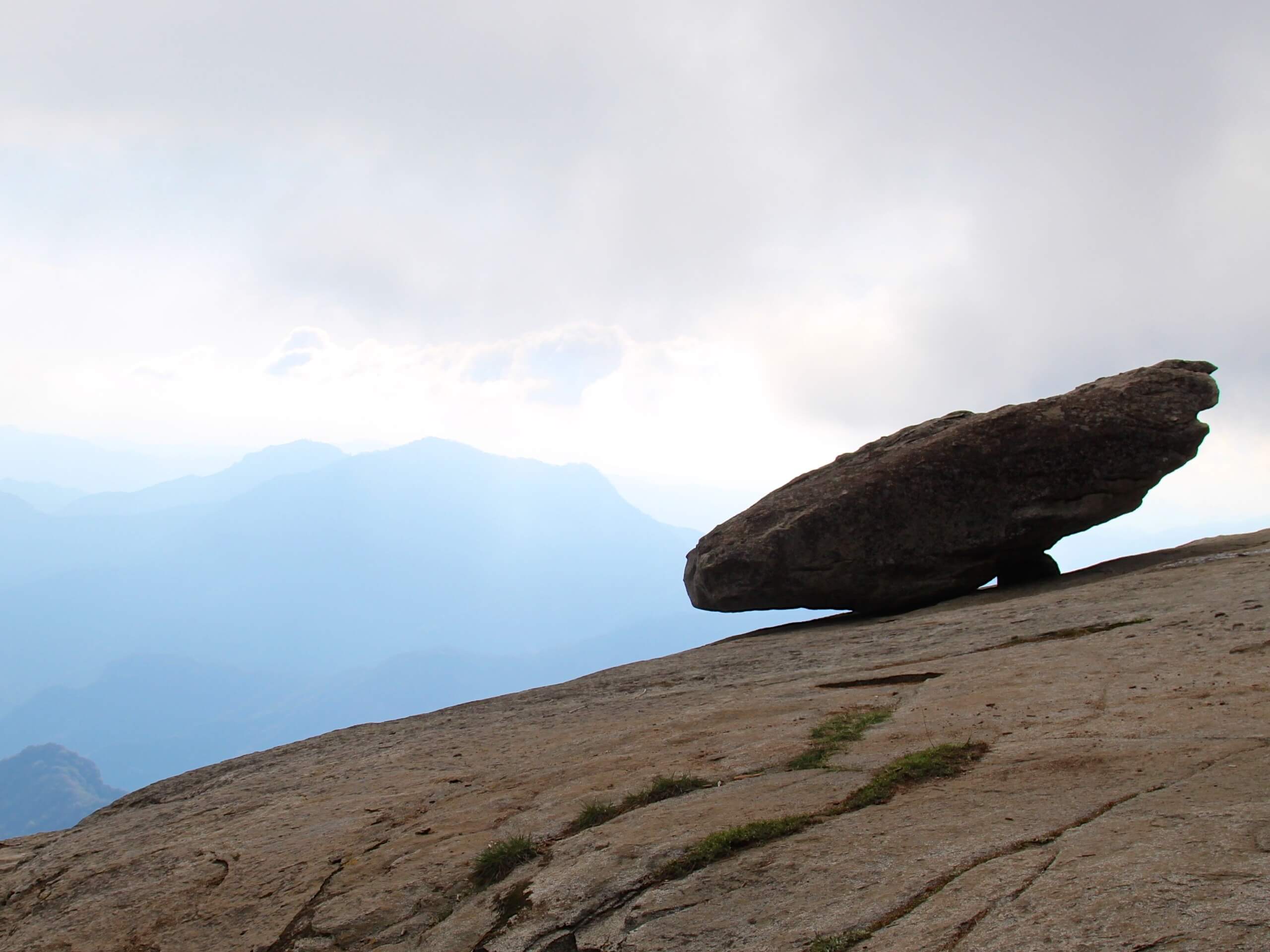
Hanging Rock Trail
Difficulty Rating:
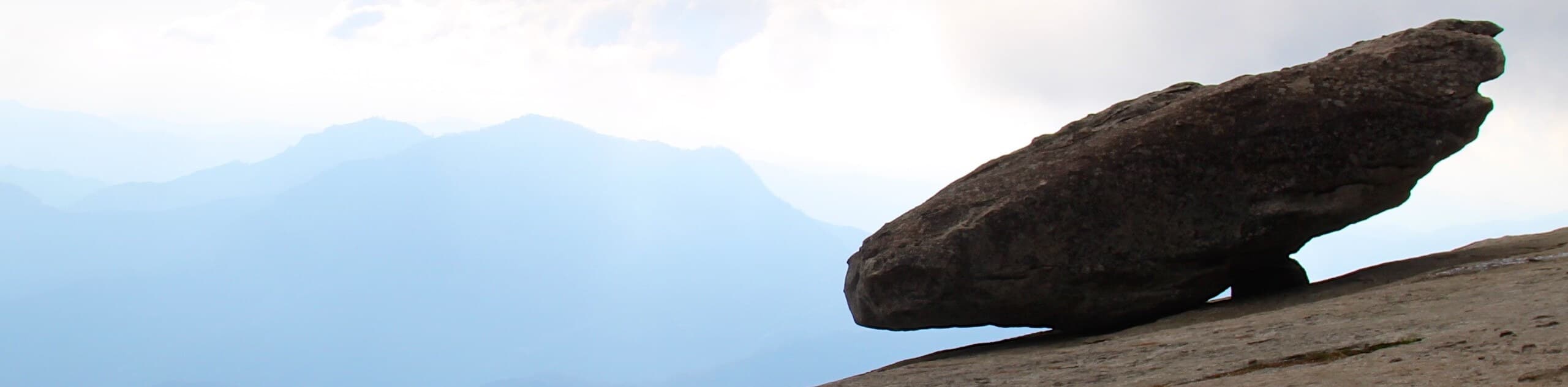
The Hanging Rock Trail is a wonderful alternative to the Moro Rock Trail that those with a fear of heights will surely enjoy. This short, but incredibly scenic hike offers mesmerizing views of the Great Western Divide and Moro Rock looming above the valley.
Getting there
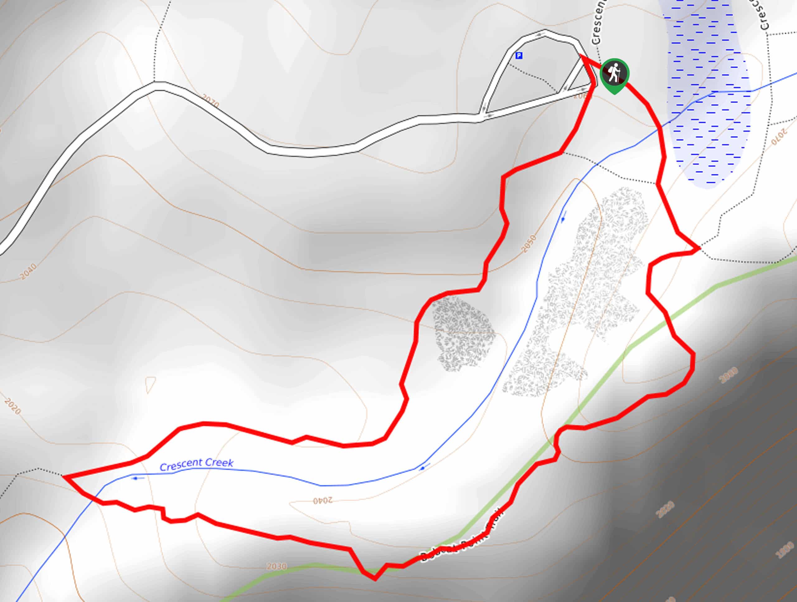
Access this hike via the trailhead and parking lot off Moro Rock Loop.

About
| Backcountry Campground | No |
| When to do | March-November |
| Pets allowed | No |
| Family friendly | Yes |
| Route Signage | Average |
| Crowd Levels | Moderate |
| Route Type | Out and back |
Hanging Rock Trail
Elevation Graph
Weather
Hanging Rock Trail Description
A magnet for photographers and outdoor enthusiasts alike, this route sees plenty of traffic. The next time you find yourself in the Sequoia National Park, take a detour to this wonderful destination. The Moro Rock Trail is closed, or you are fearful of the vertiginous climb, then this trek is perfect! Note the rocky path is slippery after rainfall, so mind your footing and be sure to keep your distance from the edge of the outcrop. Don’t forget entrance to the park costs $35USD per vehicle or $20USD per person for pedestrians or cyclists.
Setting out from the trailhead, your journey along the Hanging Rock Trail travels westwardly, gradually climbing into the woodlands. As you trek along the rocky terrain, you will be granted sporadic views of the mountainous wilderness through the tree breaks. Not long after your departure will you reach the Hanging Rock overlook. Revel in the mesmerizing vistas of the Great Western Divide dominating the landscape and Moro Rock decorated with intrepid adventurers.
After marveling at the panorama, continue along the route to the power station, which boasts equally as impressive views of the Sierra Nevada Mountains. Retrace your footing the way you came when you are ready to head back.
Similar hikes to the Hanging Rock Trail hike

Eagle and Bobcat Loop Hike
The Eagle and Bobcat Loop Hike is an amazing adventure that the whole family can enjoy. Wander through luxuriant meadows…
Bobcat Point Loop Hike
Seeking incredible vistas of the Sierra Nevada Mountain Range? The Bobcat Point Loop Hike is an incredible adventure in the…

Huckleberry and Alta Loop Hike
The Huckleberry and Alta Loop Hike is a beautiful adventure that offers a wealth of incredible scenery for hikers to…
Comments