General Sherman Trail via Generals Highway
View Photos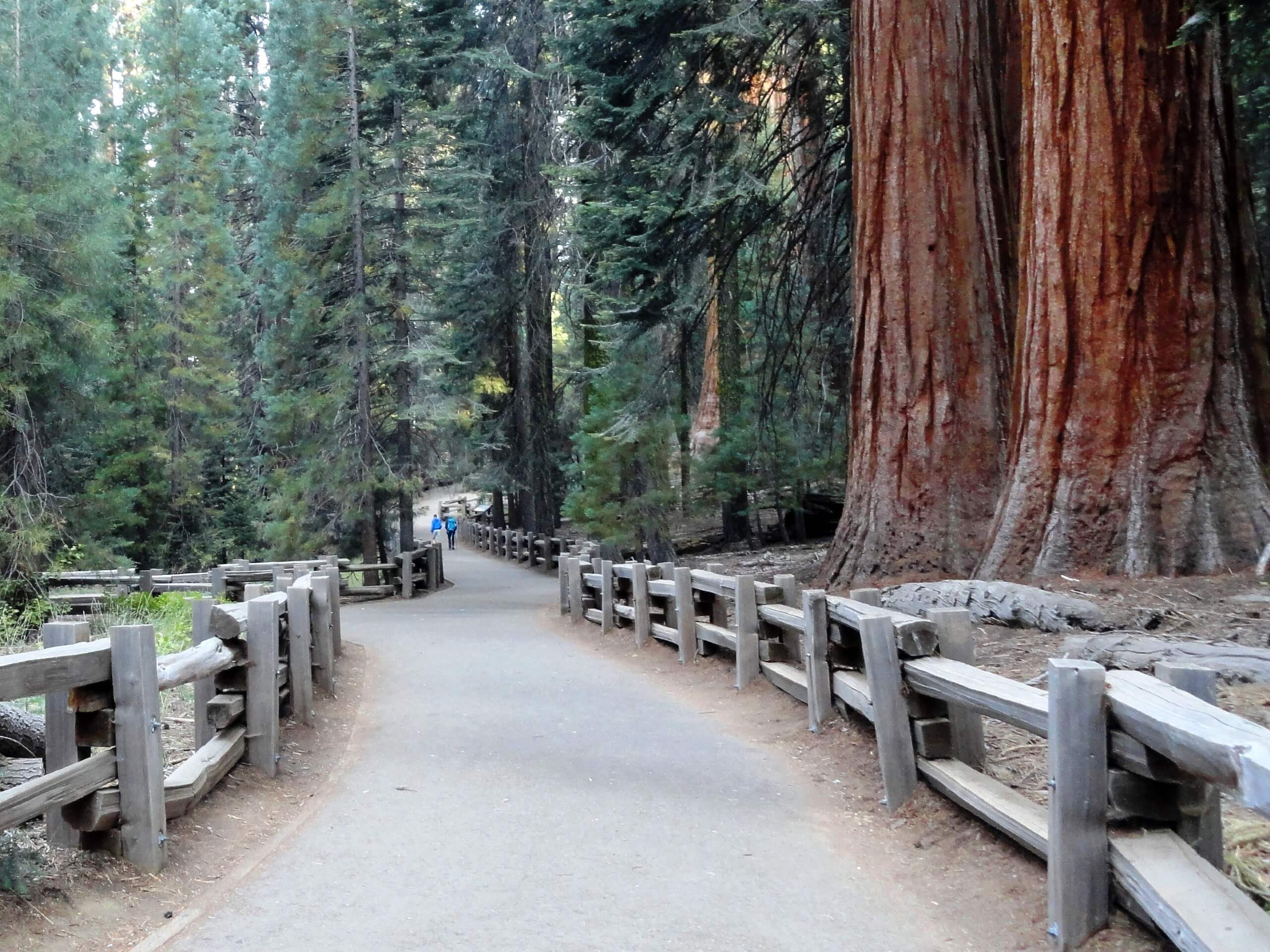
General Sherman Trail via Generals Highway
Difficulty Rating:
The General Sherman Trail via Generals Highway is the accessible route to the famous General Sherman Tree. Explore the Giant Forest Grove and revel in the grandeur of the looming sequoia that attracts adventurers around the globe.
Getting there
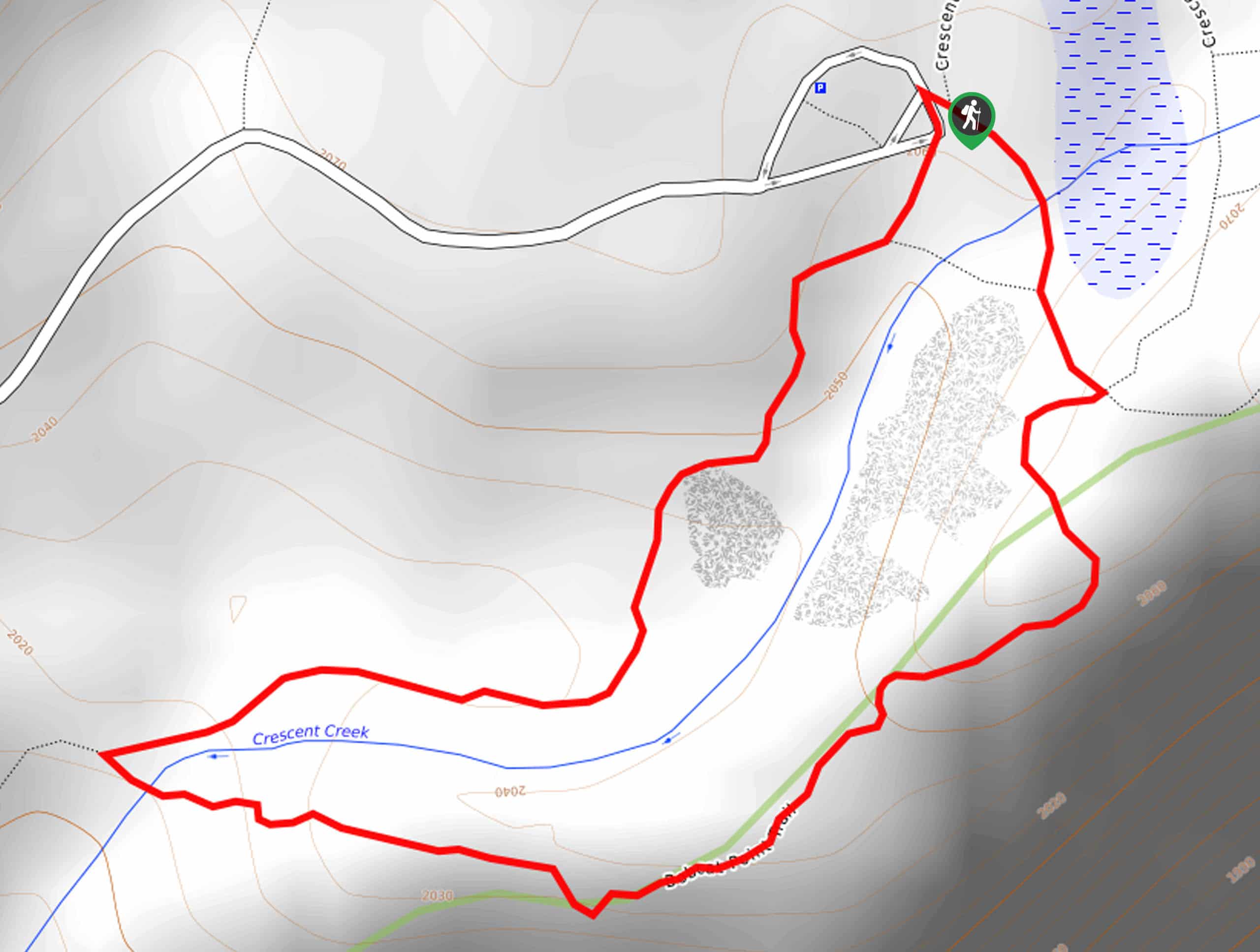
Access this hike via the trailhead off Generals Highway.

About
| Backcountry Campground | No |
| When to do | Year-round |
| Pets allowed | No |
| Family friendly | Yes |
| Route Signage | Average |
| Crowd Levels | High |
| Route Type | Out and back |
General Sherman Trail via Generals Highway
Elevation Graph
Weather
General Sherman Trail via Generals Highway Description
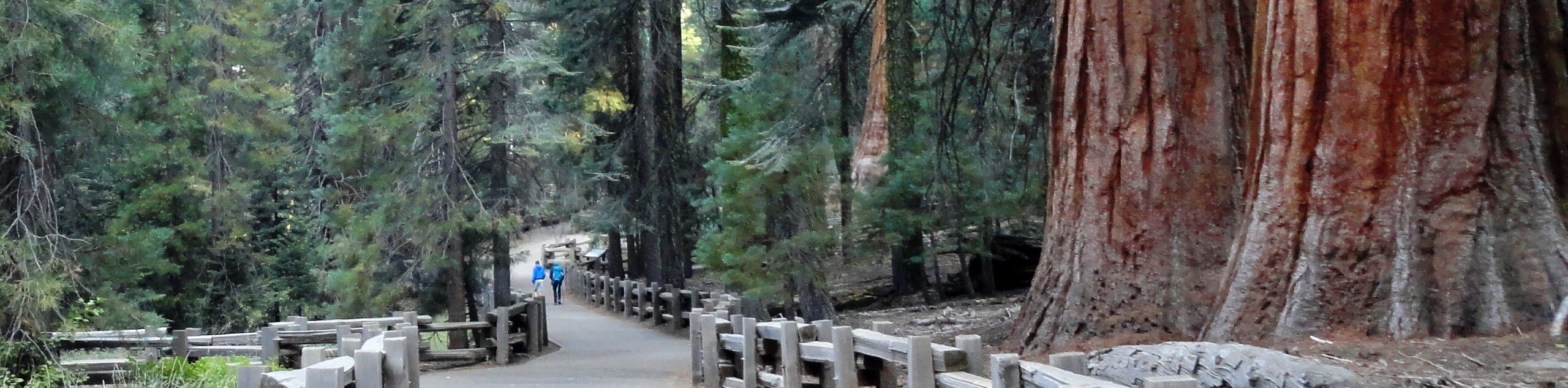
Those seeking a short, easy-going outdoor adventure will enjoy this route. Accessible to strollers and wheelchairs, this route becomes the main entrance to the Giant Forest Grove in the winter months. Note this area sees plenty of traffic, so those seeking a more tranquil experience are encouraged to head out in the early morning or evening to avoid the rush! Note entrance to the park costs $35USD per vehicle or $20USD per person for pedestrians or cyclists.
Embark on your adventure along the General Sherman Trail from the trailhead and parking lot off Generals Highway Setting out from here, you have a very quick stroll along the General Sherman Trail to the famous tree. Heading eastwardly, the path weaves through the grove amongst smaller but equally as enchanting sequoias. Soon the path will reach the base of the monstrous General Sherman Tree.
Revel in the grandeur of the old-growth sequoia that so famously adorns the forest. Take the typical photo in front of the giant tree and loop around its immense base. When you are ready, simply retrace your steps along the path back to the trailhead.
Similar hikes to the General Sherman Trail via Generals Highway hike

Eagle and Bobcat Loop Hike
The Eagle and Bobcat Loop Hike is an amazing adventure that the whole family can enjoy. Wander through luxuriant meadows…
Bobcat Point Loop Hike
Seeking incredible vistas of the Sierra Nevada Mountain Range? The Bobcat Point Loop Hike is an incredible adventure in the…

Huckleberry and Alta Loop Hike
The Huckleberry and Alta Loop Hike is a beautiful adventure that offers a wealth of incredible scenery for hikers to…
Comments