Franklin Lakes Trail
View Photos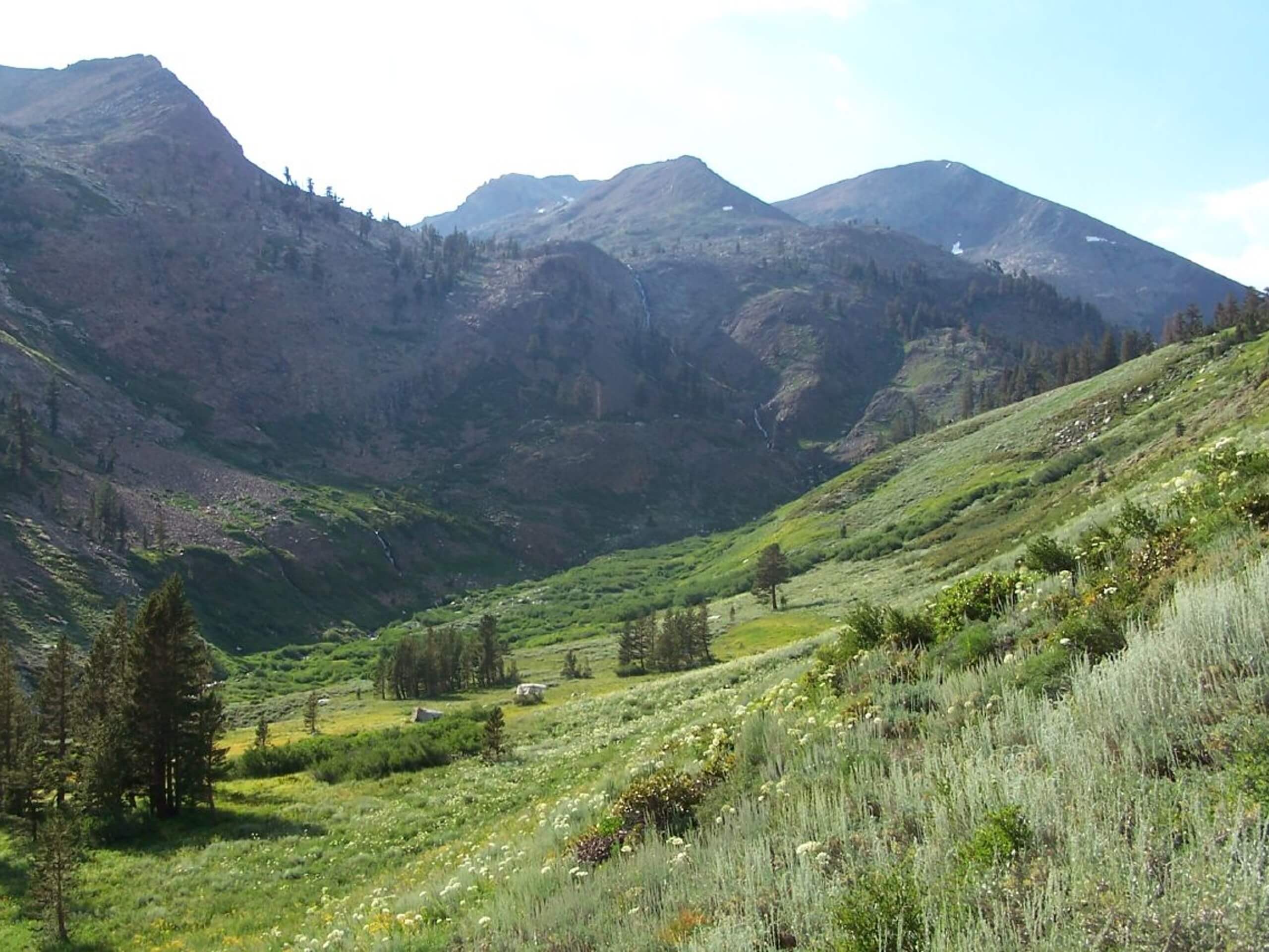
Franklin Lakes Trail
Difficulty Rating:
Explore the high country and immerse yourself in the postcard-perfect setting as you hike the Franklin Lakes Trail. If there is one route to tackle in the Sequoia National Park, it's this one. Offering a wealth of beautiful scenery, you'll want to make sure your camera is charged!
Getting there
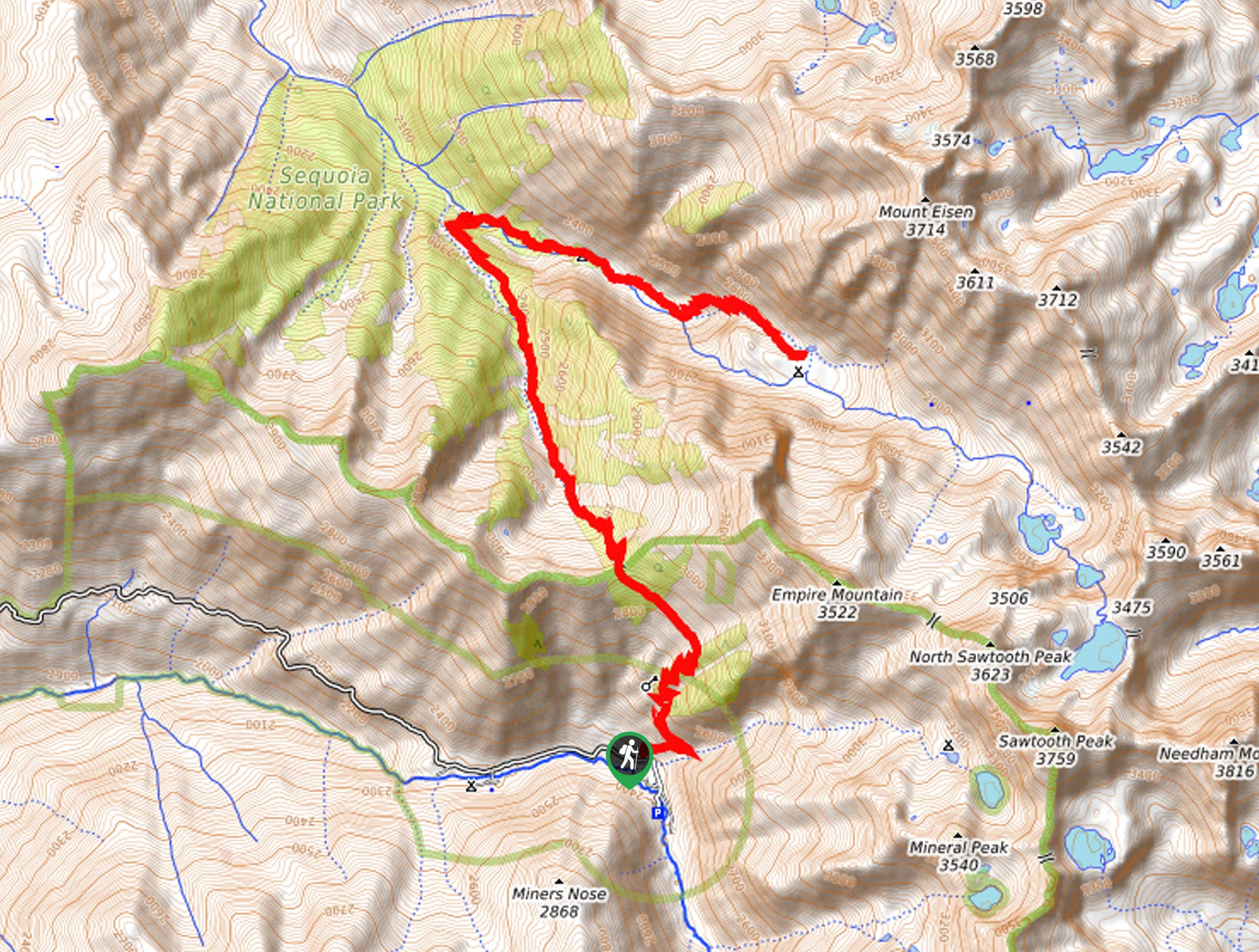
The Franklin Lakes Trail departs from the parking lot across from the Sawtooth Trailhead on the Mineral King Road.

About
| Backcountry Campground | Backcountry Camping, wilderness permits required. |
| When to do | April-October |
| Pets allowed | No |
| Family friendly | No |
| Route Signage | Average |
| Crowd Levels | Moderate |
| Route Type | Out and back |
Franklin Lakes Trail
Elevation Graph
Weather
Franklin Lakes Trail Description
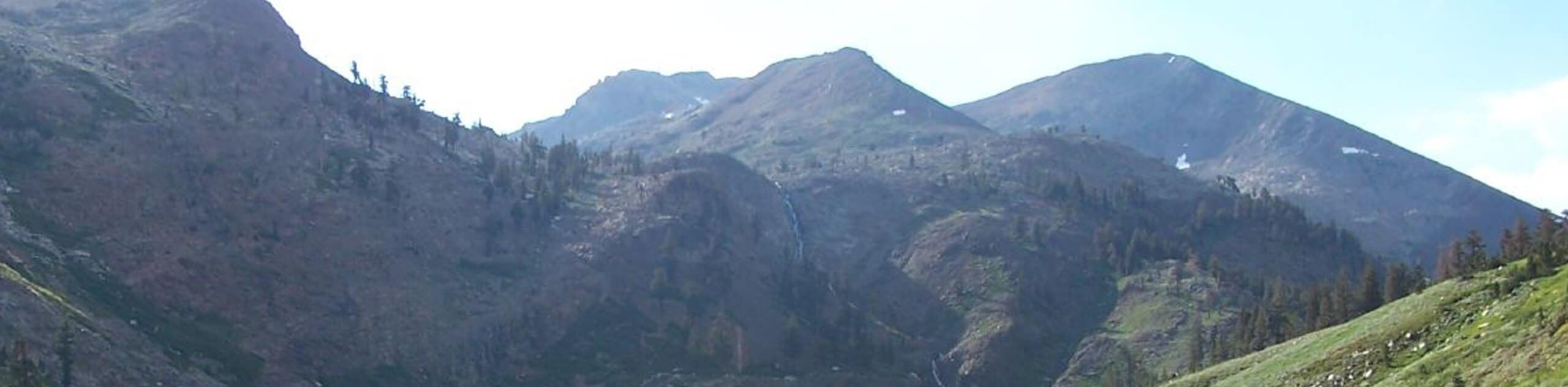
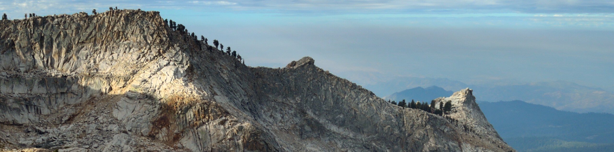
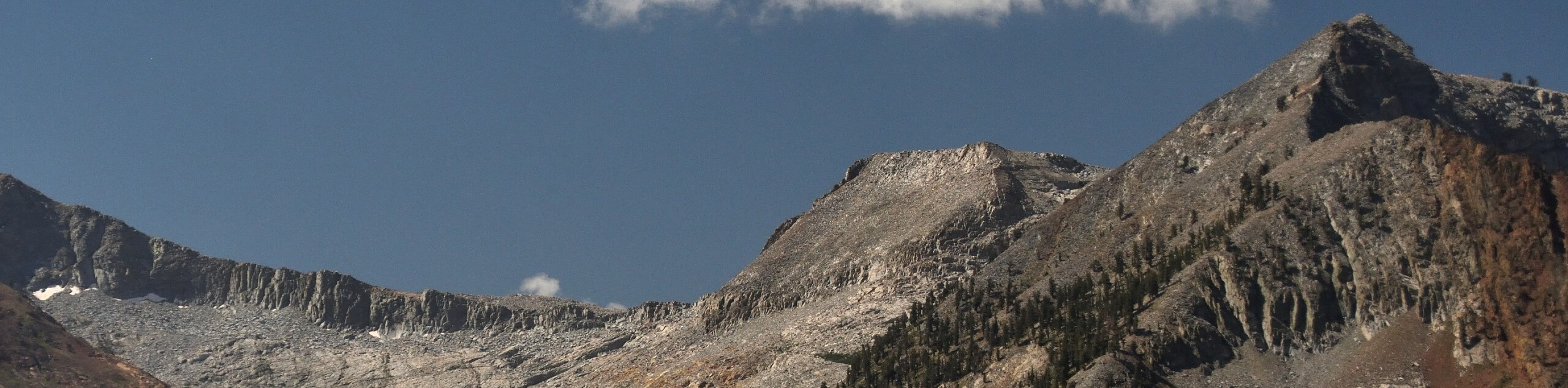
Discover the beauty and diversity of the alpine terrain along the Franklin Lakes Hike. This incredible adventure progresses through a postcard-worthy setting, exhibiting a diversity of flora and fauna that occupy the mountains. Traveling to such high altitudes, it is important to be mindful of afternoon storms, and we suggest dressing in layers as insurance against varying conditions. Though this route offers remarkable views year-round, we encourage you to visit in the spring when the wildflowers bloom, and the seasonal streams surge. Note entrance to the park costs $35USD per vehicle or $20USD per person for pedestrians or cyclists.
Embark on your trek along the Franklin Lakes Trail from the parking lot across from the Sawtooth Trailhead. From here, turn right and wander along the Mineral King Road, merging onto the Farewell Gap-Franklin Lakes Trail at the route’s end. The path will gradually climb through the valley of the East Fork of the Kaweah River. Marvel at the scene of the lush vegetation and the bounding Sierra Nevada summits. Eventually, you will encounter an intersection; veer left here and follow the Franklin Lakes Trail as it ascends some tightly wound switchbacks.
This route will guide you past the Lady Franklin Mine and over Franklin Creek before ultimately delivering you to the Franklin Lakes. Revel in the beauty of the glacial lakes located in the mountain cirque bound by Tulare Peak, Mount Florence, and Rainbow Mountain. Appreciate the expansive alpine panoramas, then head back the way you came to the trailhead.
Similar hikes to the Franklin Lakes Trail hike
Mount Silliman Hike
The Mount Silliman Hike boasts the perfect opportunity to summit a Sierra Nevada Mountain. Explore the high country and revel…
Pinto Lake Trail
Beckoning the exploration of intrepid spirits and experienced hikers, the Pinto Lake Trail is a no walk in the park.…
White Chief Canyon Trail
The White Chief Canyon Trail is a beautiful adventure in the High Sierra that rewards its tired conquerors with incredible…
Comments