

Raven Trail
View PhotosRaven Trail
Difficulty Rating:
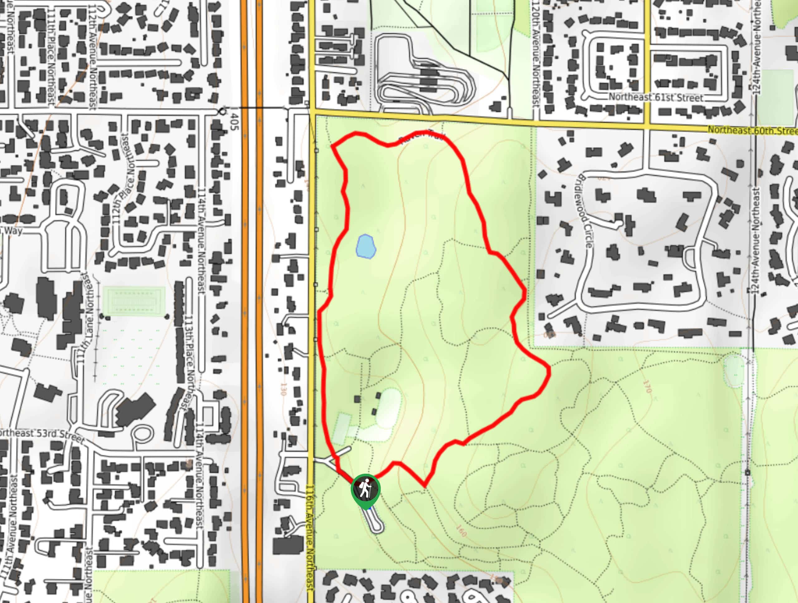
The Raven Trail is a 1.1mi loop in Bridle Trails State Park. This easy route is frequented by horseback riders, as are the other trails in the park. While it’s suitable for foot traffic as well, remember to announce yourself as you approach behind horses and ask the riders how to pass safely if you’re unsure. The trail is mostly level with a few short hills.
Getting there
The trailhead for Raven Trail is off the parking loop on the west side of the park.
About
| Backcountry Campground | No |
| When to do | Year-round |
| Pets allowed | Yes - On Leash |
| Family friendly | Yes |
| Route Signage | Good |
| Crowd Levels | Low |
| Route Type | Loop |
Raven Trail
Elevation Graph
Weather
Raven Trail Description
The Raven Trail is a relaxed walking loop that makes use of a horseback riding park. The loop is easy and laidback and the scenery is pleasant. This trail is heavily trafficked by equestrians, so remember the basics of hiking near horses: don’t come up fast from behind, allow horses the right of way, and announce yourself beforehand to the rider whether coming from in front or behind. If you’re unsure of how to pass a horse, just ask the rider. Remember to keep dogs on leash on this trail.
The loop is best done clockwise if you want to descend the steepest portion of the trail instead of climbing it at the end, although it’s not very steep. Go left at the trailhead and look for the raven signage. The loop mostly sticks to the perimeter of the park before cutting back through to the trailhead. A GPS track can help you get back if needed. If you’d like a longer loop through this park, try the Coyote Loop.
Similar hikes to the Raven Trail hike

Sky Country to Harvey Manning Loop
The Sky Country to Harvey Manning Loop is a 4.2mi loop trail in the northern part of Cougar…

Iverson Spit Preserve Loop
The Iverson Spit Preserve Loop is a 1.2mi loop hike right on the beach, coursing through a beaver…

Lowell Riverfront Trail
The Lowell Riverfront Trail is a 3.0mi route alongside the Snohomish River in Everett. This trail is heavily…


Comments