Pettit Lake to Twin Lakes Hike
View Photos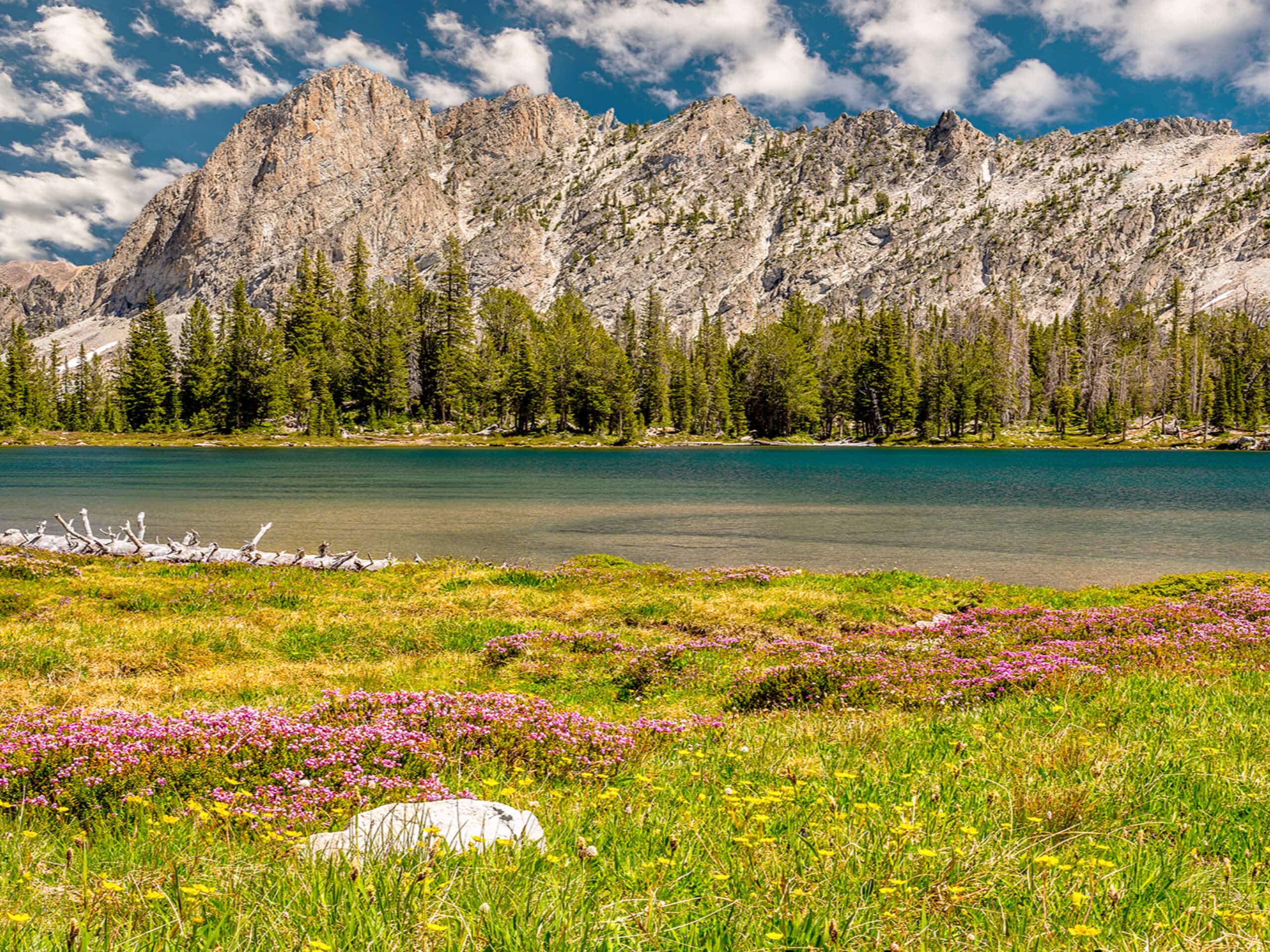
Pettit Lake to Twin Lakes Hike
Difficulty Rating:
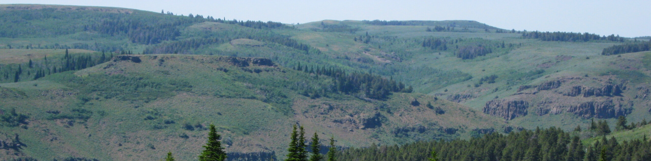
The Pettit Lake to Twin Lakes Hike has it all. This stunning adventure into the heart of the Sawtooth Range features numerous crystalline alpine lakes, gorgeous forests, blossoming meadows, meandering streams, mesmerizing cascades, and spellbinding mountain views—what more could you ask for? We can’t think of anything else!
Getting there
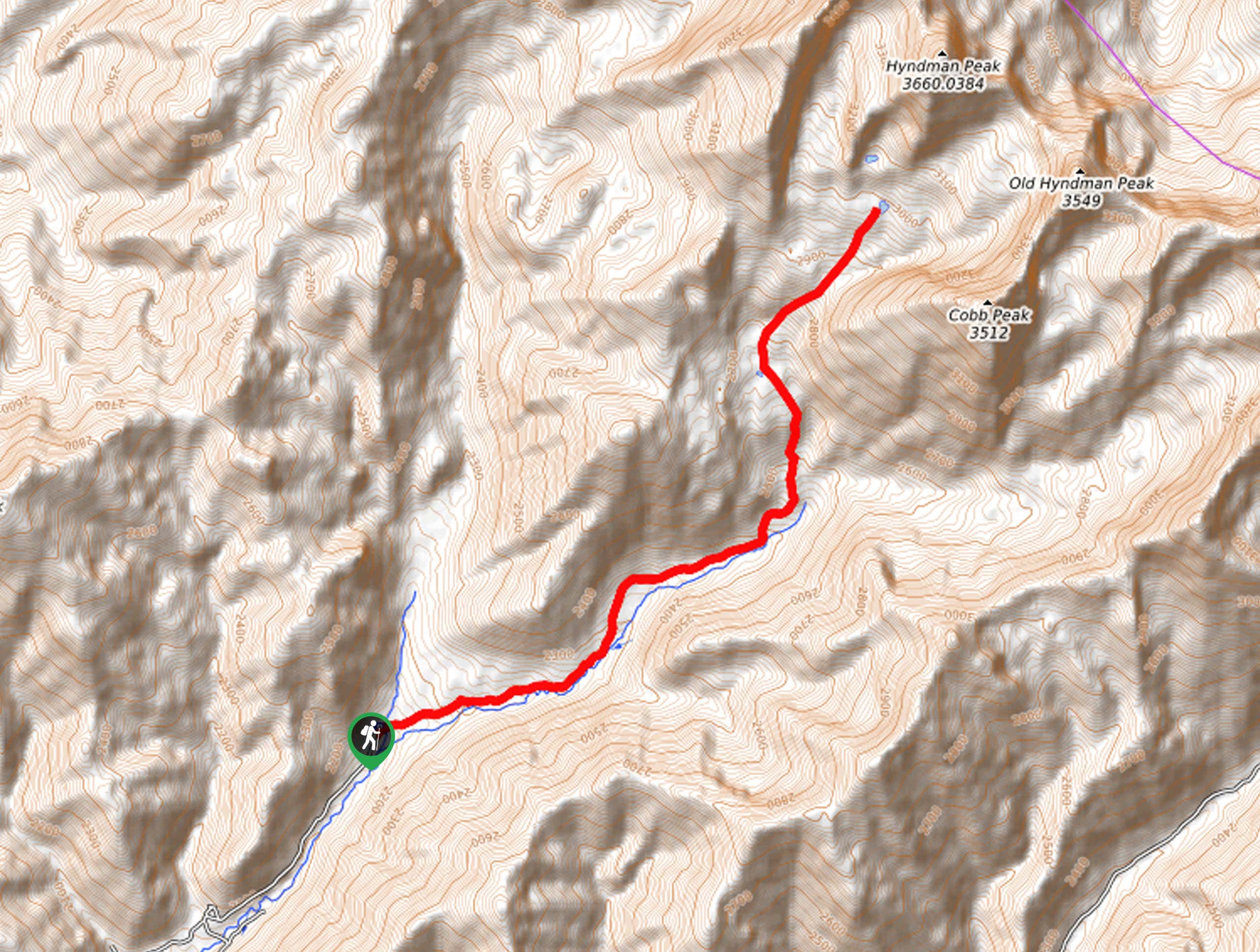
The Pettit Lake to Twin Lakes Hike departs from the Tin Cup Hiker Trailhead off National Forest Development Road 208.

About
| Backcountry Campground | Dispersed camping |
| When to do | April-October |
| Pets allowed | Yes - On Leash |
| Family friendly | Older Children only |
| Route Signage | Good |
| Crowd Levels | High |
| Route Type | Out and back |
Pettit Lake to Twin Lakes Hike
Elevation Graph
Weather
Pettit Lake to Twin Lakes Hike Description
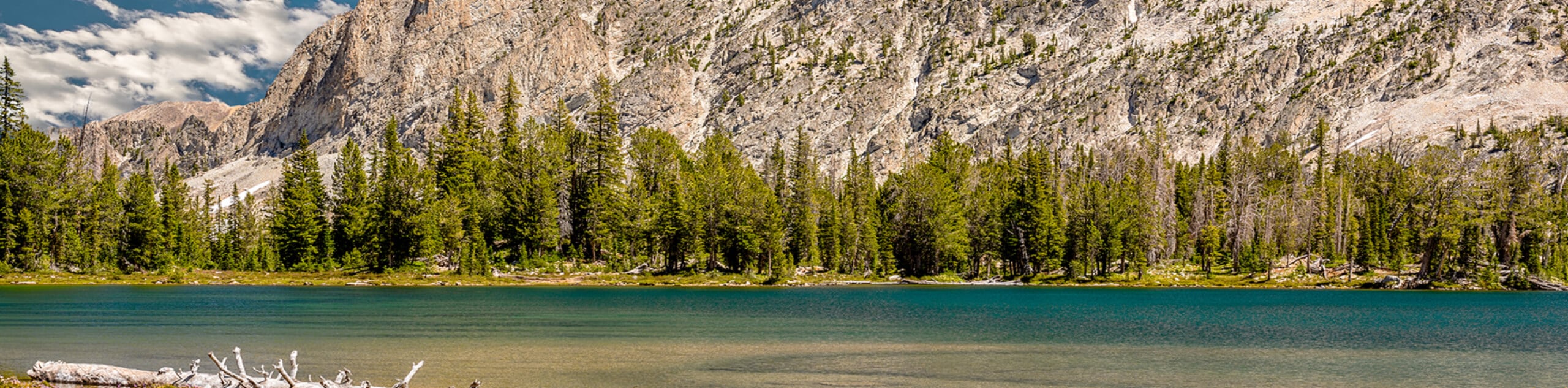
Hiking the Pettit Lake to Twin Lakes Trail is the quintessential Sawtooth Mountain experience. This incredible adventure explores the remote and rugged wilderness, traveling through montane meadows, pine forests, rock fields, and amongst the soaring crests to crystalline alpine lakes. While this trek offers gorgeous scenery, the terrain is technical, and the elevation gain is significant, so it is not for the faint of heart. Some preparation is required—bring plenty of water, wear an ankle-bracing pair of hiking boots, and dress in layers as the conditions at Twin Lakes will likely be windy and cold. Those not acclimatized to the altitude will likely take longer than usual and are encouraged to drink plenty of water. Don’t forget to pick up the self-issued wilderness permit from the trailhead.
Though the Pettit Lake to Twin Lakes Hike demands some effort, it is highly rewarding. Indulge in majestic views of towering snow-capped spires and sheer rockfaces that bound shimmering alpine lakes and enjoy the diversity of flora and fauna that occupy the rocky landscape. This area of the Sawtooth Mountain Range is an outdoor paradise, and the unrivaled beauty along this particular route attracts quite the crowd, so expect to hike in the company of like-minded enthusiasts. Those yearning for a more secluded experience are encouraged to head out in the early morning, though you will still likely be joined by others! Although busy at times, the Pettit Lake to Twin Lakes Hike is full of wonderment and worthy of your exploration.
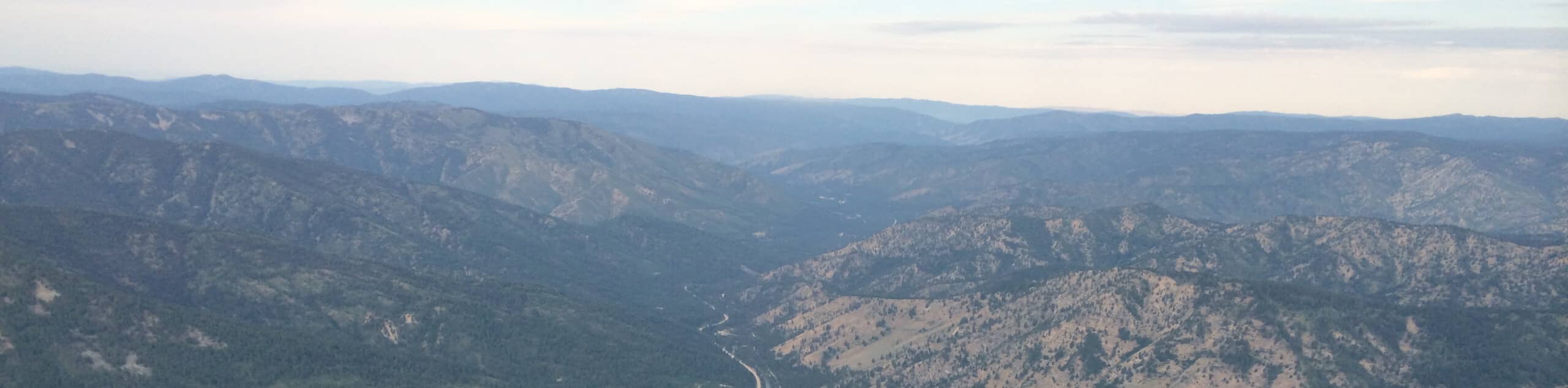
With plenty of water and a charged camera in tow, your adventure along the Pettit Lake to Twin Lakes Hike begins from the Tin Cup Hiker Trailhead. Setting out from here, the Pettit Creek Trail travels westwardly along the northern shoreline of Pettit Lake. Admire the charm of the glittering water as you explore the lakeshore, and soon you will enter the Sawtooth Wilderness. From here, the path leaves the shoreline and meanders along Pettit Creek through a rocky canyon, intersecting with the cascading drainage on numerous occasions. As you climb through the forested valley, make sure to take the time to look behind you for an incredible view of the White Cloud Mountains.
Beyond this point, sights of El Capitan will come into view as you near Alice Lake. Appreciate the grandeur of the jagged outcrop rising from the landscape. Soon you will pass a series of mini lakes along Pettit Creek before opening to the impressive Alice Lake, which often mirrors El Capitan in its calm waters. Take a moment to enjoy the flowering shoreline of Alice Lake, rest and rehydrate before commencing the final push up to the Twin Lakes. From here, the Pettit Creek Trail will wind up the rocky ridge sparsely decorated with towering ponderosa pines and blossoming meadows up to the Twin Lakes.
Explore the lakeshore of the teal-colored alpine pools separated by a thin strip of granite and Snowyside Peak towering above. Wander across the median and revel in the sweeping vistas of the encompassing craggy peaks, taking plenty of photos along the way. Remember that you have a long hike back to the trailhead ahead of you, so make sure you have enough time to return before nightfall. If time permits, take a swim in the tempting waters and relax along the scenic shoreline. When you are ready, retrace your steps along the path back to the trailhead, marking the end of your high-country hike.
Trail Highlights
Twin Lakes
The Twin Lakes are a collection of two glacial pools in the Sawtooth Mountain Range that are separated by a narrow strip of land. Sitting beneath Snowyside Peak, the North Twin Lake is located at an elevation of 8900ft, and the South Twin Lake at 8855ft.
Snowyside Peak
Snowyside Peak stands at an elevation of 10651ft and is the fifth-highest peak in the Sawtooth Mountain Range. This dramatic summit is a great climbing peak for intrepid scramblers seeking a high-country thrill.
Frequently Asked Questions
How long is the Pettit Lake to Twin Lakes Hike?
The Pettit Lake to Twin Lakes Hike is a 13.3mi out-and-back trail in the Sawtooth Wilderness.
Can you swim in the Twin Lakes?
Yes, visitors can swim in the Twin Lakes—just keep in mind they will likely be quite refreshing.
Insider Hints
Bring snowshoes when exploring in the shoulder seasons (fall and spring)
In the summer months the refreshing alpine waters are tempting, so bring your swimsuit
Head out in the morning to secure a spot in the trailhead parking lot
Dress in layers as insurance against changing conditions
Wear a sturdy pair of footwear to avoid a rolled ankle on the uneven and rocky terrain
Bring your camera, the scenery is quite photogenic
SPF and sun protection is wise as much of the route is exposed
Dogs must be on a leash between July 1 and Labor Day
Similar hikes to the Pettit Lake to Twin Lakes Hike hike
Hyndman Creek Trail
The Hyndman Creek Trail is an enchanting adventure up the slopes of the highest peak in the Hyndman Mountains. Explore…
Warm Springs Loop Hike
Remarkable mountain views await you on the Warm Springs Loop Hike in the Sawtooth National Forest. What is a popular…
Third Fork Rock Creek Trail
The Third Fork Rock Creek Trail would make a wonderful addition to your hiking itinerary. Located in the south of…
Comments