Missouri, Belford, and Oxford Mountains Hike
View Photos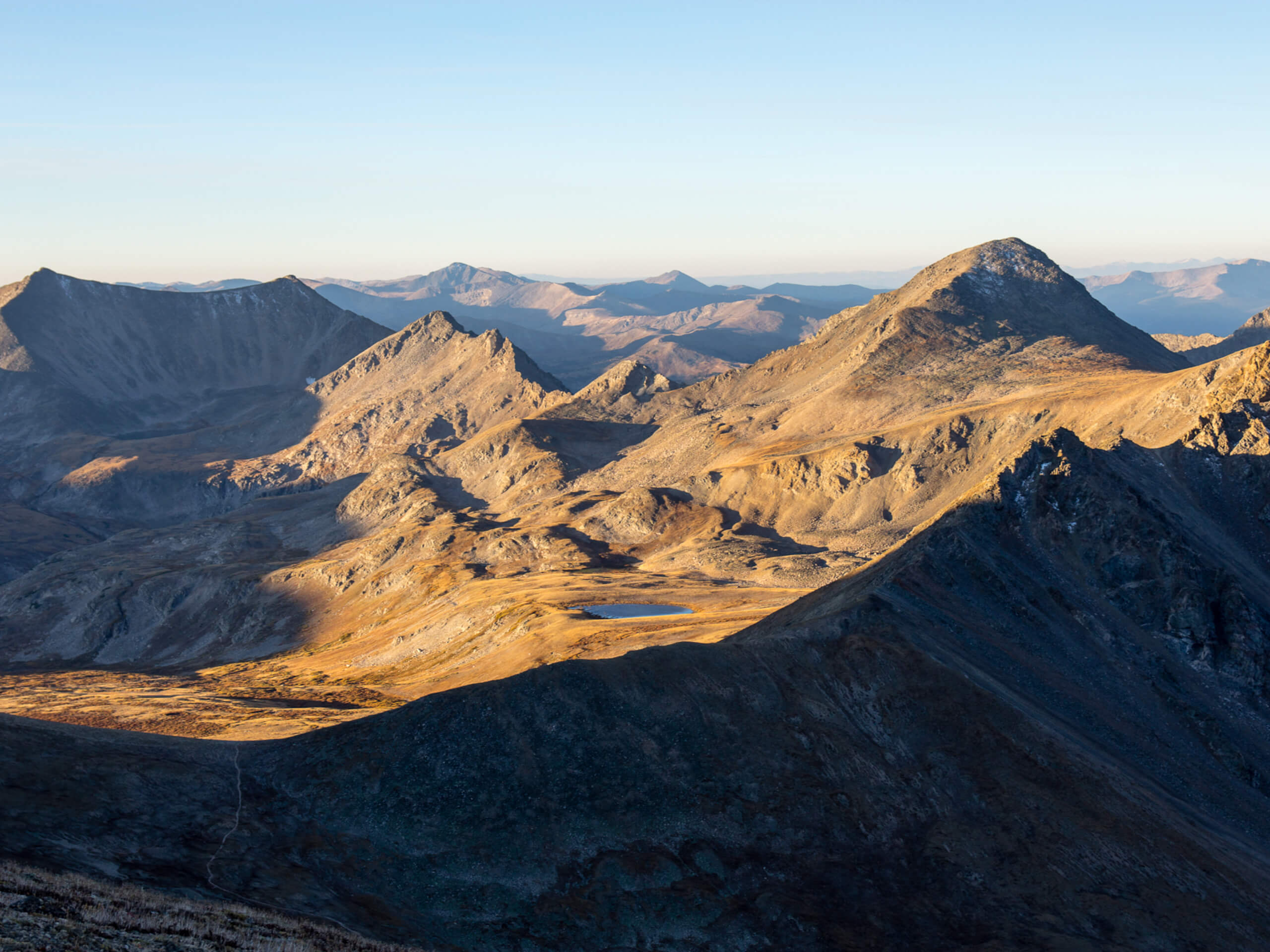
Missouri, Belford, and Oxford Mountains Hike
Difficulty Rating:
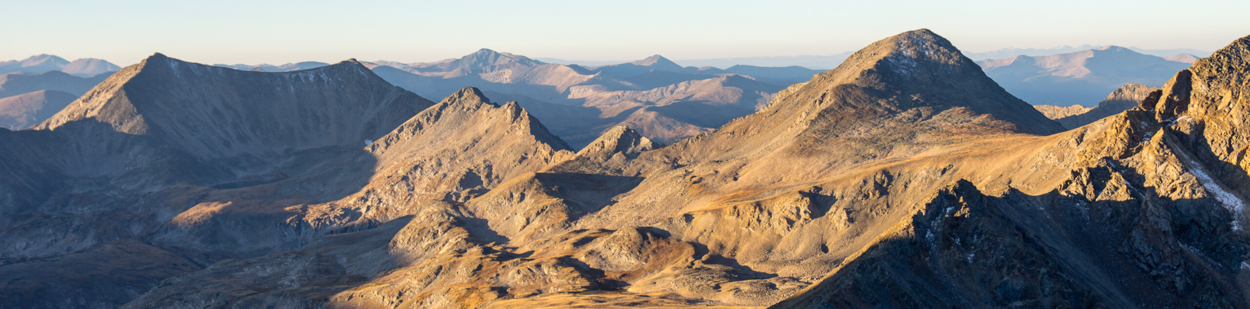
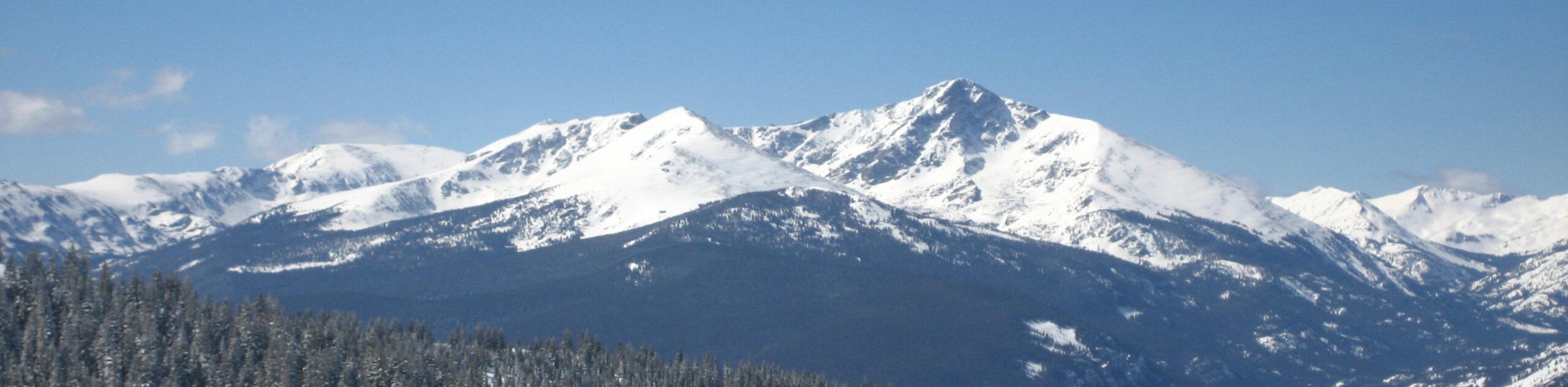
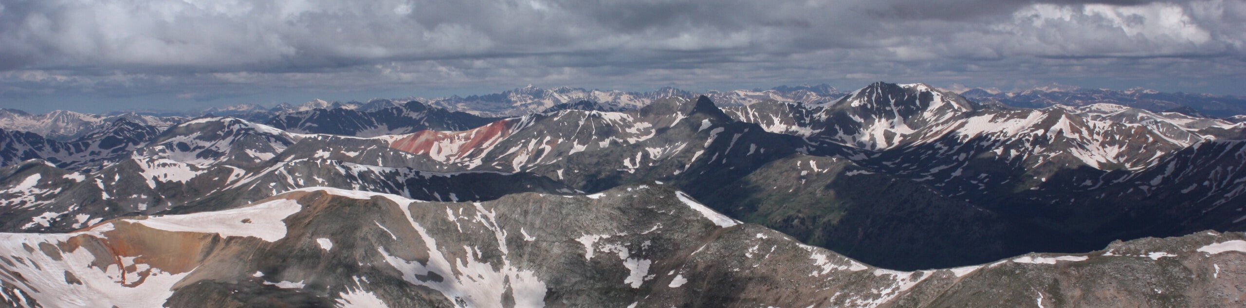
Seeking a real challenge? Try the Missouri, Belford, and Oxford Mountains Hike—a trail that ascends not one, not two, but three dramatic Colorado 14ers. Reserved for intrepid and experienced hikers, this trek is no easy feat, but the sense of personal achievement at the end is well worth the exhaustion in our opinion.
Getting there
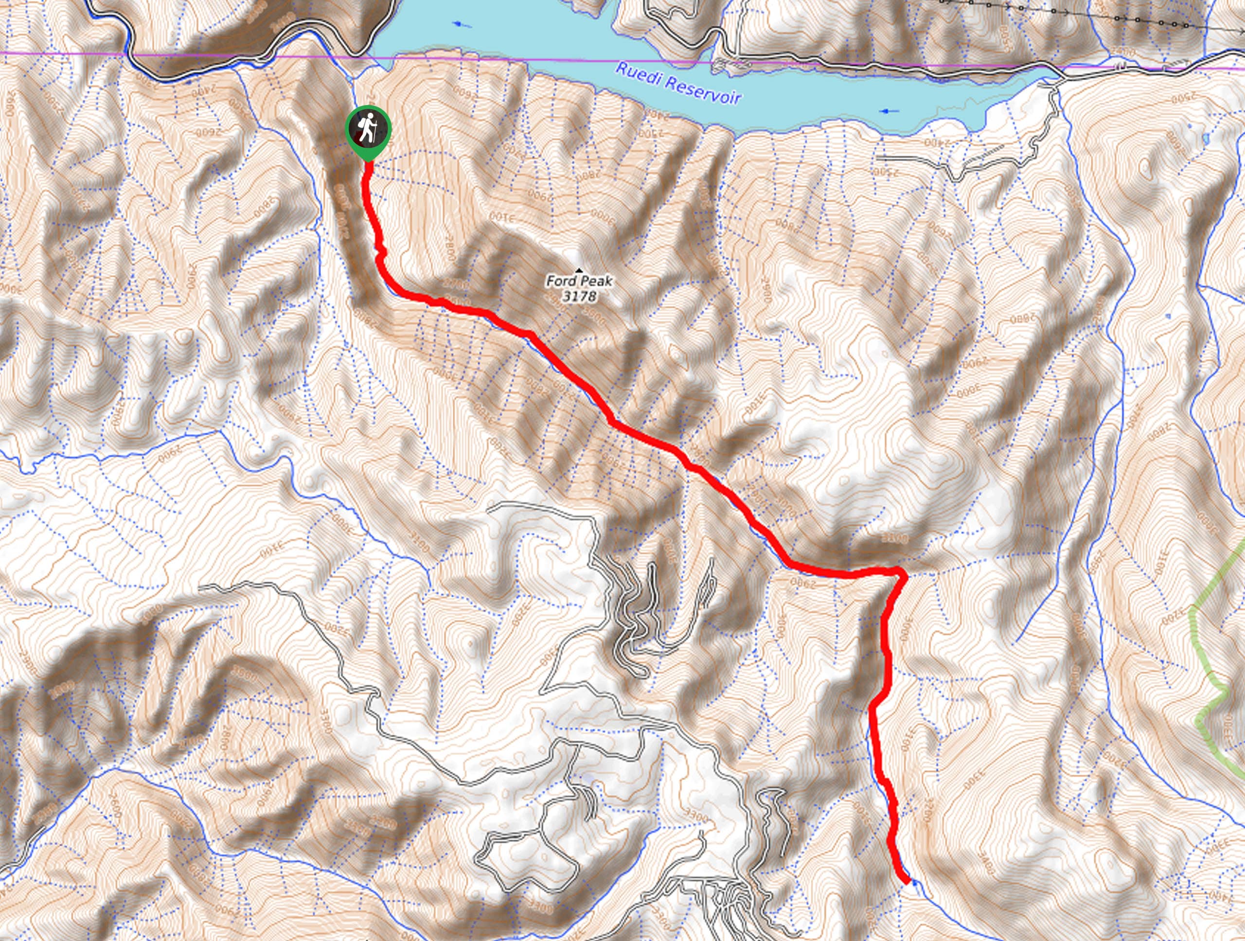
The Missouri, Belford, and Oxford Mountains Hike departs from the Missouri Gulch Trailhead off Clear Creek Road.

About
| Backcountry Campground | Dispersed Backcountry Camping |
| When to do | June-September |
| Pets allowed | Yes - On Leash |
| Family friendly | No |
| Route Signage | Average |
| Crowd Levels | Low |
| Route Type | Lollipop |
Missouri, Belford, and Oxford Mountains Hike
Elevation Graph
Weather
Missouri, Belford, and Oxford Mountains Hike DescriptionMissouri, Belford, and Oxford Mountains Hike
If you are an experienced mountaineer and feel adventurous, consider the Missouri, Belford, and Oxford Mountains Trail for your next adventure. This demanding hike demands stamina and preparation as it travels long distances at high altitudes. Make sure you are acclimated to the area’s elevation and head out before dawn to mitigate the chances of getting caught in a nasty afternoon storm at the exposed summits. Wear layers and pack plenty of water as the elevation and technical terrain will tire you. Finally, strap on microspikes in the fall and winter months and consider trekking poles to navigate the vertiginous terrain. Though this trek can be completed as an extensive day-hike, we suggest camping below the treeline and breaking this hike into a two-day adventure.
When you are packed and prepared, depart on your adventure along the Missouri, Belford, and Oxford Mountains Hike from the Missouri Gulch Trailhead. From here, wander south along the Missouri Gulch Trail. At the first intersection, keep right and climb up the steep terrain to the next junction. Here, veer right, and you will be diverted onto the Missouri Mountain Northwest Trail, hooking onto the Missouri Mountain West Ridge Trail at the next fork in the road. Ascend the peak, then retrace your footing back down to Missouri Gulch. When you return to the Gulch, take the eastern-most Missouri Gulch Trail, merging onto the Mount Belford- Elkhead Pass Trail.
This path will guide you up to the summit of Mount Belford, where you will take the Mount Oxford-Mount Belford Trail up to your third and final peak, Mount Oxford. Revel in the scenery, then retrace your footing over the saddle back to Mount Belford. Here, track the Mount Belford-Missouri Gulch Trail north, merging back onto the Missouri Gulch Trail at the base of the mountain, which will deliver you back to the trailhead.
Similar hikes to the Missouri, Belford, and Oxford Mountains Hike hike
Mount of the Holy Cross Loop Trail
Hike up to one of the most famous Colorado 14ers along the Mount of the Holy Cross Loop Trail. This…
Rocky Fork Trail
The Rocky Fork Trail is an unassumingly picturesque adventure through the Rocky Fork Creek’s forested canyon that reveals awe-inspiring views…
La Plata Ellingwood Ridge Hike
The La Plata Ellingwood Ridge Hike is a demanding feat that requires an experienced adventurer with an intrepid spirit. If…
Comments