Rocky Fork Trail
View Photos
Rocky Fork Trail
Difficulty Rating:
The Rocky Fork Trail is an unassumingly picturesque adventure through the Rocky Fork Creek’s forested canyon that reveals awe-inspiring views of the bounding craggy peaks. If you don’t mind a bit of overgrowth and bushwhacking, then this extraordinary hike is perfect for you!
Getting there
The Rocky Fork Trail departs from the trailhead at the end of the Rocky Fork Creek Road.

About
| Backcountry Campground | Dispersed Backcountry Camping |
| When to do | June-September |
| Pets allowed | Yes - On Leash |
| Family friendly | No |
| Route Signage | Average |
| Crowd Levels | Moderate |
| Route Type | Out and back |
Rocky Fork Trail
Elevation Graph
Weather
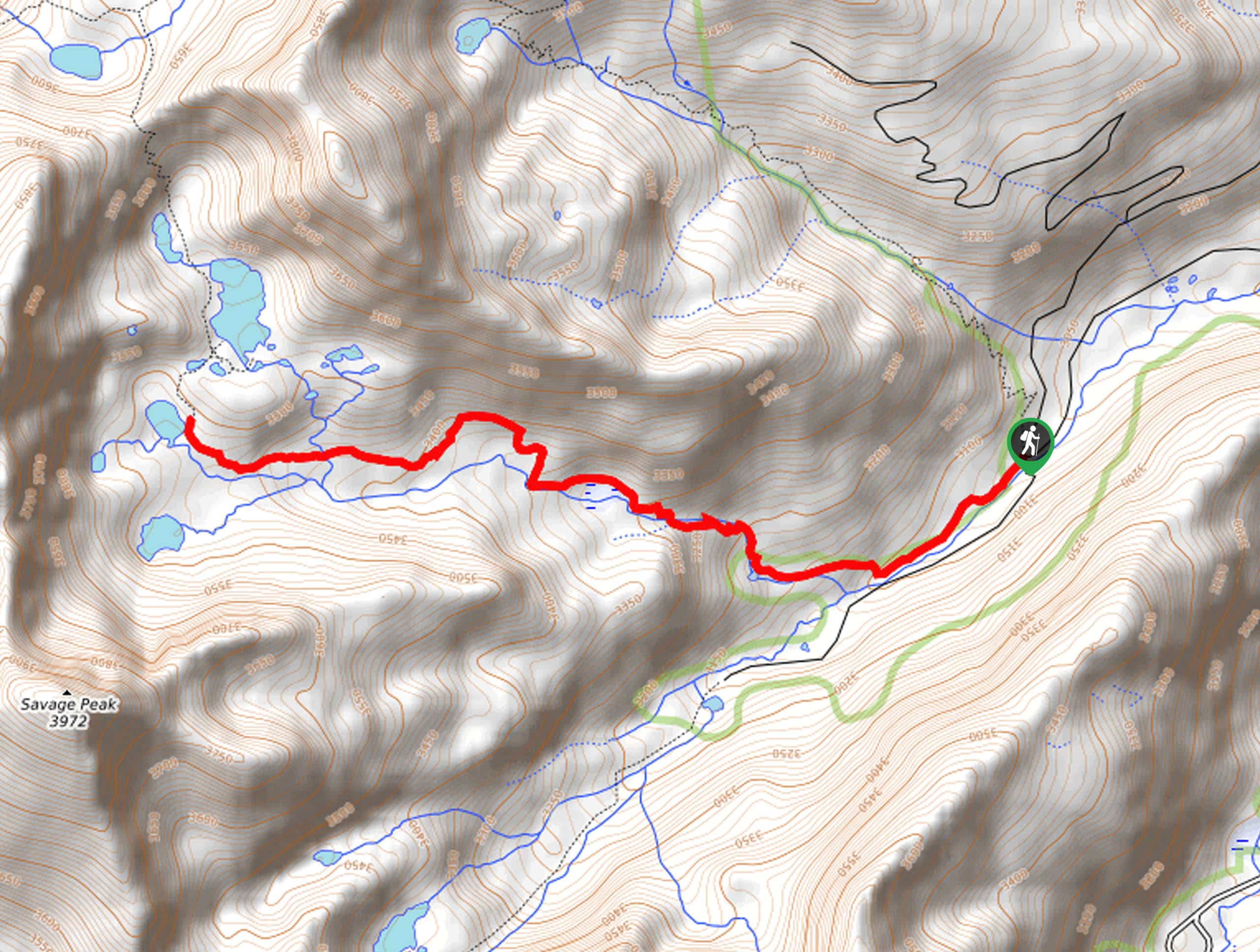
Rocky Fork Trail Description
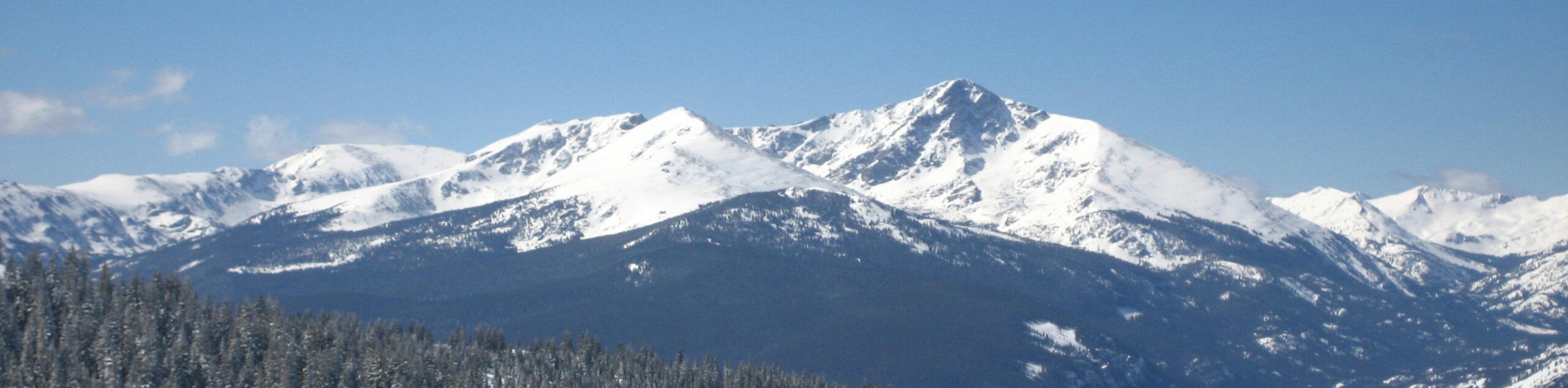
Immerse yourself in the wilderness and explore Colorado’s sub-alpine terrain along the Rocky Fork Trail. This exciting adventure exhibits the beauty of the area as it passes through aspen groves, pine forests, and lush meadows that line the running waters of the Rocky Fork Creek. While impressively scenic, this trek will also get your heartbeat racing as you climb up to a mountain basin. Note: this isolated and primitive path travels deep into the wilderness, so consider wearing a bear bell and bring bear spray to deter unwelcomed encounters with wildlife.
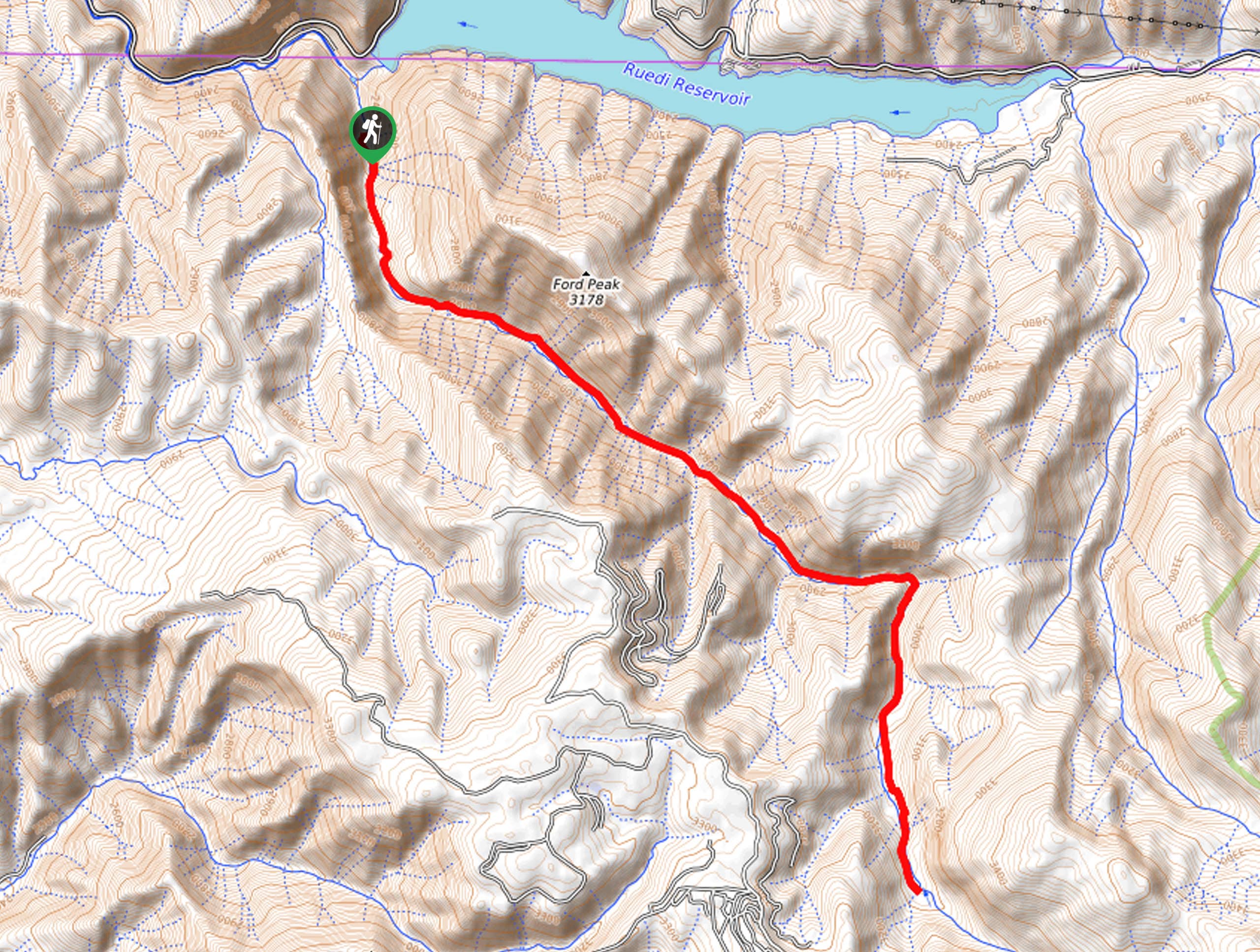
Departing from the trailhead, your journey along the Rocky Fork Trail heads south through the woodlands. Cozying up to the banks of the Rocky Fork Creek, you will be lulled into a state of relaxation by the sounds of the gurgling waters. Notice Ford Peak looming in the east as you venture deeper into nature. Gradually ascending for the entirety of your adventure, you will begin to feel the effects of the elevation gain, but the incredible scenery is well worth it! Follow the path through forests and lush meadows all the way to the trail’s end.
You will meet your turnaround point when the Rocky Fork Trail intersects with the Hannon Creek Trail. From here, revel in the grandeur of the flanking red-hued craggy cliffs. After taking in the views, retrace your steps along the path all the way back to the trailhead.
Similar hikes to the Rocky Fork Trail hike
Mount of the Holy Cross Loop Trail
Hike up to one of the most famous Colorado 14ers along the Mount of the Holy Cross Loop Trail. This…
Sopris Lake via Brady Lake Trail
Immerse yourself in the jaw-dropping scenery that the Swatch Mountain Range has to offer, as you venture to Sopris Lake…
First Missouri Lake Trail
The First Missouri Lake Trail is a stunning day hike into Colorado’s high country. Explore the alpine terrain and revel…
Comments