La Plata Ellingwood Ridge Hike
View Photos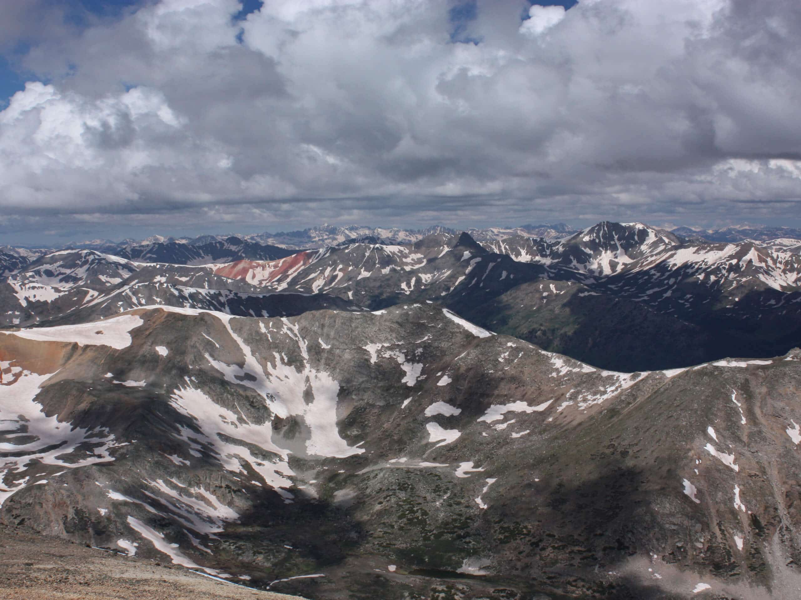
La Plata Ellingwood Ridge Hike
Difficulty Rating:
The La Plata Ellingwood Ridge Hike is a demanding feat that requires an experienced adventurer with an intrepid spirit. If this sounds like you, then we know you will love this hike! With an abundance of scrambling and technical terrain, this trek is anything but mundane.
Getting there
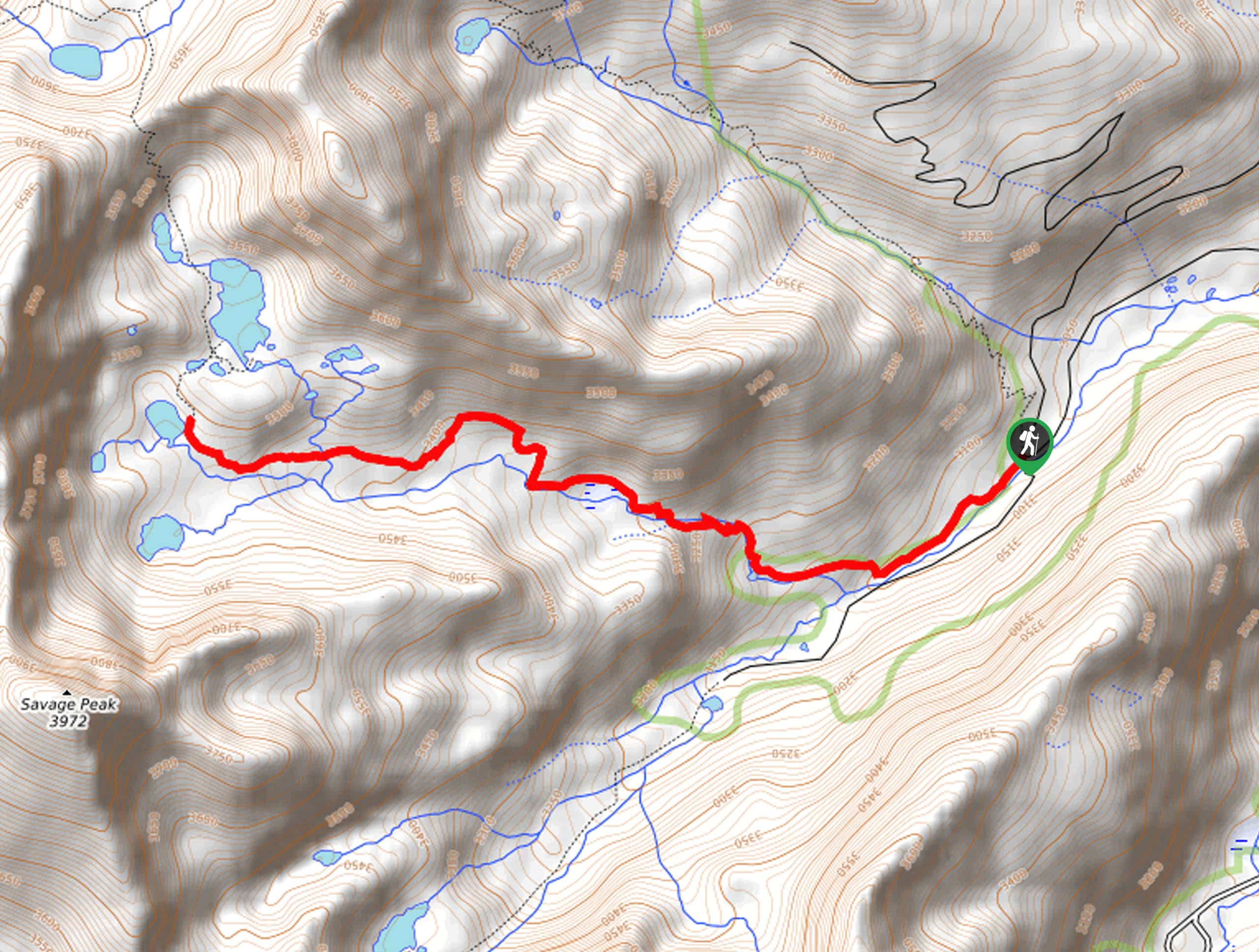
Your journey along the La Plata Ellingwood Ridge Hike begins at the La Plata Peak Trailhead off State Highway 82.

About
| Backcountry Campground | Dispersed Backcountry Camping |
| When to do | June-September |
| Pets allowed | Yes - On Leash |
| Family friendly | No |
| Route Signage | Poor |
| Crowd Levels | Moderate |
| Route Type | Lollipop |
La Plata Ellingwood Ridge Hike
Elevation Graph
Weather
La Plata Ellingwood Ridge Hike Description
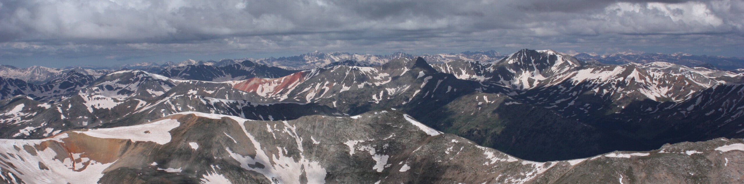
If you are one of the brave adventurers keen to take on the La Plata Ellingwood Ridge Hike, then we applaud you. Though taxing, the stimulating terrain and incredible views will distract you from your tired feet and exhaustion. Preparation is a must before this journey, so make sure you have plenty of water, microspikes, gloves, sturdy footwear, a trail GPS, and a good attitude! Additionally, traveling to high elevations will reveal epic vistas, but will likely see you encounter extreme weather conditions; try to summit the peak before noon to mitigate the chance of getting caught in an afternoon storm.
Departing from the La Plata Peak Trailhead, the La Plata Ellingwood Ridge Hike tracks south along the South Fork Lake Creek Road to an intersection. Here, turn left onto the La Plata Peak Trail, then left again at the next in order to hook onto the La Plata Peak Ellingwood Ridge Trail. Here is where the trail GPS comes in handy, as the La Plata Peak Ellingwood Trail is primitive! Follow this path east through the woodlands, then south up the vertiginous terrain to the narrow ridge. Let the epic mountain views motivate you as you make your way to La Plata Peak.
Soon you will summit La Plata Peak. Rest, rehydrate, and revel in the panoramic alpine scenery from here. When you are ready, begin your descent along the La Plata Peak Trail, which will guide you down to the first intersection. Here, you will take the South Fork Lake Creek Road back to the trailhead.
Similar hikes to the La Plata Ellingwood Ridge Hike hike
Mount of the Holy Cross Loop Trail
Hike up to one of the most famous Colorado 14ers along the Mount of the Holy Cross Loop Trail. This…
Sopris Lake via Brady Lake Trail
Immerse yourself in the jaw-dropping scenery that the Swatch Mountain Range has to offer, as you venture to Sopris Lake…
First Missouri Lake Trail
The First Missouri Lake Trail is a stunning day hike into Colorado’s high country. Explore the alpine terrain and revel…
Comments