Bartlett Gulch Hike
View Photos
Bartlett Gulch Hike
Difficulty Rating:
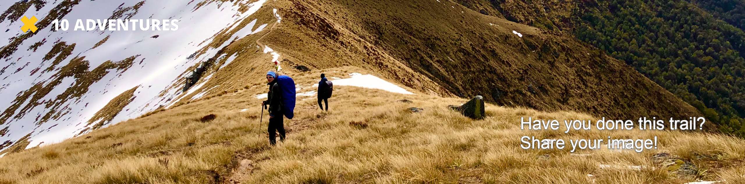
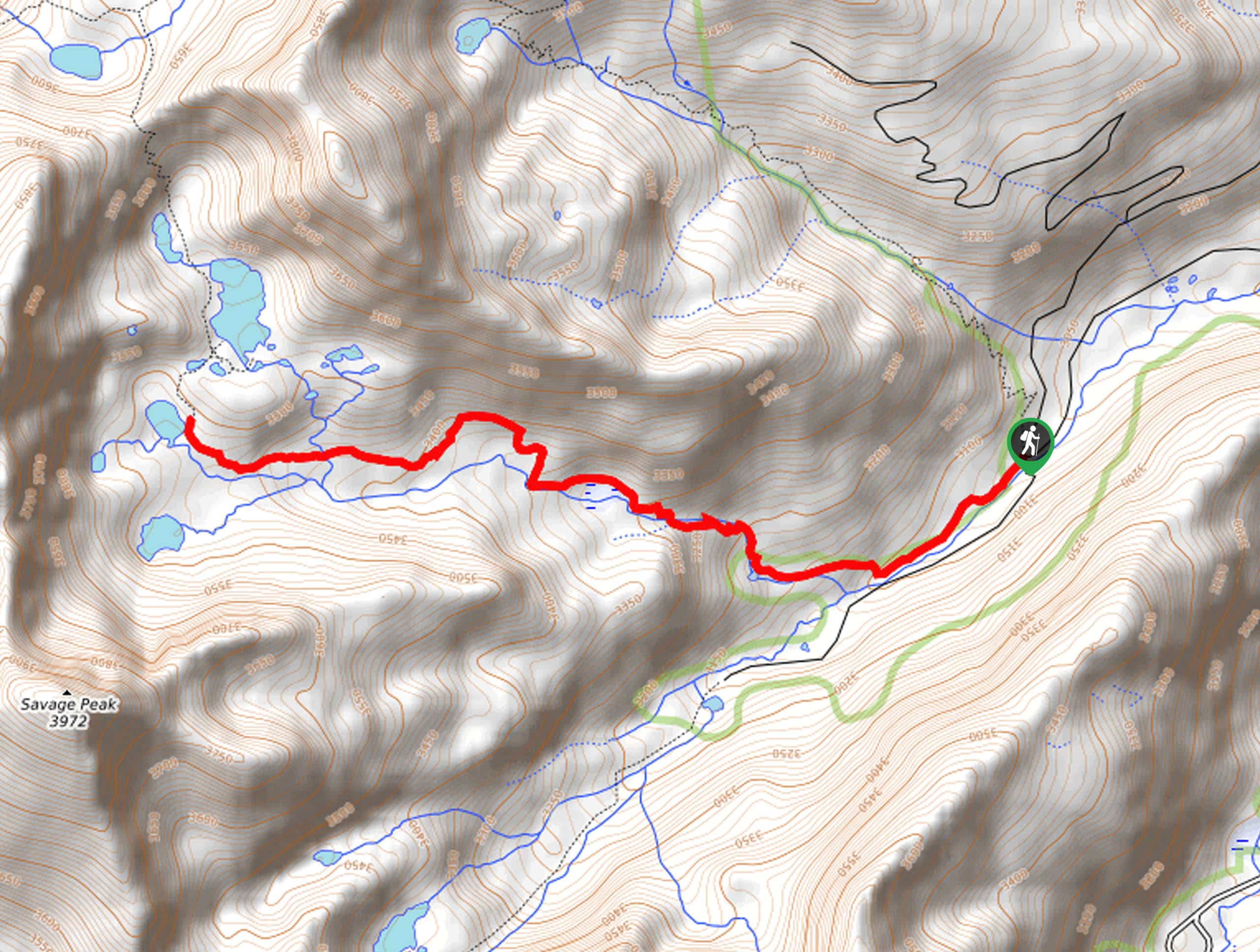
The Bartlett Gulch Hike is a short, but steep adventure along the Colorado Trail Segment 11 up to a stunning overlook of the Twin Lakes. Not only are hikers rewarded with lake views, but this scenic excursion also reveals sights of Mount Elbert, Colorado’s highest peak.
Getting there
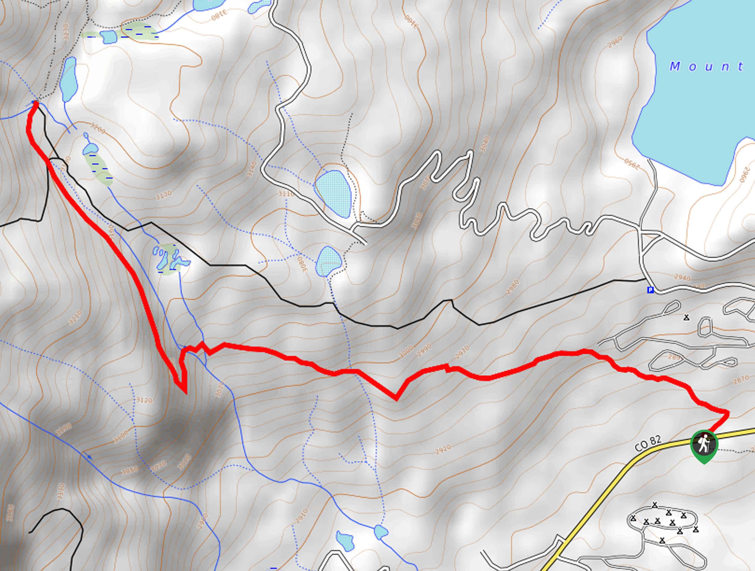
The Bartlett Gulch Hike departs from the Colorado Trail Segment 11 Trailhead on the northside of State Highway 82.

About
| Backcountry Campground | Dispersed Backcountry Camping |
| When to do | June-September |
| Pets allowed | Yes - On Leash |
| Family friendly | Older Children only |
| Route Signage | Average |
| Crowd Levels | Moderate |
| Route Type | Out and back |
Bartlett Gulch Hike
Elevation Graph
Weather
Bartlett Gulch Hike Description
The Bartlett Gulch Hike is a must-add to your Colorado adventure bucket list. Get a taste of what the Colorado Trail network is all about as you venture along a portion of Segment 11. Surrounded by verdant vegetation and epic alpine views, you will forget all about your tired feet as you climb. When hiking in the late fall and winter months, we highly suggest a pair of microspikes or snowshoes to more easily navigate the likely snow-packed and icy terrain.
Embark on your adventure along the Bartlett Gulch Trail from the trailhead on the north side of State Highway 82. From here, track the Colorado Trail Segment 11 northwest beneath the treeline. As you wander through the woodlands you will intersect with several streams. Enjoy the shade of the vibrant trees and the meditative sounds of the creek’s gurgling waters. Soon the path will redirect you north, guiding adventurers up to the Mount Elbert Trailhead.
The trailhead marks your turnaround point. If you still have some gas left in the tank, feel free to explore further. To get back to the trailhead, all you need to do is backtrack along the same route. On your way back to your vehicle you will be granted wonderful views of the Twin Lakes below.
Similar hikes to the Bartlett Gulch Hike hike
Village Creek Trail
Explore the Beaver Creek Ski Resort and revel in the vibrance of the encompassing woodlands as you venture the Village…
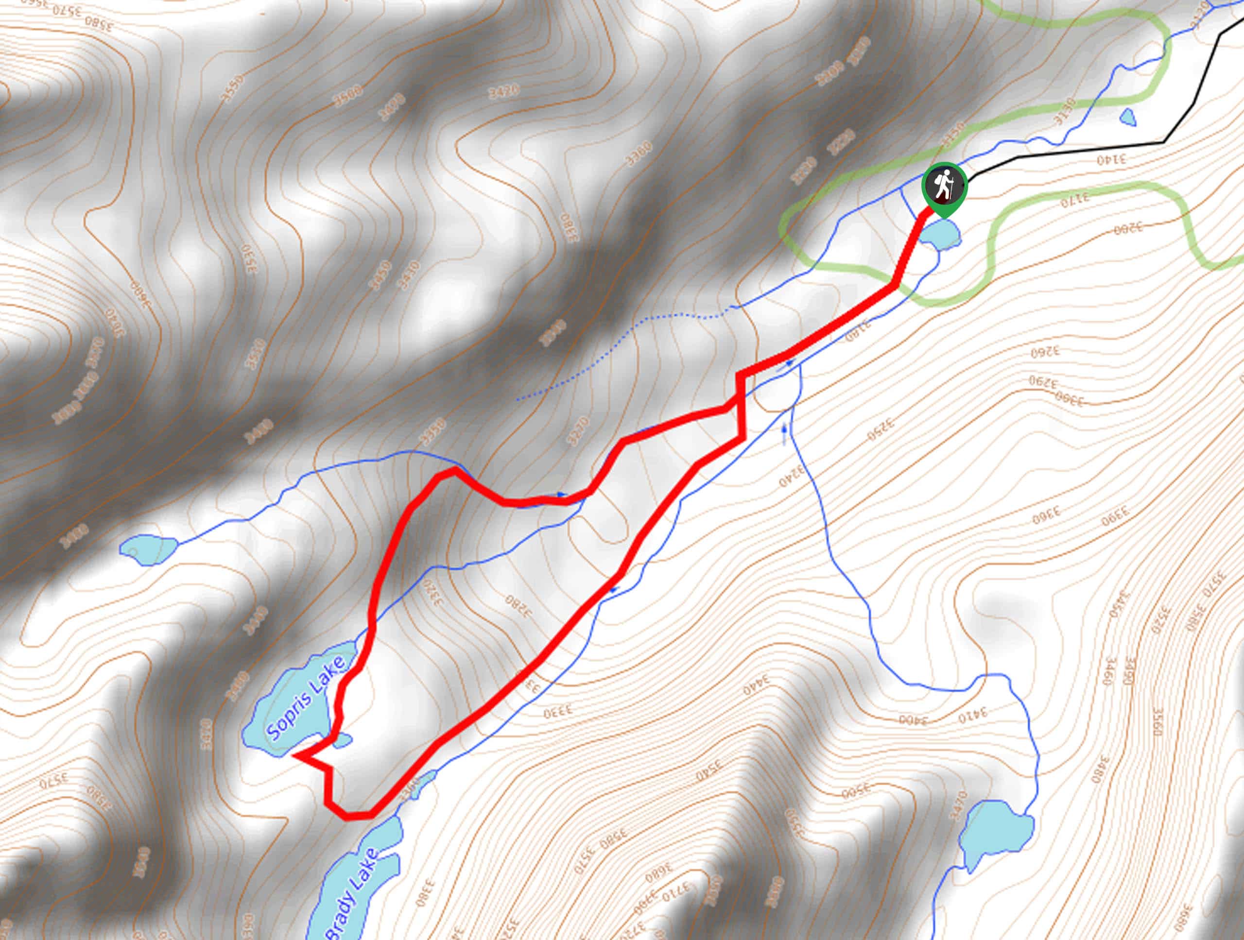
Sopris Lake via Brady Lake Trail
Immerse yourself in the jaw-dropping scenery that the Swatch Mountain Range has to offer, as you venture to Sopris Lake…
First Missouri Lake Trail
The First Missouri Lake Trail is a stunning day hike into Colorado’s high country. Explore the alpine terrain and revel…
Comments