Huron Peak via Lulu Gulch Hike
View Photos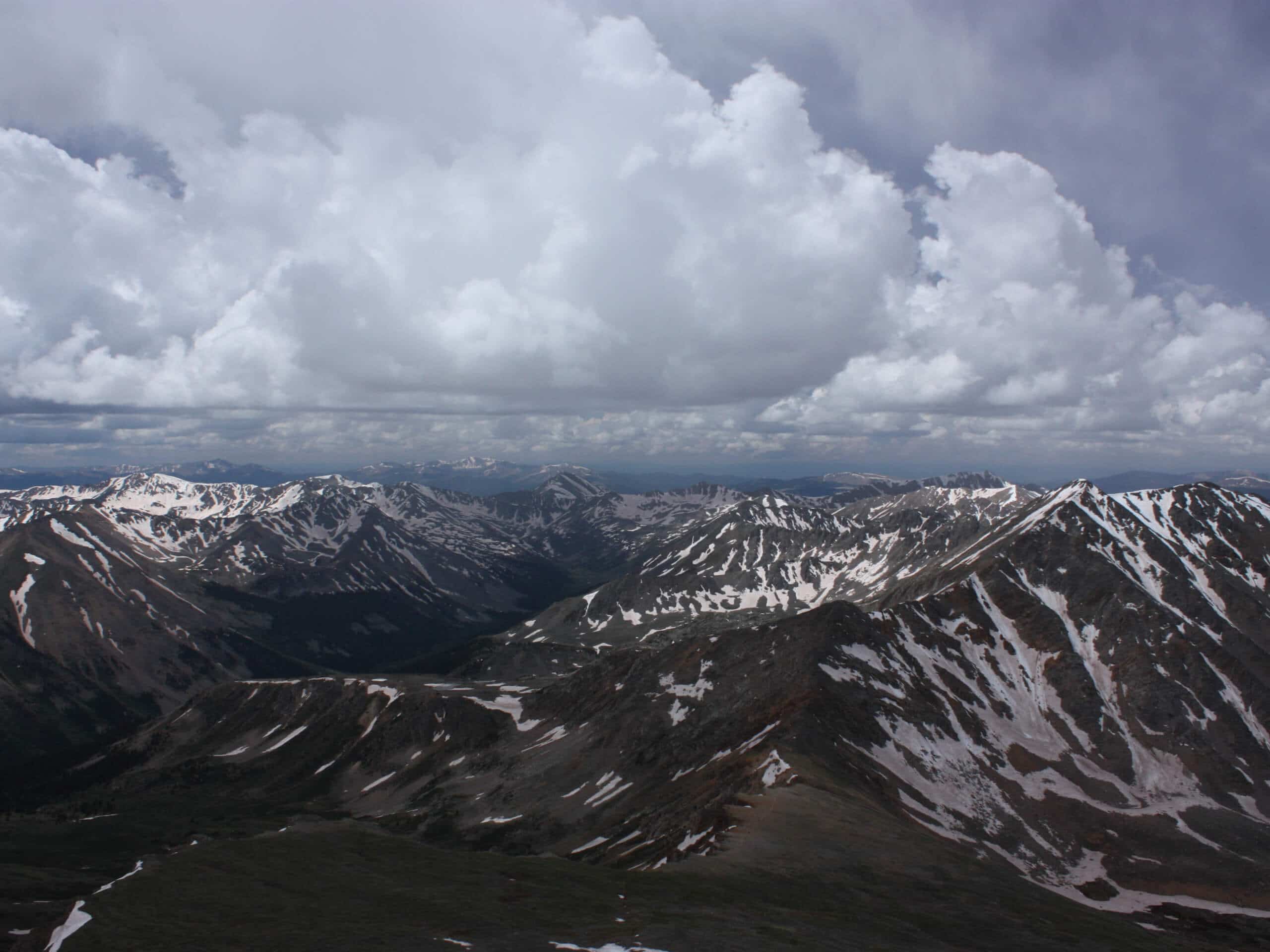
Huron Peak via Lulu Gulch Hike
Difficulty Rating:
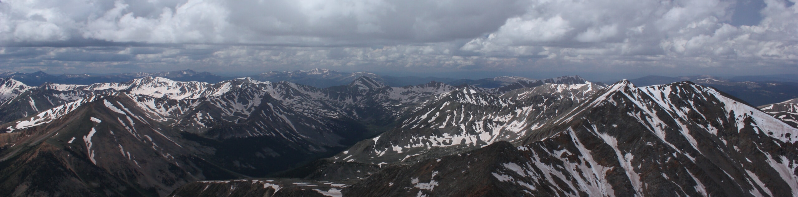
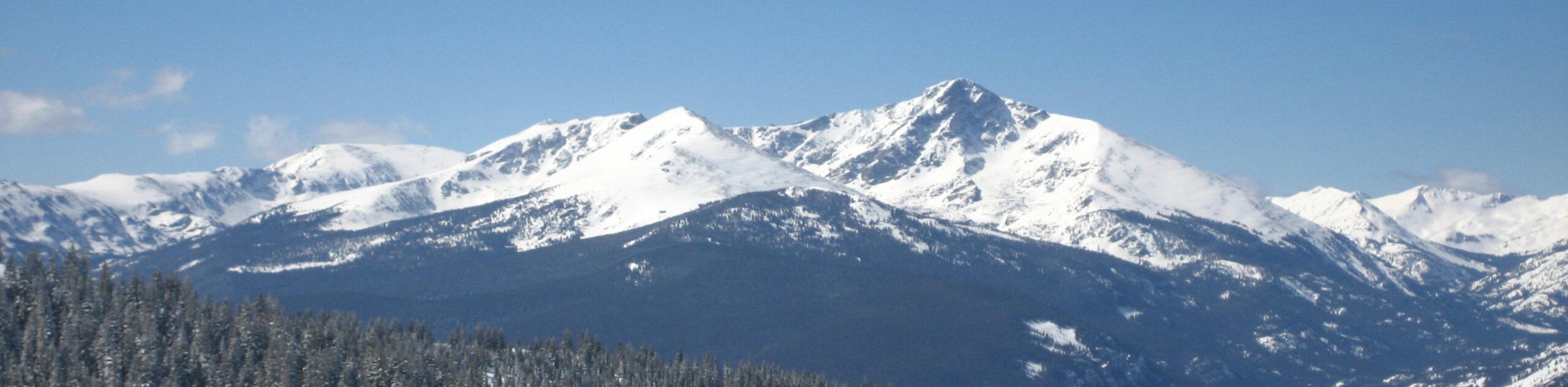
The Huron Peak via Lulu Gulch Hike is a unique adventure in the Sawatch Mountain Range that guides intrepid adventurers up not one, but three dramatic summits. Exhibiting the diversity and beauty of the high country, this trek is not one you are going to want to miss!
Getting there
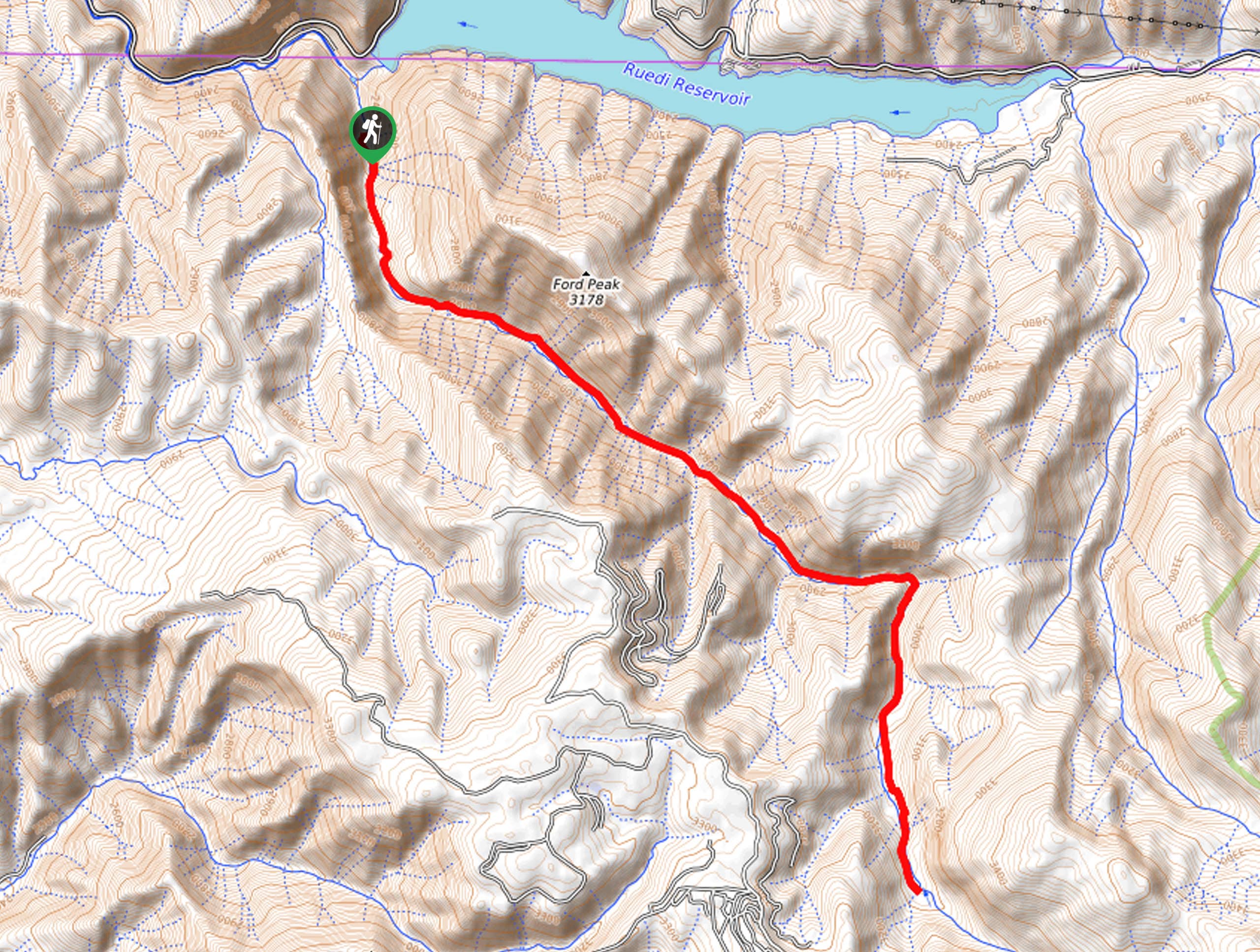
The Huron Peak via Lulu Gulch Hike departs from the South Winfield Trailhead and parking lot on Clear Creek Road.

About
| Backcountry Campground | Dispersed Backcountry Camping |
| When to do | May-October |
| Pets allowed | Yes - On Leash |
| Family friendly | No |
| Route Signage | Poor |
| Crowd Levels | Low |
| Route Type | Circuit |
Huron Peak via Lulu Gulch Hike
Elevation Graph
Weather
Huron Peak via Lulu Gulch Hike Description
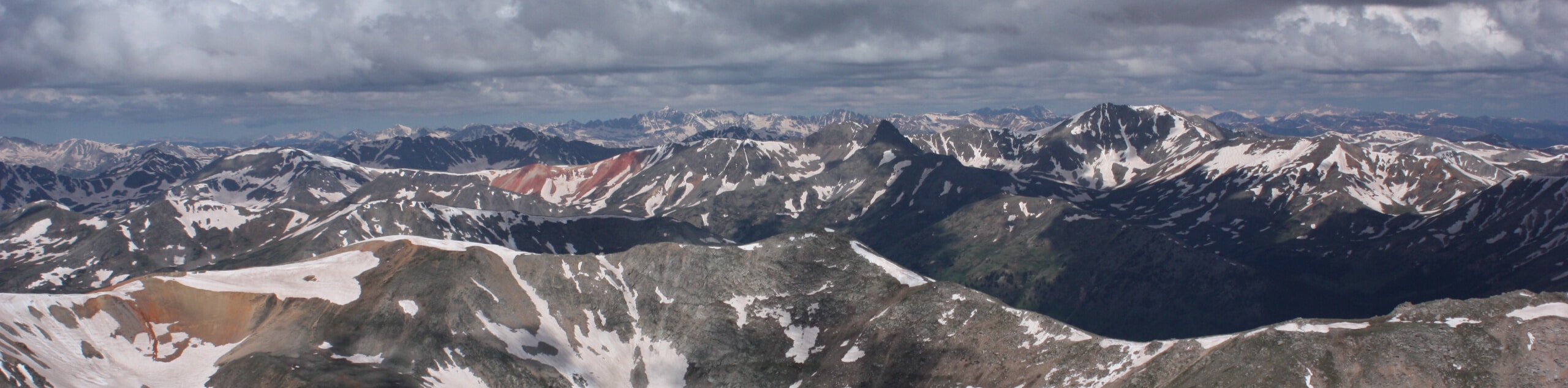
The Huron Peak via Lulu Gulch Hike is an epic journey in the Sawatch Mountain Range. Hike through pine forest and the rugged alpine tundra as you make your way up to the summits. Reserved for experienced hikers, this excursion demands stamina and preparation, so make sure that you are acclimated to the area’s elevation and ensure you are properly equipped before commencing this hike. The terrain is technical, steep, and will require scrambling in sections. Consider trekking poles, microspikes, and a sturdy pair of hiking boots to better navigate the trail. Note: a trail GPS is necessary, as most of this route travels along primitive, unmarked paths.
Your trek along the Huron Peak via Lulu Gulch Hike begins at the South Winfield Trailhead. From the parking lot, hike southwest along Clear Creek Road before turning left onto an unmarked, primitive trail up Lulu Gulch. Navigate a seemingly never-ending set of switchbacks through the pine forest before, topping the timberline into the alpine tundra. With the help of the trail GPS, you will soon summit Middle Mountain, at which point, you will head south across the saddle to Browns Peak. Revel in the vistas, then continue south to Huron Peak, where you can rest and rehydrate as you take in the sweeping alpine views from atop the mountain.
When you are ready, begin your descent by tracking the North Huron Trail west, following it down the slope of the dramatic peak. You will meet the trail’s end at the Clear Creek South Fork Trailhead. From here, keep right and hike along Clear Creek Road back to your vehicle.
Similar hikes to the Huron Peak via Lulu Gulch Hike hike
Mount of the Holy Cross Loop Trail
Hike up to one of the most famous Colorado 14ers along the Mount of the Holy Cross Loop Trail. This…
Rocky Fork Trail
The Rocky Fork Trail is an unassumingly picturesque adventure through the Rocky Fork Creek’s forested canyon that reveals awe-inspiring views…
La Plata Ellingwood Ridge Hike
The La Plata Ellingwood Ridge Hike is a demanding feat that requires an experienced adventurer with an intrepid spirit. If…
Comments