Ophir Pass Road Hike
View Photos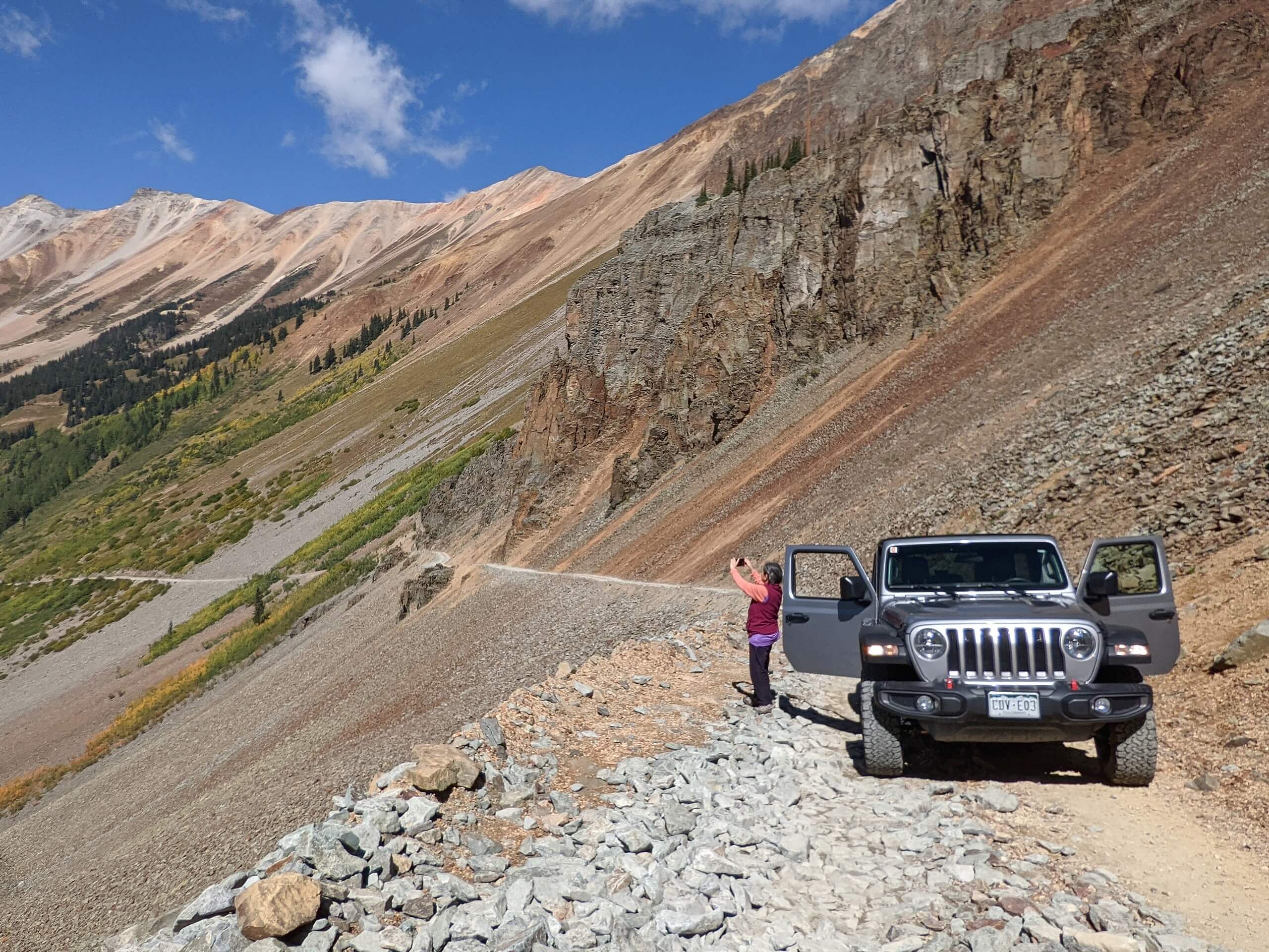
Ophir Pass Road Hike
Difficulty Rating:
The Ophir Pass Road Hike is a straightforward adventure near Silverton, Colorado that will take you along a rugged road through the mountains. While out hiking the trail, you will traverse a rough and rugged road that leads through Ophir Pass, enjoying the views of the surrounding mountains as you trek from the starting point to the end point of this one-way route. Hikers should take note that this is a multi-use route that is popular with off-road vehicle enthusiasts, so make sure to keep an eye out for passing traffic and share the road.
Getting there
The trailhead for the Ophir Pass Road Hike can be found at the junction between US-550 and Ophir Pass Road, just 4.7mi northwest of Silverton.

About
| Backcountry Campground | No |
| When to do | March-November |
| Pets allowed | Yes |
| Family friendly | Older Children only |
| Route Signage | Average |
| Crowd Levels | Moderate |
| Route Type | One Way |
Ophir Pass Road Hike
Elevation Graph
Weather
Ophir Pass Road Hike Description
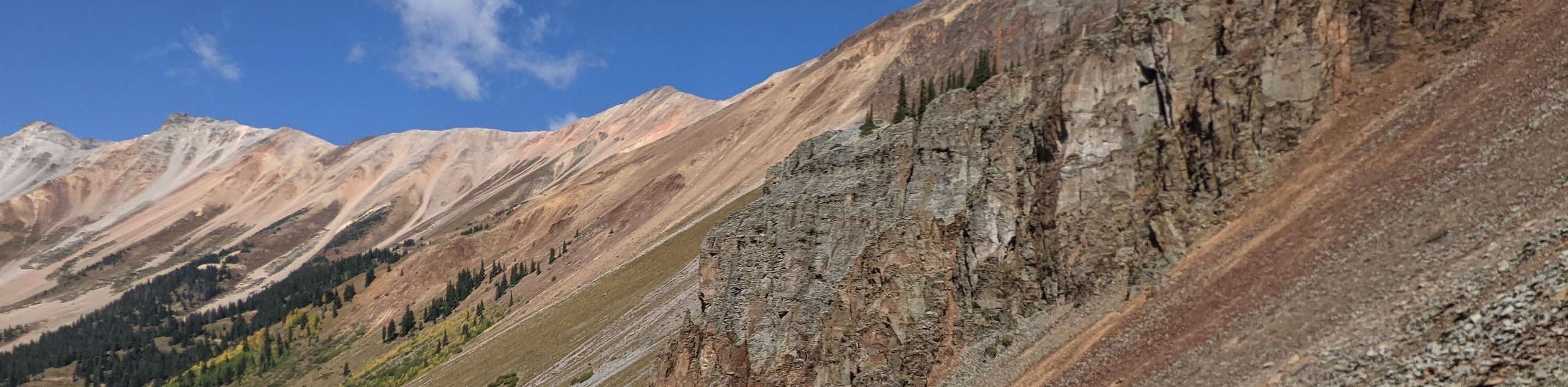
Although the Ophir Pass Road Hike is fairly long, the fact that it follows along an off-road vehicle route means that the terrain isn’t all that tricky to deal with. Even still, you will want to wear proper hiking boots with good support. Additionally, you should remain alert at all times and allow vehicles enough room to pass along the road, especially in the narrow stretches near Ophir.
While this is essentially a road hike, the stunning views of the surrounding mountains as you make your way through the pass are enough to make the journey worthwhile. If you have been looking for a relatively laidback way to experience the dramatic landscape of the San Juan Mountains, then this is a great route to try out.
Setting out from the junction between US-550 and Ophir Pass Road, you will follow Ophir Pass Road as it heads north across Mineral Creek, before turning to the southwest through the forest. Continuing along the road, it will eventually turn a bit more to the northwest, a direction that it will follow for the duration of the hike.
As you traverse the road you will pass through stretches of forest and open meadow, while taking in the beautifully scenic views of the surrounding mountains, including the Lookout and Palmyra Peaks to the north. Be sure to keep to the side of the road in order to let off-road vehicle drivers safely pass.
After 7.5mi along the road, you will pass through the small town of Ophir nestled beneath the imposing San Joaquin Ridge to the north and continue on through the pass to the west. This is a great place to pause for a quick rest, before continuing along the road for the final leg of the hike.
Following along the banks of Howard Fork, you will continue on to the west until you arrive at the edge of State Highway 145, marking the endpoint of the route. Here, you can relax and wait for your ride, having completed your adventure along the Ophir Pass Road Hike.
Trail Highlights
Ophir Pass
Located in San Miguel County, Colorado, Ophir Pass is a mountain pass situated at 11788ft above sea level. The pass is within the rugged San Juan Mountain Range and features a relatively wide grade with some narrow stretches that increase the difficulty of driving it. The pass is often used as a hiking/off-road vehicle route to experience the beauty of the mountains.
Frequently Asked Questions
Can you drive Ophir Pass Road?
Ophir Pass Road is a fairly easy-going drive for 4WD vehicles, although there is one very narrow section near the town of Ophir that is challenging.
Do I need a 4×4 vehicle for Ophir Pass Road?
While it is not required, it is certainly recommended to have a 4×4 high clearance vehicle to safely traverse Ophir Pass Road.
Insider Hints
Keep an eye out for passing off-road vehicles.
Wear proper hiking boots.
Plan a pickup at the end point of the trail or bring a separate vehicle to make travel easier.
Similar hikes to the Ophir Pass Road Hike hike

Twin Buttes and Lightner Creek Loop Trail
The Twin Buttes and Lightner Creek Loop Trail is a great hiking route in Durango, Colorado that features some challenging…

Meadow Loop via Horse Gulch Trail
The Meadow Loop via Horse Gulch Trail is a great hiking route in Durango that will take you uphill for…

The Ridge Trail
The Ridge Trail - also known as Raiders Ridge Trail - is an amazing hiking route in Durango, Colorado that…
Comments