Lower, Middle, and Upper Blue Lakes Hike
View Photos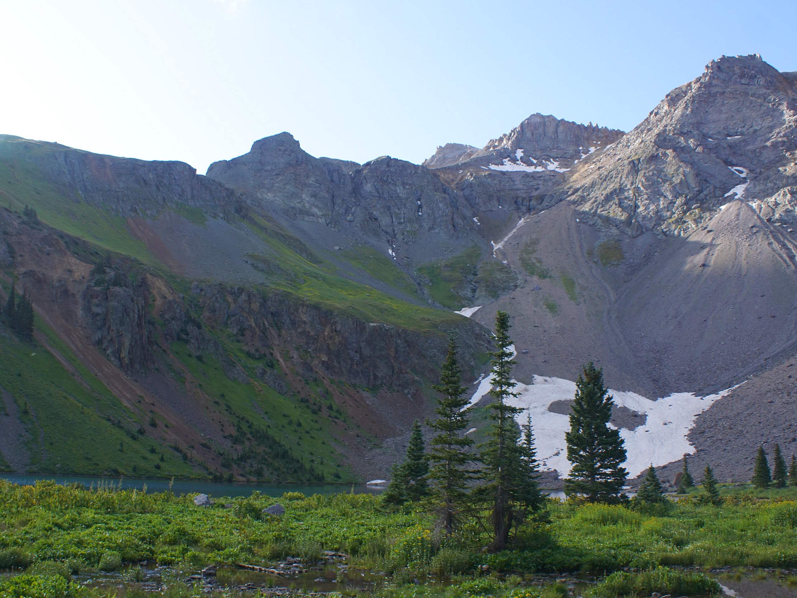
Lower, Middle, and Upper Blue Lakes Hike
Difficulty Rating:
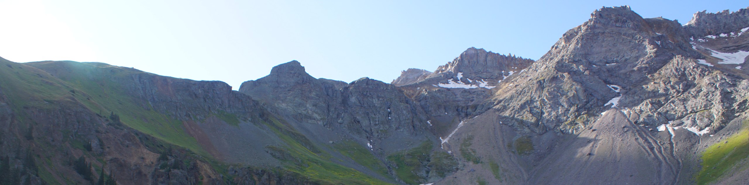
The Lower, Middle, and Upper Blue Lakes Hike is a spectacular adventure in the San Juan Mountains of Colorado that will take you up to a series of alpine lakes. While out hiking the trail, you will make your way uphill through the forests and meadows along the East Fork Dallas Creek, before arriving at the Blue Lakes and the imposing Mount Sneffels looming overhead. Although challenging, this is a fantastic route to experience some truly beautiful Colorado scenery.
Getting there
The trailhead for the Lower, Middle, and Upper Blue Lakes Hike can be found at the Blue Lakes Trailhead on County Road 7.

About
| Backcountry Campground | Blue Lakes |
| When to do | June-October |
| Pets allowed | Yes |
| Family friendly | No |
| Route Signage | Average |
| Crowd Levels | Moderate |
| Route Type | Out and back |
Lower, Middle, and Upper Blue Lakes Hike
Elevation Graph
Weather
Lower, Middle, and Upper Blue Lakes Hike Description
While the Lower, Middle, and Upper Blue Lakes Hike does feature a good amount of elevation gain along the route, it is not a technical trail, making it suitable for casual hikers wanting a good challenge. Even still, you will want to wear proper hiking boots with good support and bring any necessary gear and supplies to safely traverse the trail. Additionally, you will need a high-clearance vehicle in order to safely reach the trailhead.
While it is a bit of a challenge to reach the shores of the Blue Lakes, the stunning alpine scenery that you will experience will be more than worth the effort. If you feel like spending some extra time in this beautiful locale, be sure to bring your camping equipment to spend a night up in the mountains!
Setting out from the parking area, you will head towards the southwest along the trail for a short distance, before arriving at a fork. Keep right here and make your way through the dense cover of the forest alongside the banks of Dallas Creek for 0.2mi, where the trail will begin to climb more steeply uphill.
After 1.5mi of working your way uphill through the peaceful landscape of the forest, you will break free of the tree cover to briefly pass through an alpine meadow with stunning mountain views, before entering back into the forest to the southeast. Here, you will continue on to the southeast through a mixture of woodland and meadow terrain, until you arrive at the shores of Lower Blue Lake and the nearby campsite.
Turning left at the junction in the trail near the lake, you will quickly exit the canopy of the forest once again and begin climbing uphill through a wonderfully scenic alpine basin. Take some time here to appreciate the gorgeous scenery, as you meander past the Middle and Upper Blue Lakes, while taking in the views of Mount Sneffels, Dallas Peak, and Gilpin Peak.
Once you have taken in the stunning scenery, you can backtrack along the trail to return to the first of the Blue Lakes. If you are planning on camping overnight in the area, make sure to give yourself adequate time to set up camp, otherwise, simply head back through the basin on the return to the parking area having completed the Lower, Middle, and Upper Blue Lakes Hike.
Trail Highlights
Mount Sneffels
Mount Sneffels is a prominent peak in the Rockies that is well-known for its vertical relief. The imposing fourteener rises 7201ft above the nearby town of Ridgway, and is 51st in terms of the highest peaks in North America. It is one of the most photographed peaks in the entire state of Colorado.
Frequently Asked Questions
Where are the Blue Lakes?
The Blue Lakes are a series of alpine lakes that can be found in the Mount Sneffels Wilderness Area of Colorado.
How tall is Mount Sneffels?
Mount Sneffels is categorized as a fourteener, standing tall at 14157ft.
Insider Hints
Wear proper hiking boots with good support.
Bring crampons or microspikes in order to better traverse snowy/icy terrain.
A vehicle with decent clearance is recommended to reach the trailhead.
Toilet facilities can be found at the trailhead.
Similar hikes to the Lower, Middle, and Upper Blue Lakes Hike hike

Twin Buttes and Lightner Creek Loop Trail
The Twin Buttes and Lightner Creek Loop Trail is a great hiking route in Durango, Colorado that features some challenging…

Meadow Loop via Horse Gulch Trail
The Meadow Loop via Horse Gulch Trail is a great hiking route in Durango that will take you uphill for…

The Ridge Trail
The Ridge Trail - also known as Raiders Ridge Trail - is an amazing hiking route in Durango, Colorado that…
Comments