Bonita Falls Trail
View Photos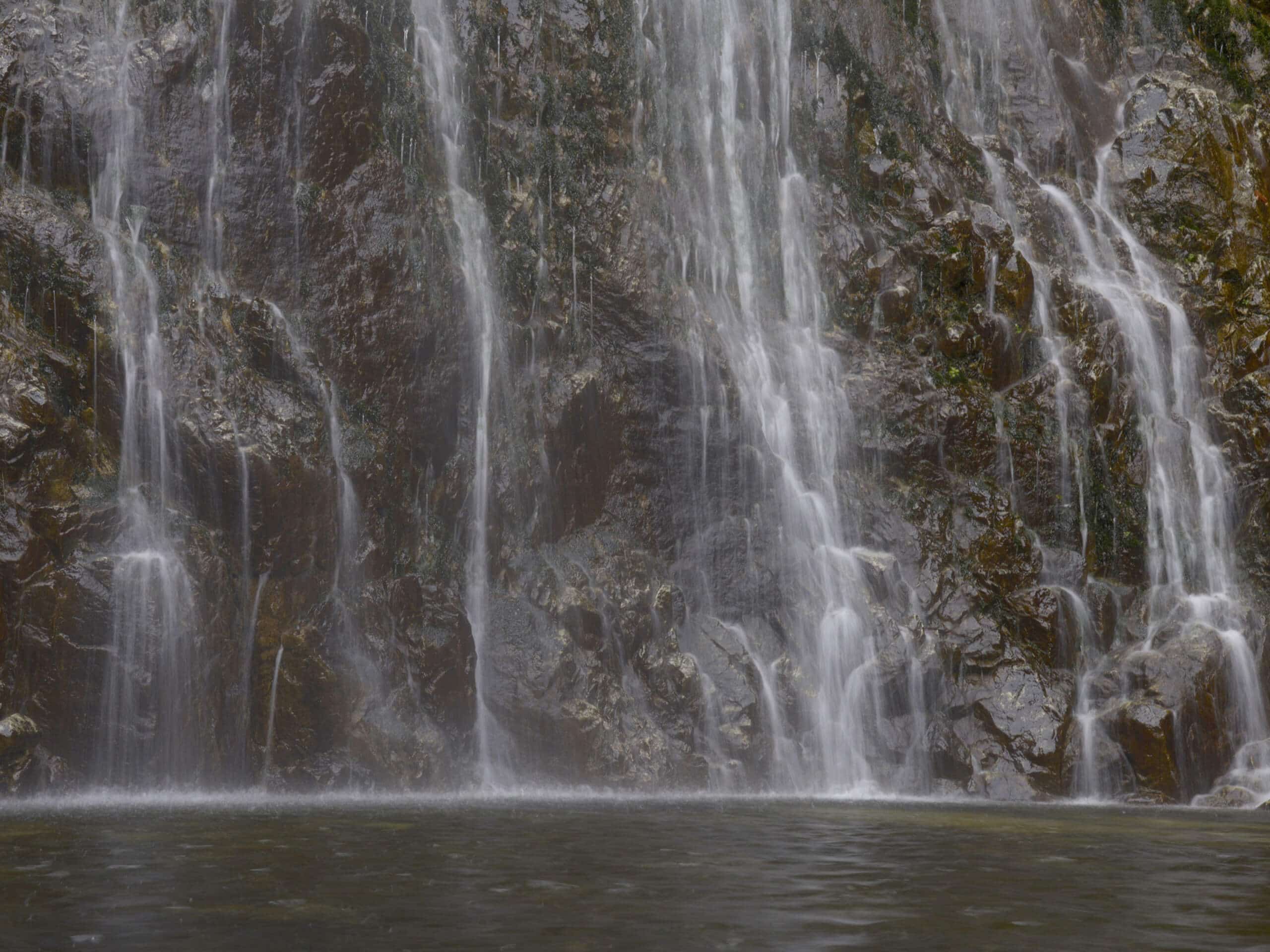
Bonita Falls Trail
Difficulty Rating:
The Bonita Falls Trail is a short hiking route in the San Bernardino National Forest of California that will take you out to a viewpoint overlooking a waterfall. While out on the trail, you will hike the rocky terrain along the banks of Lytle Creek, before entering into the tree cover to view the cascading waters of Bonita Falls. Don’t forget to stop off at the ranger station to purchase a daily parking pass for $5.
Getting there
The Bonita Falls Trailhead can be found at the parking area along Lytle Creek Road, just 5.9mi northwest of the junction with I-15.

About
| Backcountry Campground | Bonita Ranch Campground |
| When to do | March-October |
| Pets allowed | Yes - On Leash |
| Family friendly | Yes |
| Route Signage | Average |
| Crowd Levels | High |
| Route Type | Out and back |
Bonita Falls Trail
Elevation Graph
Weather
Bonita Falls Trail Description
The main downsides to the Bonita Falls Trail are its short overall length and its popularity. Be sure to arrive early to secure a parking space and make sure to purchase a valid adventure pass before your hike. Additionally, there is a bit of rocky terrain along this trail, so try to wear some good hiking shoes to have the best footing on your hike.
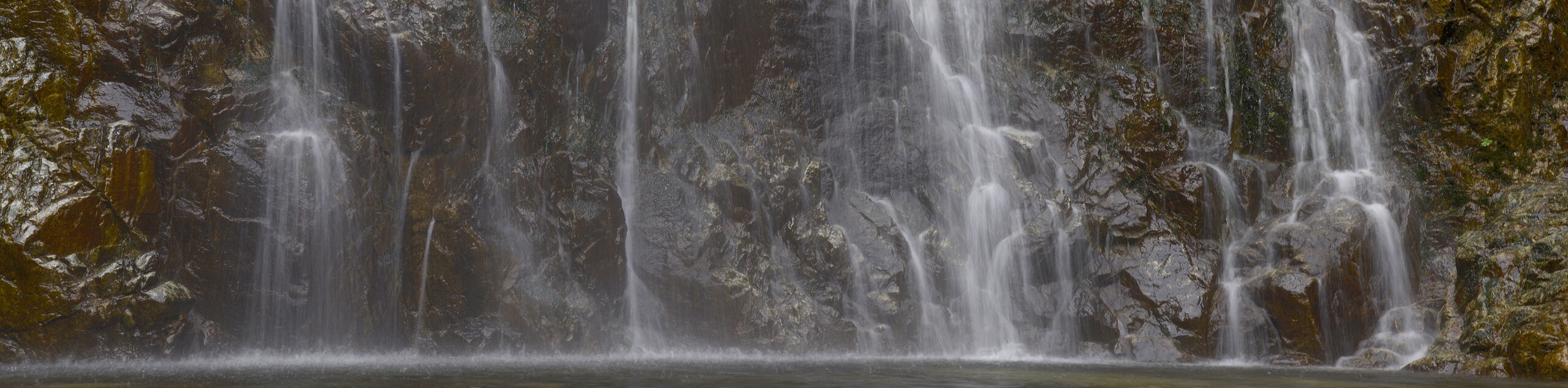
While the Bonita Falls Trail is certainly a popular hiking route, it is absolutely warranted, as the viewpoint looking onto Bonita Falls is stunning. After a quick hike across Lytle Creek, you will stand in awe of the waterfall that cascades 195ft to meet up with the creek. Although you can’t really see the upper two tiers of the falls, the view that you do get is spectacular enough to make for a fun afternoon outdoors.
Setting out from the parking area, you will make your way to the southwest and cross over the Middle Fork of Lytle Creek, as well as the South Fork. From here, you will follow along the edge of the creek to the southwest for roughly 0.4mi, taking care with your footing as there are plenty of loose rocks scattered about.
At this point, you will turn to the south and begin climbing uphill slightly to arrive at the viewpoint looking onto Bonita Falls. Take some time here to appreciate the majesty of the cascading water and the natural beauty of your surroundings, before heading back along the trail. Here, you will simply retrace your footsteps on the way back into the parking area where you started your journey along the Bonita Falls Trail.
Trail Highlights
Bonita Falls
Situated in San Bernardino National Forest, the Bonita Falls are a series of 3 waterfalls along Bonita Creek. When the upper two drops are taken into consideration, the total height of the waterfall is 495ft. In the lower canyon where the falls meet Lytle Creek, the waterfall consists of a 195ft cascade.
Frequently Asked Questions
Can you swim at Bonita Falls?
As the water at the base of Bonita Falls is fairly shallow, swimming is not really a possibility.
How tall is Bonita Falls?
Taking into consideration the upper two drops, the entire height of Bonita Falls is 495ft.
Insider Hints
You will need to purchase an adventure pass from the ranger station in order to access this trail.
Wear proper hiking boots and bring hiking poles for stability on the rocky terrain.
Arrive early to secure parking.
Similar hikes to the Bonita Falls Trail hike

Bluff Mesa Hike
The Bluff Mesa Hike is a fantastic adventure in Southern California that features a lovely woodland setting and can be…

Palm View Peak Trail
The Palm View Peak Trail is a great hiking route in the San Bernardino National Forest that features a solid…

Cram Peak Ridge Trail
The Cram Peak Ridge Trail is a fantastic, albeit difficult, hiking route in the San Bernardino National Forest that will…
Comments