Big Falls Trail
View Photos
Big Falls Trail
Difficulty Rating:
The Big Falls Trail is a short and beautifully scenic hiking route in the San Bernardino National Forest that will lead you to a charming waterfall. While out hiking the trail, you will climb uphill through the forest alongside Falls Creek, where you will quickly arrive at the viewpoint for the Big Falls. Due to the high volume of search and rescue operations that have been conducted in the area, hikers are no longer allowed to continue on past the falls.
Getting there
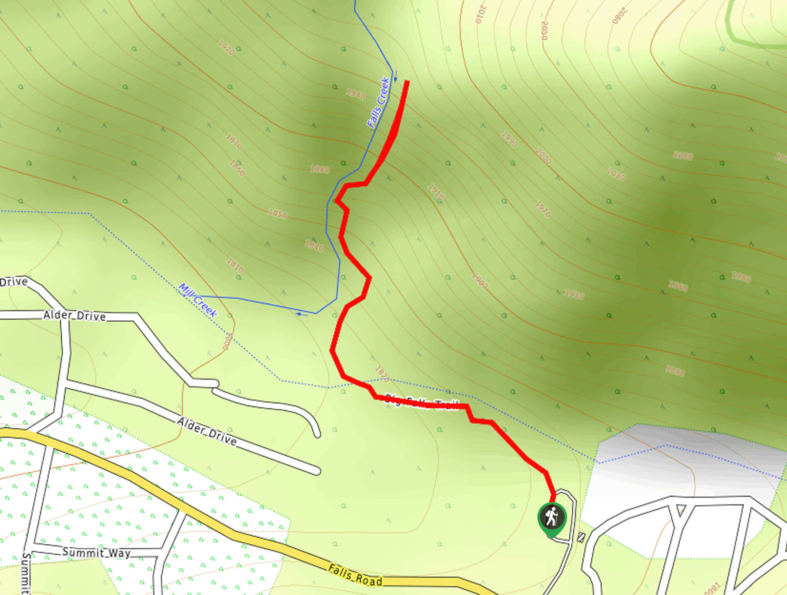
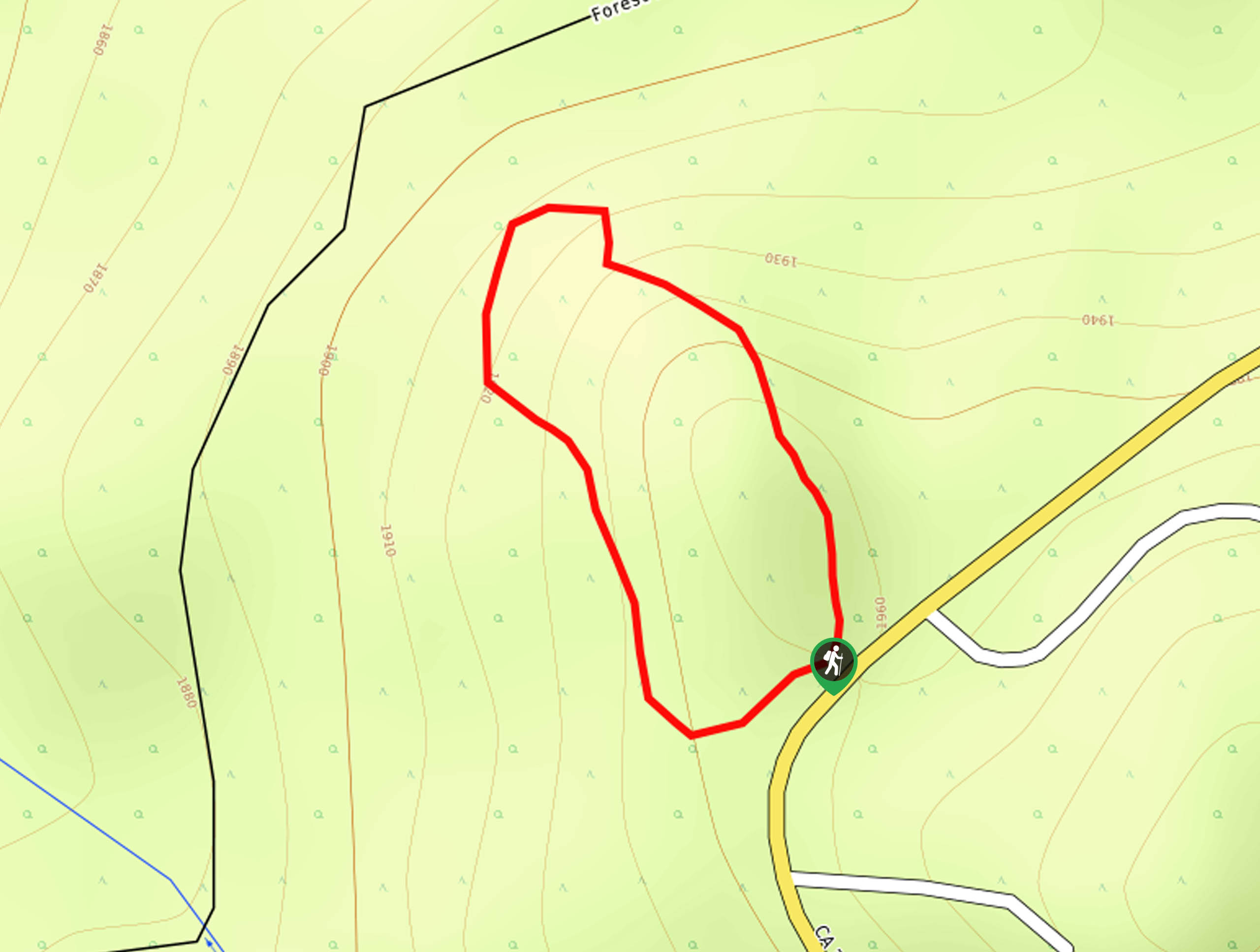
The trailhead for the Big Falls Trail can be found along Falls Road at the Big Falls parking area, just southeast of Forest Falls.

About
| Backcountry Campground | No |
| When to do | April-October |
| Pets allowed | Yes - On Leash |
| Family friendly | Yes |
| Route Signage | Average |
| Crowd Levels | High |
| Route Type | Out and back |
Big Falls Trail
Elevation Graph
Weather
Big Falls Trail Description
While it might not be the longest hiking route around, the Big Falls Trail is a fun little adventure that will take you to a viewpoint overlooking a charming waterfall along Falls Creek. There are two parking lots at the trailhead, so make sure that you arrive early enough to secure a spot in the free gravel parking on the left before it fills up!
Setting out from the trailhead, you will make your way to the northwest and cross over Mill Creek, following the trail as it bends more to the north through the tree cover. Here, you will meet up with the banks of Falls Creek and continue climbing uphill until you arrive at the viewpoint for the cascading Big Falls. Take some time here to appreciate the views or pause for a quick snack, before heading back along the trail to return to your vehicle.
Similar hikes to the Big Falls Trail hike

Bluff Mesa Hike
The Bluff Mesa Hike is a fantastic adventure in Southern California that features a lovely woodland setting and can be…
Highway 138 VOE Trail
The Highway 138 VOE Trail is a fantastic hiking route north of the Valley of Enchantment that will see you…
Ponderosa Nature Trail
The Ponderosa Nature Trail is a quick and easy hiking loop in the San Bernardino National Forest that features a…
Comments