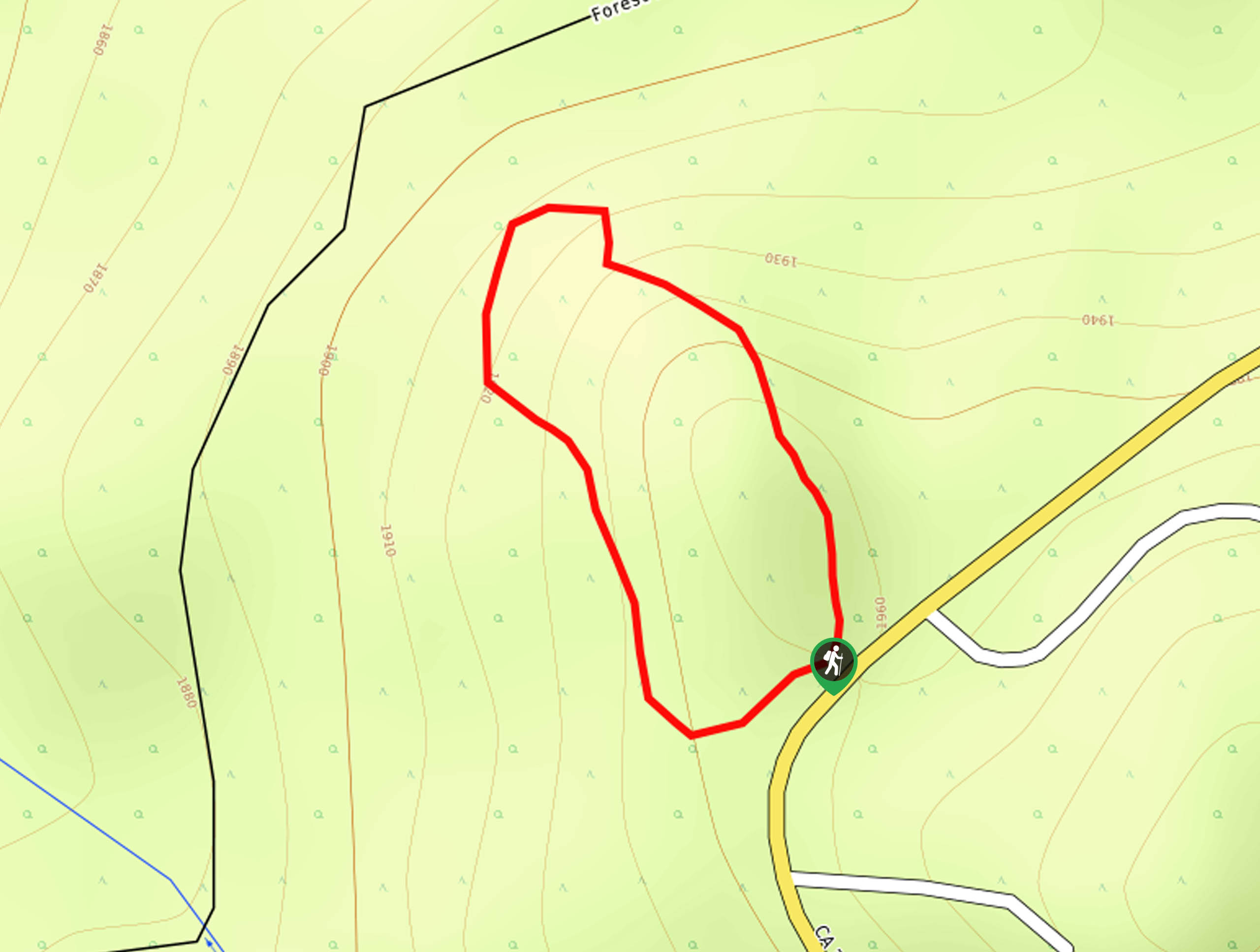
2N10 Trail to Bear and Silvertip Peaks
View Photos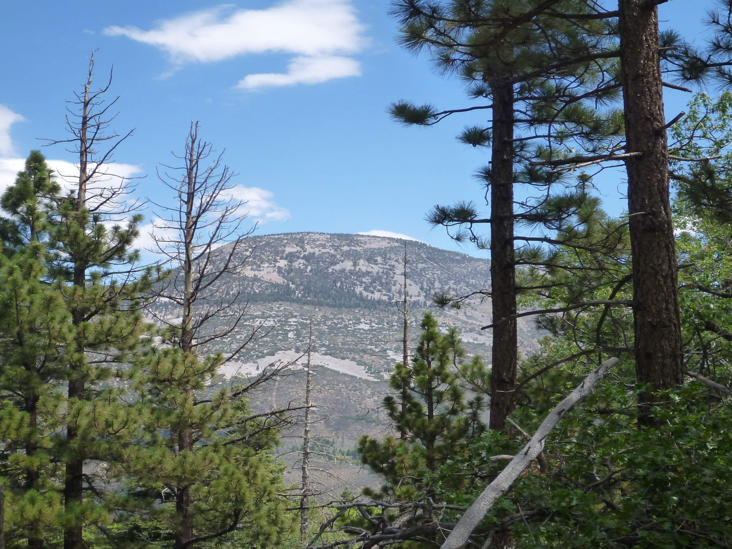
2N10 Trail to Bear and Silvertip Peaks
Difficulty Rating:
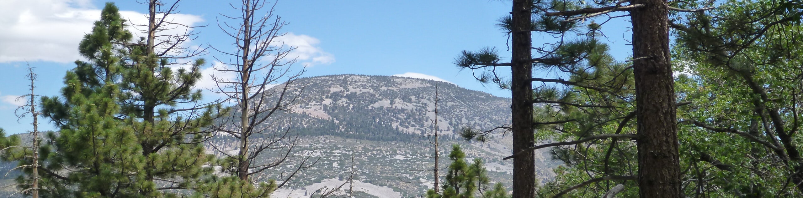
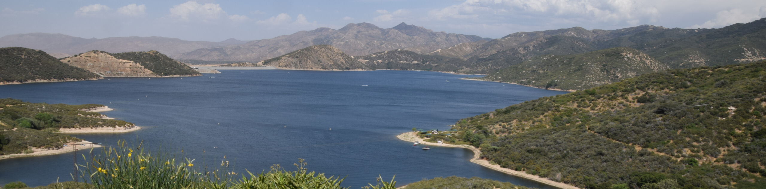
The 2N10 Trail to Bear and Silvertip Peaks is a great little adventure near Big Bear Lake, California that offers beautiful views of the surrounding landscape. While out on the trail, you will meander through the forest and gain elevation along the mountainside to reach the picturesque summits of bear and Silvertip peaks, before looping around on the return leg. Be sure to display a valid adventure Pass prior to setting out on your hiking adventure.
Getting there
The trailhead for the 2N10 Trail to Bear and Silvertip Peaks can be found along Club View Drive, just 0.4mi west of the Bear Mountain Ski Resort.

About
| Backcountry Campground | No |
| When to do | April-November |
| Pets allowed | Yes - On Leash |
| Family friendly | Older Children only |
| Route Signage | Average |
| Crowd Levels | Moderate |
| Route Type | Lollipop |
2N10 Trail to Bear and Silvertip Peaks
Elevation Graph
Weather
2N10 Trail to Bear and Silvertip Peaks Description
Hiking the 2N10 Trail to Bear and Silvertip Peaks is a fantastic adventure in the San Bernardino National Forest, thanks largely to the peaceful woodland landscape and scenic views of the surrounding landscape.
The trail climbs uphill through the forests southeast of Big Bear Lake, Working across the ski runs of the Bear Mountain Ski Resort to reach the top of Bear and Silvertip Peaks. From here, the trail loops around downhill for a return to your starting point.
Similar hikes to the 2N10 Trail to Bear and Silvertip Peaks hike

Bluff Mesa Hike
The Bluff Mesa Hike is a fantastic adventure in Southern California that features a lovely woodland setting and can be…
Highway 138 VOE Trail
The Highway 138 VOE Trail is a fantastic hiking route north of the Valley of Enchantment that will see you…
Ponderosa Nature Trail
The Ponderosa Nature Trail is a quick and easy hiking loop in the San Bernardino National Forest that features a…
Comments