
East Pass Creek Trail
View Photos
East Pass Creek Trail
Difficulty Rating:
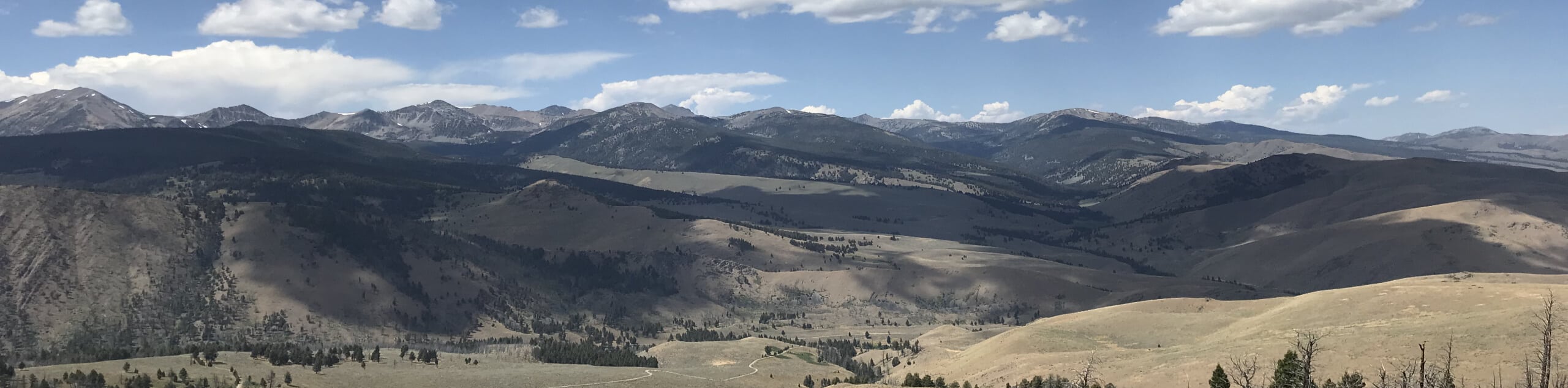
Sweeping mountain views await you on the East Pass Creek Trail. This demanding day hike is well-worth adding to your adventure itinerary, trust us. The unrivaled beauty of the landscape and panoramic vistas are unmatched.
Getting there
The East Pass Creek Trail departs from the trailhead off North Fork Big Lost River Road.

About
| Backcountry Campground | Dispersed Camping |
| When to do | May-September |
| Pets allowed | Yes - On Leash |
| Family friendly | Older Children only |
| Route Signage | Average |
| Crowd Levels | Moderate |
| Route Type | Out and back |
East Pass Creek Trail
Elevation Graph
Weather
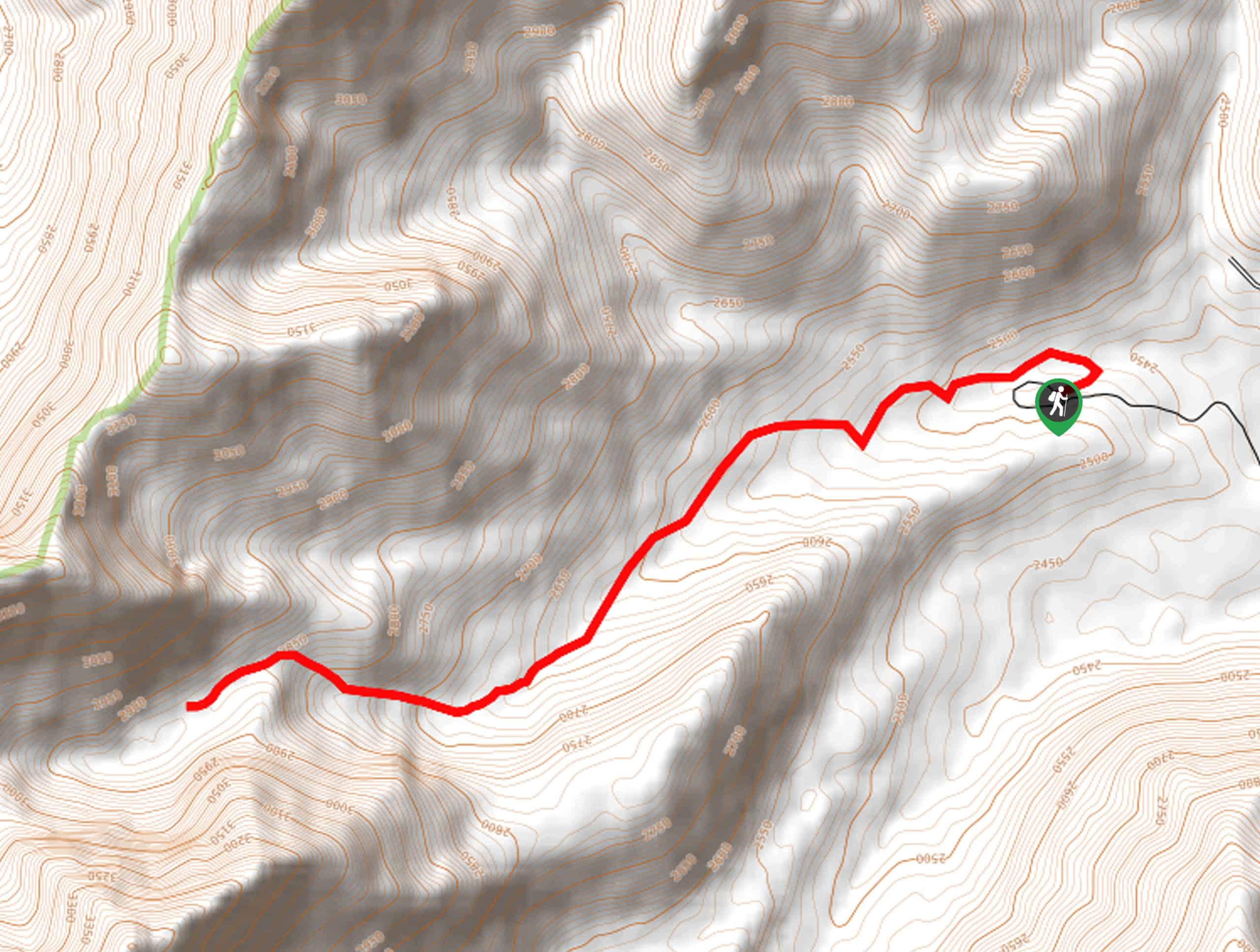
East Pass Creek Hike Description
The East Pass Creek Hike features the perfect ratio of strenuousness and scenery. Ideal for intermediate hikers or families with older children, this adventure offers a great taste of what treks into the Boulder Mountains entail. Make sure to bring plenty of water and snacks to stay fueled, especially when exploring with children—they make for great motivation. Additionally, it is important to note that much of the terrain is exposed, so it is wise to wear sun protection.
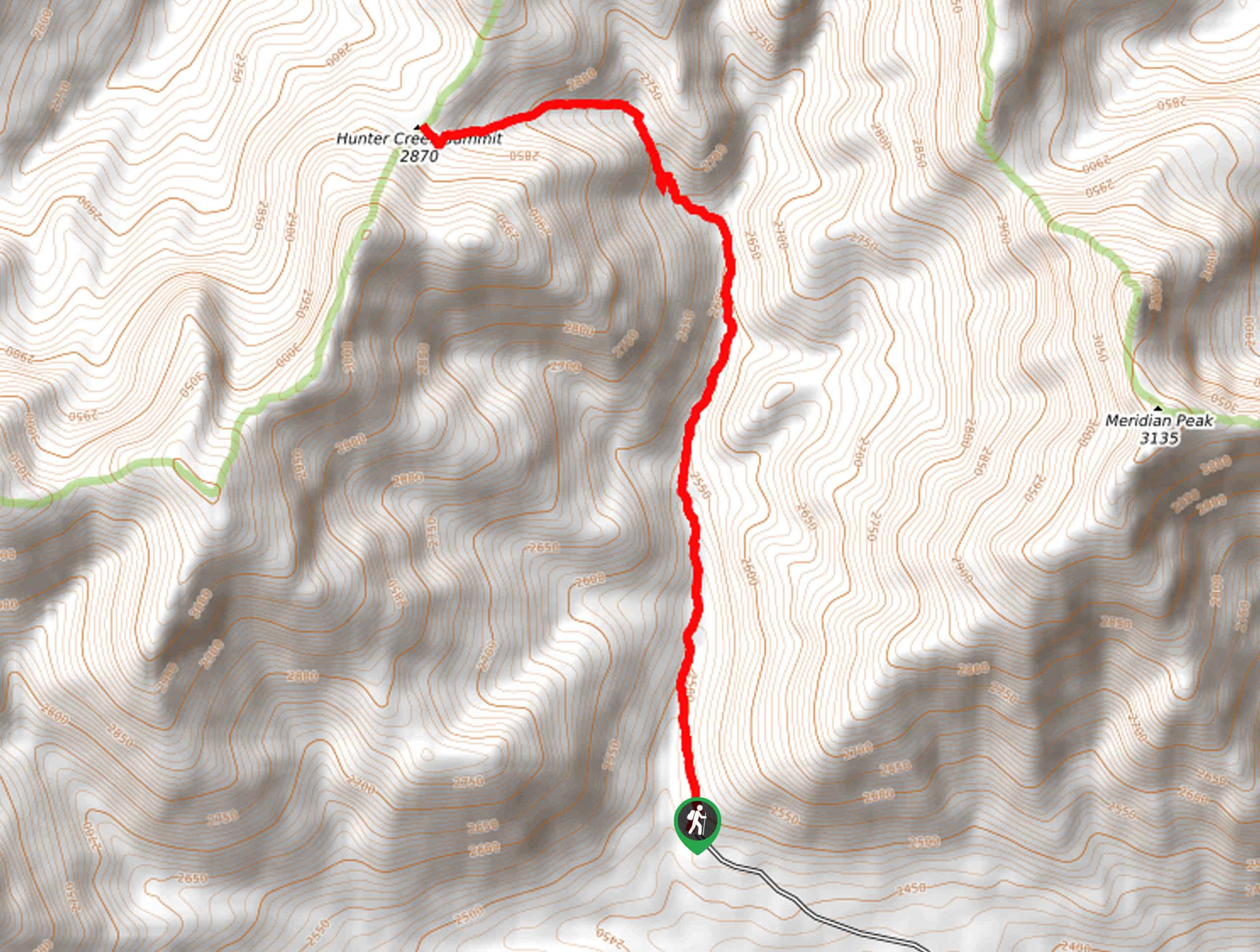
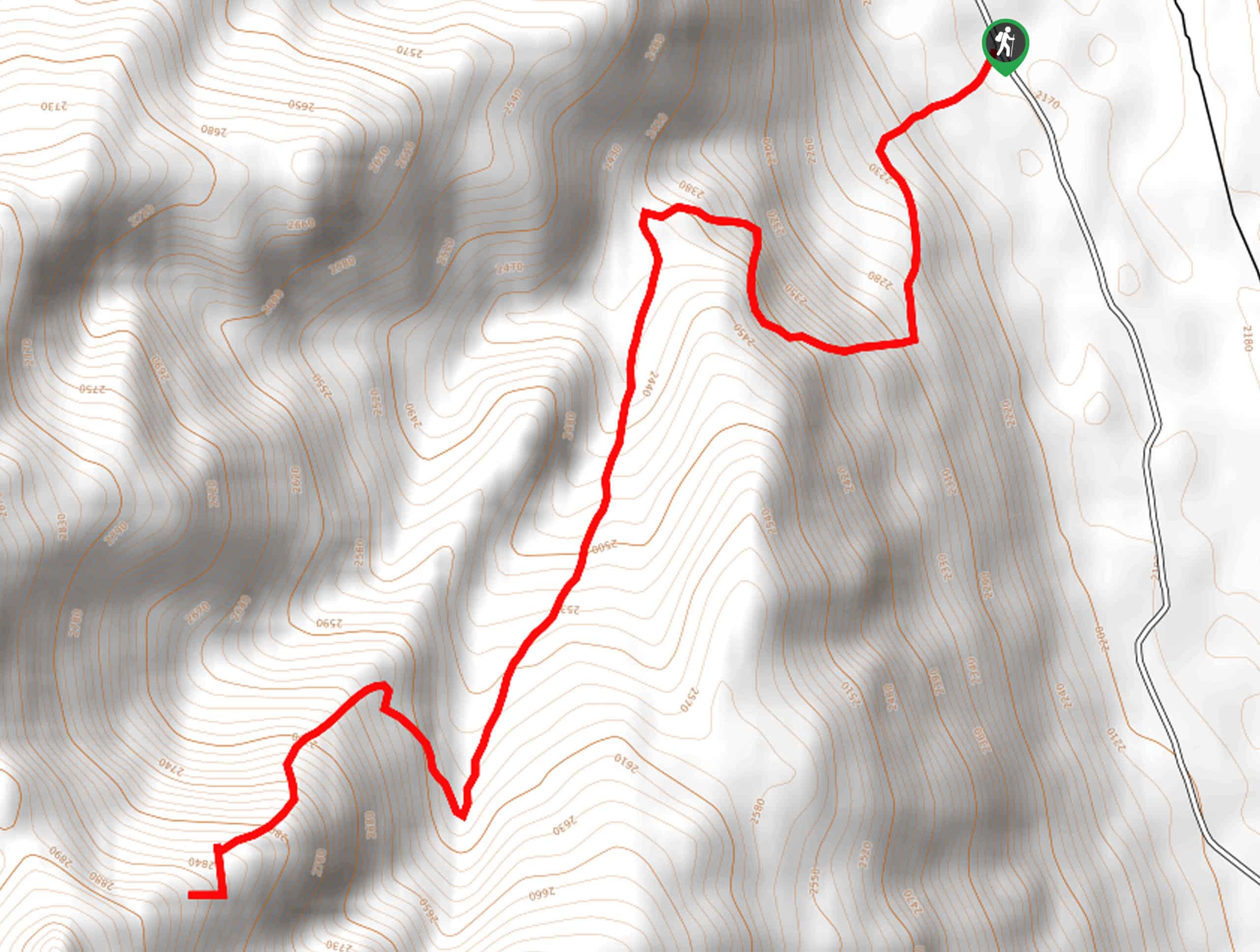
Embark on your adventure along the East Pass Creek from the trailhead off North Fork Big Lost River Road. Setting out from here, the East Pass Creek heads northward into the mountain-bound canyon. Alternating through exposed meadowlands and alpine fir, you will be granted views of Hunter Creek Summit in the northwest and Meridian Peak in the northeast. Enjoy the sounds and scenes of the gurgling creek, and after some hiking, the path will reroute west, more intensely climbing towards the summit.
As you gain the ridge, the terrain will become rockier and more exposed. Mind your footing on the uneven path, and soon you will reach the summit of Boulder Mountain. Marvel in the 360-degree views of the dramatic mountainscape, then head back down the path the way you came, all the way to the trailhead.
Similar hikes to the East Pass Creek Trail hike
Boulder Lake via Boulder Creek Trail
Explore a rugged and remote area of the Salmon-Challis National Forest on Boulder Lake via Boulder Creek Trail. This pleasant…
Burnt Aspen Trail
The Burnt Aspen Trail is a scenic hike that demands a relentless climb through the forested foothills of the Pioneer…
North Fork Lake Trail
Explore Idaho’s Boulder Mountains and enjoy a refreshing swim in an idyllic alpine pool on the North Fork Lake Trail.…
Comments