
Middle Canyon Trail
View Photos
Middle Canyon Trail
Difficulty Rating:
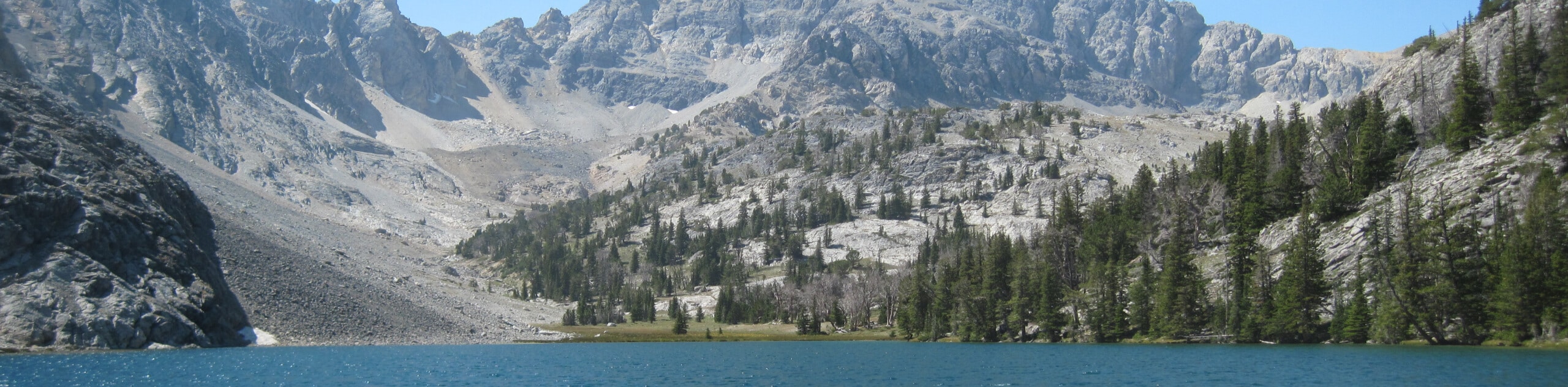
The Middle Canyon Trail is a hidden gem in the Gem State. This incredible hike explores a remote area of the Salmon-Challis National Forest, providing those who venture it with tranquility. Immerse yourself in the preserved wilderness and revel in the unique geology.
Getting there
Access this hike from the unmarked service road off Route 1500W.

About
| Backcountry Campground | No |
| When to do | May-September |
| Pets allowed | Yes - On Leash |
| Family friendly | Yes |
| Route Signage | Poor |
| Crowd Levels | Low |
| Route Type | Out and back |
Middle Canyon Trail
Elevation Graph
Weather
Middle Canyon Hike Description
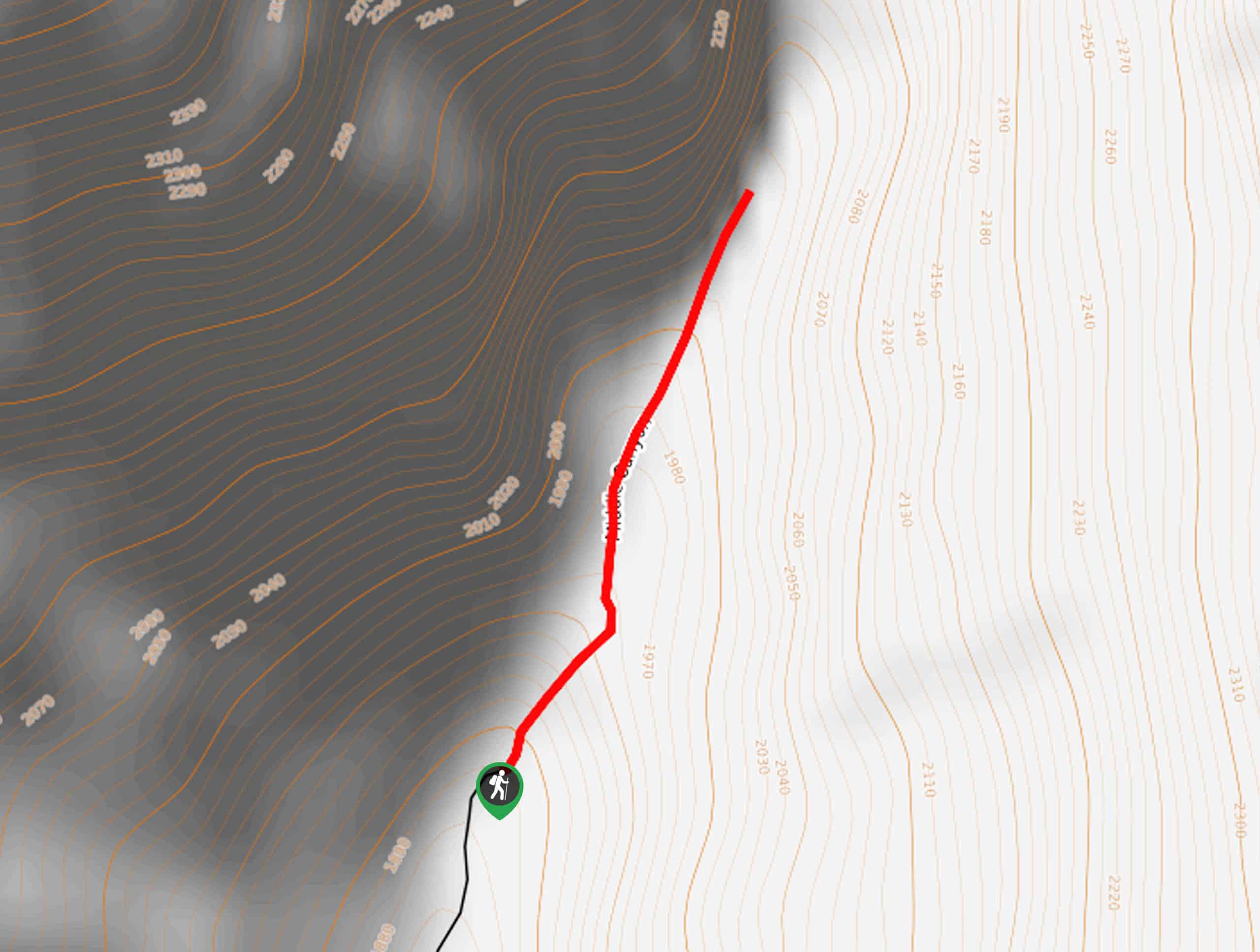
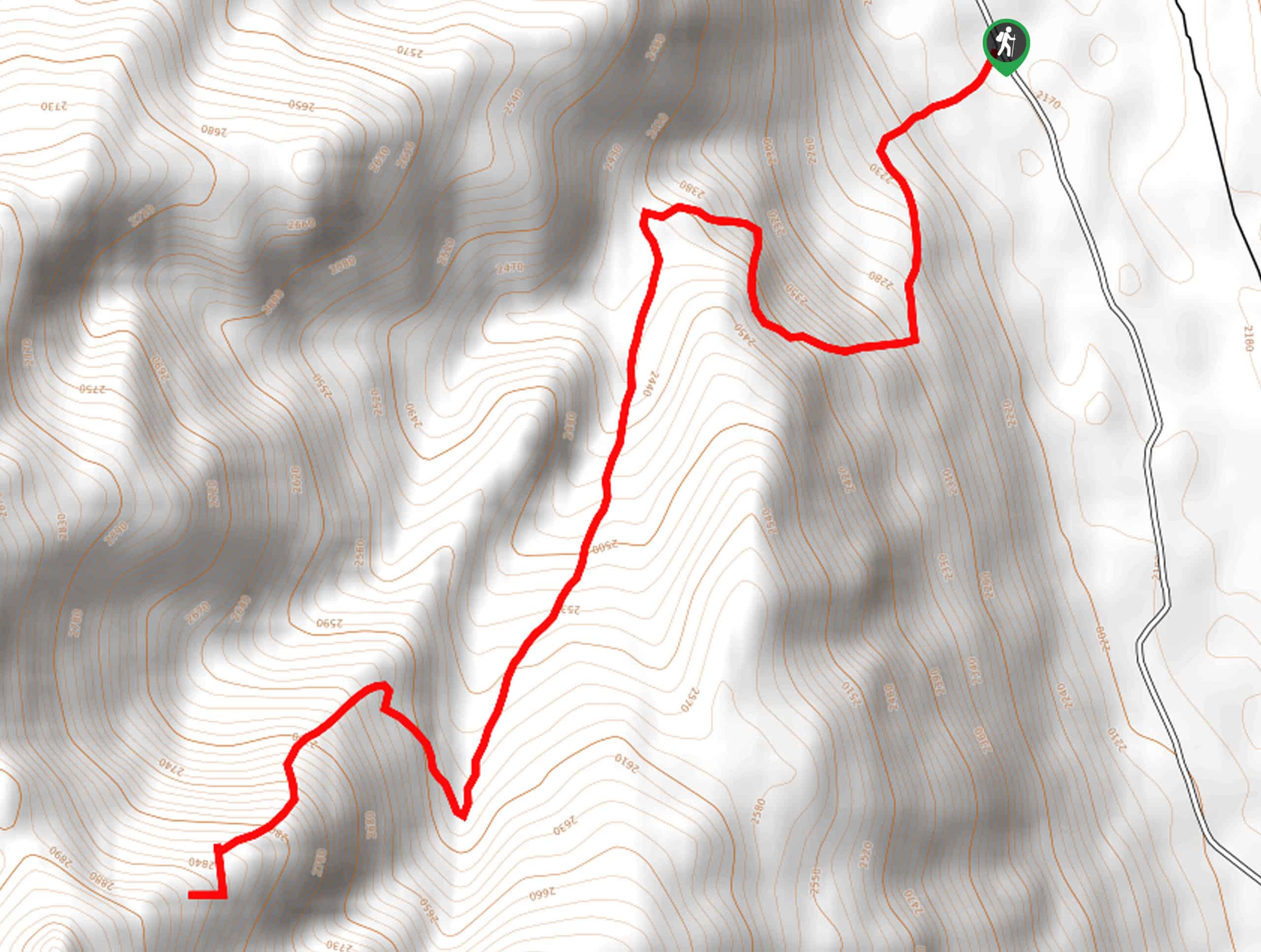
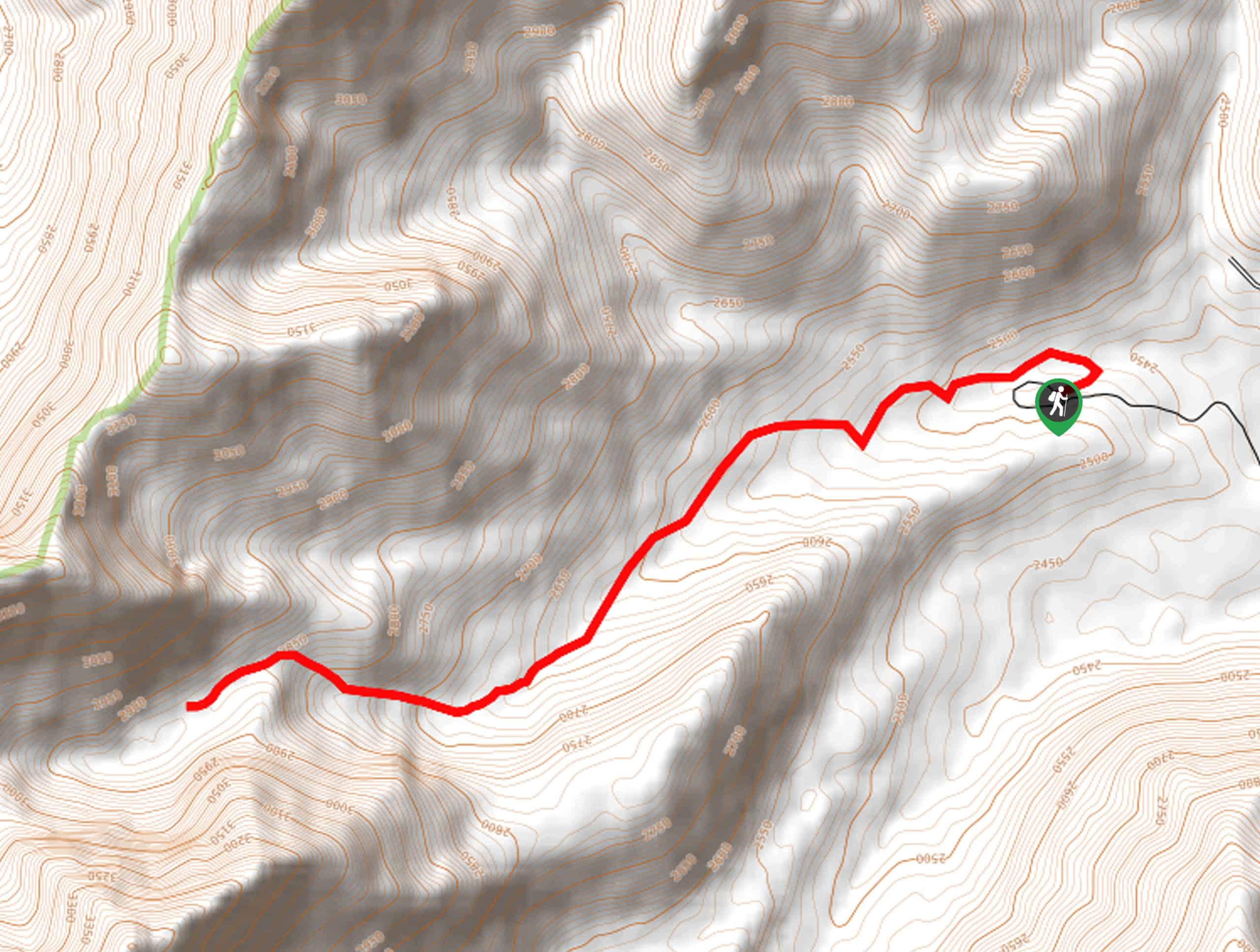
Those visiting Howe, Idaho, are encouraged to hike the Middle Canyon Trail. This scenic route travels through a corridor of limestone cliffs of the Lemhi Range. The bounding ridges are unquestionably quite impressive, but the diversity of flora and fauna in the area is quite astonishing. Offering great views, the terrain is exposed, so come prepared to face the elements. Additionally, it is worth noting that this route is not signposted, nor are the dirt roads to the trailhead, so the trail GPS is necessary.
Setting out from the small parking lot, your adventure along the Middle Canyon Trail travels north, steeply climbing into the canyon sparsely decorated with pines and sagebrush. Minding your footing on the rocky scree, you will be immersed in the narrows of the valley, boasting impressive views of the craggy cliffsides. After some hiking, the incline will mellow. Make sure to look behind you for expansive views of East Idaho Snake River Plain.
Admire the scenery and keep an eye out for evidence of wildlife as you progress further into the canyon. While some chose to tackle the climb up to Saddle Mountain from here, we turned around using the queue from the trail GPS, retracing our steps back to the trailhead.
Similar hikes to the Middle Canyon Trail hike
Burnt Aspen Trail
The Burnt Aspen Trail is a scenic hike that demands a relentless climb through the forested foothills of the Pioneer…
North Fork Lake Trail
Explore Idaho’s Boulder Mountains and enjoy a refreshing swim in an idyllic alpine pool on the North Fork Lake Trail.…
Merriam Lake Hike
Spellbinding mountain views await you on the Merriam Lake Hike. This incredible adventure into the Lost River Mountains is not…
Comments