Burnt Aspen Trail
View Photos
Burnt Aspen Trail
Difficulty Rating:
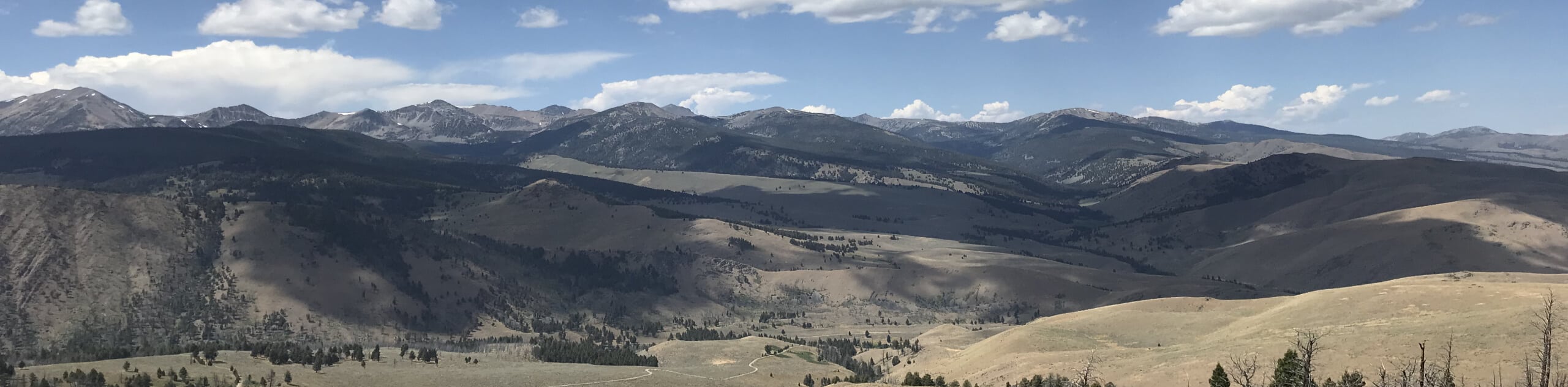
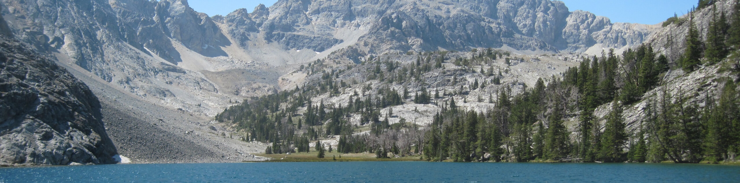
The Burnt Aspen Trail is a scenic hike that demands a relentless climb through the forested foothills of the Pioneer Mountains. Get a great workout in and indulge in the topographic range of Idaho’s landscape.
Getting there
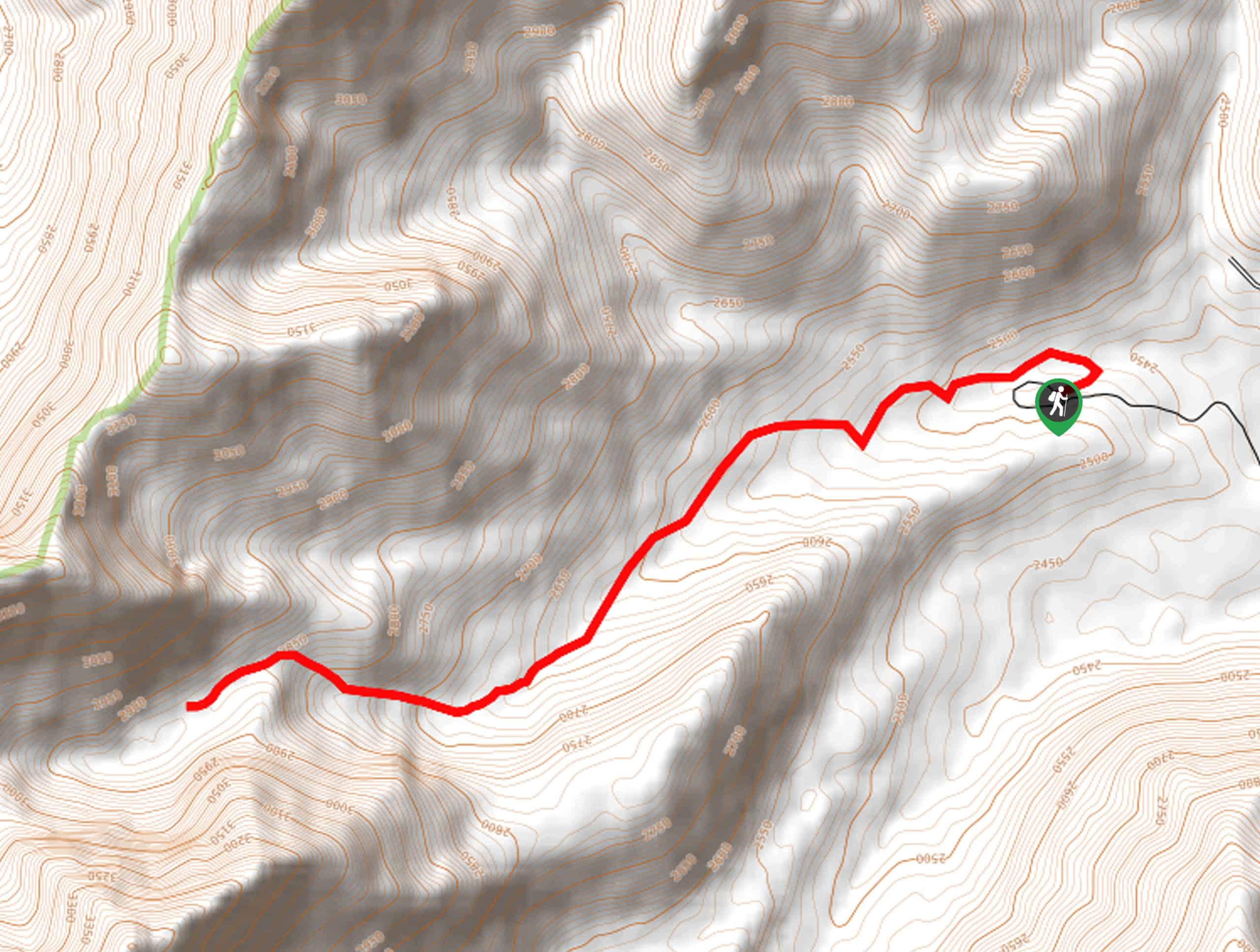
The Burnt Aspen Trail is accessed from the trailhead off Wild Horse Creek Road.

About
| Backcountry Campground | No |
| When to do | April-October |
| Pets allowed | Yes - On Leash |
| Family friendly | Older Children only |
| Route Signage | Average |
| Crowd Levels | Low |
| Route Type | Out and back |
Burnt Aspen Trail
Elevation Graph
Weather
Burnt Aspen Hike Description
The Burnt Aspen Hike would make an excellent addition to your Salmon-Challis National Forest adventure itinerary, assuming you don’t mind breaking a sweat. Explore exposed grasslands and pine forests interspersed with aspen groves, occupied by a diversity of flora. This scenic expedition offers great views of the Pioneer Mountains, so make sure you bring your camera! Don’t forget to pack plenty of water and wear SPF to avoid overexposure.
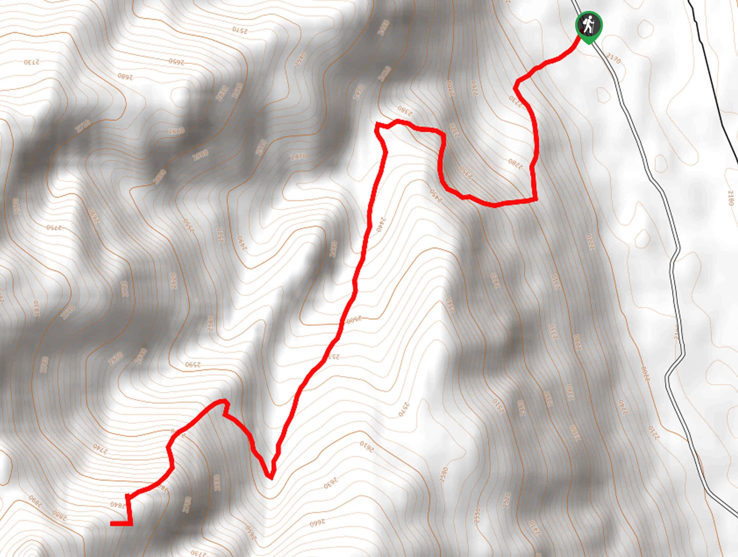
Embark on your adventure along the Burnt Aspen Trail from the trailhead off Wild Horse Creek Road. Setting out from here, you will immediately begin your climb, trekking southwestwardly. The steep terrain is made more manageable with the help of switchbacks, winding up the forested ridge. Mind your footing on the uneven terrain and revel in the diversity of wildflowers and brush that carpet the landscape. After some hiking, the trail will straighten out for a while before quickly traversing some switchbacks up the ridge.
Eventually, you will reach the route’s end—marvel at the mountain views, then head back down the path the way you came, all the way to the trailhead.
Similar hikes to the Burnt Aspen Trail hike
Boulder Lake via Boulder Creek Trail
Explore a rugged and remote area of the Salmon-Challis National Forest on Boulder Lake via Boulder Creek Trail. This pleasant…
North Fork Lake Trail
Explore Idaho’s Boulder Mountains and enjoy a refreshing swim in an idyllic alpine pool on the North Fork Lake Trail.…
Merriam Lake Hike
Spellbinding mountain views await you on the Merriam Lake Hike. This incredible adventure into the Lost River Mountains is not…
Comments