Ute Trail
View Photos
Ute Trail
Difficulty Rating:
Feel as though you are on top of the world as you hike amongst the clouds on the Ute Trail. This alpine excursion is incredibly Instagram worthy as you hike a high-country ridge overlooking the dozens of snow-dusted peaks that surround you. This expedition is a must add to your Rocky Mountain National Park itinerary.
Getting there
The Ute Trailhead is located off Trail Ridge Road.

About
| Backcountry Campground | Ute Meadow Dispersed Campsites |
| When to do | June-September |
| Pets allowed | No |
| Family friendly | Older Children only |
| Route Signage | Average |
| Crowd Levels | High |
| Route Type | Out and back |
Ute Trail
Elevation Graph
Weather
Ute Hike Description
The Ute Trail is a unique excursion in the Rocky Mountain National Park (RMNP). Instead of a technical summit hike, the Ute Route will guide its adventurers through an alpine meadow before descending into a gulch. The trail passes through exposed mountainous terrain, meaning inclement weather is likely. Check the forecast prior to your adventure and wear layers as insurance against the almost certain windy conditions. Because there is no tree shade, it is important to keep your eyes on the sky to avoid getting caught in a storm. If you trek this path in the autumn or winter months, make sure you wear snowshoes or microspikes to help navigate the icy terrain. Note you will have to purchase a RMNP pass to access the trail.
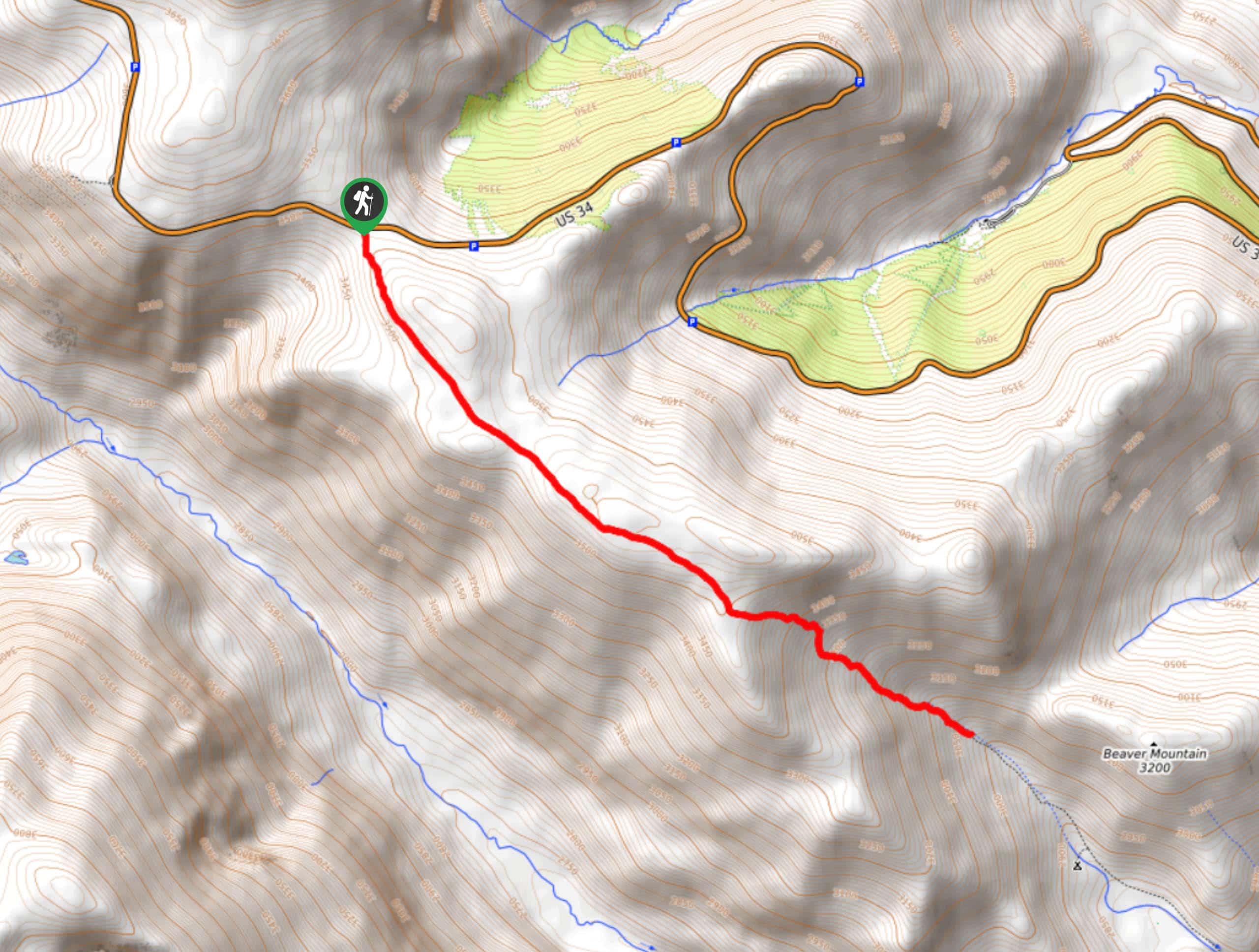
Embark on your adventure across the Ute Trail from the trailhead off the Trail Ridge Road. From here, track the Ute Trail southeast. Hike along the dirt path through the alpine tundra, keeping an eye out for mountain goats and longhorn sheep. As you hike, the extreme wind will discourage you, but let the unforgettable vistas of the Continental Divide be your motivation. Trek along the ridge and admire the scenery of the snow-capped peaks that hemmed the lush sub-alpine forests below. Continue hiking and the trail will eventually begin to descend.
As you descend into the Windy Gulch, the trail will merge with an alpine creek. Soon after the path begins to descend, you will encounter the trail’s end. Revel in the beauty of the Colorado Front Range and the alpine lakes that sit below. If you still have some gas left in the tank, trek further down the route to the Ute Dispersed campsites. When you are ready to return, retrace your steps along the path back to the trailhead.
Similar hikes to the Ute Trail hike
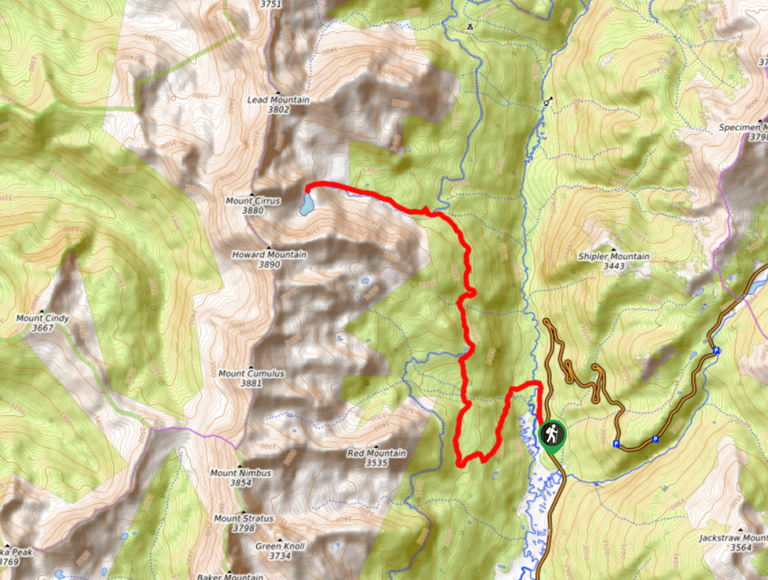
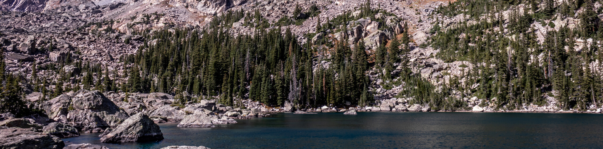
Lake of the Clouds Hike
The Lake of the Clouds Hike is a picturesque adventure on the western border of the Rocky Mountain National Park.…
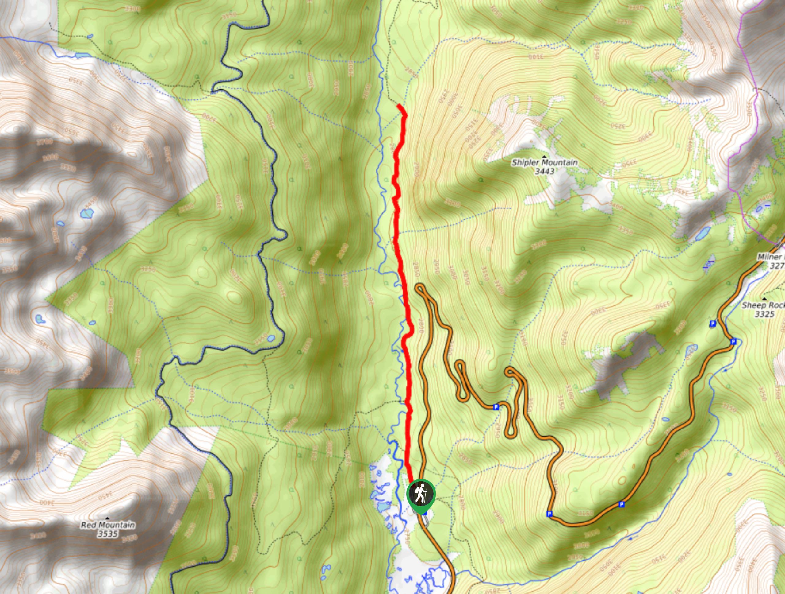
Shipler Cabin Trail
The Shipler Cabin Trail is a magical adventure in the Rocky Mountain National Park through meadowlands and towering pines. Perfect…
Six Lakes Hike
The Six Lakes Hike is a stunning alpine adventure in the Rocky Mountain National Park. If you love lake hikes…
Comments