Trail Ridge Road hike
View Photos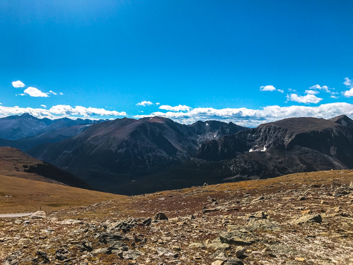
Trail Ridge Road hike
Difficulty Rating:
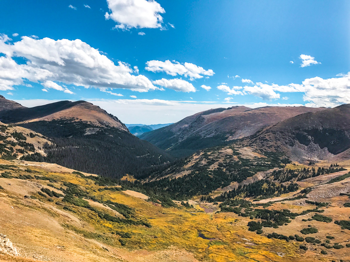
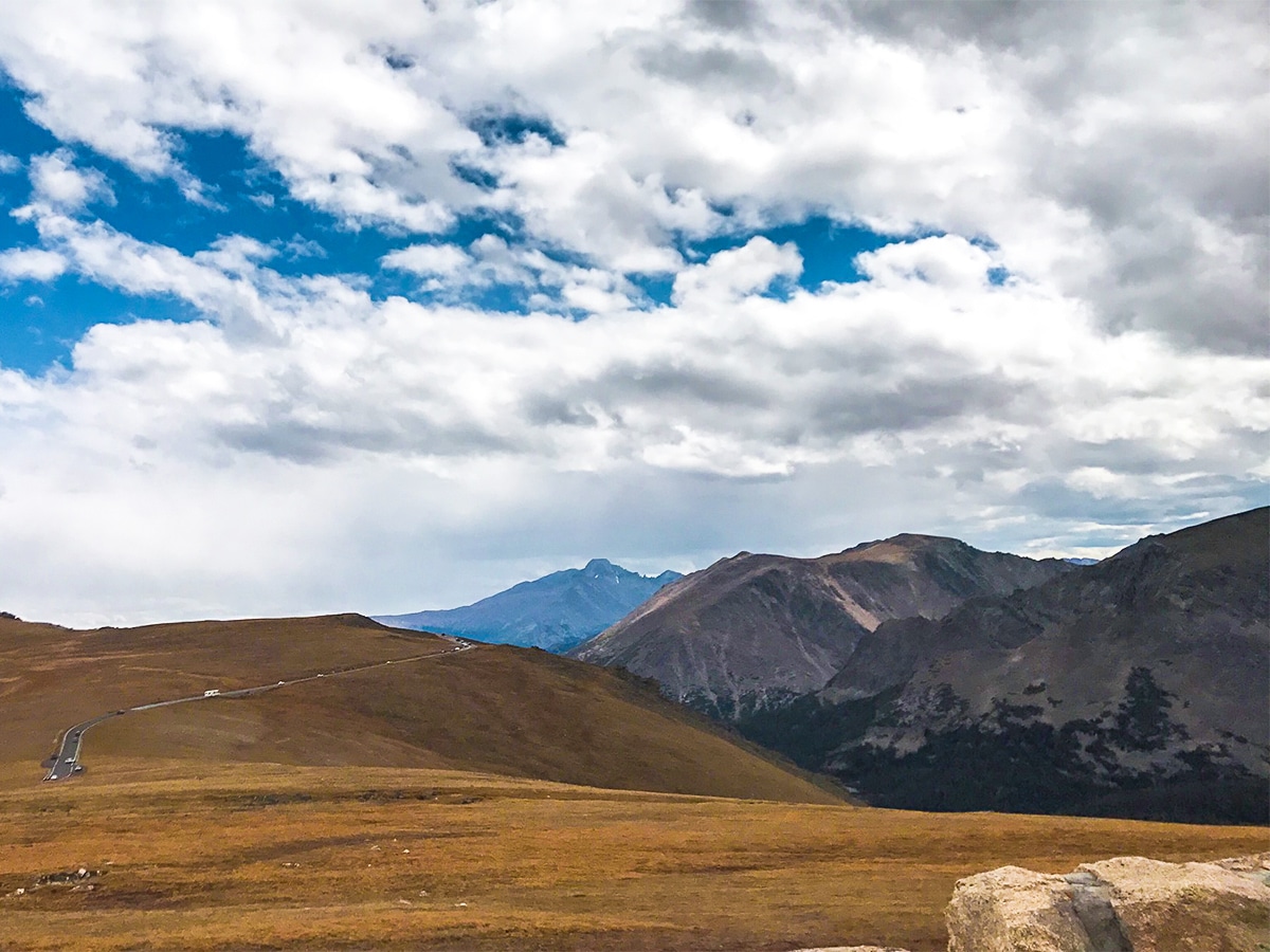
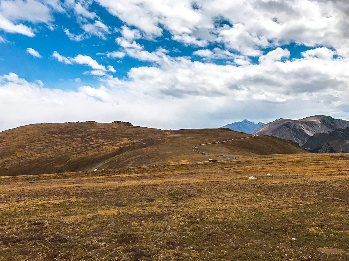
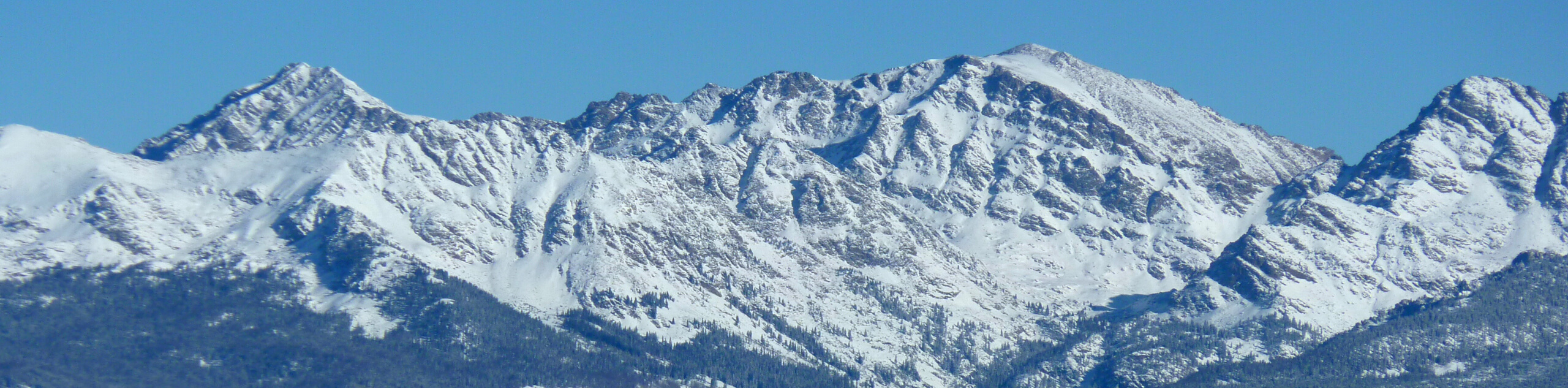
The Trail Ridge Road hike climbs high into the alpine tundra to an elevation of 12183ft with incredible panoramic views of RMNP. Trail Ridge Road itself is the destination with many unique and exciting hikes along the way! Most are short so make a day out of travelling the road and stopping for several hikes.
Getting there
From Estes Park, take highway 36 west and enter RMNP at the Fall River Entrance along Fall River Rd. After the pay station, turn left on Trail Ridge Rd.

About
| When to do | Click here to see when Trail Ridge Road is open to traffic |
| Backcountry Campsites | No camping allowed at Bear Lake |
| Toilets | Yes, primitive pit toilet |
| Pets allowed | Yes - On Leash |
| Family friendly | Yes |
| Route Signage | Good |
| Crowd Levels | High |
| Route Type | Out and back |
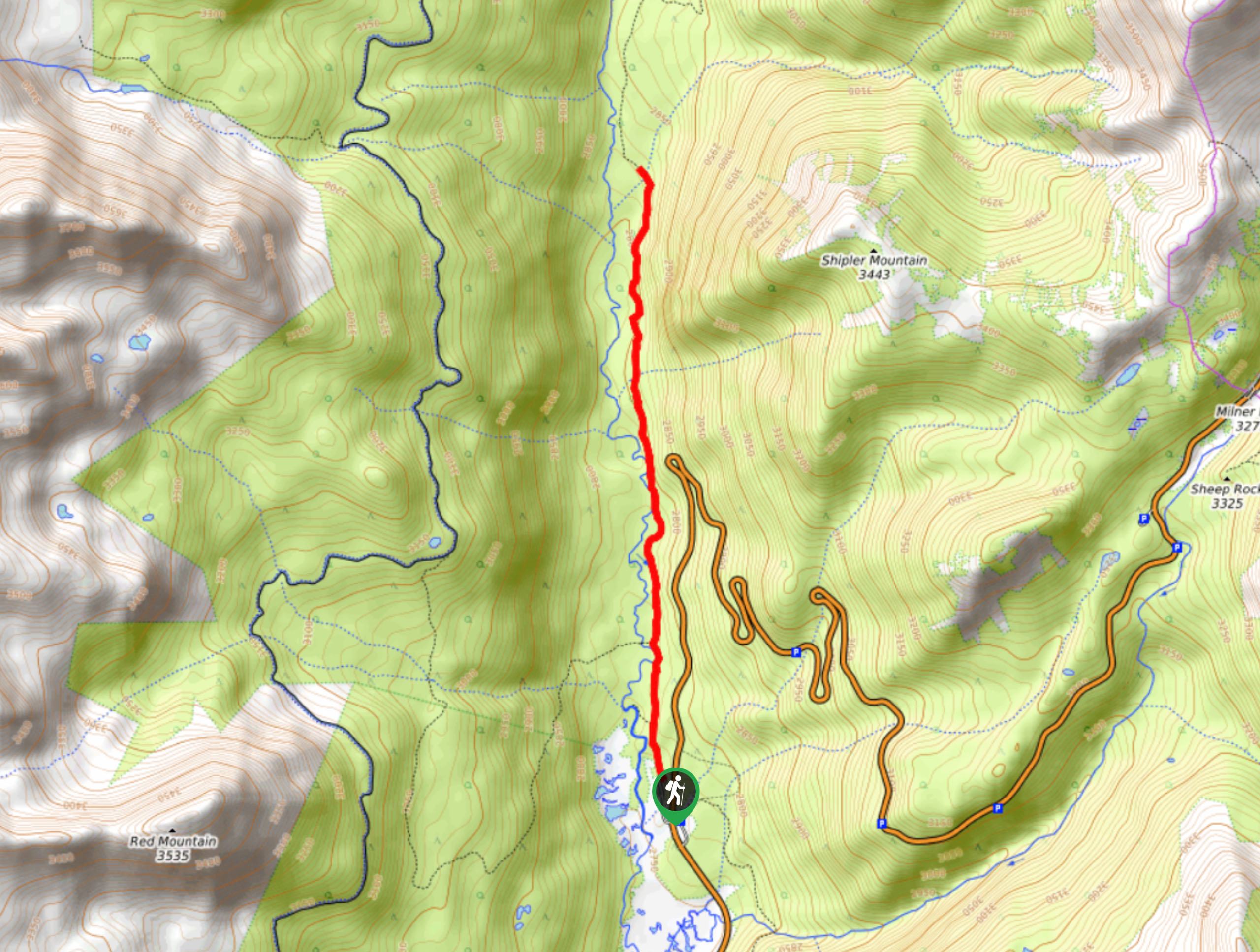
Trail Ridge Road
Elevation Graph
Weather
Route Description for Trail Ridge Road
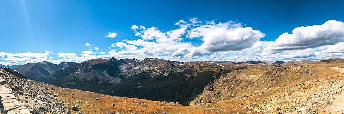
Trail Ridge Road is a must do when visiting RMNP. While many people just drive the road, we think it’s best experienced by stopping at the numerous stops along Trail Ridge Road and enjoying the short hikes available. We like making the following stops at Beaver Ponds, Hidden Valley, Forest Canyon Overlook, Mushroom Rocks, Lava Cliffs Overlook and Alpine Ridge Trail.
Beaver Ponds
One of the first points of interest along Trail Ridge Road is Beaver Ponds, this is a very short and wheelchair accessible trail to Hidden Valley Creek and a great location for wildlife viewing.
Hidden Valley
Beyond Beaver Ponds is the parking area for Hidden Valley, which is a retired ski resort within the national park and now serves as a great day use area. There is good parking here and it’s a nice place to stop for a break.
The road circles back over Hidden Valley and passes Rainbow Curve Overlook, with pretty views here.
The road quickly climbs above tree line and intersects Ute Trail which traverses Tombstone Ridge via Timberline Pass and provides access to backcountry camping at Ute Meadow.
Continue along Trail Ridge Road, keeping an eye open for Forest Canyon Overlook, a stunning viewpoint on your left. There is a short walk to the viewpoint.
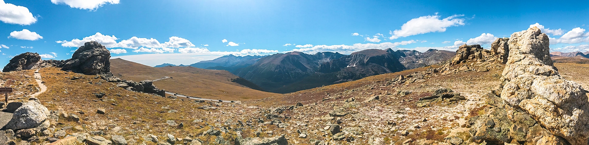
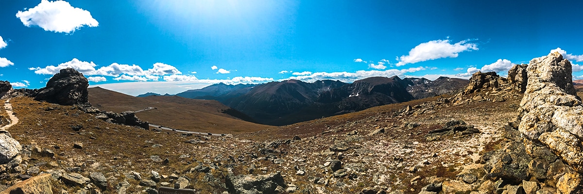
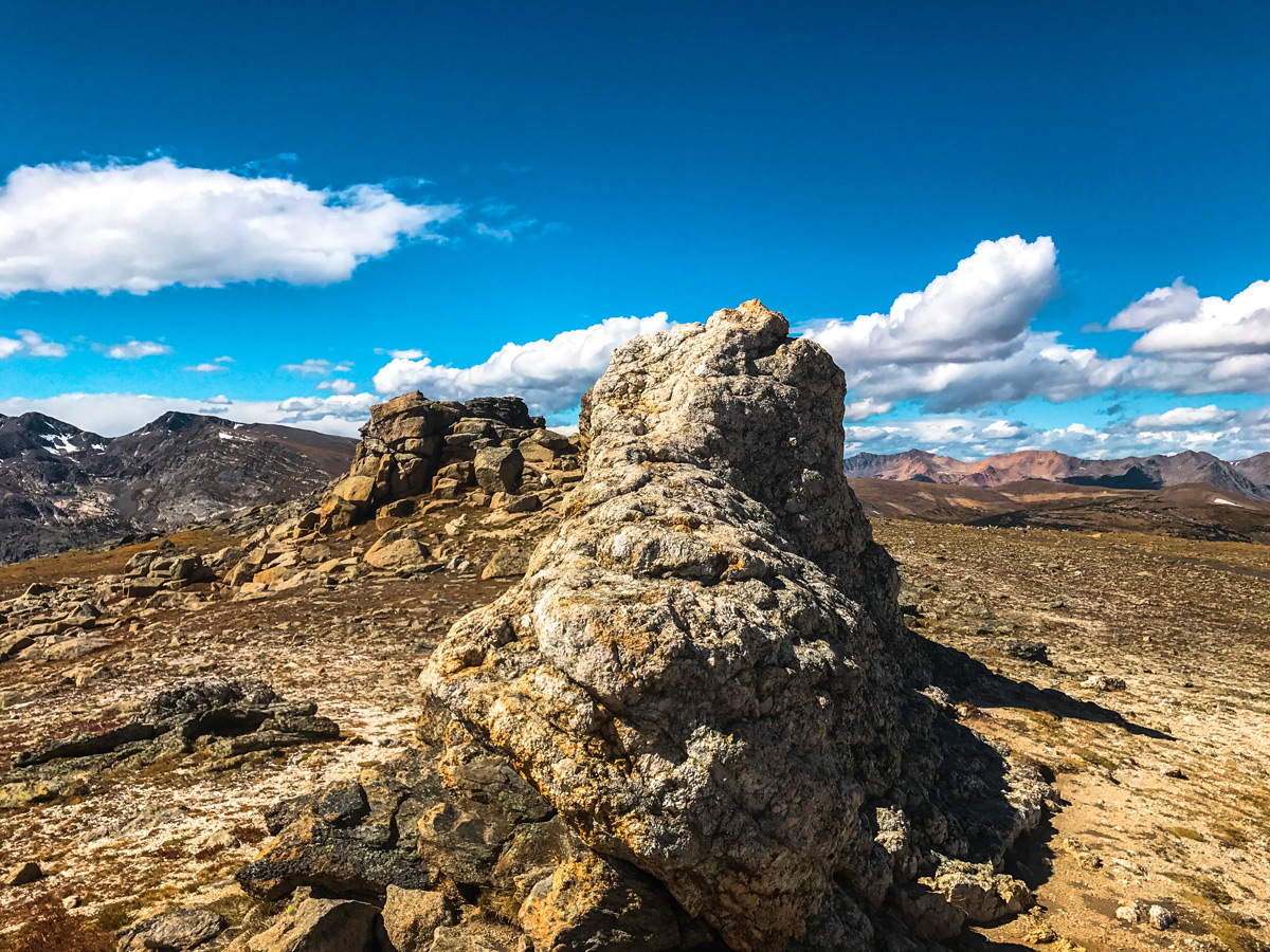
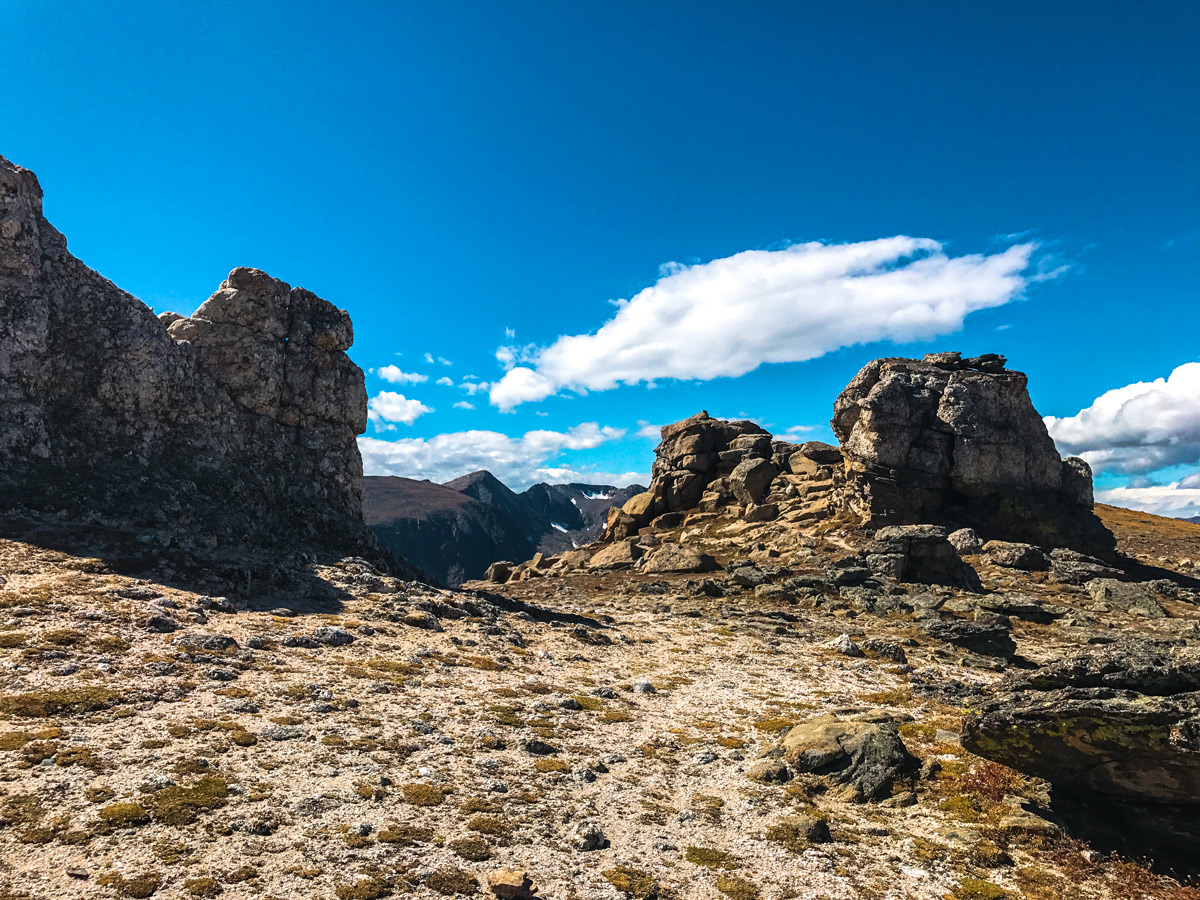
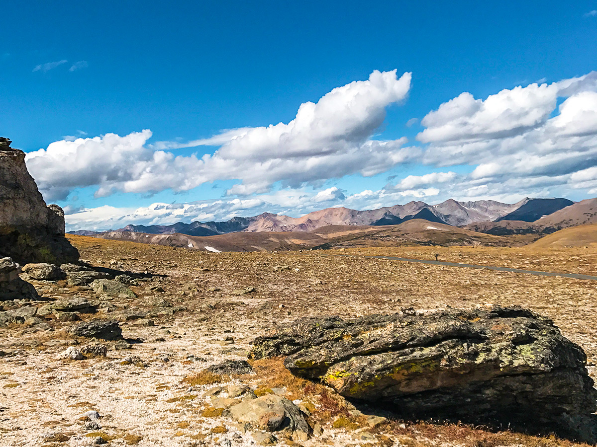
Further along Trail Ridge Road you drive through Rock Cut, an obvious cut through a rocky outcropping to allow passage for the road. This is a stunning part of the drive on Trail Ridge Road. Farther along you’ll come to the Tundra Communities Trailhead, where you should park. The route map listed on this hike is for this short but impressive hike to the Mushroom Rocks formations scattered across the alpine tundra. This short out and back trail offers amazing views of the entire park!
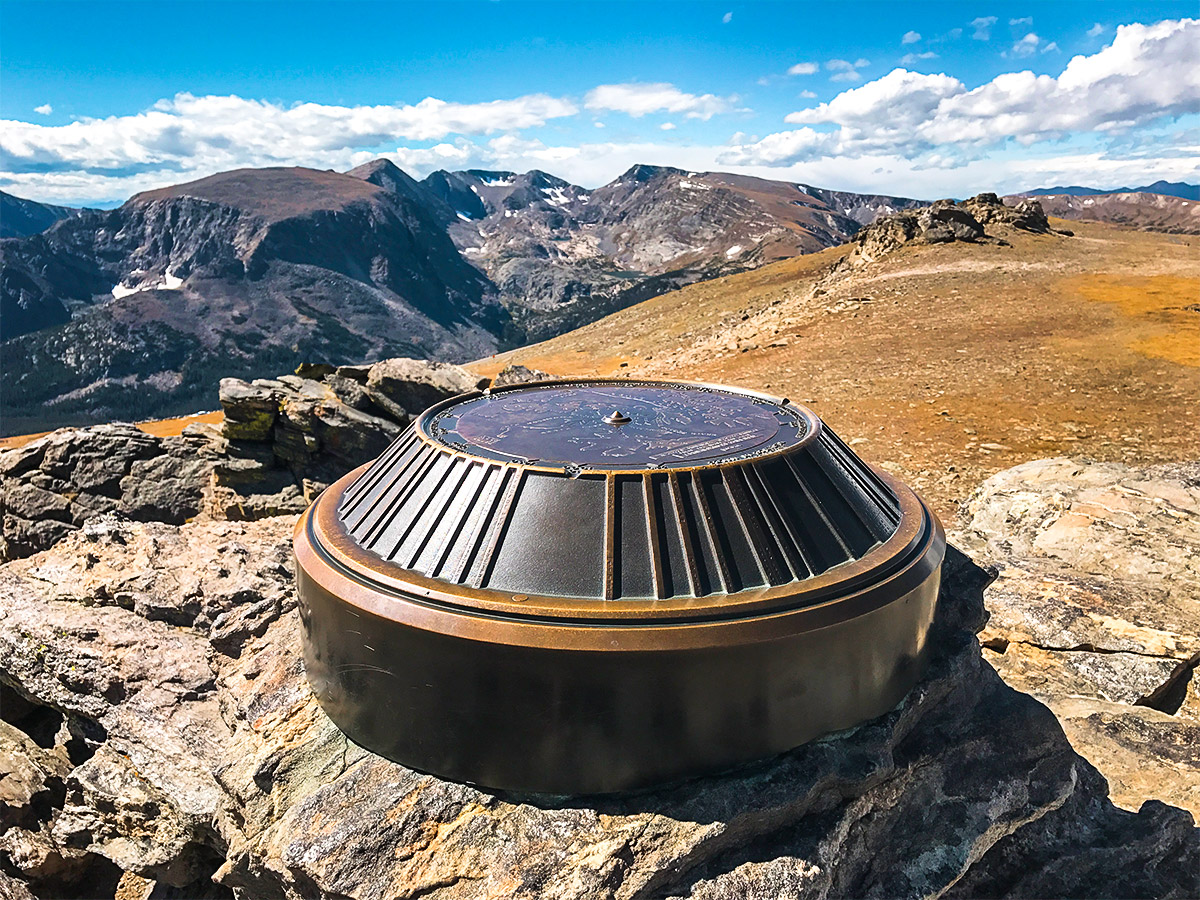
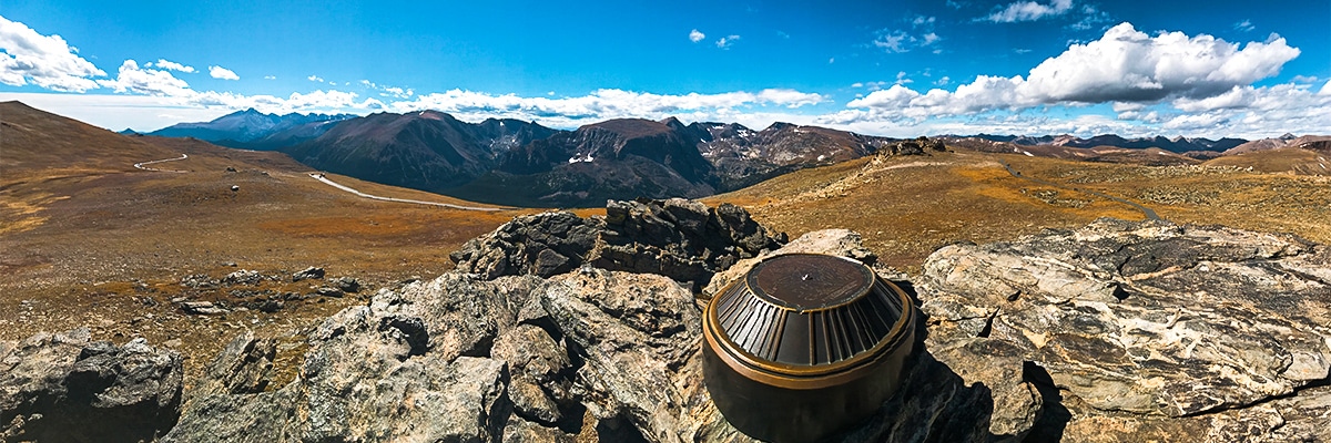
Hop back in the car and continue over Iceberg Pass and onto Lava Cliffs Overlook and the Trail Ridge Road Summit (12182ft).
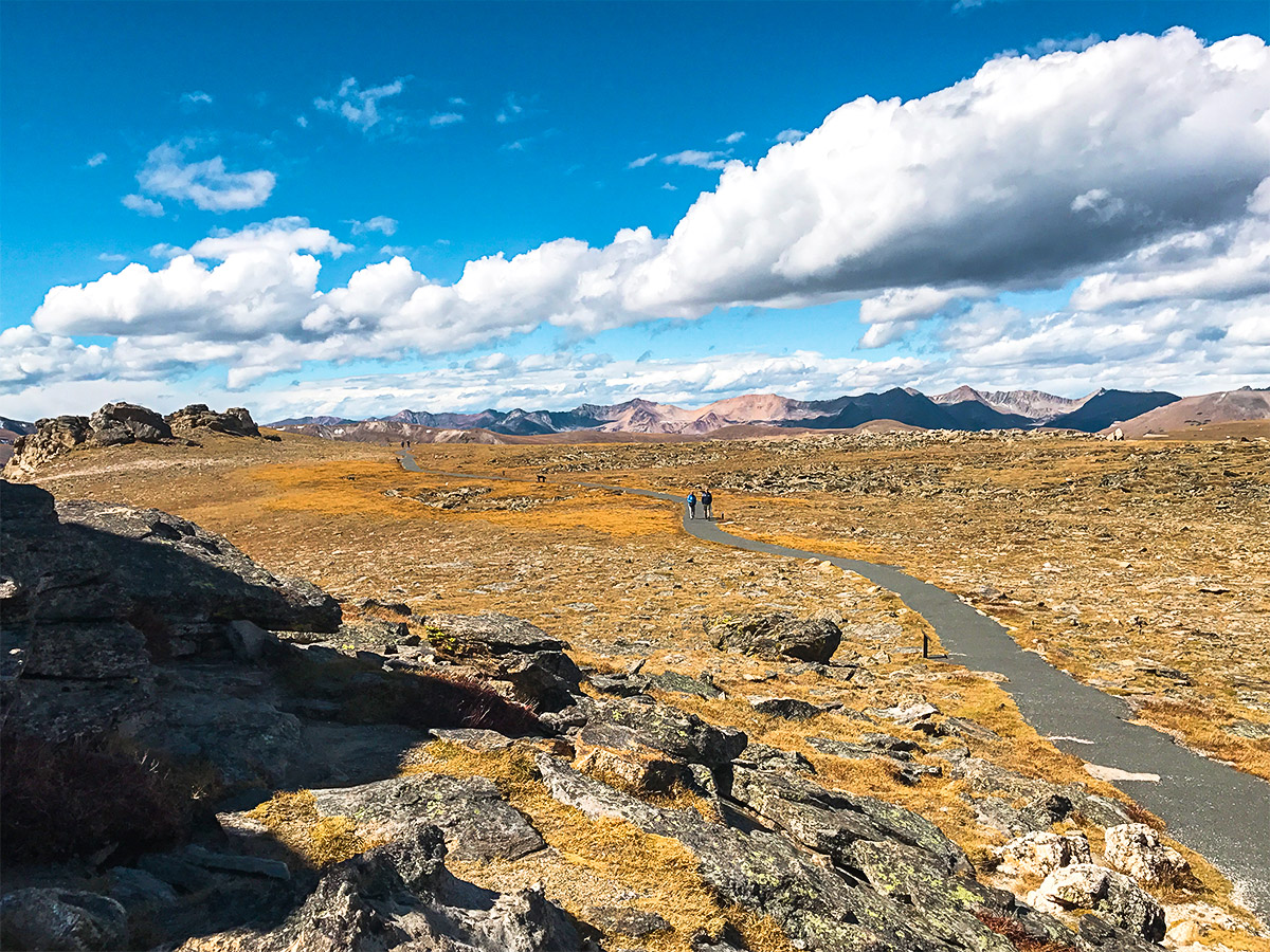
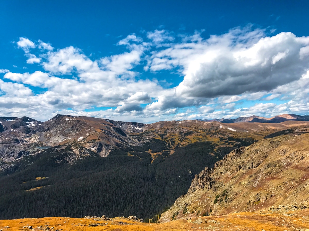
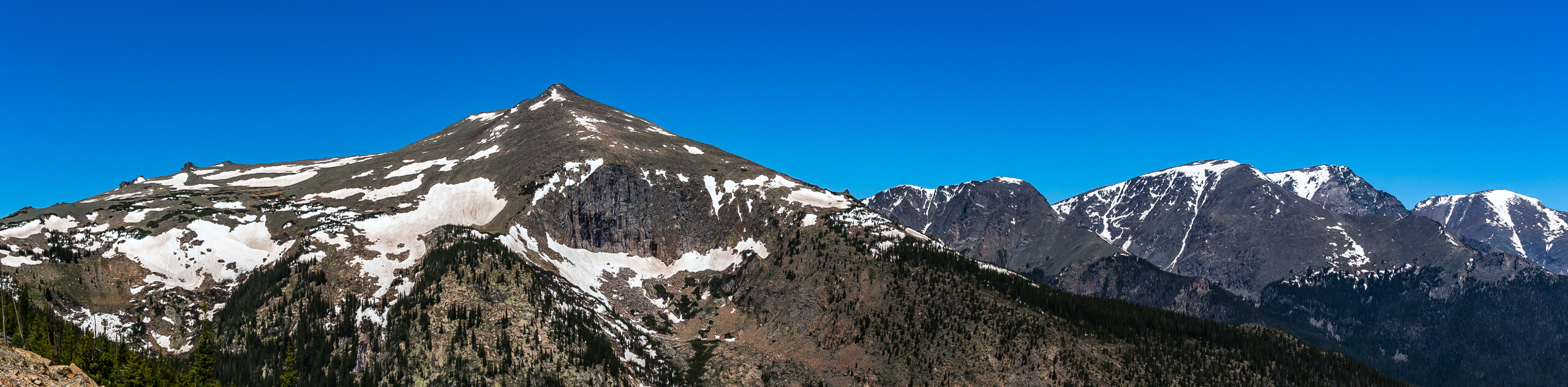
Continue past one more overlook of the Gore Range and arrive at the Alpine Visitor Center. This often-crowded parking lot is where a lot of visitors from Trail Ridge Road and Old Fall River Road converge into a single Visitor Center and Gift Shop. Stopping at the Alpine Visitor Center is worth it because it is also the trailhead parking for another short but impressive out and back Alpine Ridge Trail. From the top of the Alpine Ridge Trail, you will be able to see well beyond the Continental Divide to the Never Summer Range in western Colorado.
Trail Ridge Road starts its descent down towards Grand Lake. To head back, turn around and drive out the way you came.
Want to find more amazing hikes in Rocky Mountain National Park? Check out Chasm Lake hike, Lake Haiyaha hike or the Sky Pond and Lake of Glass hike.
Insider Hints
To avoid the crowds, plan to visit Trail Ridge Road during a weekday. It’s best to start early.
Sections of Trail Ridge Road can be hiked when the road is closed in the off-season, or there is a narrow window when it is ideal to ride your bike up when the road is mostly clear, but still closed for vehicle traffic!

Similar hikes to the Trail Ridge Road hike
Shipler Cabin Trail
The Shipler Cabin Trail is a magical adventure in the Rocky Mountain National Park through meadowlands and towering pines. Perfect…
North Deer Mountain Hike
The North Deer Mountain Hike is a lovely woodland adventure around the base of Deer Mountain. Family-friendly and manageable, this…
Beaver Mountain Trail
Appreciate the grandeur of the Colorado wilderness as you trek the Beaver Mountain Trail. This adventure reveals stunning alpine views…
Adamcox 4 years ago
What a great experience in every respect.
TwoBoots 4 years ago
Stunning views abound in all directions. This is a lovely trail and would love to visit again.
Lola M. 4 years ago
Wonderful trail, but nothing much to see here. It's ok for a short hike.
Lloyd Frank 5 years ago
It was a fun day hike. Enjoyed our visit to the Mushroom Rocks! They look so unique.
lilibethl 5 years ago
The trail was rocky and rugged but they're not that bad. You just need to pay attention to where you're walking to avoid tripping.
Xyla O. 5 years ago
Nice hike that you can do along with other short hikes. Great warm-up for a moderate climb!
Brexit Smith 5 years ago
Amazing hike. This hike is short and easy lots of people come and go every few hours after taking pictures.
Jordan A. 5 years ago
An easy and short hike in the Park. Nice alpine tundra and gorgeous expansive scenery.
Susanne P. 5 years ago
Absolutely stunning. The journey was so memorable. Nice sweeping scenery all around.
Jericho D. 5 years ago
It was a good hike. The trail was well kept, but there were tons of people.