Mount Chiquita Hike
View Photos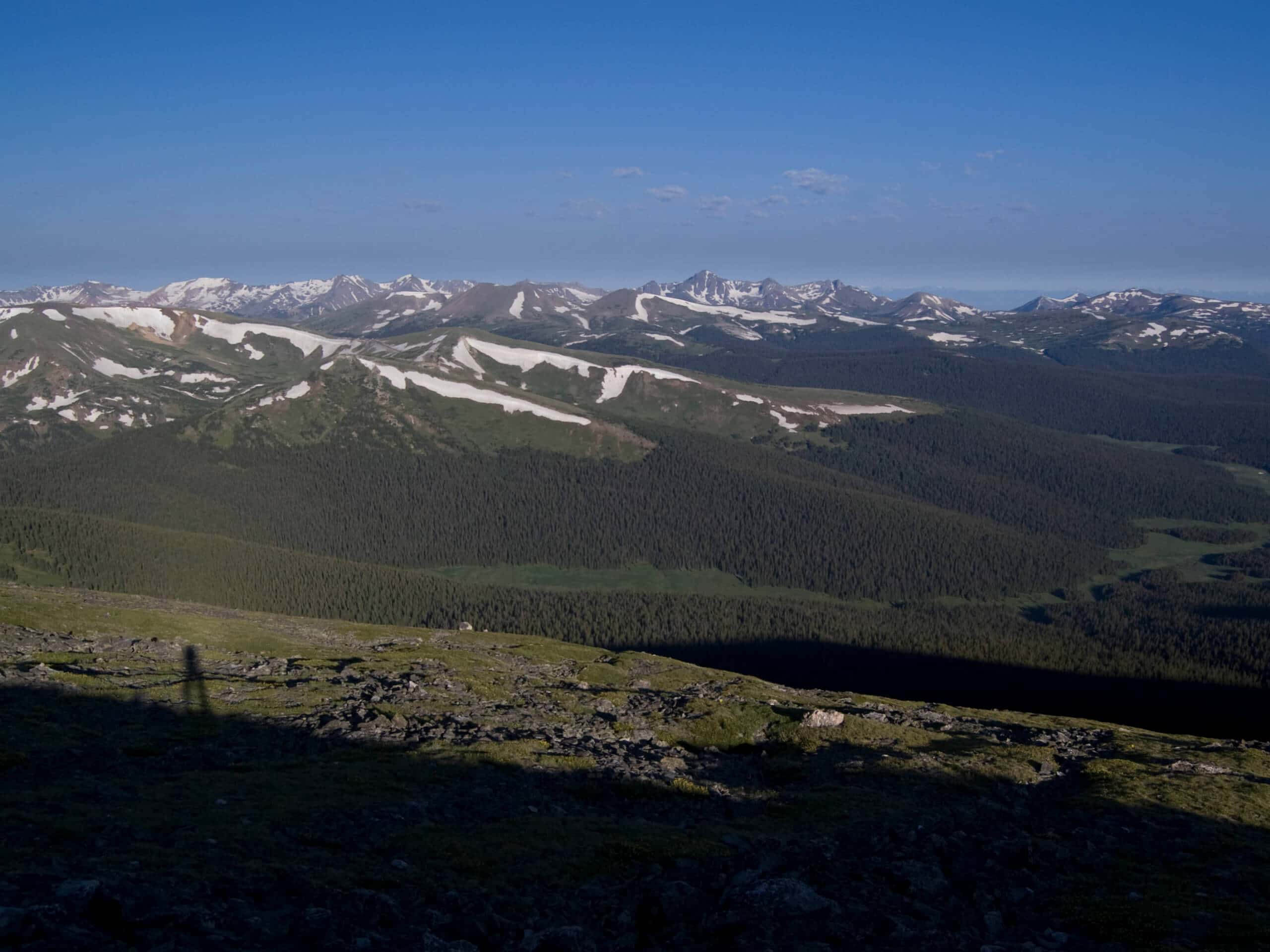
Mount Chiquita Hike
Difficulty Rating:
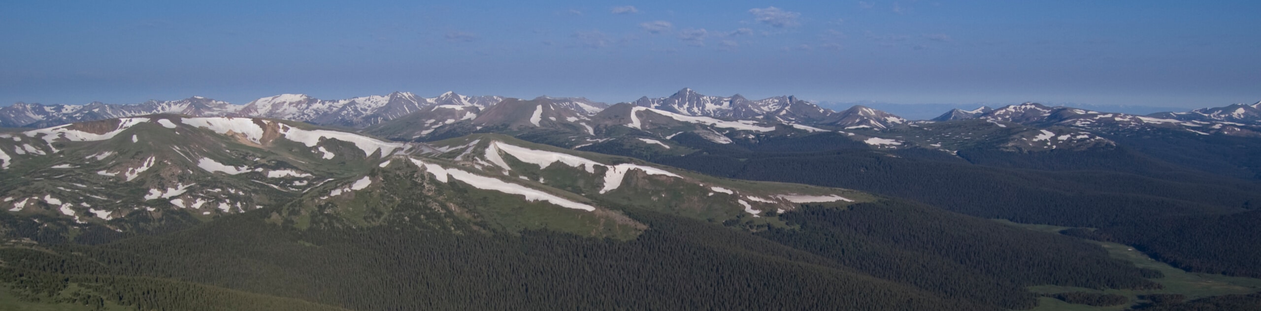
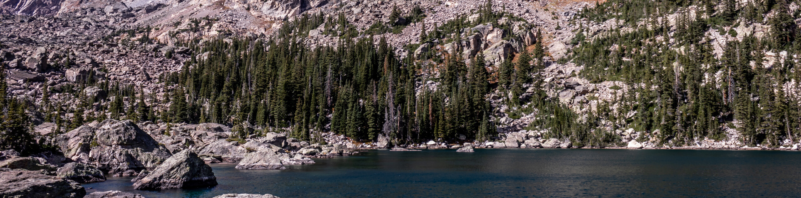
Revel in the grandeur of the Rocky Mountain National Park and the Front Range peaks from the summit of Mount Chiquita. The Mount Chiquita Hike is an epic excursion that reveals the beauty and diversity of the Colorado wilderness.
Getting there
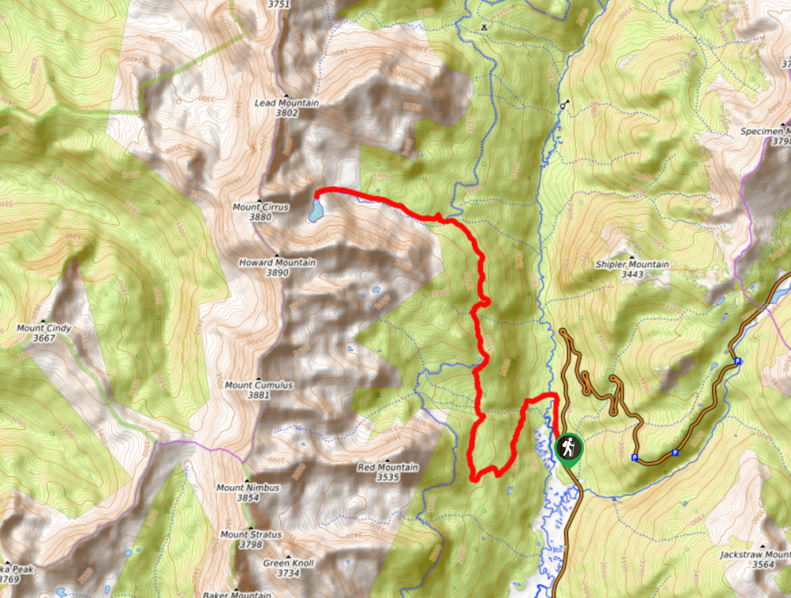
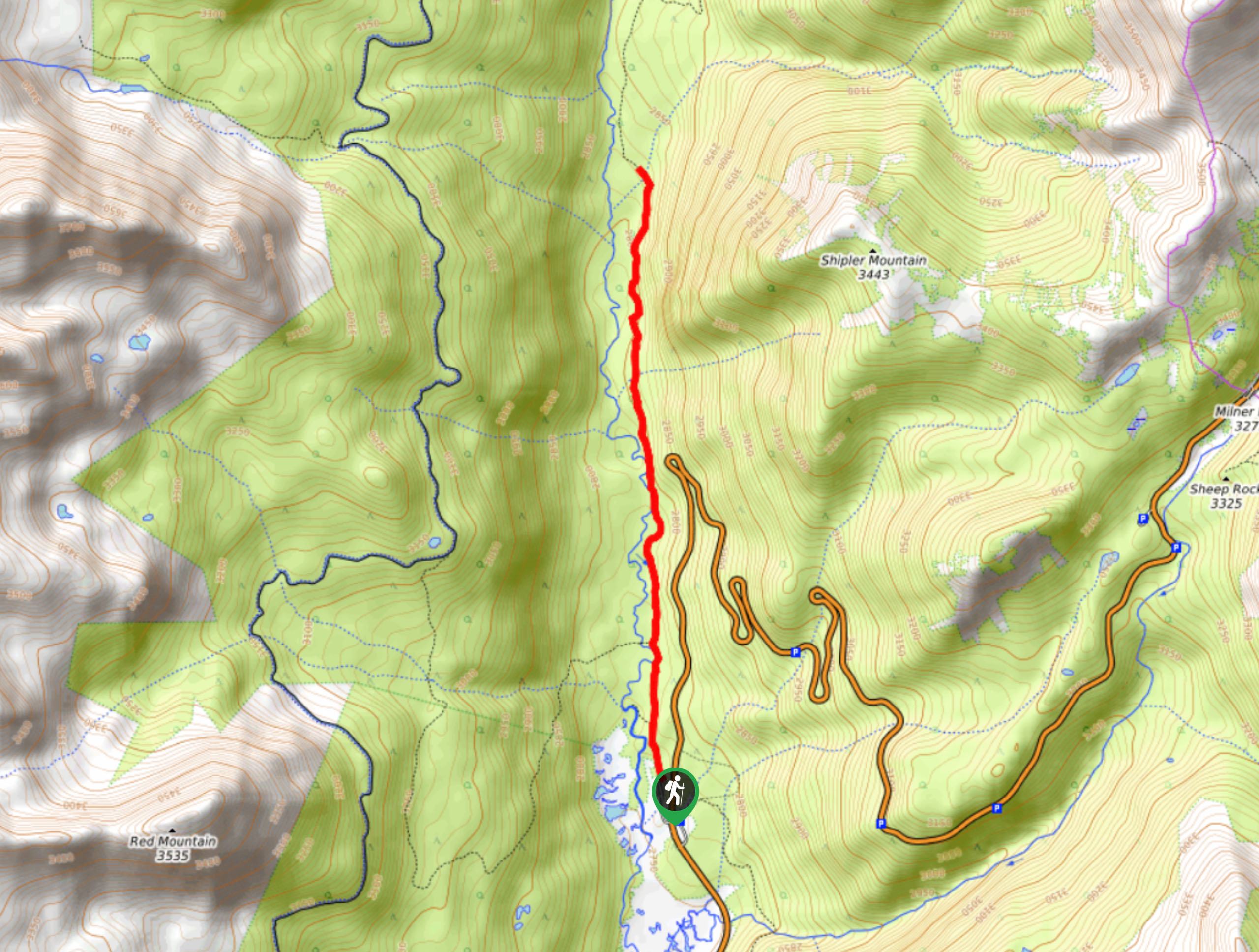
The Mount Chiquita Hike departs from the Chapin Pass Trailhead off the Old Fall River Road.

About
| Backcountry Campground | No |
| When to do | Year-round |
| Pets allowed | No |
| Family friendly | Older Children only |
| Route Signage | Average |
| Crowd Levels | Moderate |
| Route Type | Out and back |
Mount Chiquita Hike
Elevation Graph
Weather
Mount Chiquita Hike Description
The Mount Chiquita Trail is a great summit hike for those dipping their toes into peak ascents in the Rocky Mountain National Park. The gradual grade and easy terrain are manageable for novice adventurers and families with older children alike. Begin your lifelong love of summit hikes with the Mount Chiquita Trail. As the path is exposed at a high altitude, we recommend checking the forecast prior to your climb to mitigate the chances of getting caught in an afternoon storm, which are so common to the area. If you venture in the autumn or winter, we highly suggest microspikes or snowshoes to help navigate the snowy terrain. Located within the Rocky Mountain National Park (RMNP), visitors are required to purchase a pass.
Embark on your journey along the Mount Chiquita Hike from the Chapin Pass Trailhead. From here, follow the Chapin Pass Trail north. Shortly after your departure, you will encounter an intersection, veer right, and the Chapin Pass Trail will guide you east through the sparse pine tree coverage. At the next junction, keep right along the path as it guides you along the rocky ridge. Notice Mount Chapin on your right and hike across the saddle to the summit of Mount Chiquita.
At the next fork in the road, keep right and ascend the peak. From the summit of Mount Chiquita, you will be rewarded with expansive mountain vistas. Revel in the scenery from atop the peak and notice Ypsilon Mountain across the saddle in the north. Appreciate the breathtaking views before beginning your descent. When you are ready, simply follow the path the way you came, retracing your steps back to the trailhead.
Similar hikes to the Mount Chiquita Hike hike
Lake of the Clouds Hike
The Lake of the Clouds Hike is a picturesque adventure on the western border of the Rocky Mountain National Park.…
Shipler Cabin Trail
The Shipler Cabin Trail is a magical adventure in the Rocky Mountain National Park through meadowlands and towering pines. Perfect…
Six Lakes Hike
The Six Lakes Hike is a stunning alpine adventure in the Rocky Mountain National Park. If you love lake hikes…
Comments