Lily Lake to Estes Cone Hike
View Photos
Lily Lake to Estes Cone Hike
Difficulty Rating:
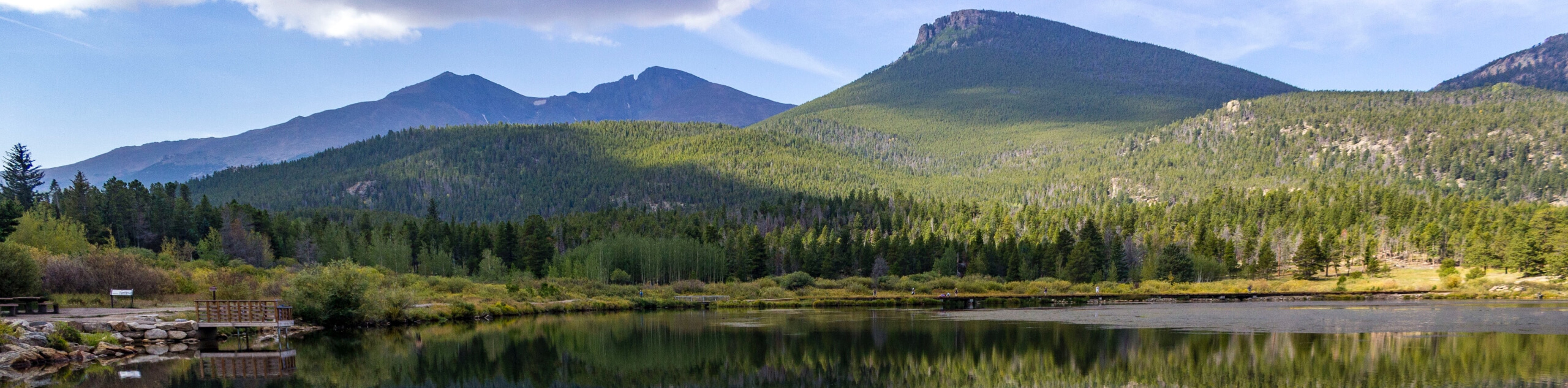
The Lily Lake to Estes Cone Hike is a perfect extension to the typical lakeshore perimeter adventure. This excursion exhibits several typographies within the Rocky Mountain National Park (RMNP). Culminating at the summit of Estes Cone, the overlook will reward hikers with epic vistas of the encompassing snow-capped peaks.
Getting there
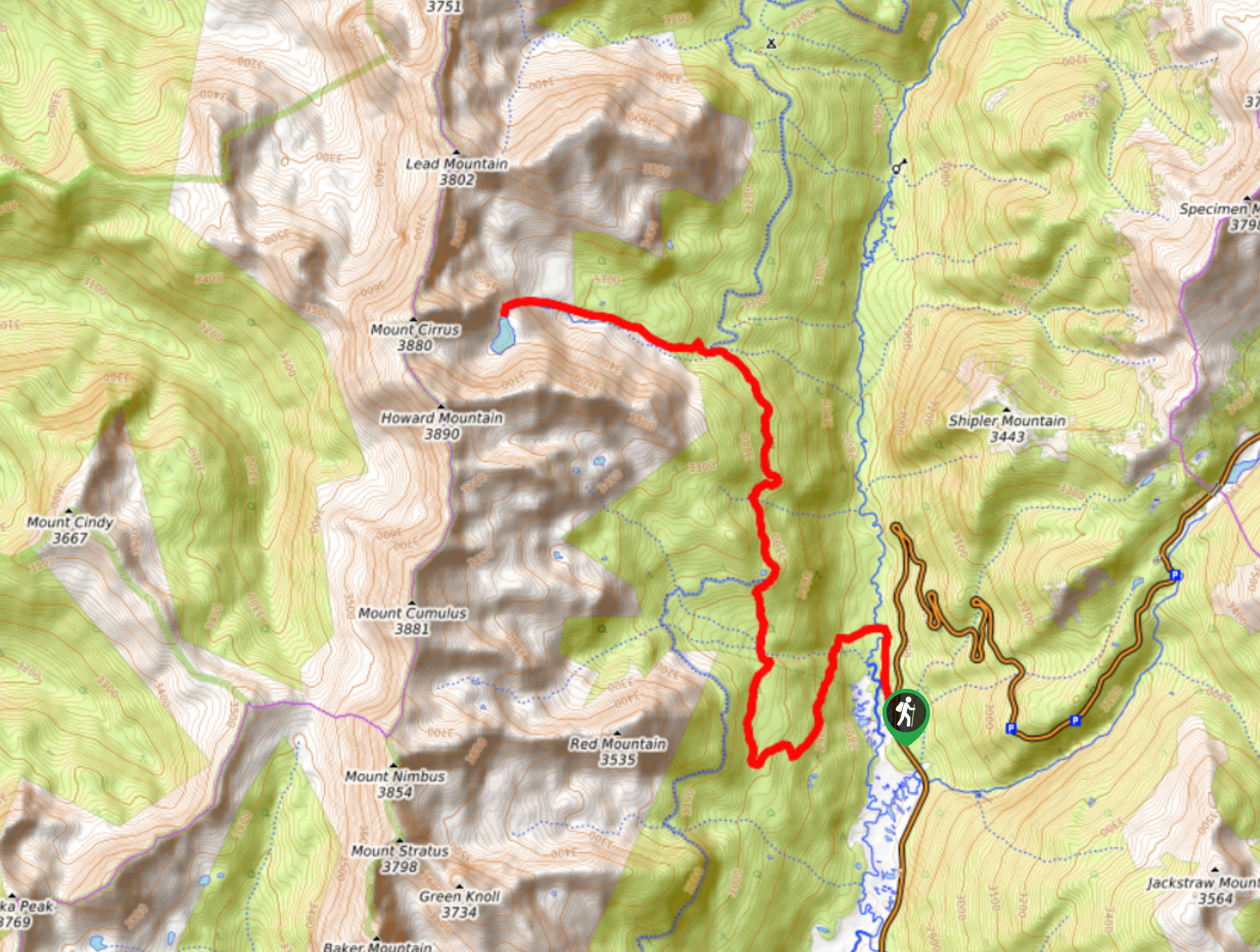
The Lily Lake to Estes Cone Hike departs from the Lily Lake Trailhead off S St. Vrain Ave.

About
| Backcountry Campground | No |
| When to do | May-September |
| Pets allowed | No |
| Family friendly | No |
| Route Signage | Poor |
| Crowd Levels | Moderate |
| Route Type | Loop |
Lily Lake to Estes Cone Hike
Elevation Graph
Weather
Lily Lake to Estes Cone Hike Description
The Lily Lake to Estes Cone Trail is a great adventure. Let the stunning Colorado scenery motivate you as you venture this lengthy hike. Because this trail passes through diverse terrain at various elevations, it is important to wear layers and check the weather prior to your adventure. We recommend heading out on the trail early to summit Estes Cone before noon, which will greatly reduce the likelihood of getting caught in an afternoon storm. Make sure to wear sturdy footwear and use trekking poles if you struggle with joint pain. Lastly, charge your camera because you are going to want to take pictures. Note you are required to purchase a Rocky Mountain National Park pass to access the trails.
From the Lily Lake Trailhead, track north along the Lily Ridge Trail. Maintain along this ridge which delivers epic lake views until it guides you around to the east south shore and merges into the Lily Lake Trail. Briefly hike this route until you meet the intersection with Storm Pass. From here, veer right and you will be diverted onto the Storm Pass Trail. Track west along the route, crossing Aspen Brook. As you continue to trek further into the wilderness, the path will become increasingly steep. Eventually, the Storm Pass Trail will curve around the base of Estes Cone and lead you to a junction.
Here, turn right and hike the primitive Estes Cone Trail. Marked by cairns, navigate the switchbacks up the steep terrain to the summit of Estes Cone. From the summit, enjoy spectacular views of the Continental Divide, the Mummy Range, and the verdant woodlands of the Rocky Mountain National Park. When you are done exploring the summit and revelling in the views, retrace your steps along the trail all the way back to Lily Lake. At the Lily Lake junction, instead of hiking around the perimeter again, simply follow the Storm Pass Trail all the way to the trailhead.
Similar hikes to the Lily Lake to Estes Cone Hike hike
Lake of the Clouds Hike
The Lake of the Clouds Hike is a picturesque adventure on the western border of the Rocky Mountain National Park.…

The Spearhead Hike
The Spearhead Hike is a demanding but awesome hike in the Rocky Mountain National Park. Ascend the Glacial Gorge past…
Bear Lake to North Inlet Hike
The Bear Lake to North Inlet Hike is a demanding one-way excursion across the Rocky Mountain National Park. This challenging…
Comments