Yonchevo Lake hike
View Photos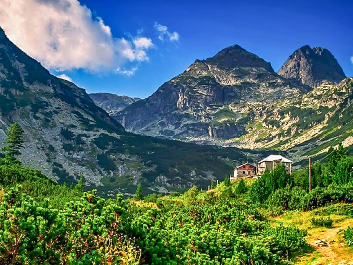
Yonchevo Lake hike
Difficulty Rating:
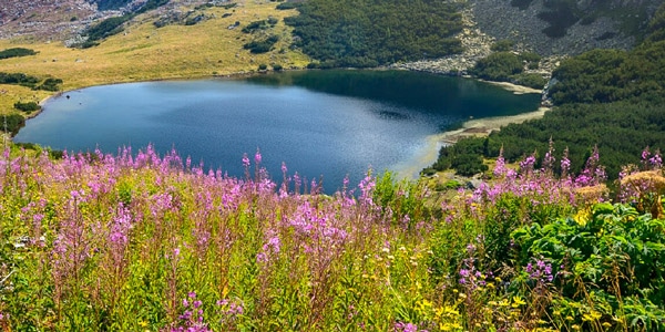
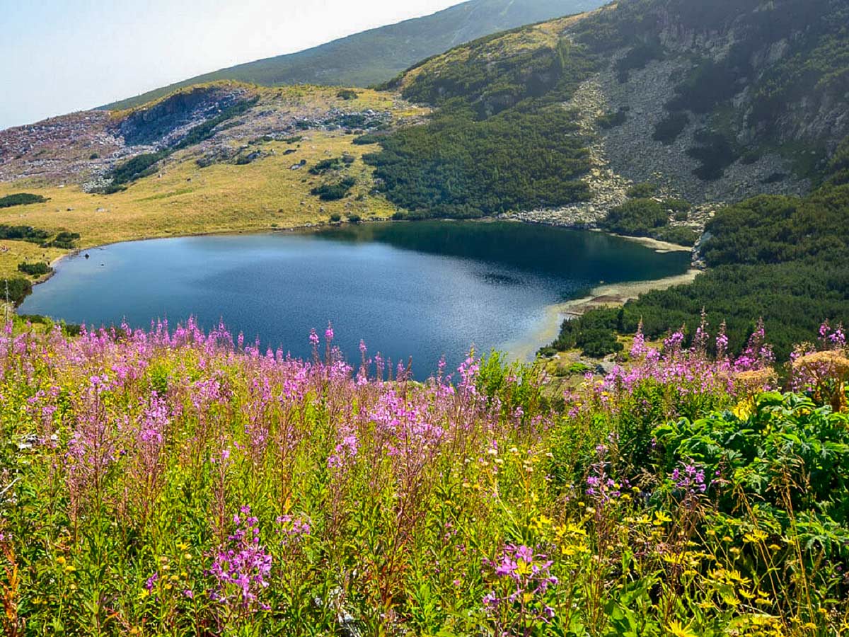
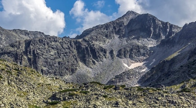
In the eastern part of Malyovitsa range—the most exciting part of the Rila Mountains—lies Yonchevo Lake (also called Scary Lake) and the shelter with the same name. The lake, cradled by towering boulders, exudes an eerie, mystical, enchanting feeling. While the lake itself doesn’t look scary, but it’s the rocky, jagged peaks casting their reflections into the crystal clear waters encircling this lake that do. This 6.8mi circuit hike is one of Bulgaria’s most classic, loved routes, and for good reason.
Getting there
The route starts from the Malyovitsa Mountain School and the Bear Meadow. This place is easily reachable from Govedartsi village by car. Govedartsi village is just 6.8mi from Samokov, which is a famous ski center and is known as the gate to the Rila mountains. Samokov, at 40.4mi south from the capital, is reached easily from Sofia’s Southern Bus Station, where busses service this destination every 30 minutes. From Samokov, one can take a minibus straight to the Malyovitsa Mountain School twice a day. The starting point resembles a large meadow with some ski facilities, surrounded by several hotels as well as the school.

About
| When to do | June to September |
| Family friendly | No |
| Route Signage | Average |
| Crowd Levels | Low |
| Route Type | Circuit |
Yonchevo Lake
Elevation Graph
Weather
Route Description for Yonchevo Lake
This circuit hike leads to the ever-so magical, otherworldly Scary Lake, Yonchevo Lake, and a collection of other renowned bodies of water. It’s ranked as an easy to moderate hike, but still has somewhat challenging sections, such as the part where the route travels through large boulders. However, it’s relatively easy to navigate and grants beautiful views as you trek.
The first stage of this route is quite well known, so it should be decently easy to navigate. From the meadow, the route goes further into the Malyovitsa valley, gently gaining altitude as it follows a stony path. The first bit goes through old pine forest, on the left bank of the Malyovitsa river, while the second part, after crossing the bridge, reveals exposed land. The path goes above the tree line on the right bank of the river.
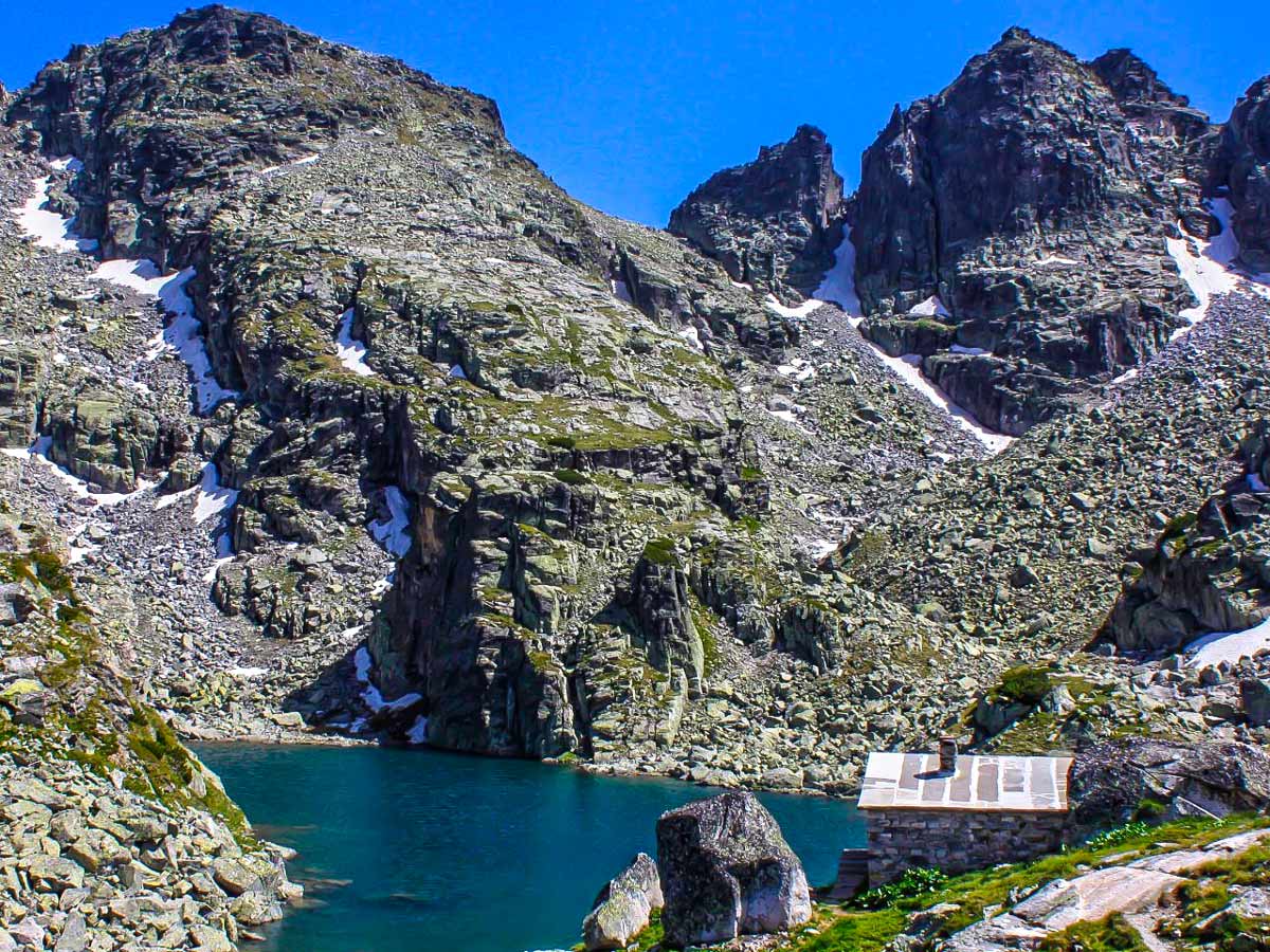
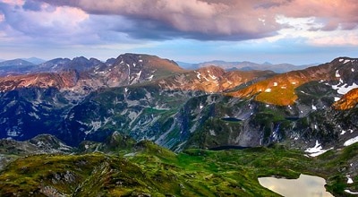
The final point of this stage is Malyovitsa hut—home of Bulgarian alpinists—located at 6437ft above the sea. It’s surrounded by the vertical faces of the “Puppet” and “Black Rock.” Beverages and simple meals are available at the hut. On average, the first stage can take around 1 hour. Up until this point, you’ll follow a white-blue-white marking on the trees and rocks.
The second stage begins with going behind (eastern side) the hut, where the route continues. At first, the path descends to the river and goes across it. Afterward, you’ll begin on a very gradual ascent to the north, towards a small side valley. The terrain here is challenging, as the path goes through large boulders (some of which are moving) and dense pine bushes—caution and concentration are needed. After around 15 minutes, the trail goes up in serpentines following the little creek, and the ascent becomes steeper, but the terrain is easy to navigate. Shortly, the area becomes flat, and the path exits the bushes, and more and more rocky peaks become visible ahead.
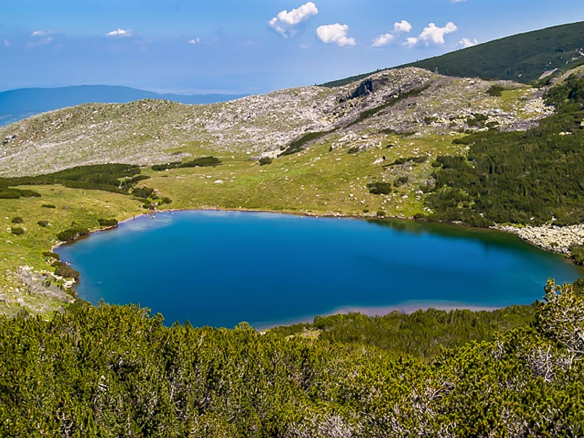
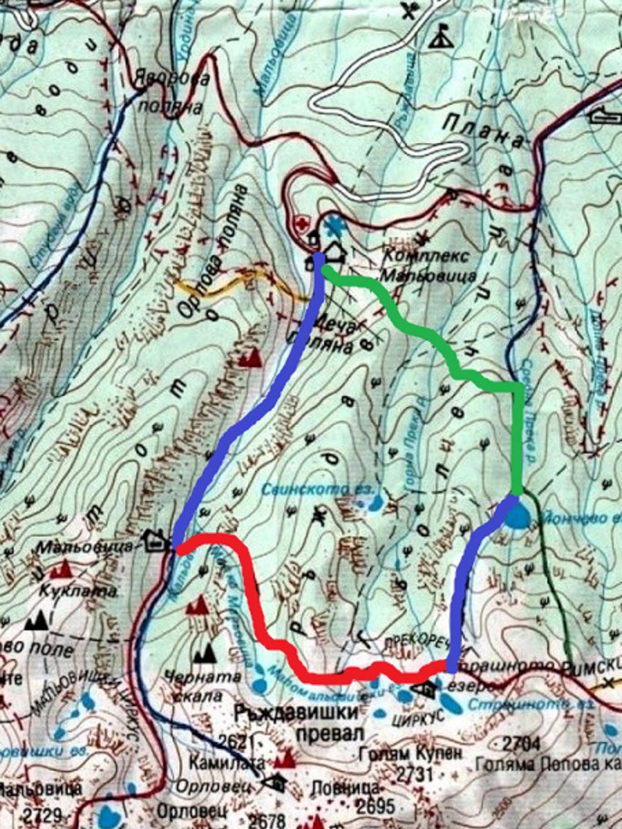
The trail passes nearby the two Camel lakes, under the imposing 700ft vertical north face of the Camel (8599ft above the sea) before another incline takes over. The terrain here is easy, the path is stony and grassy, and the steepness doesn’t exceed 35 degrees. Next is a short descent, where another two lakes emerge into view. Expect the terrain to become rockier.
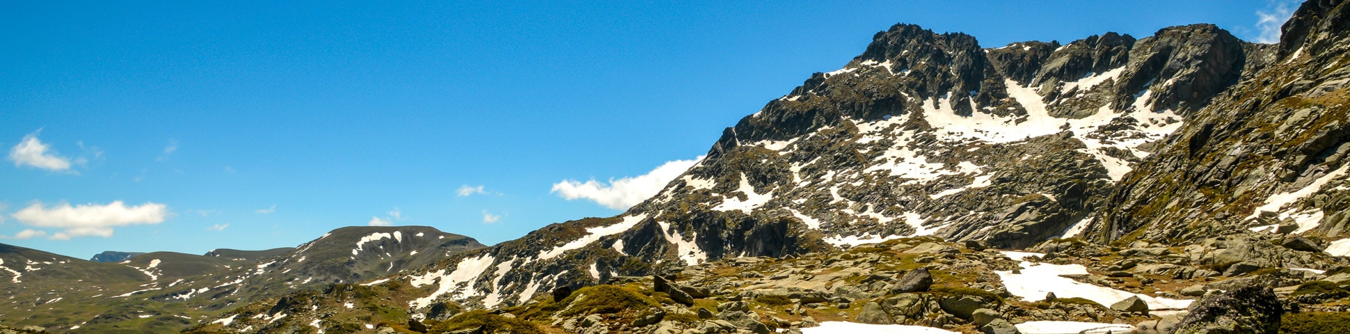
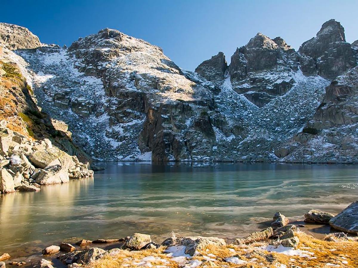
The final part of this stage is a short grassy ascent (up to 40 degrees) to Scary Lake and the shelter next to it. This is the highest point of the route; the altitude sits at 8088ft above sea level.
Encircling the lake sits rocky and pointy summits of strange shapes—some say they look like fangs or nails. The highest peak of the Malyovitsa range—Golyam Kupen—dominates the view. Do note that the shelter at Scary Lake does not offer any food or supplies—it is just a place to hide from bad weather, but with good beds, table and chairs, first aid kit, and a fireplace. This makes it a reliable place for emergency overnight situations. It may take you around 3.5 hours to reach this point from the start of the trek. From the hut up to here, you’ll notice white-red-white markings on rocks guiding you along the path.
The third stage begins with a descent, which starts behind the shelter’s building. At first, it is very gentle and heads towards the right (east), then it faces an almost vertical and quite rocky 100ft section. This descent requires you to be super careful, especially in winter. The following is a gentle path snaking down through a grassy area. Eventually, a large lake will come into view below you. The descent to Yonchevo Lake is on very rocky, yet mild terrain. The lake is 1 hour from the shelter. You’ll follow white-blue-white markings on rocks during this stage of the hike.
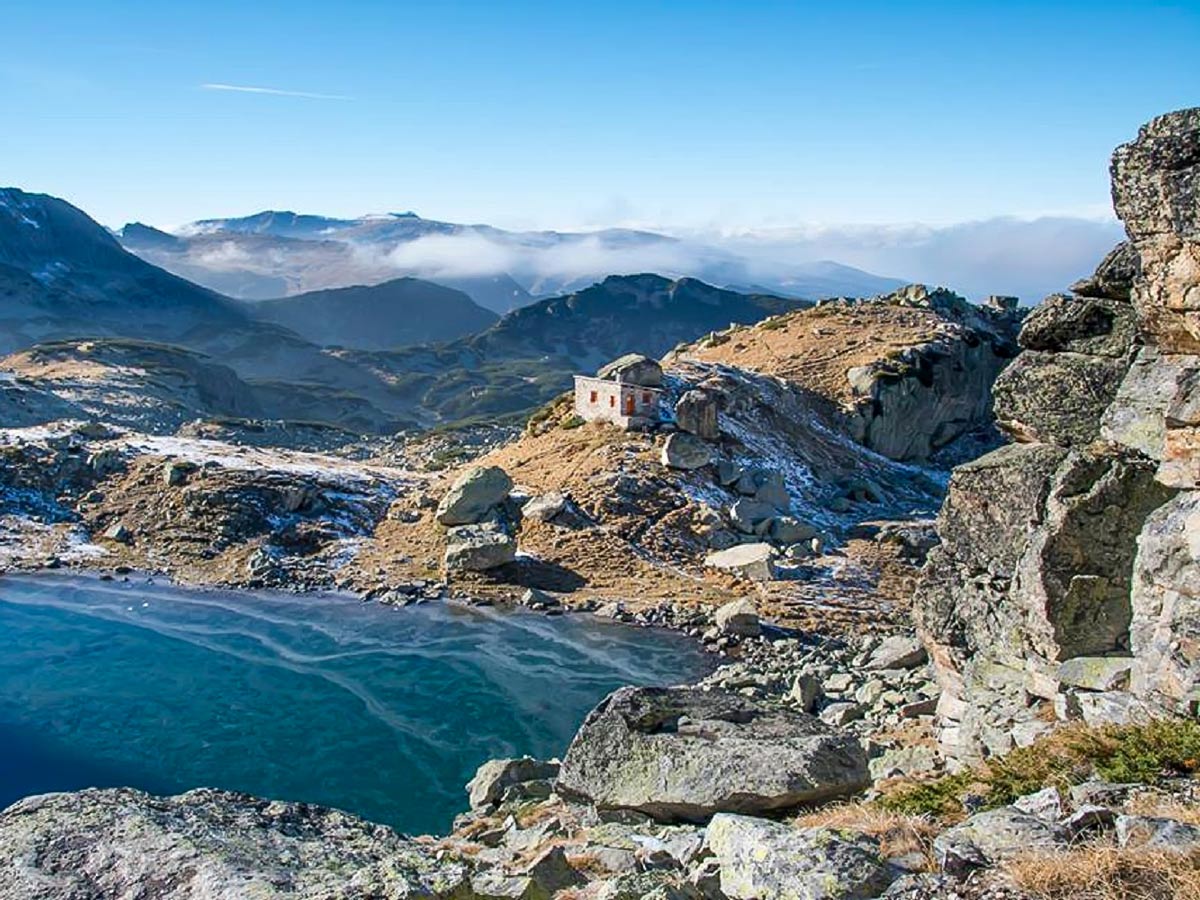
In the fourth stage, the trail goes down below Yonchevo Lake. The valley is pretty exposed and naked, as there was a massive forest fire here in 2000. The path eventually dips into the old pine forest and turns left (west), going across several small rivers. One small section of steep descent can be found on the way. In the last part, the route goes horizontally through pine bushes to the north and ends up at a large ski slope with a drag lift. From the lowest section of the ski slope, where there is a little wooden building, the path goes to the left (west), and with several wide serpentines, it descends to the starting point at the Malyovitsa Mountain School. You’ll follow white-green-white markings on rocks during the fourth stage.
Insider Hints
You can buy snacks and beverages from the Malyovitsa hut.
Bring and wear snowshoes, an avalanche transceiver, avalanche shovel & probe, crampons if you plan on doing this hike in winter.

Similar hikes to the Yonchevo Lake hike
Malyovitsa Mountain
Mount Malyovitsa, with its 8953ft above the sea level, might not be the highest summit in the Rila…
Mount Musala
With its 9600ft or exactly 9600ft above the sea level, Mount Musala is the highest summit…
Okoto Lake
It is absolutely impossible to have the best hikes in the Rila Mountain Range, without one of them being the…
Elijah Barnett 4 years ago
Exciting hike! After crossing the river, you would notice the gradual inclination. The rest of it was reasonable considering how beautiful the views are.
Cocoah Medeza 4 years ago
The thing about these hikes is that nobody knows, until when will they exist. I'm just so glad I was able to do this hike.
Elaine S. 4 years ago
We spent a total of 6.28 hours to complete the trail. This hike is very calming and enchanting.
Malik Samosa 4 years ago
Thrilling trail for walking. You can enjoy the scenery and pretty lakes.
Annie Schmindt 5 years ago
Astronomical views! Love the classic views of the Bulgarian Alps.
Julien L. 5 years ago
The lake was so lovely. Perfect combination of steep and flat sections.
Melly Moon 5 years ago
This is a nice hike to do when the weather is great. Doing if after raining might affect the quality of the trail. Best to check the weather first.
Emiko Satoru 5 years ago
Lots of picturesque spots. Looks like something out of post cards.
Angie W. 5 years ago
The scenery variation was fantastic. My favorite was the main attraction itself. It looks perfect with all the wildflowers surrounding it.
ramblerilly 5 years ago
The surroundings were super clean! The trail was rocky and challenging. It's a bit hard, but it's not as hard as I expected.