Mount Musala hike
View Photos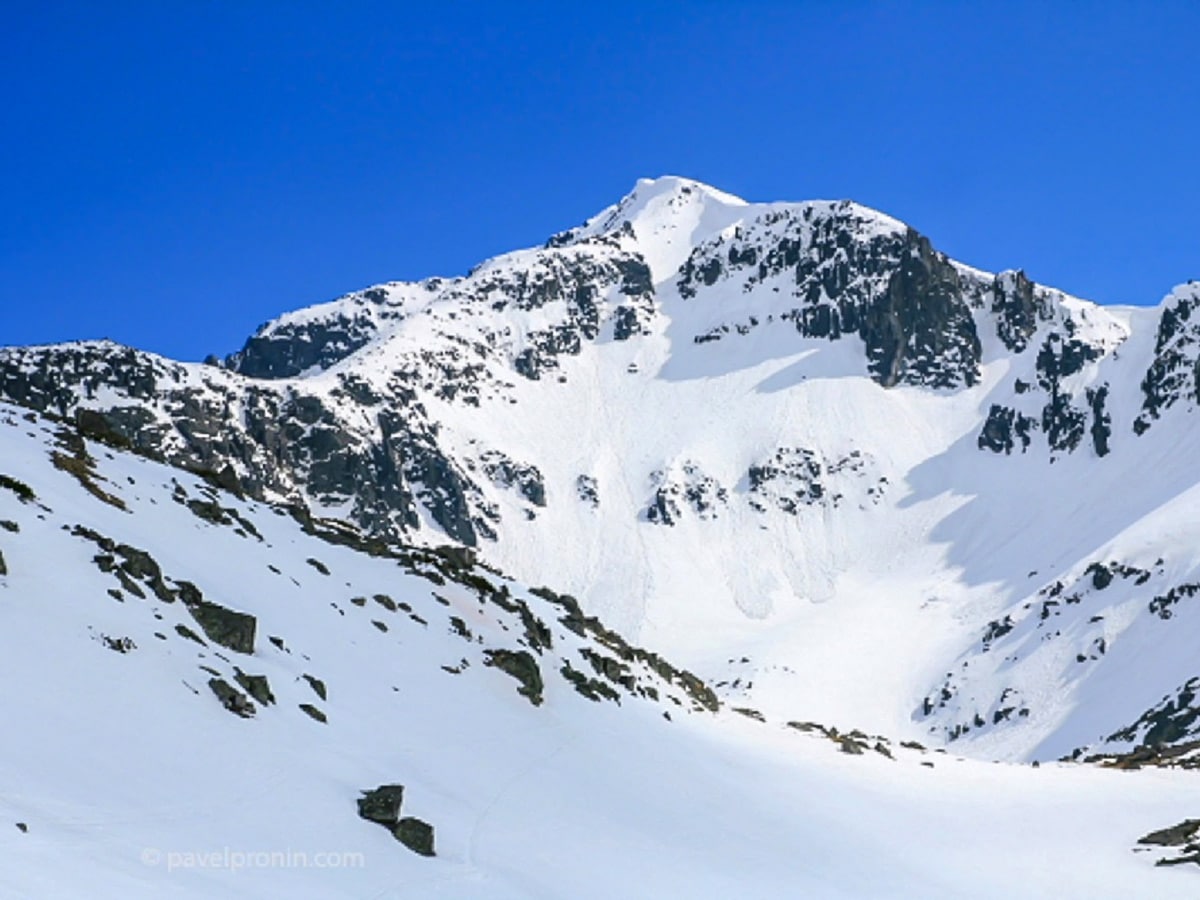
Mount Musala hike
Difficulty Rating:
With its 9600ft or exactly 9600ft above the sea level, Mount Musala is the highest summit of the entire Balkan peninsula. It sits in the eastern part of the Rila range, above the famous Borovets Ski resort. Many people incorrectly think that the Ottomans came up with its name, but its title derives from Arabic travelers. Translated from their language, the name means “highest altar before God." This one-day route will allow you to ascent the summit through the northern, more raw and imposing side.
Getting there
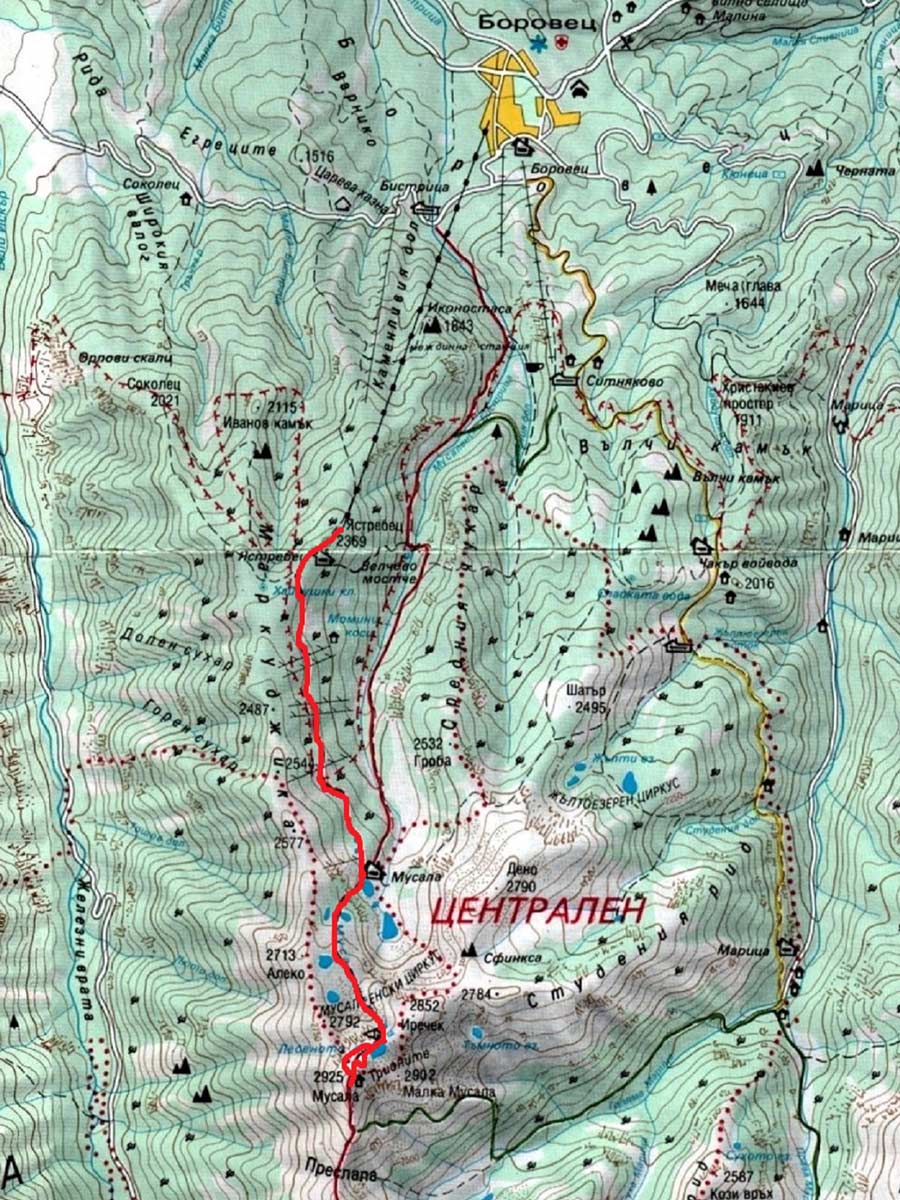
Find your way to Borovets—one of the largest and well known ski resorts in Bulgaria. It takes 50.3mi from the capital Sofia and sits just 6.2mi away from Samokov. From Sofia there are busses every 30 minutes to Samokov and from Samokovthere you can find minibuses to Borovets. Once you reach the Ski resort, take the gondola to its last stop at Yastrebets peak (7772ft above the sea)—this is where the hike begins.

About
| When to do | June to September |
| Family friendly | No |
| Route Signage | Average |
| Crowd Levels | Low |
| Route Type | Out and back |
Mount Musala
Elevation Graph
Weather
Route Description for Mount Musala
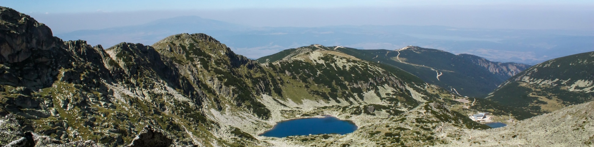
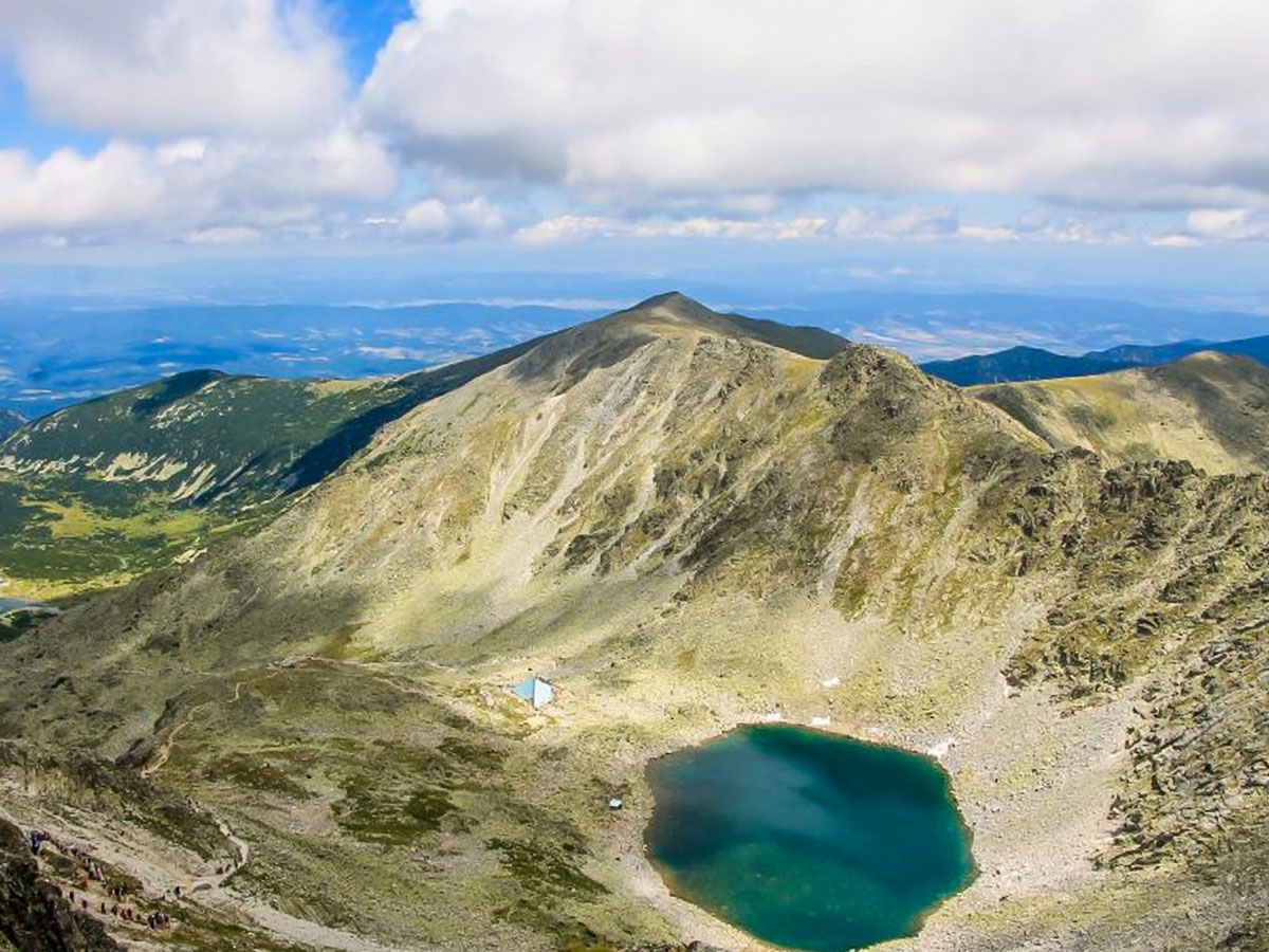
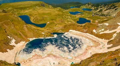
The first stage is a straightforward, pleasant walk! From the upper Gondola station, the vast path goes across the slope of Markudjitsite ridge, which is to the right, and above the deep valley of Bistritsa to the left, with insignificant undulations. After around 1 hour, the route reaches the bottom of the valley, where the Musala hut sits at 7838ft above sea level. Do note that this is the highest hut in Bulgaria. Next to the hut, there are two large beautiful glacial lakes.
The second stage of the ascent starts from the hut, turns right (west) along the shore of the lake, and starts climbing back up towards the ridge. The terrain is rocky, but it’s not too steep at all. The serpentines lead to a gully. Once you reach the top of the hill, to the south, you’ll come across “The Thumb.” Throughout the hike, there are both white-red-white markings on the rocks and black-yellow poles (winter markings) to help guide you along the path.
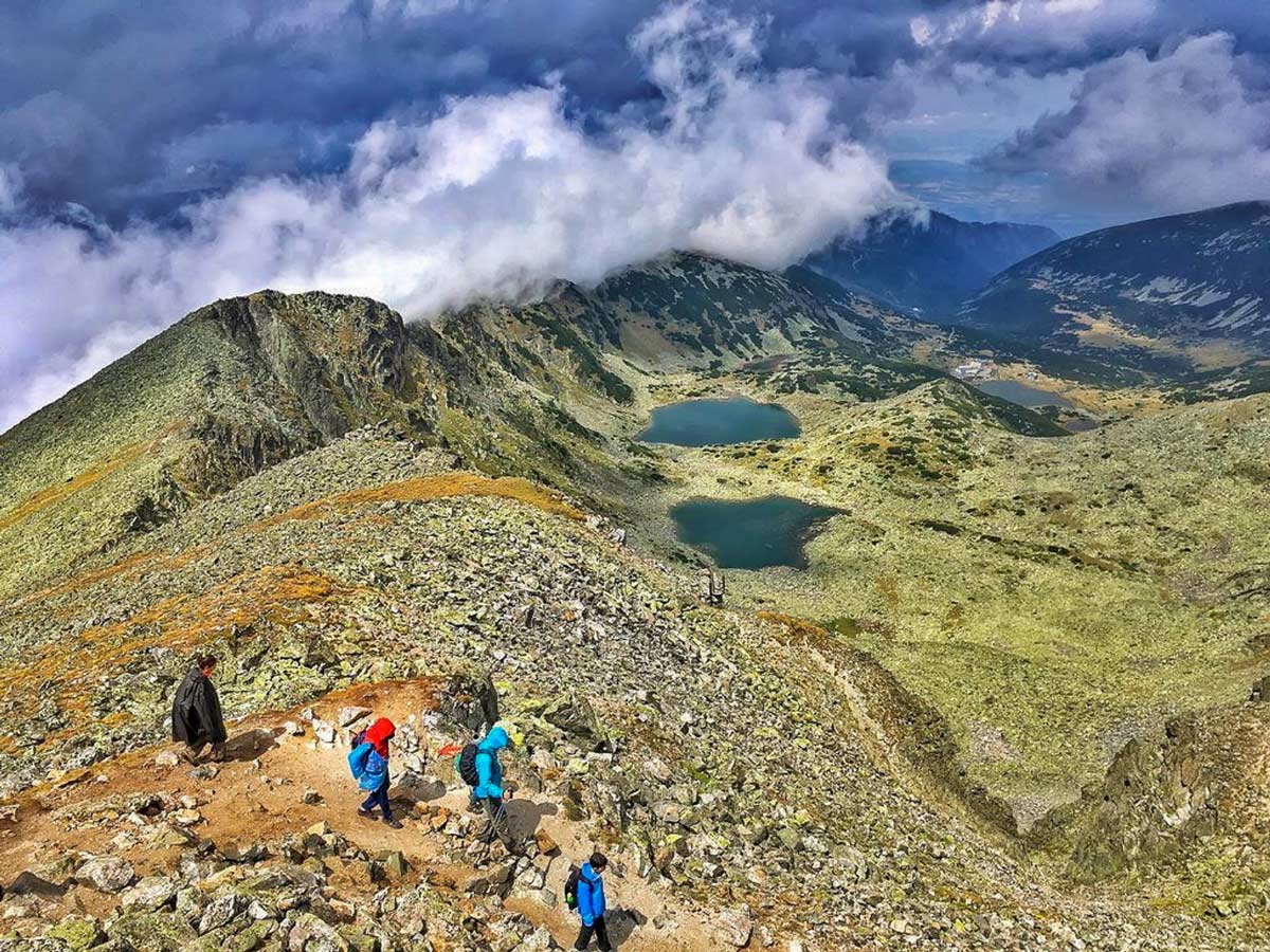
From the top of The Thumb, one can enjoy the view of three new lakes, squeezed between the two ridges. The path continues along the shores of the two upper lakes and then ascends high above them.
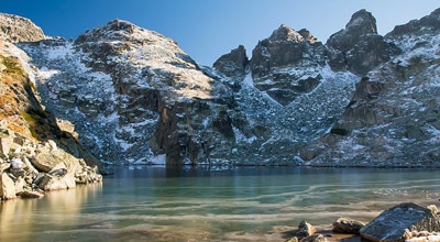
At this stage, the pyramid building of the “Everest” shelter comes into view. The shelter, located at 8940ft above the sea, rests along the shore of Icy lake—the highest lake within the Balkan peninsula. Almost ten months per year, this lake contains either a partial or full coat of ice. It takes another hour to get from the hut to this place. The area looks very raw and alpine.
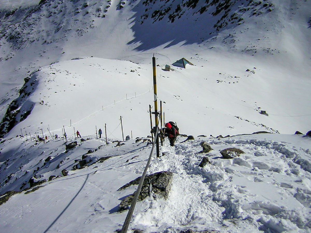
The third stage starts from here–it is the most challenging and steep part of the ascent. It is important to note that there are two options from this point for the last part of the climb: the summer or winter routes.
Summer option:
At first, the path follows the easy, grassy bit of Mount Musala’s northeastern ridge. Just before the ridge unfolds into a rocky, steeper and more technical track, the route turns left and goes to the steep eastern slope of the peak. With several not too steep, rocky, and dusty serpentines, it gains altitude until it reaches the summit ridge. The summit ridge is short, and with a very gentle ascent brings you to the summit point.
Winter option:
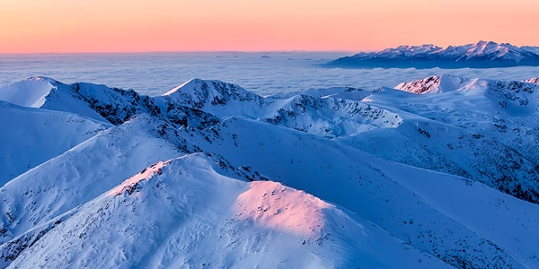
The path follows the entire length of Mount Musala’s northeastern ridge. Most of this ridge is very rocky and gets quite icy in winter. The existing 1000ft drop to the right can be disturbing. Overall, the ridge is not too steep, except for its last 40-50 feet, where it gets up to 55 degrees. However, along the whole ridge, there is a fixed metal rope, making the ascent much safer. After the steepest bit, the route joins the summer one, at the beginning of the summit ridge.
Both options take around 1 hour. In total, the ascent takes about 3 hours. At the summit point, there is a building of the National Meteorological Services. If you go behind the building, you’ll encounter a spacious, grassy meadow and very gentle southern slopes. Of course, being the highest peak in Bulgaria, the crown offers fantastic views of Samokov, Iskar lake reservoir, Vitosha mountain above Sofia, and even further, the Balkan mountain range.
Head back the way you came. The descent usually takes 2 to 2.5 hours. In total, the hike can take around 5–5.5 hours.
Insider Hints
One hour into the hike, you'll encounter the Musala hut, which serves hot beverages and snacks. If you want a warm meal, you have to order a few days in advance. You can also get snacks and drinks at the shelter midway through the hike.
Do follow the different routes provided for summer and winter during the appropriate season.
In winter, it is obligatory to carry crampons.

Similar hikes to the Mount Musala hike
Malyovitsa Mountain
Mount Malyovitsa, with its 8953ft above the sea level, might not be the highest summit in the Rila…
Yonchevo Lake
In the eastern part of Malyovitsa range—the most exciting part of the Rila Mountains—lies Yonchevo Lake (also called Scary Lake)…
Okoto Lake
It is absolutely impossible to have the best hikes in the Rila Mountain Range, without one of them being the…
Elijah Barnett 4 years ago
It might be one of the finest hikes in Bulgaria. We've chosen the summer route, and it was a bit challenging but enjoyable. I highly recommend it.
Cocoah Medeza 4 years ago
Beautiful. I'm lost for words to describe this hike. It's so amazing.
Elaine S. 4 years ago
This hike is not only beautiful, but it also has a beautiful meaning behind it.
Kathy R. 5 years ago
Balkan Peninsula was absolutely beautiful and well worth the hike.
Malik Samosa 5 years ago
It's really beautiful. The mountain range were incredible. The path we've taken seems very sacred, there are lots of sightings.
Annie Schmindt 5 years ago
Good hike with few good spots to rest.
Julien L. 5 years ago
Interesting terrain. I love the views from the top.
Heather Blitz 5 years ago
If you like a moderately challenging hike, you should definitely do this one. It's a great workout! Plus there is outrageous scenery waiting to be explored.
Bobbie K. 5 years ago
Great hike! Make sure to bring lots of water and take lots of pictures!!!
Melly Moon 5 years ago
Great hike with different levels of the trail! The views were truly delightful.