Okoto Lake hike
View Photos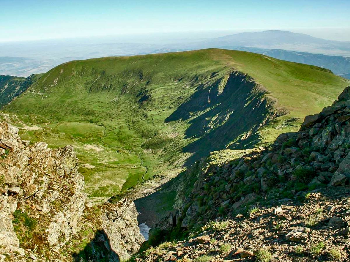
Okoto Lake hike
Difficulty Rating:
It is absolutely impossible to have the best hikes in the Rila Mountain Range, without one of them being the ever-so mystical, Okoto Lake - one of the magical Seven Rila Lakes. This world-famous place is the heart and soul of Rila. And when you combine it with a visit to a waterfall shimmering with enchantment and a climb to a remarkable summit, the result is an exciting round trip of one of the most classic hikes spanning Bulgaria.
Getting there
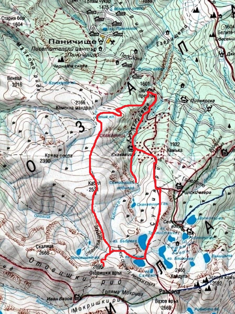
Reach the start point of this hike from Panichishte. Go to the Pionerska hut and take a chairlift towards the Rila Lakes hut. Midway between the resort and the chair lift's bottom station, at 1.2mi from central Panichishte, there is a side road, drifting to the right, which takes you to the Zeleni Preslap (Green Saddle), where there is a small hotel and parking. There are plenty of signs on the main road's junction, so the spot cannot be missed–the Green Saddle is the starting point of the hike.

About
| When to do | June to September |
| Family friendly | No |
| Route Signage | Average |
| Crowd Levels | Low |
| Route Type | Circuit |
Okoto Lake
Elevation Graph
Weather
Route Description for Okoto Lake
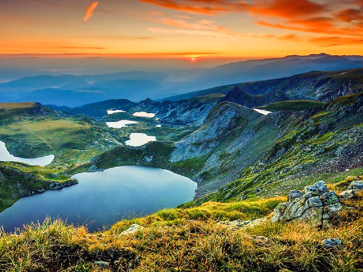
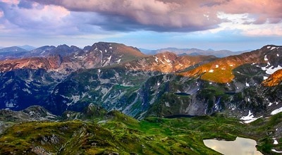
You can’t go hiking in Bulgaria without visiting the Seven Rila Lakes. And the memory of viewing these dark blue glacial lakes from above will remain fresh in your mind for a long, long time.
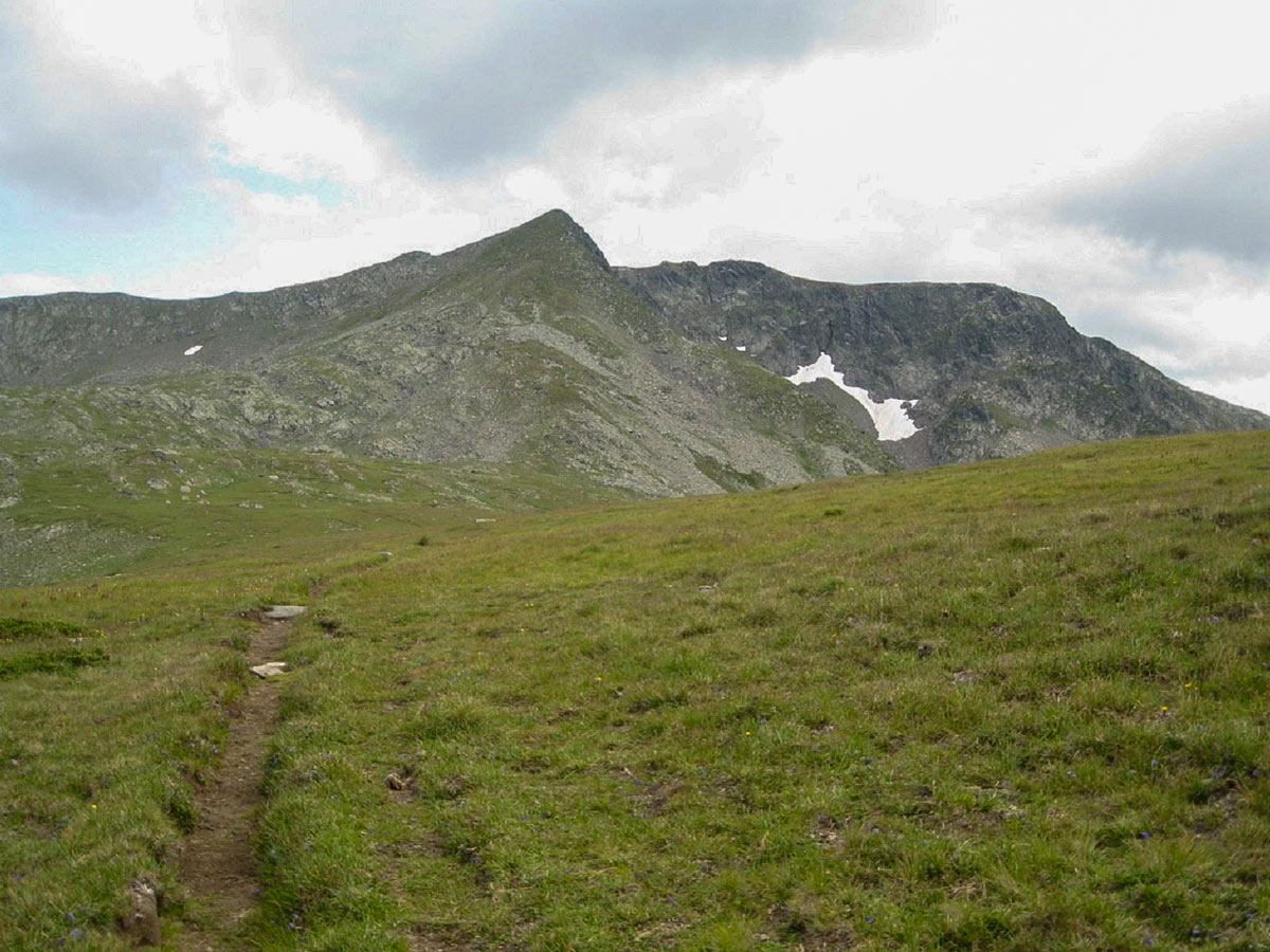
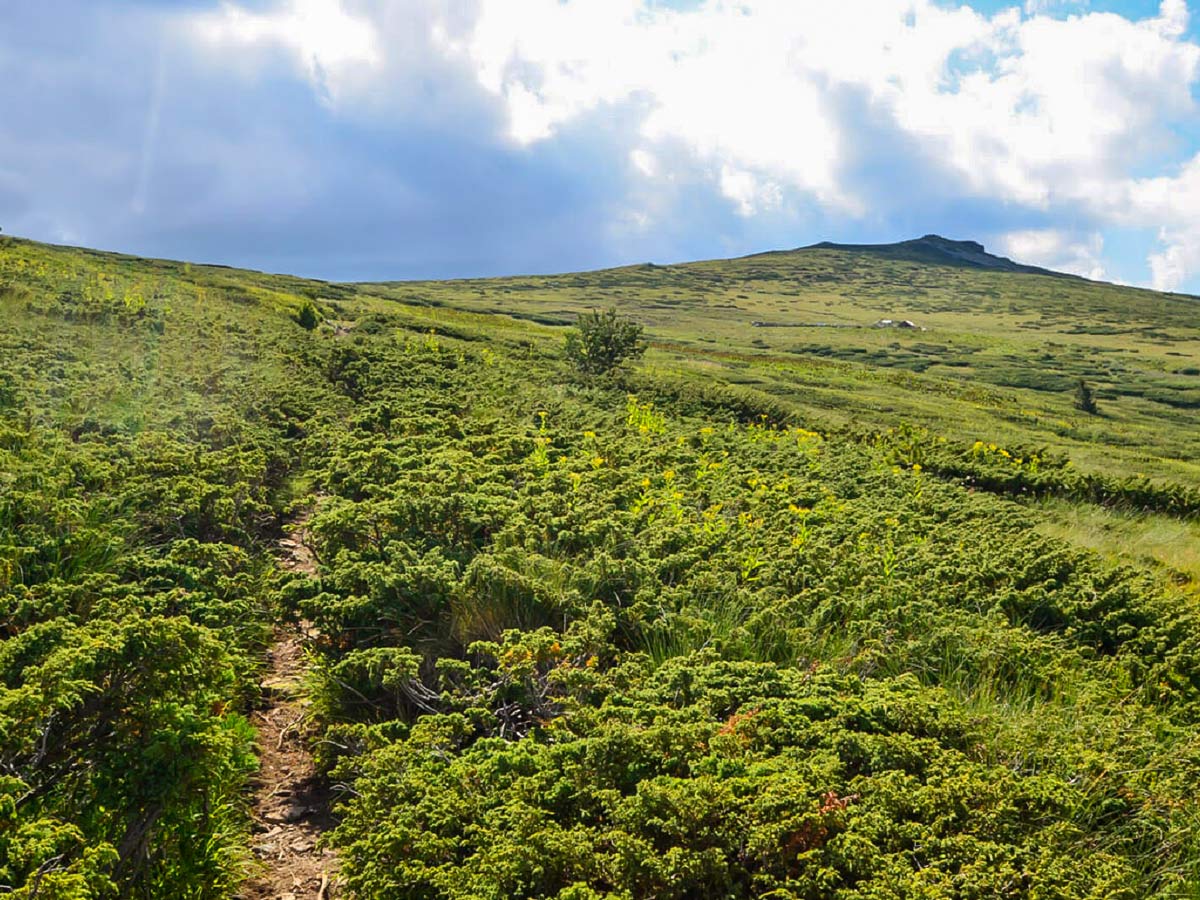
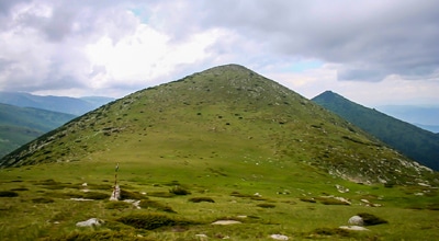
The first stage, starting from the Green Saddle, begins at a decorative wooden gate, signifying the entrance to Rila National Park. Through the gate is the beginning of an extensive dirt road, which does not go in the right direction! Once you’re at the gate, look right (south) and discover a small building of a power substation, where the trail begins. Follow the white-green-white markings along this path. The trail traverses the old pine forest and soon travels above the tree line. The slope in the woods is quite steep, but once you’re above it, it gets more gentle. The trail then goes across some juniper and pine bushes, and around 7500ft, the path follows a comfortable, wide grassy slope. This part has you walking on a long but mild ascent. Eventually, you’ll reach the summit point of Mount Kabul, which stands at 8304ft above sea level. It takes around 2 hours from the start to get to this point. Be sure to admire the views of the summits and valleys dotting the land!
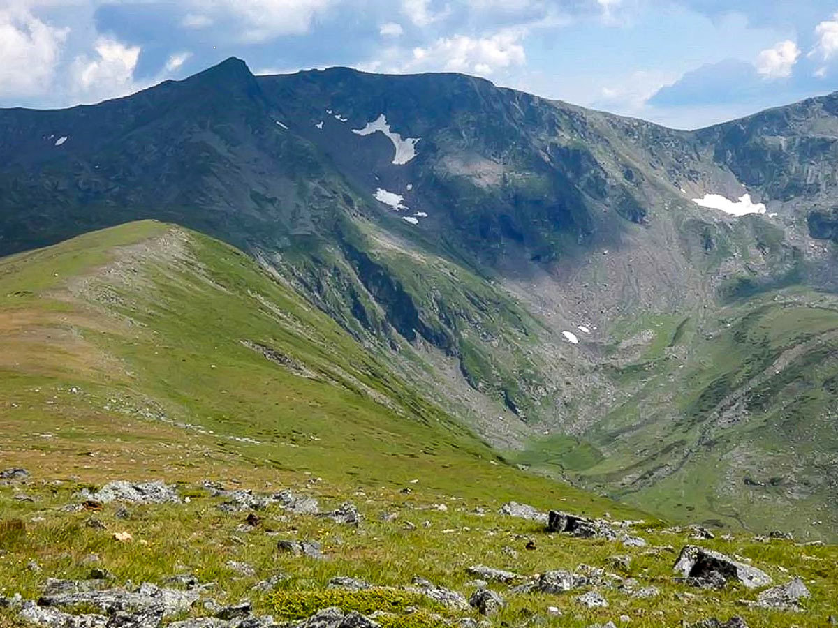
The second stage starts from Kabul Summit and goes further south with a gentle descent to the saddle. Next is the ascent to Otovishki peak—the remaining 500ft is the steepest part of this climb. In some sections, the uphill goes to 45 degrees, yet the terrain is easy. This part may be challenging, but know that majestic views await you along the ridge at the top.
Once you’re on the Otovishki summit, which is the highest point of the hike and stands at 8852ft above sea level, you’ll have the chance to marvel at the peaks lining the Rila range. It may take around 2.75 hours to get here from the starting point.
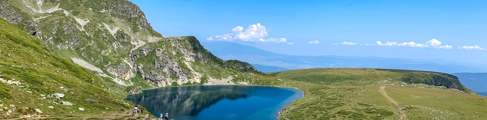
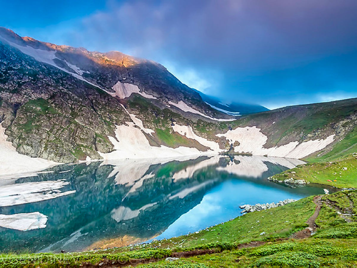
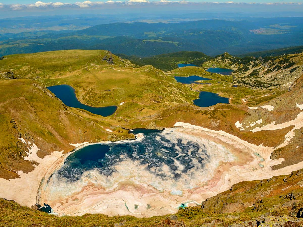
In the third stage, you will head back to the saddle between Ototviski peak and Kabul peak—it is just a short descent. From the saddle, straight to the right (east), a path starts. After walking the mild grassy slope, the trail leads to The Eye’s deep cirque—one of the most famous Seven Rila Lakes. There is a good reason why The Eye is the most famous glacial lake in Bulgaria. And not only due to the fact that it’s the most beautiful, thanks to its impressive coloring, but because it’s the deepest glacial lake in the Balkan peninsula (125ft). Here, our trail joins the main route of the Seven Rila Lakes. It may take around 4 hours to reach this section.
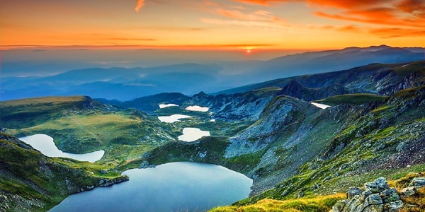
Some consider the fourth stage to be one of the most popular walks in Bulgaria—welcome to the Seven Rila Lakes trail. Once at The Eye, the inevitable beautiful descent to the Kidney is next. After the Kidney, the path splits in two, and the route takes the trail to the left (north). It follows a broad and flat ridge and doesn’t descend into the valley. From here, you can view the four remaining lakes peppering the landscape below. Plus, you can also spot the Malyovitsa range in the distance.
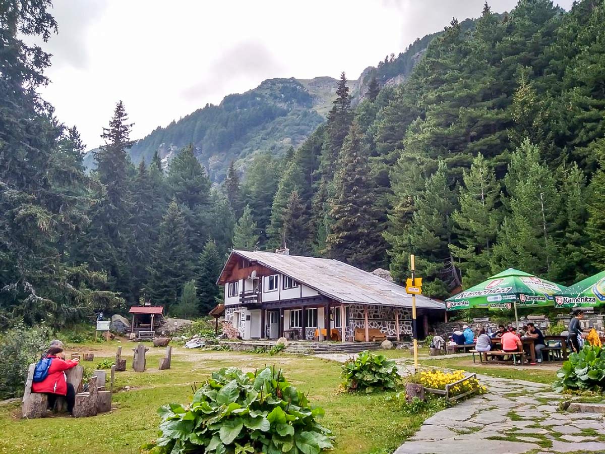
Following the flat, broad line, known as the “Dry ridge,” you’ll come across a new splitting of the trail. To the right (west), the path travels for a short distance longer to the Rila Lakes hut—this is the upper station of the chair lift. The route continues as a straight line along the flat ridge. At first, the trail is entirely horizontal, but in a few minutes, it starts descending gently through pine bushes. As the descent steepens, the trail enters the old pine forests, turns to the left (west), and with several easy serpentines, it eventually reaches the bottom of Skakavitsa valley. The marking from The Eye, all the way to here, is heavily marked with different colors, including red, green, and yellow. It may take around 5.5 hours to reach the oldest hut in Bulgaria: Skakavitsa. Feel free to fuel your body with hot and cold beverages, snacks, and soups.
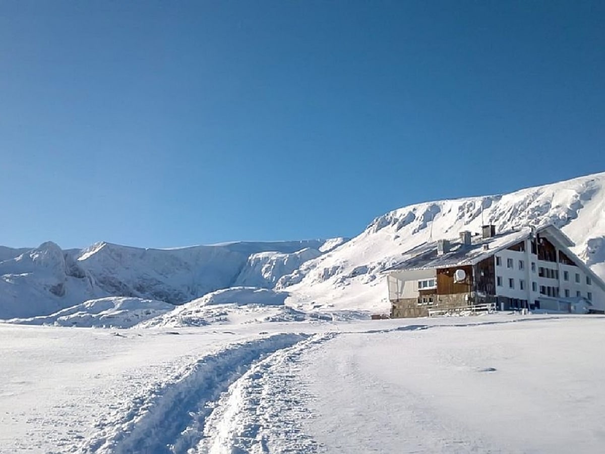
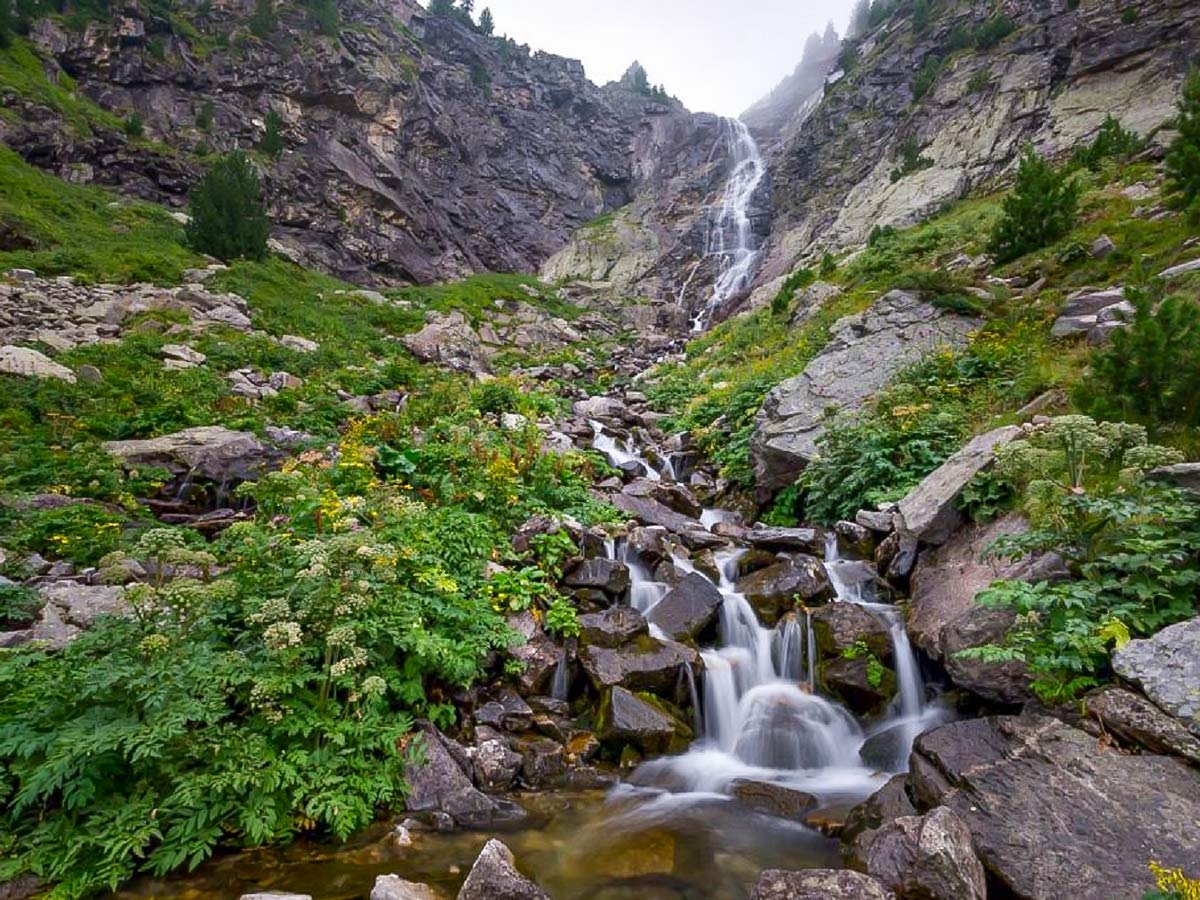
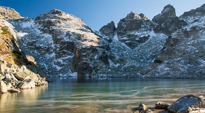
The fifth stage is actually a detour of the main route—the walk to the nearby Skakavitsa waterfall starts from the hut straight south, crosses two broad meadows, then climbs with several serpentines through centuries-old pine forest and finishes at the bottom of the valley. This place is surrounded by 500ft vertical faces—the impressive waterfall, with its 224ft drop, cascades here. The trail leads directly below the Skakavitsa waterfall and offers terrific views. In winter, this waterfall freezes entirely and becomes an arena for ice climbing. Do note that if you plan to do this in winter that the trail crosses two gullies. This can be super dangerous during avalanche season.
The final stage starts from Skakavitsa hut and, following a white-blue-white marking on the rocks and trees, the trail descends, and goes along the river, high on its left bank. Just ten minutes after the mild start, the path becomes steeper, but it eventually gets to the bottom of the valley. Despite the steep angle, the terrain is easy to navigate in the forest. The last part of the valley follows a flat path, and the river is crossed twice on wooden bridges. Eventually, the trail ends at a dirt road, which goes from the left to the right (west to east). This route leads to the west. The path is completely flat and in about 20 minutes finishes at the Zeleni Preslap (Green Saddle), where the trek began.
Insider Hints
Skakavitsa hut near the end of the hike offers hot and cold beverages, snacks, and soups.
It can be dangerous crossing the gullies to Skakavitsa waterfall during the winter. Avalanche conditions may lead to a life-threatening situation.

Similar hikes to the Okoto Lake hike
Malyovitsa Mountain
Mount Malyovitsa, with its 8953ft above the sea level, might not be the highest summit in the Rila…
Yonchevo Lake
In the eastern part of Malyovitsa range—the most exciting part of the Rila Mountains—lies Yonchevo Lake (also called Scary Lake)…
Small Bears Peak
This classic trek gives the hiker a different perspective of the highest mountains spanning Bulgaria, offering mild, grassy, and easy-to-navigate…
Elaine S. 4 years ago
Simply amazing. This is the most beautiful hike I've done to date.
Malik Samosa 4 years ago
Excellent views as you head to the lake. Challenging hike but magical experience.
Kathy R. 4 years ago
Enjoyed the hike up! Definitely worth it. The highest point offers some astonishing views!
Annie Schmindt 4 years ago
Rough hike with spectacular views. There are few steep-ascends while crossing the woodlands, and a more steep trail to otovishki peak.
Melly Moon 5 years ago
The lake is mesmerizing. There's no dull moment while doing the hike. I truly enjoyed this hike.
Emiko Satoru 5 years ago
Okoto Lake is a pleasant hike. It looks like a hiddem gem. Unpolished yet so natural.
Angie W. 5 years ago
So glad to unlock one of the Seven Rila Lakes! The falls also captured my interest.
Heather Blitz 5 years ago
The long hike pays off once you reach the lake. Savor every moment, take lots of photos.
Bobbie K. 5 years ago
It was a very rigorous climb, but the views were so amazing. It's like unlocking a different dimension.
Vincent Von Triu 5 years ago
The lake was interesting. I wonder how deep it is. It's probably one of the quietest lakes I've seen.