
Small Bears Peak hike
View Photos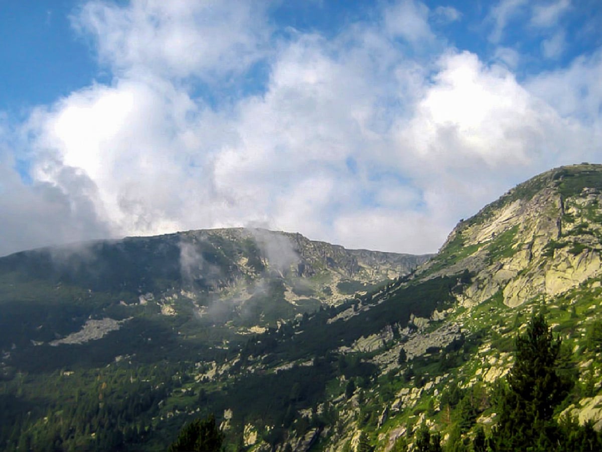
Small Bears Peak hike
Difficulty Rating:
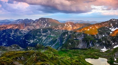
This classic trek gives the hiker a different perspective of the highest mountains spanning Bulgaria, offering mild, grassy, and easy-to-navigate terrain. The Small Bears Peak hike may be gentle, but it uncovers the diverse nature colouring the landscape. Even the oldest Nature Reservation in the Balkan peninsula thrives here!
Getting there
The trailhead begins near the Rila monastery. You can't reach the starting point without hiring a taxi. The road from the monastery to the beginning of the hike drifts to the left (southeast) and follows the Iliyna river for 5.0mi.

About
| When to do | June to September |
| Family friendly | Older Children only |
| Route Signage | Average |
| Crowd Levels | Low |
| Route Type | One Way |
Small Bears Peak
Elevation Graph
Weather
Route Description for Small Bears Peak
The Small Bears Peak trek embodies the phrase: “the best bang for your buck.” It may be one of the more accessible hikes dotting the Rila range, but it doesn’t compromise on the palette of views painting the scenery as you walk. However, it’s vital to note that it’s a one-way walk and ends along the road, just 2.5mi from Dobarsko village. You can organize a car to wait for you there or take a bus to Razlog, which is 11.8mi away. The busses run four times a day. From here, you can take a bus back to Sofia, if that’s where you came from; these busses run every hour.
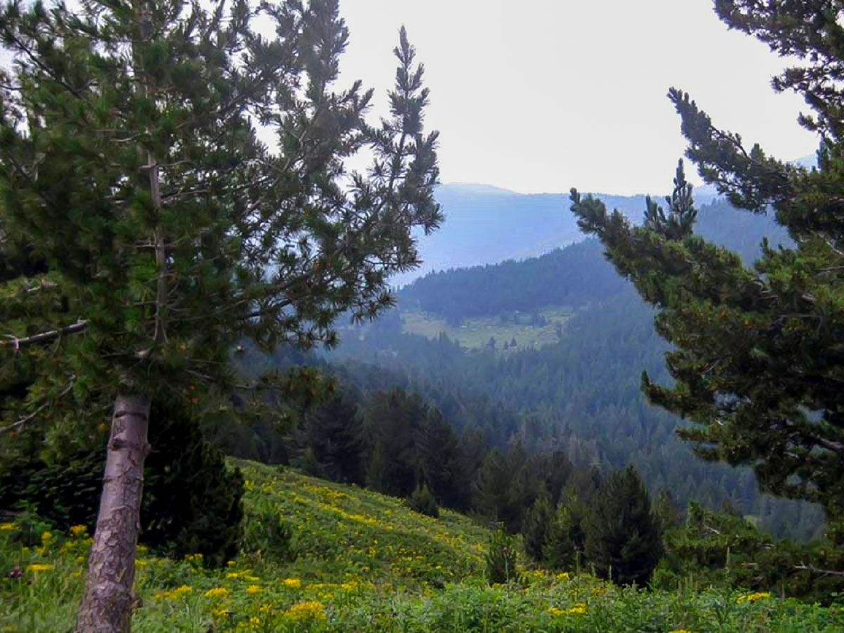
The first stage of the route follows the Radovitsa river’s valley, along the left bank until the path drifts more to the left (east), taking you through quite steep serpentines and a very dense, dark pine forest.
After around 30 minutes, the trail ascends high above the valley to a wide forest road. Once you’re on the forest road, turn right (south) and follow the path for about 15 minutes until the road splits in two. The much wider trail goes ahead horizontally, while the other one, which is more overgrown by grass, heads uphill a bit to the left. Take this path. Embark on a gentle ascent through a charming forest.
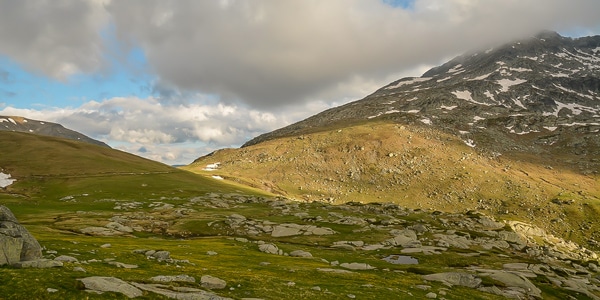
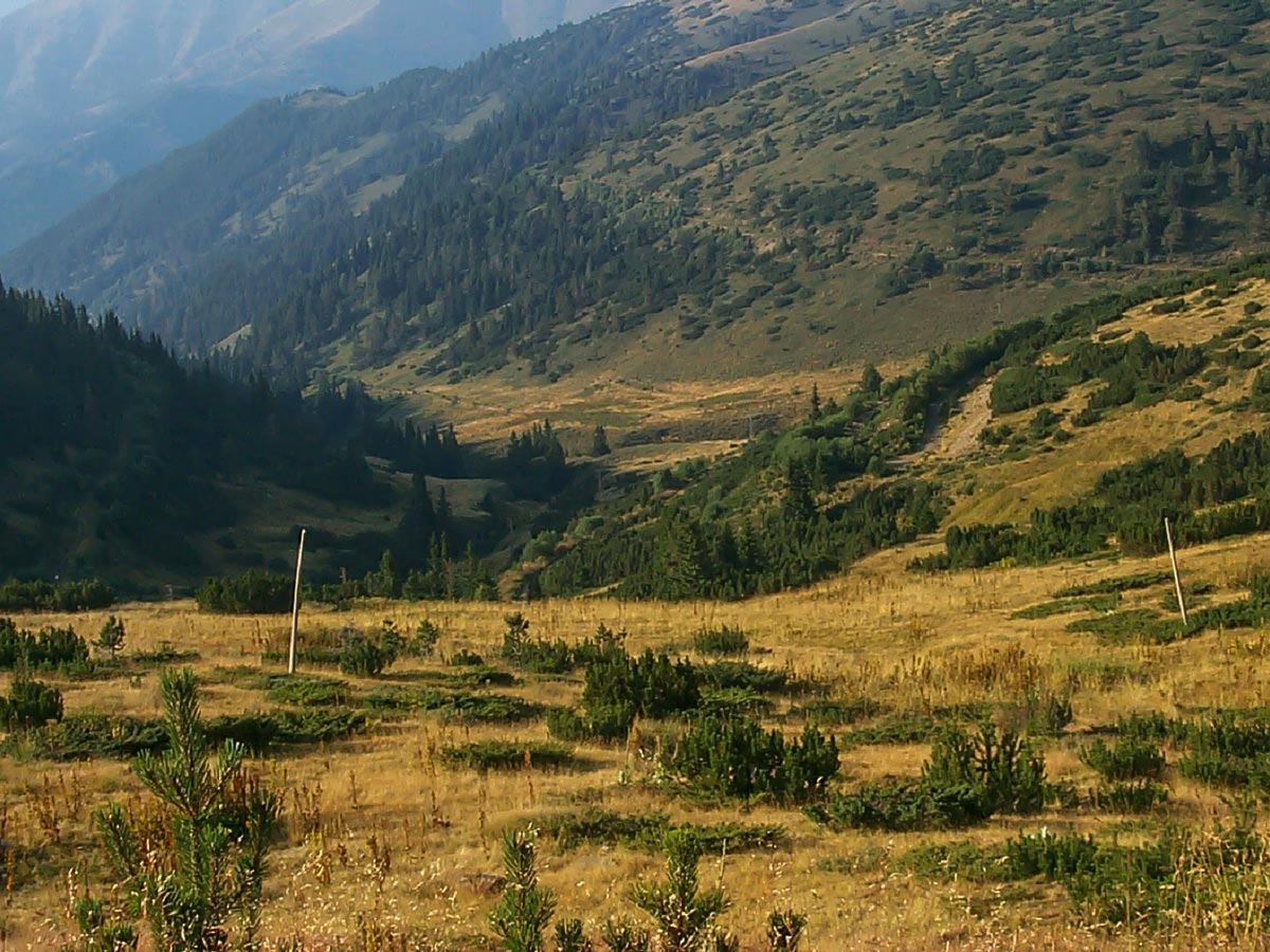
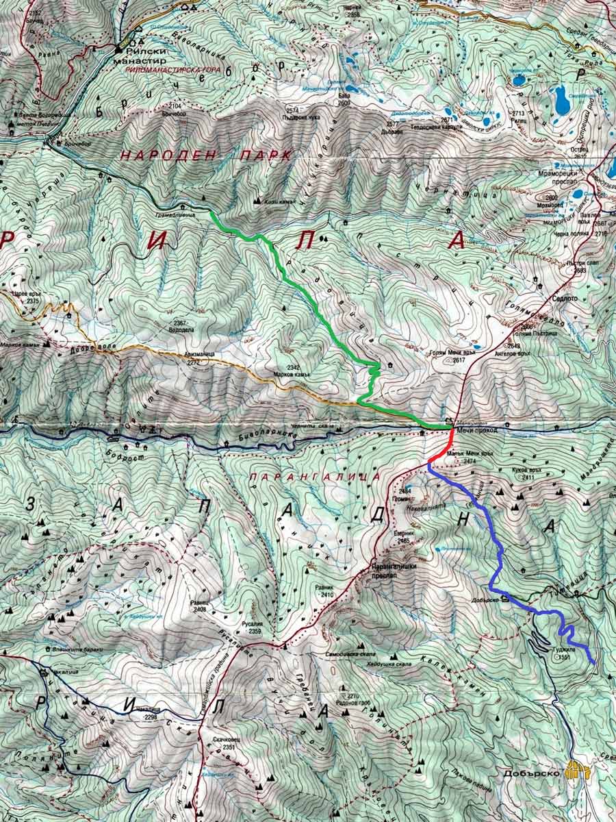
After a while, the trail curves several times to the left and right, and traverses two splendid meadows with flowers—there are some signs here in Bulgarian and English about rare flowers. Further along, the path continues in the same direction, and vast meadows take over the scenery, while a steep ridge looms ahead. At the bottom of the meadows, the path takes you across a tiny creek and joins a stony road with some concrete construction. The trail turns right (southwest) and, while following the way up, with several wide serpentines, eventually reaches the ridge. The top is a very spacious meadow, which offers fantastic views from all sides, but especially to the south, where the Bistrica valley blankets the land below. Across the way, the Parangalitsa Nature Reserve sits—it’s the oldest in the Balkans (est. 1933). This is the end of the first stage. During this initial stage, you’ll follow the white-green-white markings on the trees and rocks. From the starting point up to here, it can take around 2.5 hours. The altitude at this point rests at 7055ft above sea level.
Once you enter the second stage, you’ll notice that from the meadows to the left (east), there are two wide, perfectly shaped stone roads—one starts descending, while the other goes horizontally across the southern slope of the Golyam Mechi Vruh (Big Bear’s peak). There is a wooden fence, which borders the road on the right side, which is a good sign that one is on the correct route. This stage ends after around 45 minutes at the Macedonia hut, located at 7107ft above sea level. This is the middle of the hike and makes for an ideal rest and lunch spot. In summer, the hut sells hot and cold beverages as well as soups, salads, and some hot meals. It can take around 3.25 hours to reach the hut from the starting point.
Do note that in winter, this stage changes completely, as going across the slope can be quite dangerous due to avalanches. If you hike during winter, it’s best to go through Big Bear’s peaks summit, which adds another 45 minutes to the trek.
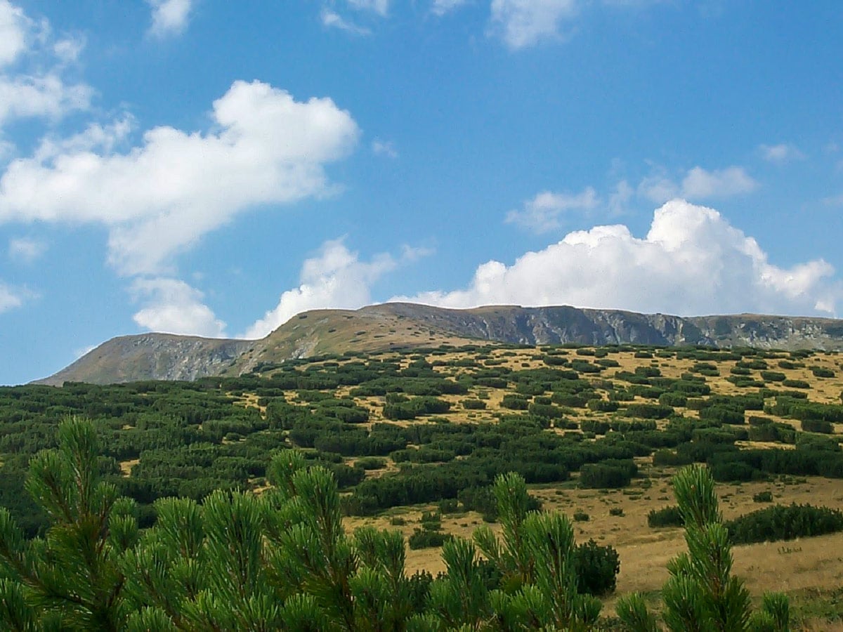
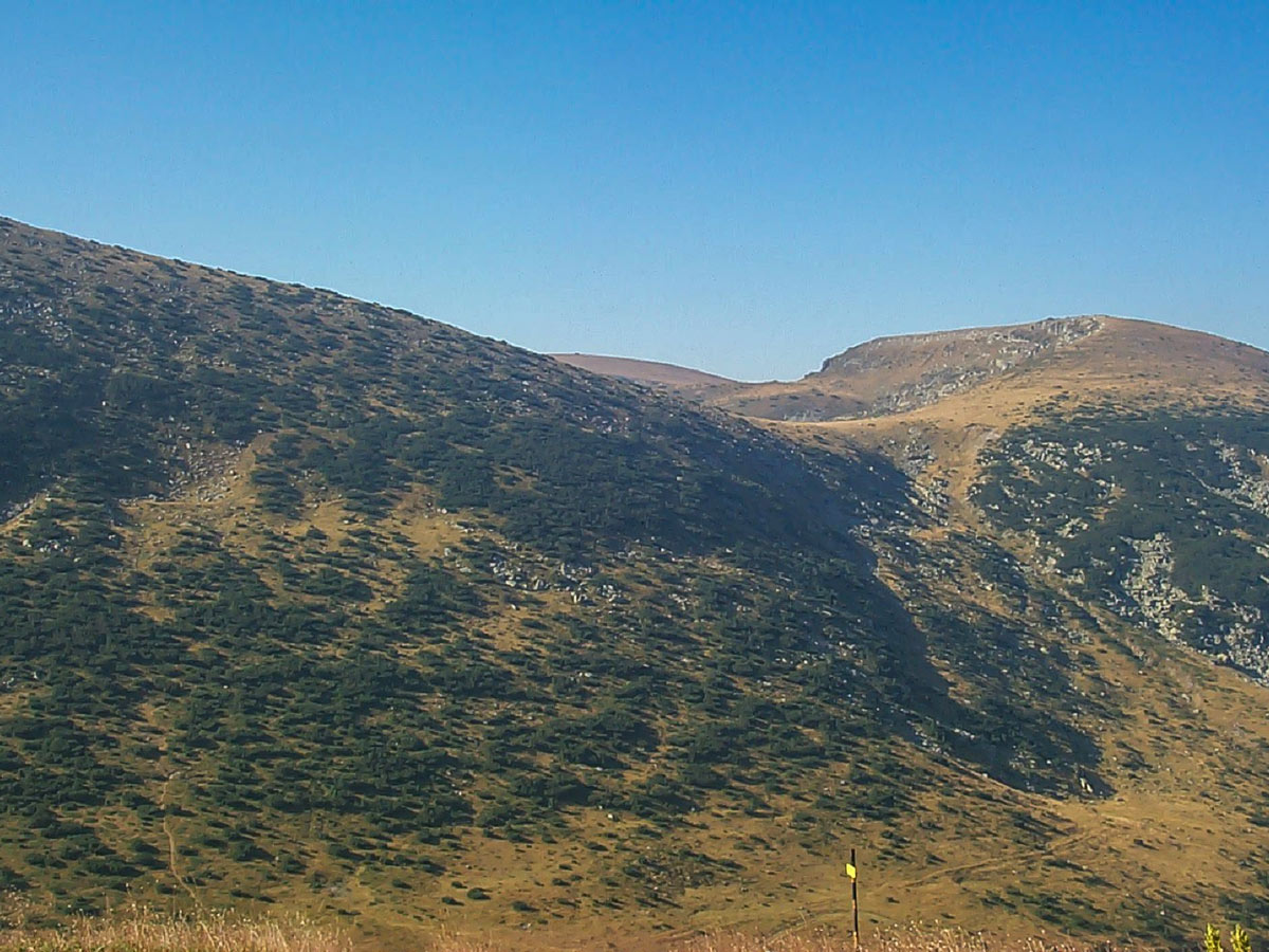
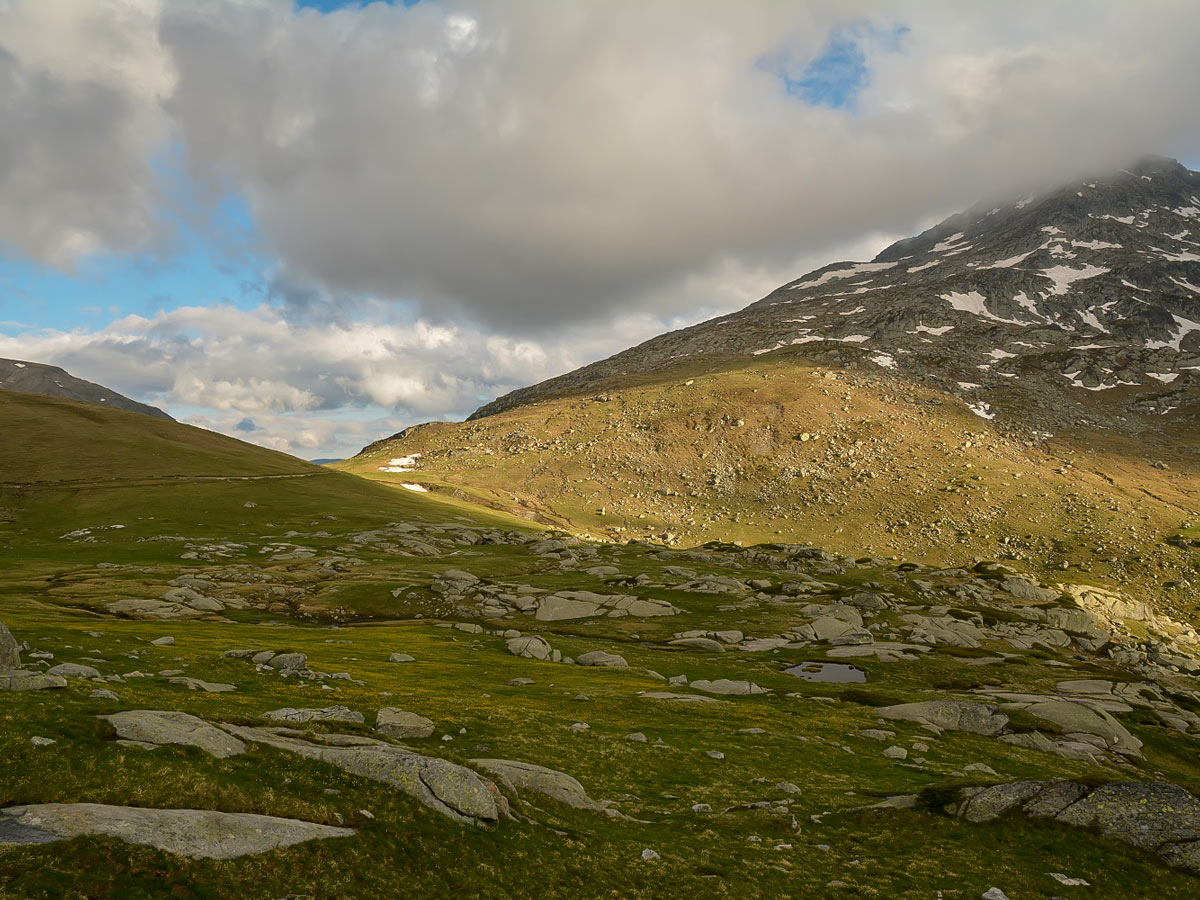
The third stage starts with an ascent. The route continues straight south, up towards the Malyk Mechi Vruh (Small Bear’s peak). The terrain here is a bit steeper (up to 35 degrees), yet it is quite easy and grassy. Soon the path drifts to the right (west) and heads towards the saddle, west from the summit point—during this part of the ascent, the terrain becomes a bit rockier. Soon the trail ascends to the saddle, which, again, is very wide and resembles a spacious meadow. This is the highest point of the entire hike—7940ft above sea level. From the hut up to here, you’ll follow the white-red-white markings on the rocks. It takes a little over 4 hours to reach this point from the trailhead.
From the highest point, during the fourth stage, the route follows white-blue-white markings. Note that the trail splits in two shortly after commencing this stage. You’ll see white-red-white markings guiding the path straight ahead (southwest) and to the left (southeast), the rocks have white-blue-white markings. You can’t see these white-blue-white markings as well, but you need to follow this option. After several feet off the saddle, the trail begins descending to the vast deep valley of Draglishkariver. The terrain here is grassy with some relatively steep (30 degrees), short sections along the way. At first, the trail goes straight down before it starts turning more and more to the left (east). When it reaches the valley, and the terrain gets more flat, it traverses several beautiful meadows. You’ll see a sign with info about the wild goats on one of them.
After the meadows, the trail reaches the river and takes you across a wooden bridge. Once you’ve reached the southern side of the river, there is a forest road, which goes horizontally through the old pines. After around 30 minutes of flat walking, it reaches Dobyrsko hut on the right-hand side, which is located at 5775ft above the sea. The hut offers hot and cold beverages and snacks, but no meals. It can take around 6 hours to reach this hut from the trailhead.
The final fifth stage begins from the hut, following down that same forest road, which after a few minutes, turns left (west) and enters a broad meadow. Here the trail divides into three. Take the route that follows the road furthest to the left. Eventually, you’ll reach another divide, and you’ll take the left option again here. The final stage descends 1000ft along a stony path, leading to a green meadow with a tiny chapel and a road; this is the endpoint of the hike.
Insider Hints
You can get to the Rila monastery by bus from Sofia—which sits 71.5mi away—or from Dupnitsa, a closer town, every hour.
Bring and wear snowshoes, an avalanche transceiver, avalanche shovel & probe, crampons if you plan on doing this hike in winter.
The Macedonia hut, which you reach midway through the trek, offers hot and cold beverages as well as soups, salads, and some hot meals during the summer. You can also buy snacks and drinks (not meals) from the Dobyrsko hut near the end of the hike.

Similar hikes to the Small Bears Peak hike
Malyovitsa Mountain
Mount Malyovitsa, with its 8953ft above the sea level, might not be the highest summit in the Rila…
Yonchevo Lake
In the eastern part of Malyovitsa range—the most exciting part of the Rila Mountains—lies Yonchevo Lake (also called Scary Lake)…
Okoto Lake
It is absolutely impossible to have the best hikes in the Rila Mountain Range, without one of them being the…
Cocoah Medeza 4 years ago
Such a beautiful hike. I recommend doing this hike early. We left our house at 5am and arrived at the park at 6am. We started our trek around 6:30am and finished at 2:18pm.
Heather Blitz 5 years ago
The terrain was a great combination of grassy and rocky. It's quite long and the trail was quite crazy. It's not suitable for young children.
Bobbie K. 5 years ago
The diverse nature was majestic.
Vincent Von Triu 5 years ago
Enjoyed the myriad of colors in this area. It was a hike worth doing.