
Malyovitsa Mountain hike
View Photos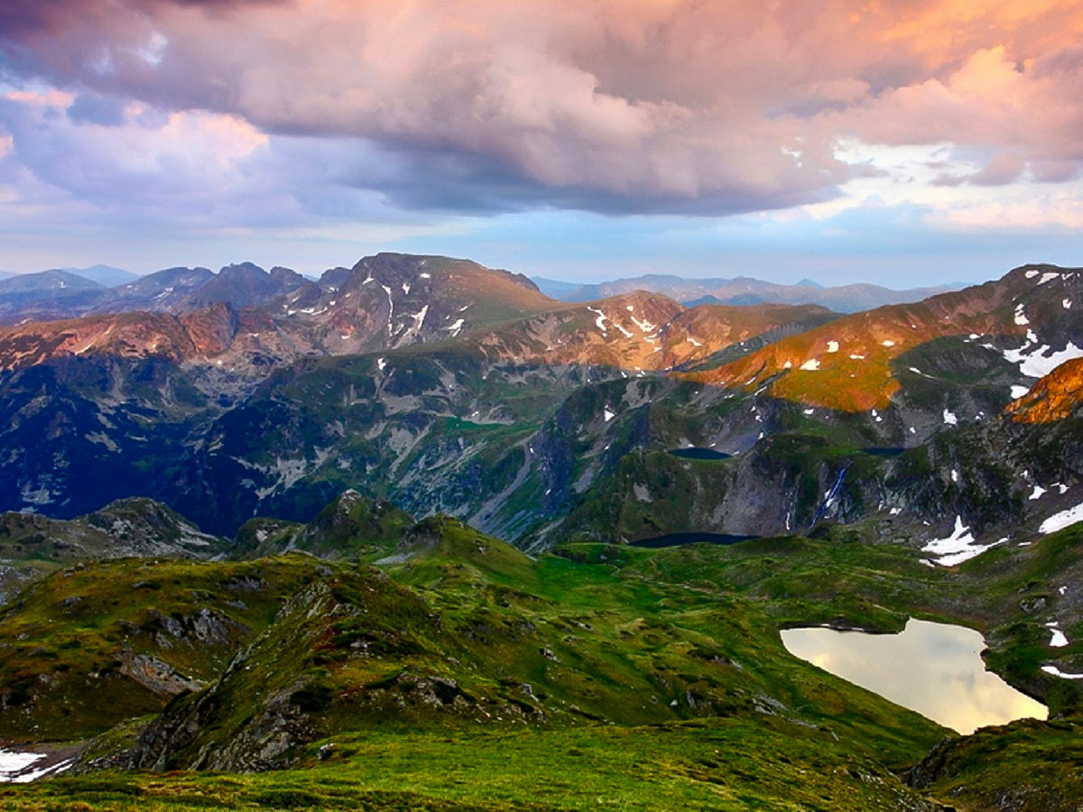
Malyovitsa Mountain hike
Difficulty Rating:
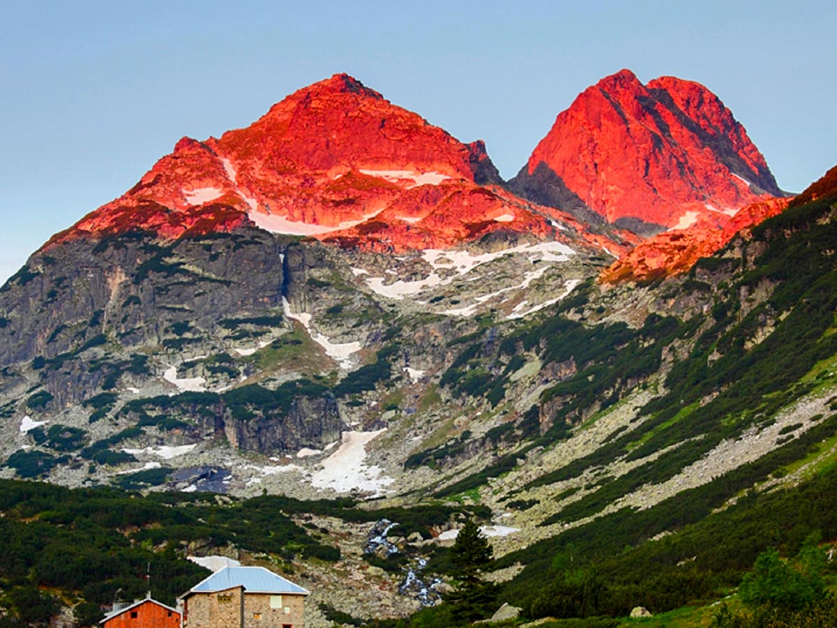
Mount Malyovitsa, with its 8953ft above the sea level, might not be the highest summit in the Rila range. However, with its imposing 1000ft tall north face, the mountain is considered the one symbol of mountaineering and alpinism in Bulgaria. For more than a century now, the fantastic shape of Malyovitsa has provoked people's desire to get closer to the wilderness–this climb will always be one of the best hikes in Bulgaria.
Getting there
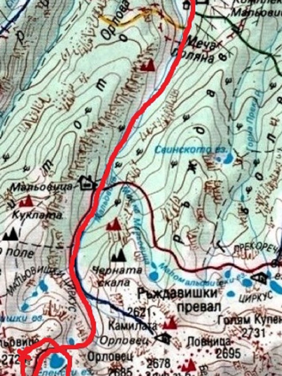
The route starts from the famous Mecha Polyana (Bear's Meadow)–the center of a small ski resort, where three hotels and the popular Central Mountaineering School are located. This place can be reached by any vehicle, as it is 11.2mi away from the town of Samokov and just 6.2mi away from the village of Govedartsi, on a good road. There is also an organized transport–minibus–twice a day (in the morning and the afternoon).

About
| When to do | June to September |
| Family friendly | No |
| Route Signage | Average |
| Crowd Levels | Low |
| Route Type | Out and back |
Malyovitsa Mountain
Elevation Graph
Weather
Route Description for Malyovitsa Mountain
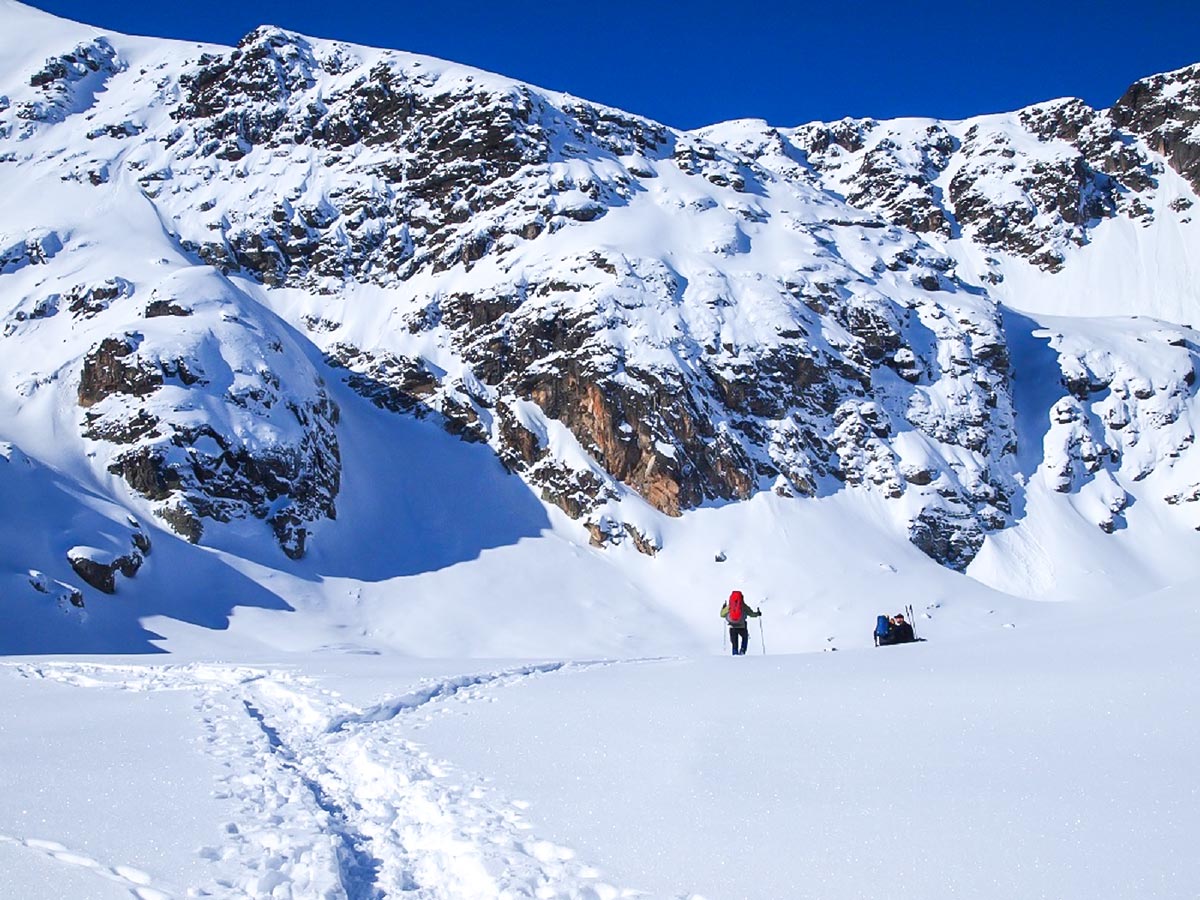
This is one of the most rewarding day hikes in Bulgaria! If you plan on doing this trek during the winter, do your best to be avalanche aware! There are sections where avalanches can occur, but you can follow alternate routes to avoid this.
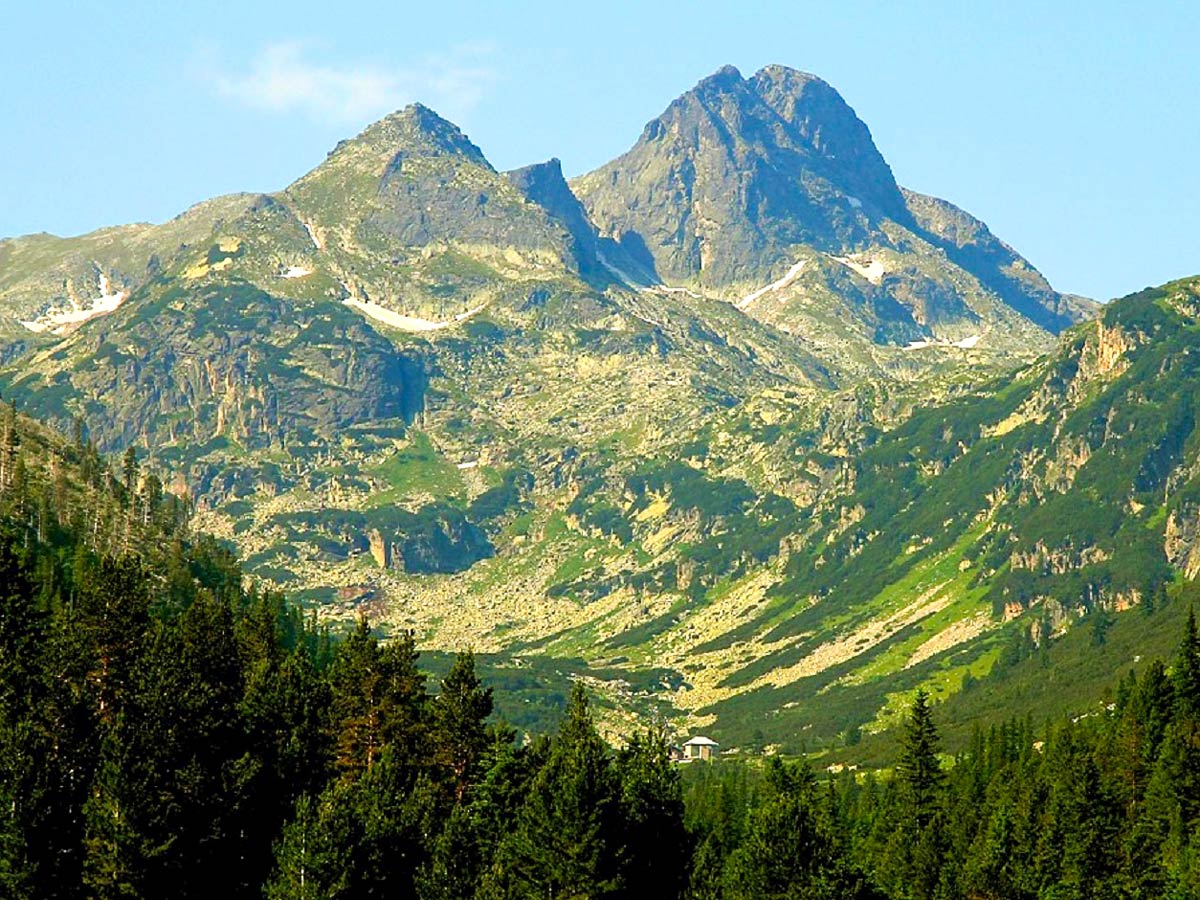
From the meadow (5807ft above the sea), the route goes further into the Malyovitsa Valley, gently gaining altitude following a stony path. The first half of this section traverses old pine forest, on the left bank of the Malyovitsa river. And the second part offers more exposure after crossing the bridge and travels above the trees along the river bank. The final point of this stage is Malyovitsa hut–the true home of the Bulgarian alpinists–located at 6437ft above the sea, surrounded by the vertical faces of the “Puppet” to the west and the “Black Rock” to the east. You can typically do the first stage in an hour.
From the hut, the route continues with its second stage, following the glacial valley, climbing to the First Balcony (6890ft above the sea), and then to the Second Balcony (7283ft above the sea). The two balconies are typical glacial shapes–two flat areas, which emulate a staircase. On the Second Balcony, there is a very well recognizable mark–a massive rock in the middle of the flat area, covered in memorial monuments of Bulgarian climbers, who lost their lives in the mountains. From the hut up to that place, it usually takes 30 minutes.
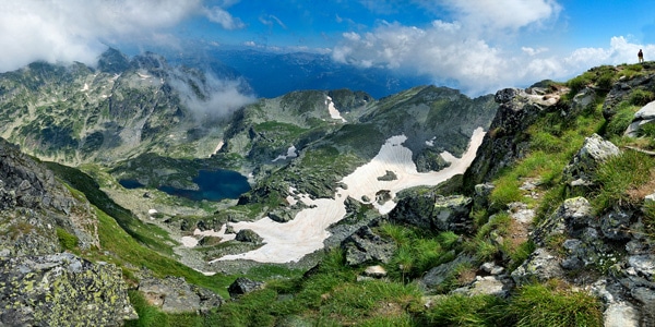
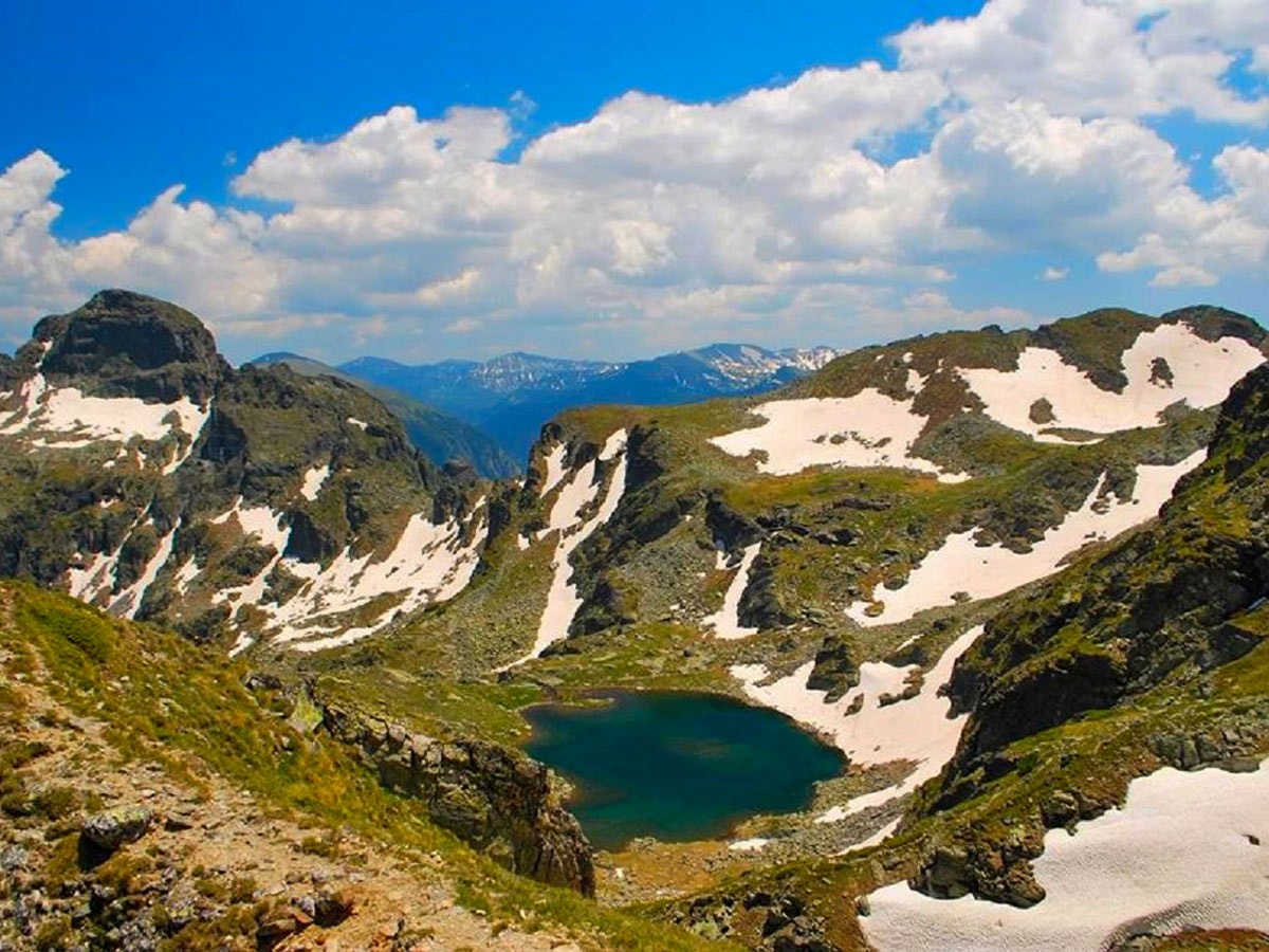
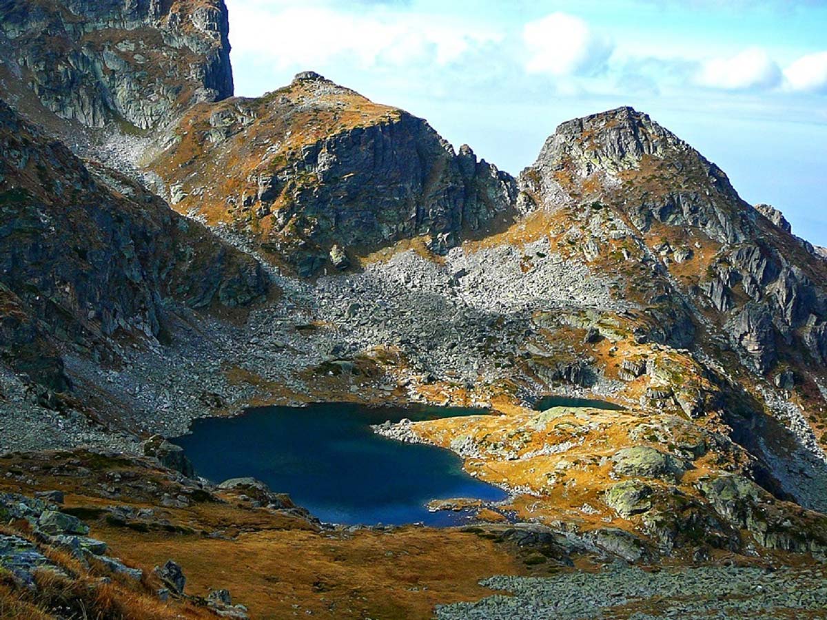
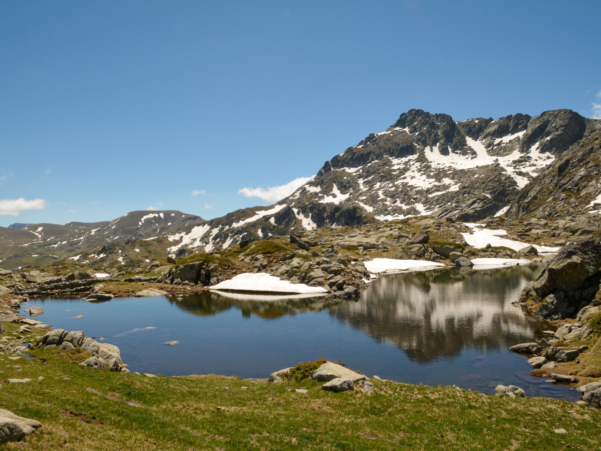
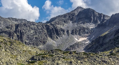
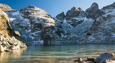
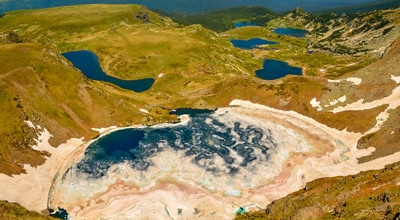
The third stage of the route is the steepest one! From the Second Balcony, the path climbs to the cirque of Deer Lake (8087ft above the sea). The terrain is rocky, and it does go up to 40 degrees of steepness, it requires patience and fitness, but there is no scrambling, so no special skills or equipment is needed. Deer Lake is a crystal clear, profound blue, ice-cold glacial lake–one of more than 150 in the Rila mountains. It is located in a beautiful cirque, surrounded by the summits of Malyovitsa (8953ft), Small Malyovitsa (8563ft) Deer peak (8707ft), and Orlovets (8812ft) and swimming in it is forbidden.
Hiking from the Second Balcony to Deer Lake normally takes around 45 minutes. The fourth stage will bring you to the main ridge of the mountain.
Please note that there are three different options to get to the main ridge.
First option: Travel through The Northern ridge of Deer Peak and then follow the summit crest of the Malyovitsa summit. This is the easiest possible option, as it is the least steep, and practically everyone in summer uses it. However, this is not a good option for winter ascents, as there is more avalanche risk on this route. The terrain is stony but not too steep at all.
Second option: Hike along the Eastern ridge of Malyovitsa crest and then follow the summit crest of the Malyovitsa summit. This is also an easy option, but it is longer, so it is not used in summer. It is used by most people in winter, as it is relatively safe from any potential avalanche risk. Its first few minutes are a bit steeper, but the following 90% is quite gentle. The terrain is rocky at first, and then very easy.
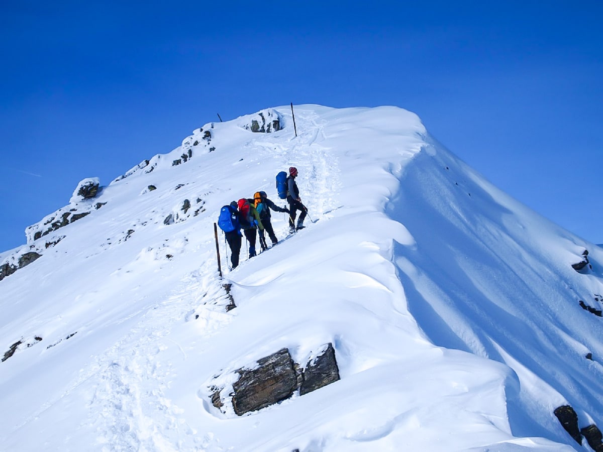
Third option: Follow the Northeastern ridge of Mount Malyovitsa straight to the summit. This is the most straight forward, yet by far most technically, challenging and steepest route. The ridge is quite rocky at places and has up to 60 degrees of steepness in short sections, but overall, it does not require any special skills or equipment.
The biggest challenge of this route is the second, less steep part, as the ridge becomes quite exposed here, and it is not suitable for people with vertigo or general lack of experience, because of the existing 600ft drop on the right-hand side. This route is used by advanced hikers and mountaineers, mostly in winter, because it’s free from any avalanche risk. The Northeast ridge of Mount Malyovitsa is not recommended to go without a guide unless you know what you are doing.
All three options take around 45 minutes. If you use one of the first two options, you will end at the Malyovitsa crest, at 8760ft above the sea. And from here, the fifth stage starts. The route follows the ridge to the summit point.
The first half is where the crest is quite narrow, yet not too exposed and dangerous. The second half is where the ridge becomes very wide, almost like a football stadium, and with a very gentle ascent reaches the summit point at 8953ft above the sea.
From the summit of Malyovitsa, expect an array of rewarding views of the surplus of mountain ranges dotting the area.
The ascent to the summit can take around 3.5 hours. While the descent follows the same route, and it usually takes 2.5 hours.
Insider Hints
Beverages and simple meals are available at the hut in the first stage
You can do this hike in both the winter and summer. If you plan on going in winter, consider bringing snowshoes, avalanche transceiver, avalanche shovel & probe.

Similar hikes to the Malyovitsa Mountain hike
Mount Musala
With its 9600ft or exactly 9600ft above the sea level, Mount Musala is the highest summit…
Yonchevo Lake
In the eastern part of Malyovitsa range—the most exciting part of the Rila Mountains—lies Yonchevo Lake (also called Scary Lake)…
Okoto Lake
It is absolutely impossible to have the best hikes in the Rila Mountain Range, without one of them being the…
Elijah Barnett 4 years ago
Great hike with great viewpoints. I enjoyed the overlooking views of the Valley.
Malik Samosa 4 years ago
Remarkable hike! Lots of contrasting colors, they look very nice to look at.
Cocoah Medeza 5 years ago
Classic view of the Bulgarian Alps. It was a wonderful experience. Had some trouble climbing the steep section. Better not do this hike if you're not physically fit.
Elaine S. 5 years ago
Amazing views! The terrain was quite rocky. Glad I had my hiking poles!
Kathy R. 5 years ago
The climb up the final stage was the most difficult part. It was a tough but memorable hike.
Julien L. 5 years ago
Amazing hike. The wilderness looks fantastic.
Heather Blitz 5 years ago
Nice hike. Some sections were greatly exposed to elements. Better wear some sunscreen to avoid sunburn.
Bobbie K. 5 years ago
It's a nice moderate hike. It took us about 6 hours to finish it.
Melly Moon 5 years ago
Astonishing rock faces. Better check the weather first. It was so foggy when we visited, so the visibility of the views was pretty crap.
Vincent Von Triu 5 years ago
It was a fun and memorable hike. The terrain was fantastic!