
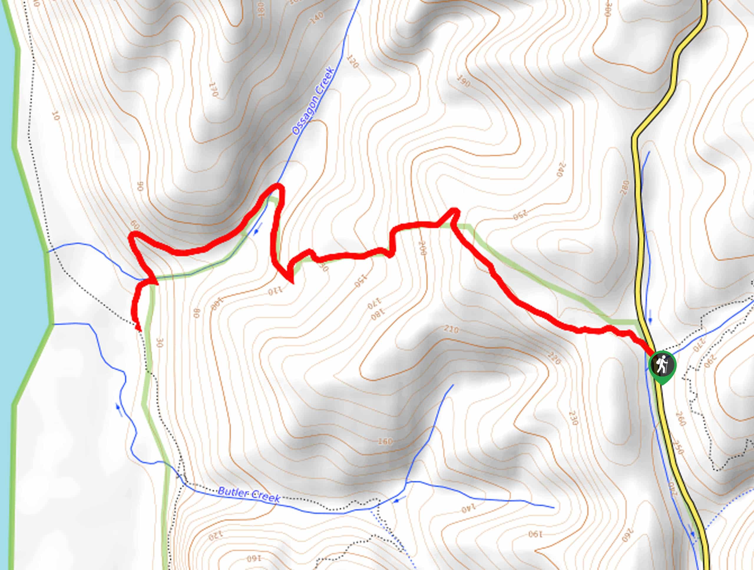
Ossagon Trail
View Photos
Ossagon Trail
Difficulty Rating:
Hiking the Ossagon Trail is an exciting experience. Compared to most redwood hikes in the area, this route boasts the opportunity to explore the forestlands by bike. No matter your mode of transportation the lush woodlands and epic ocean views will not disappoint.
Getting there
The trailhead for this hike is found off the Newton B. Drury Parkway.

About
| Backcountry Campground | No |
| When to do | Year-round |
| Pets allowed | No |
| Family friendly | Older Children only |
| Route Signage | Average |
| Crowd Levels | Moderate |
| Route Type | Out and back |
Ossagon Trail
Elevation Graph
Weather
Ossagon Trail Description
The Ossagon Trail would make a great addition to your adventure bucket list in northern California. Indulge in the quintessential redwood grove scenery and reward yourself with unparalleled maritime panoramas. Offering the best of both worlds and the opportunity to bike, this route cannot be beaten. Note that due to the area’s proximity to the coast, conditions are likely to be foggy, windy, or damp—so dress accordingly! Additionally, sections of the terrain are steep and single track, so take your time and be aware of passers-by.
Setting out from the trailhead, the Ossagon Trail will guide you northwest into the woodlands. Marvel in the lively vegetation and the grandeur of the towering redwoods as you begin your climb down to the coast. Navigating the odd switchback, the path will soon guide you over a charming footbridge atop of Ossagon Creek—which marks the final leg of your adventure. Gradually descending through the woodlands, the sound of crashing waves will intensify as you near the route’s end.
You will ultimately reach your turnaround point at the intersection with the California Coastal Trail. Explore the beach and rejuvenate your feet in the chilly waters if time permits. When you are set to return to the trailhead, simply backtrack along the path.
Similar hikes to the Ossagon Trail hike
Holter Ridge via Lost Man Trail
The Holter Ridge via Lost Man Trail is a popular mountain biking route in Redwood National Park—but it is open…
McArthur Creek Loop
Discover the beauty and diversity of Northern California’s coast along the McArthur Creek Trail. This challenging day hike exhibits the…
Mill Creek Horse Trail
Indulge yourself in the magical scenery of California’s coastal rainforests along the Mill Creek Horse Trail. This secluded adventure provides…
Comments