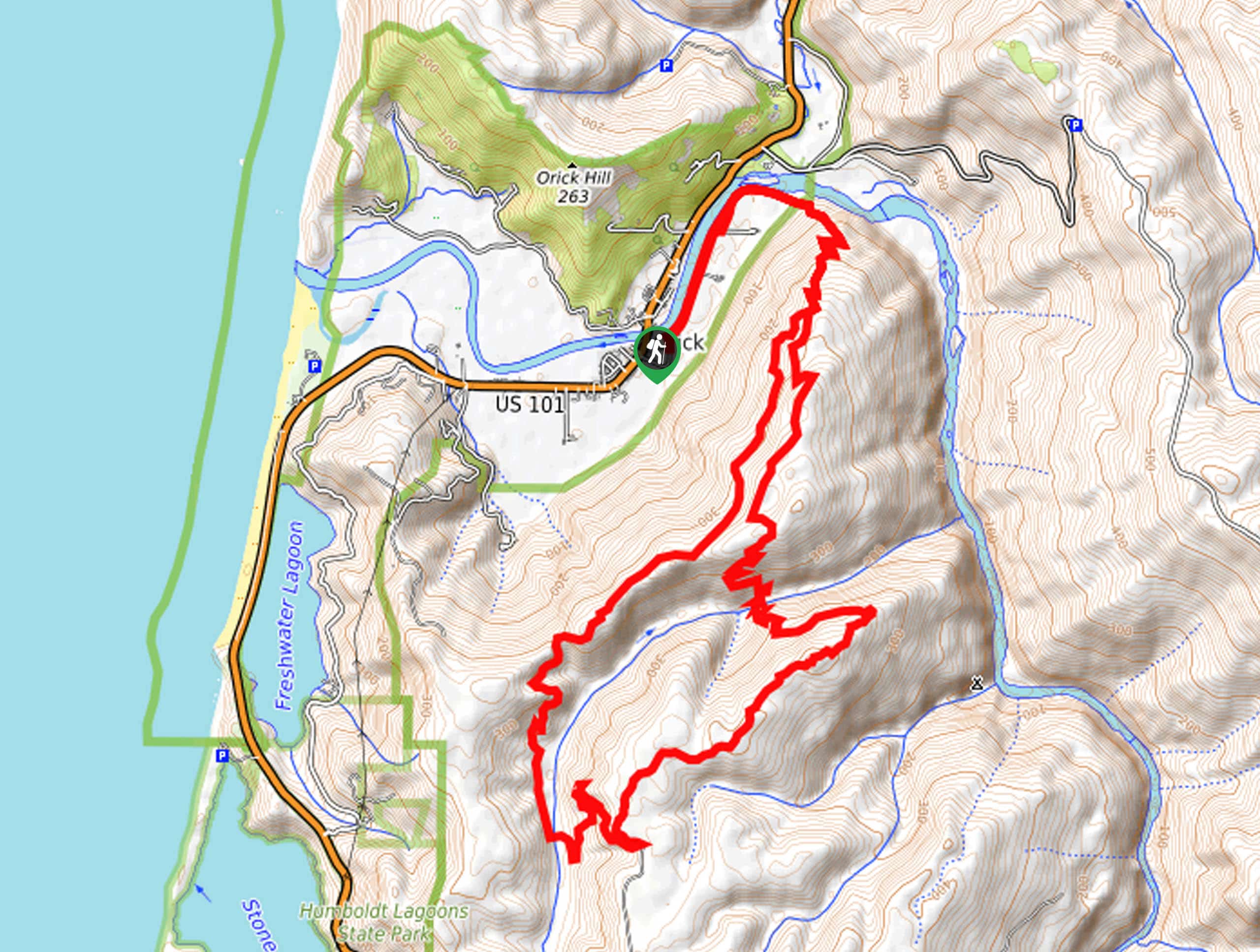
Flint Ridge Section Trail
View Photos
Flint Ridge Section Trail
Difficulty Rating:
Leading hikers through lush woodlands decorated with moss, wildflowers, mushrooms, and of course—redwoods, the Flint Ridge Section Trail is unparalleled in its scenery. Indulge in the wonderful primeval forest before the path opens to magnificent coastal vistas—what more could you ask for?
Getting there
Find the trailhead off Coastal Drive.

About
| Backcountry Campground | |
| When to do | Year-round |
| Pets allowed | No |
| Family friendly | Older Children only |
| Route Signage | Average |
| Crowd Levels | Moderate |
| Route Type | Out and back |
Flint Ridge Section Trail
Elevation Graph
Weather
Flint Ridge Section Trail Description
This hike would be a great addition to any intermediate hikers’ itinerary. Explore the lush old-growth forest, hiking amongst avid backpackers tackling the California Coastal Trail. Unlike many redwood hikes in the area, the Flint Ridge Section Trail offers a more secluded adventure—which we love! Reconnect with nature and revel in the natural beauty of the area. Located on the coast, this route is often cloaked in thick fog—so we encourage you to bring a raincoat to avoid getting damp!
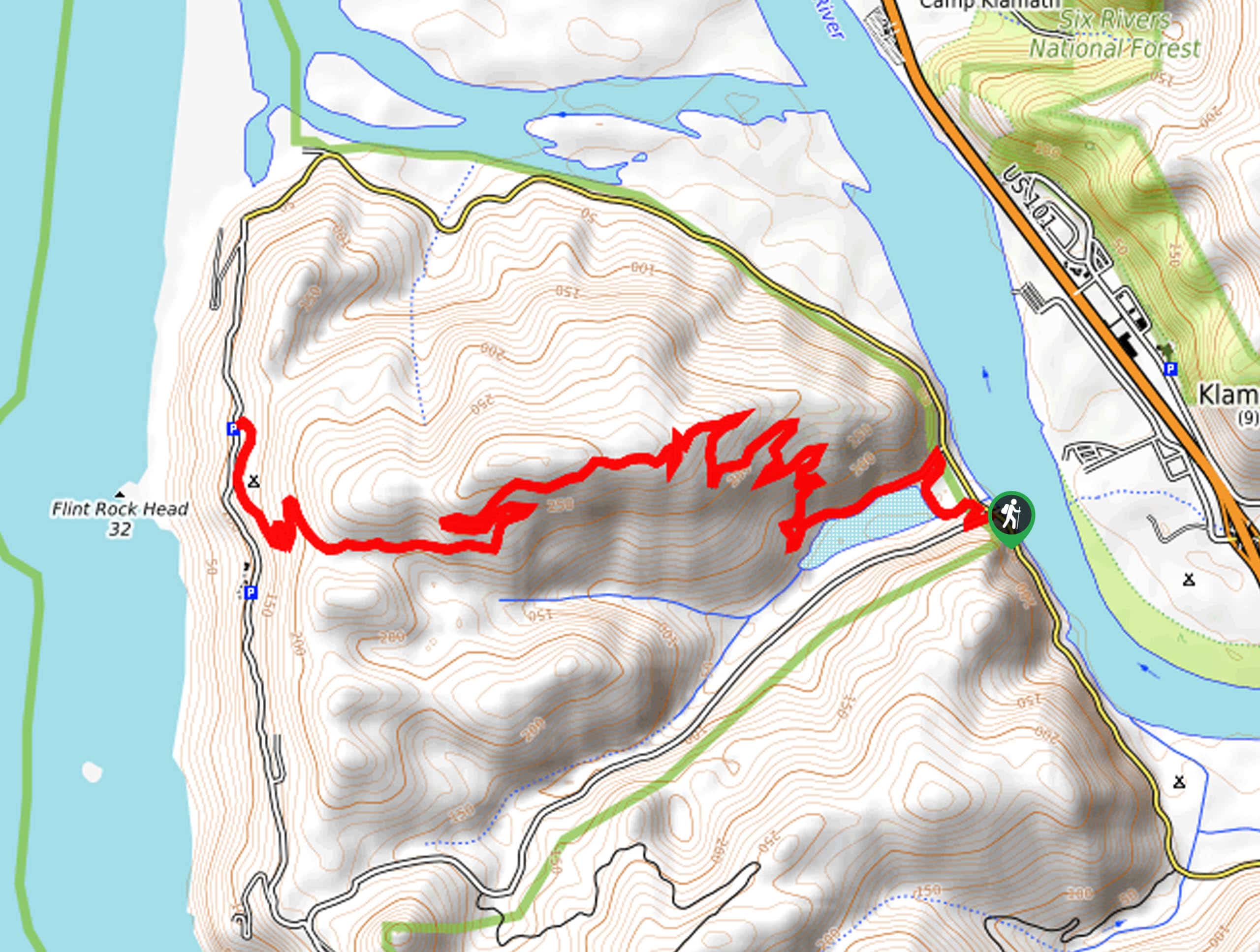
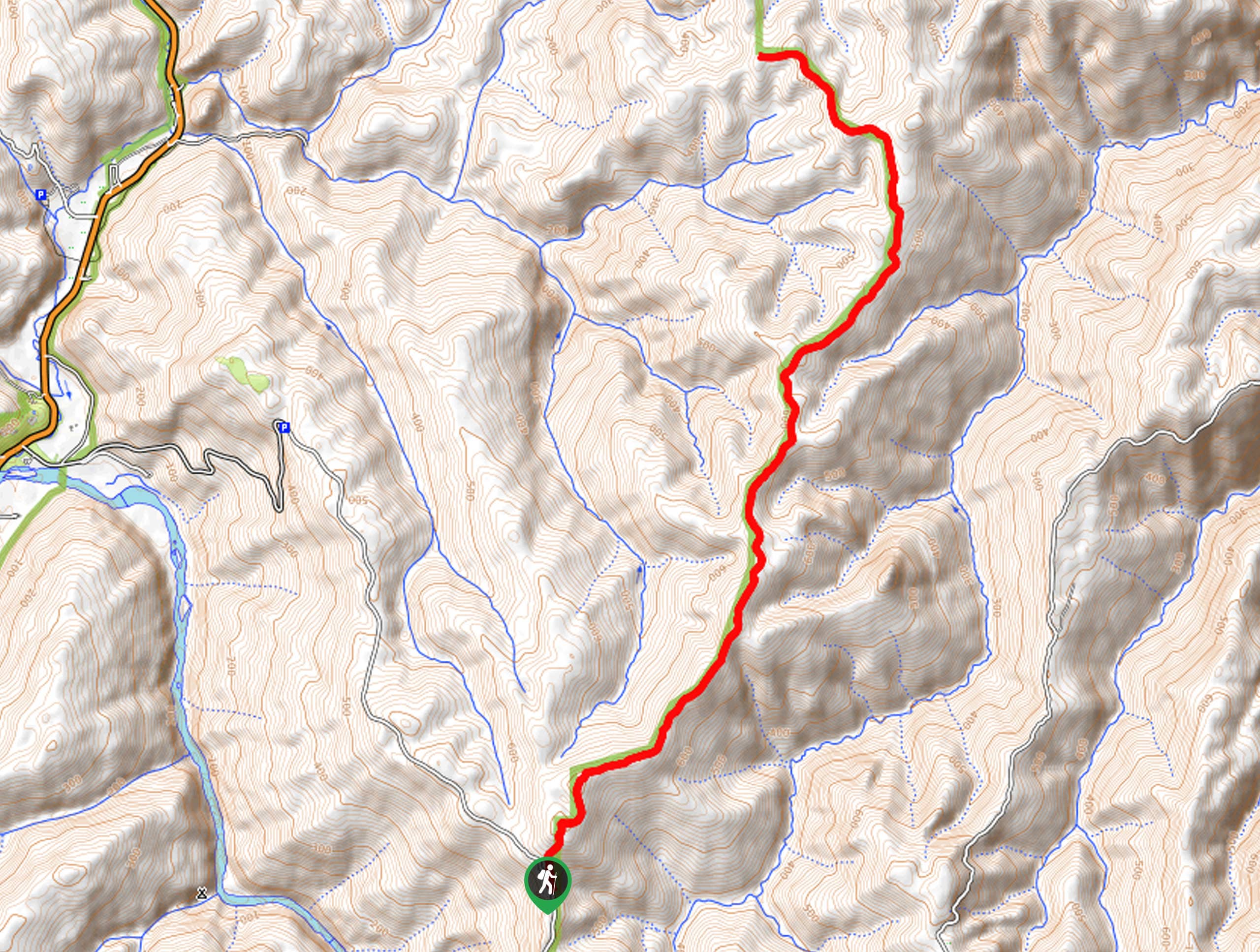
Setting out from the trailhead, this hike follows the California Coastal Trail- Flint Ridge. The initial segment of this path travels along the shores of Richardson Creek before climbing deep into the woodlands. Diverting you away from the creek, you will be led up the vertiginous terrain via several switchbacks. Take your time navigating the winding path, and be sure to savor the scenes of the enchanting landscape.
Eventually, the route will begin to gradually drop down to the Flint Ridge Backcountry Campground—marking your adventure’s end. Revel in the views of the Pacific from here, and when you are ready, retrace your footing along the path back to the trailhead.
Similar hikes to the Flint Ridge Section Trail hike
Holter Ridge via Lost Man Trail
The Holter Ridge via Lost Man Trail is a popular mountain biking route in Redwood National Park—but it is open…
McArthur Creek Loop
Discover the beauty and diversity of Northern California’s coast along the McArthur Creek Trail. This challenging day hike exhibits the…
Mill Creek Horse Trail
Indulge yourself in the magical scenery of California’s coastal rainforests along the Mill Creek Horse Trail. This secluded adventure provides…
Comments