
Shutlingsloe Circular Walk
View Photos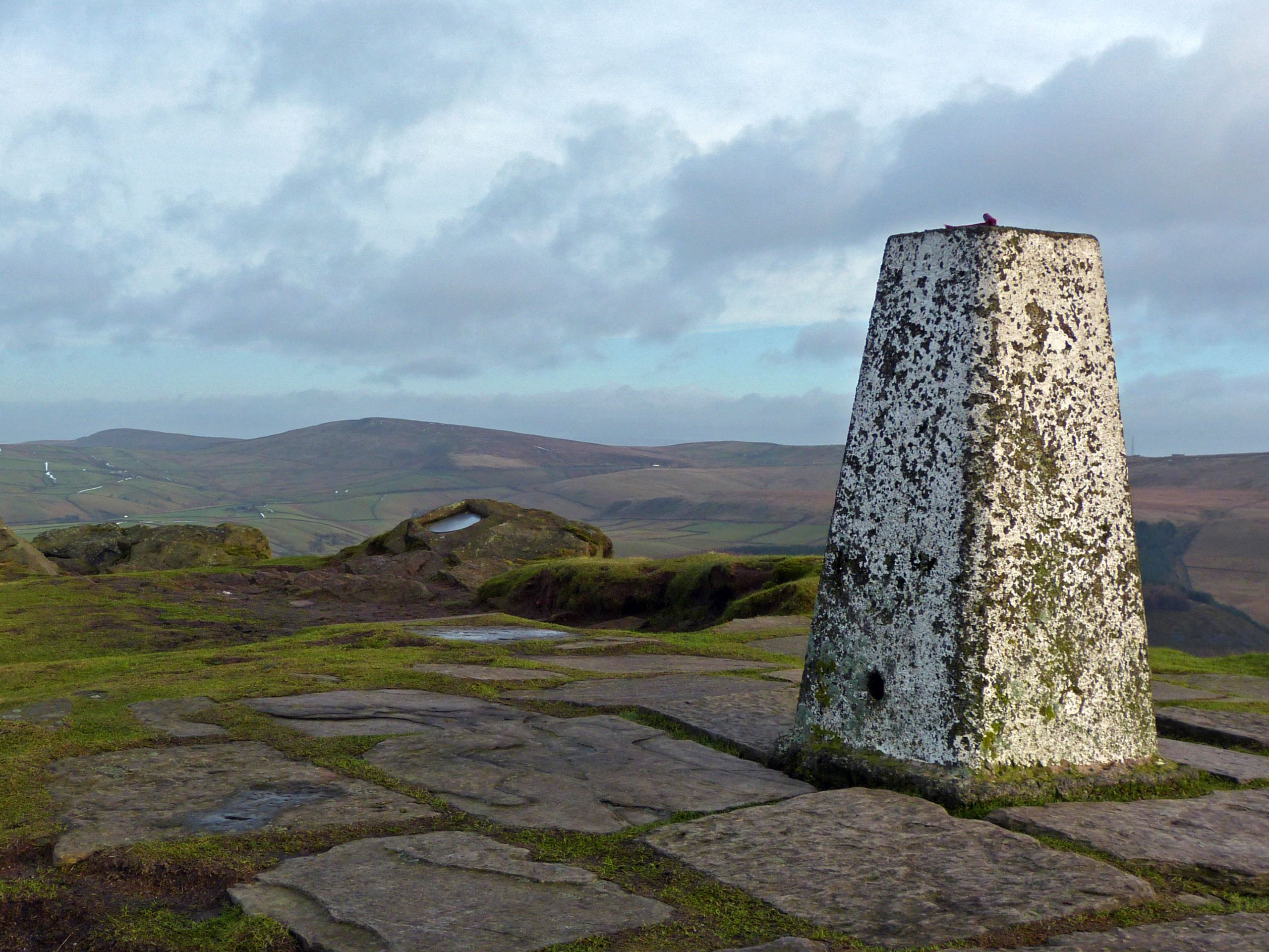
Shutlingsloe Circular Walk
Difficulty Rating:
The Shutlingsloe Circular Walk is a 12.4mi circuit route near Macclesfield that will take you through the historic Macclesfield Forest to summit the third highest peak in Cheshire. Along the trail, walkers will experience serene forest terrain and spectacular views that sweep across the Cheshire countryside from atop the hill. The route itself is easy to navigate and well-maintained with several steep sections, making it a suitable challenge for hikers of most skill levels.
Getting there
To reach the Shutlingsloe Circular Walk car park from the village of Langley, head east on Main Road for 0.2mi and continue straight onto Clarke Lane. After 0.6mi, make a right and continue on for 0.5mi. Turn left here and you will find the car park on the right in 0.1mi.

About
| When to do | March-November |
| Backcountry Campsites | No |
| Pets allowed | Yes - On Leash |
| Family friendly | Older Children only |
| Route Signage | Average |
| Crowd Levels | Moderate |
| Route Type | Circuit |
Shutlingsloe Circular Walk
Elevation Graph
Weather
Shutlingsloe Circular Walk Description
The Shutlingsloe Circular Walk begins in the Macclesfield Forest, which features a number of walking trails and recreational spaces that are available for use by the public. Because of this, parking might be limited and you should try to arrive early enough to beat the crowds. There are also a few steep portions of trail along this walk, so make sure to wear proper walking boots.
This walking route features a variety of terrain along its length that will allow you to explore beautiful forests, walk along the edge of reservoirs, and climb to the top of a rugged hill for views across the countryside. With a few expectations, the trail is fairly easy to navigate and traverses level terrain, making for a fun outdoor experience that the whole family can enjoy.
Setting out from the car park, follow the path east through the forest and turn right at the first junction. In 225ft, keep straight through the next junction and continue on for 0.2mi through the tranquil forest atmosphere, until you meet up with a track. Follow this to the left, as you pass by Nessit Hill on your right and eventually arrive at an intersection.
Take the path to the right and follow it for 0.4mi, where you will pass through a kissing gate and meet up with the Forest Bridleway. Go left and follow the path for 0.13mi, veering right to meet up with a trail. Keep right at the junction and pass through another kissing gate, following the path southeast across the open countryside for 0.4mi. Keep right through the kissing gate and you will eventually reach a stile at the foot of Shutlingsloe.
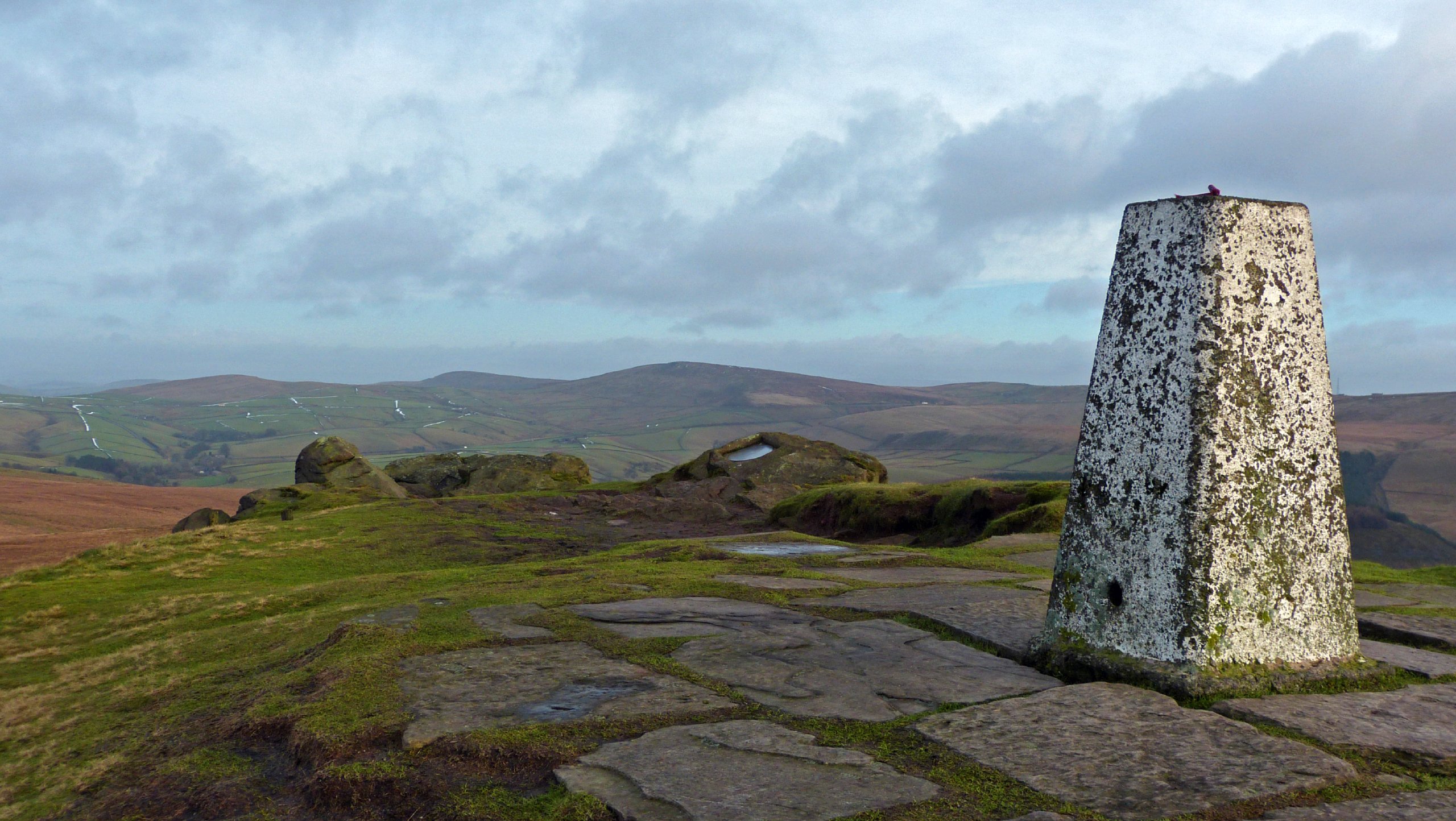
Make your way over the stile and begin your ascent of the steep terrain towards the summit of the hill. Once you have reached the top, you will have a panoramic view across the Cheshire countryside, with the green expanse of Macclesfield Forest behind you to the north, and the rest of the Peak District stretching out before you to the south. Once you have taken in the views, follow the trail to the right to head south and descend the hillside.
After 0.3mi, keep right and cross over the stile to follow the trail as it cuts across the farmland to another stile next to a bridge. Make your way over each of these and turn right at the next road, continuing along it for 0.4mi. Here, you will need to turn right and follow along the road as it passes the Crag Inn on your right, which is a great spot to stop for some mid-walk refreshments. Roughly 225ft from Crag Inn, you will find a gate on your right. Pass through the gate to continue west along the trail.
This portion of the walk will see you make your way across the picturesque English countryside for 0.8mi, as you cross a series of four gates and two stiles that help to divide the farmland. Reaching the lane, follow it left and continue along it until you meet up with Nabbs Road. From here, a short walk of 0.2mi will bring you to a stile on your right. Cross over the stile and follow the path north as it runs parallel to the winding Highmoor Brook.
Pass through the gate and over the bridge to take a more north westerly course away from the brook towards a farm on the right. Pass through the gate and over the stile to meet up with the lane in front of the farm. Cross directly over the road and continue along the path as it heads west, crossing over two stiles before arriving at the Hanging Gate Inn. From here, cross over the road and pass through a series of kissing gates to turn left along the road, following it for 0.1mi before picking up the path on your right and crossing over another stile.
Make your way north along the trail, passing through a series of kissing gates before arriving at Heathcote Lane. Cross over the road and pass through another series of gates and kissing gates, cutting across several fields until you arrive at a lane with a cottage on your right. Head left and follow the lane for 330ft before turning right on a course that will take you through a gate and past another cottage.
Keep straight along the road until you arrive at an intersection with Clarke Lane, following it to the right on the final leg of the Shutlingsloe Circular Walk. During this part of the walk you can stop in at the Leather’s Smithy for some post-walk fuel, or continue walking by the calm water of the reservoir to pass through the forest and arrive back at the car park where you began your journey.
Trail Highlights
Macclesfield Forest
Once known as the Royal Forest of Macclesfield that served as a hunting ground for nobility following the Norman Conquests, Macclesfield Forest now operates as a nature reserve and recreation area. Due to efforts to preserve this historic landscape, the area features populations of red deer, heron, and other wildlife species that inhabit the primarily conifer forests that surround several tranquil reservoirs.
Shutlingsloe
Sometimes called the ‘Cheshire Matterhorn’ because of its resemblance to the famous peak in Switzerland, this small 506m hill is the third highest peak in Cheshire after Black Hill and Shining Tor. The hill dominates the surrounding landscape and offers a commanding view over the scenic rolling green hills of the countryside.
Find other amazing walks in Peak District National Park:
Insider Hints
Pay and Display Parking is available at the trailhead.
Wear proper walking boots, as the trail leading up Shutlingsloe is fairly steep.
Pop into the nearby Leather’s Smithy for a post-walk pint.
Keep your dogs on a lead, as there are grazing sheep and other wildlife in the area.
Similar hikes to the Shutlingsloe Circular Walk hike

Valehouse Reservoir Circular
The Valehouse Reservoir Circular is a 3.1mi lollipop trail near Glossop that travels around the edge of the…

Three Edges Walk
The Three Edges Walk is a challenging circuit in Derbyshire that will take you along three escarpments that offer some…

Edale Rocky Ridges Walk
The Edale Rocky Ridges Walk is just that - an adventurous walk along a rugged ridgeline. While out on the…
Comments