

Three Edges Walk
View Photos
Three Edges Walk
Difficulty Rating:
The Three Edges Walk is a challenging circuit in Derbyshire that will take you along three escarpments that offer some of the most spectacular views of the surrounding Peak District terrain. Along the trail, you will climb up across the moor to reach the Derwent Edge with its views over the valley before making your way to Stanage Edge and finally Bamford Edge for the best views of the day. There are a fair amount of ups and downs along this route; however, the excellent views across the English countryside are well worth the effort.
Getting there
To reach the parking area for the Three Edges Walk from Hope Valley, make your way north along Station Road/A6013 for 2.6mi and turn left onto the A57. Here, you will find roadside parking on the left in 0.4mi.

About
| When to do | March-October |
| Backcountry Campsites | No |
| Pets allowed | Yes - On Leash |
| Family friendly | No |
| Route Signage | Average |
| Crowd Levels | Moderate |
| Route Type | Circuit |
Three Edges Walk
Elevation Graph
Weather
Three Edges Walk Description
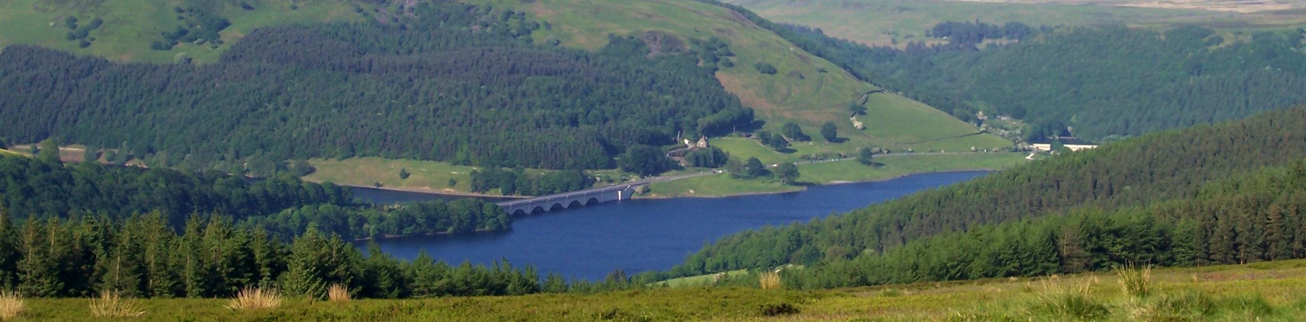
Although it may be a bit challenging in areas, the Three Edges Walk is a popular route in the Derbyshire area due to the fact that you can walk along three gritstone escarpments that offer some of the absolute best views within the Peak District. Setting out from the car park, cross over the road and follow the trail on the opposite and make your way uphill for some views overlooking the Ladybower Reservoir.
After traversing Whinstone Lee Tor, the trail will climb uphill to the southeast to reach the top of the Derwent Edge. From here, you will head east to descend the valley and cross over Manchester Road before beginning the climb up Stanage Edge. After walking the edge and taking in the views across the moor, follow the path southwest to cut across the rugged terrain on the approach to Bamford Edge. Follow the trail north and enjoy the picturesque views across the valley, as you eventually arrive back at the trailhead having completed the Three Edges Walk.
Other amazing walks in Peak District National Park
Check out our guides to Kinder Scout, Mam Tor, Stanage Edge, Dovedale, and Padley Gorge. Or see all of our Peak District walks on 10Adventures.
Similar hikes to the Three Edges Walk hike

Valehouse Reservoir Circular
The Valehouse Reservoir Circular is a 3.1mi lollipop trail near Glossop that travels around the edge of the…

Edale Rocky Ridges Walk
The Edale Rocky Ridges Walk is just that - an adventurous walk along a rugged ridgeline. While out on the…
Ladybower Reservoir & Derwent Edge Walk
The Ladybower Reservoir & Derwent Edge Walk is a fantastic route that offers gorgeous views across the Peak District Landscape.…
Comments