Marsden Moor Walk
View Photos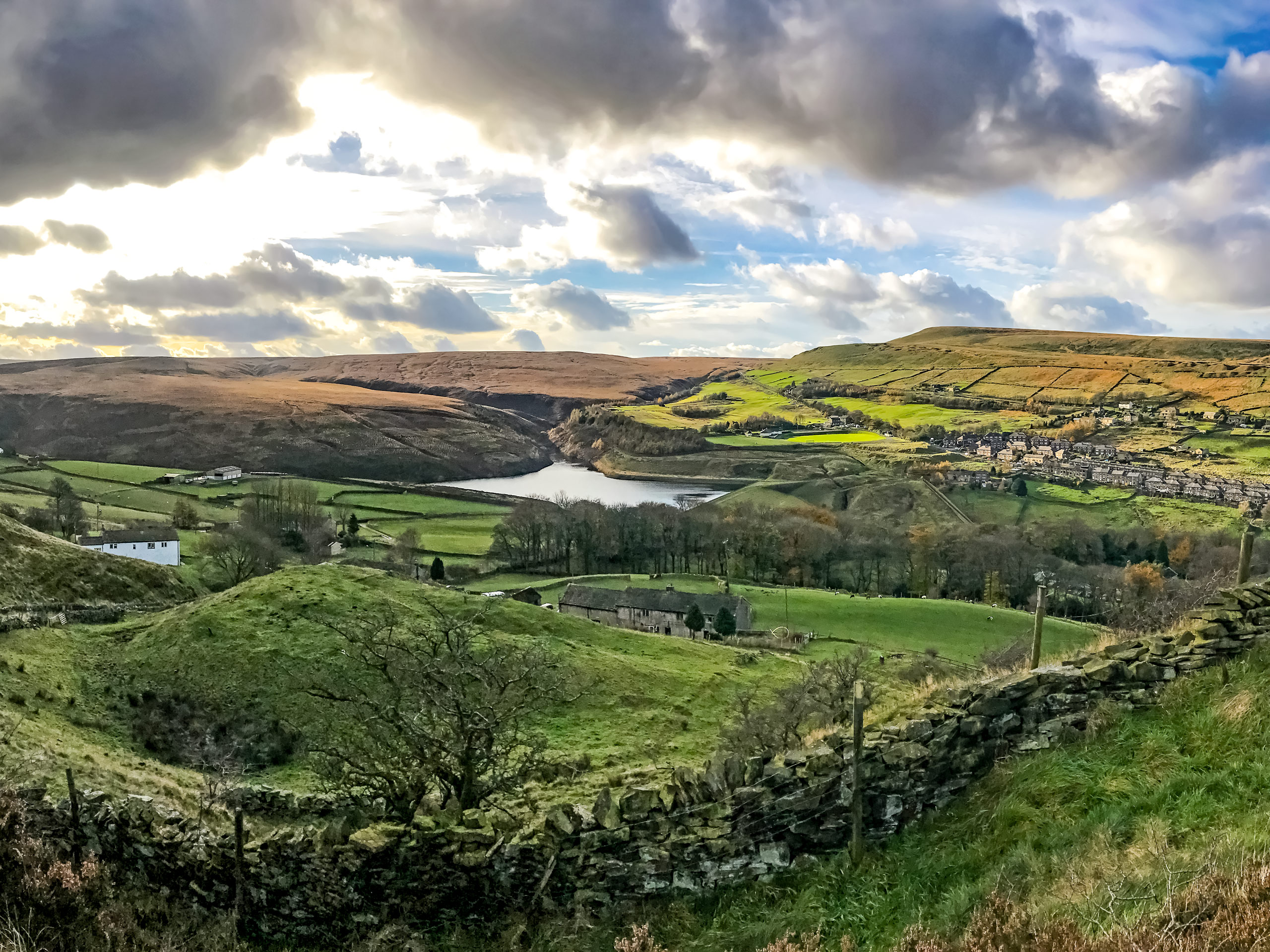
Marsden Moor Walk
Difficulty Rating:
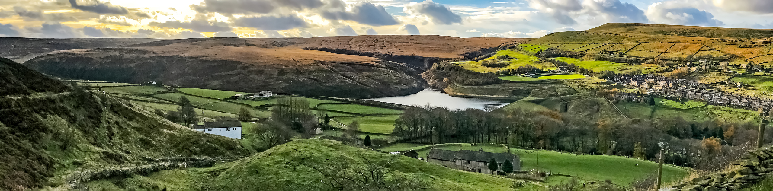
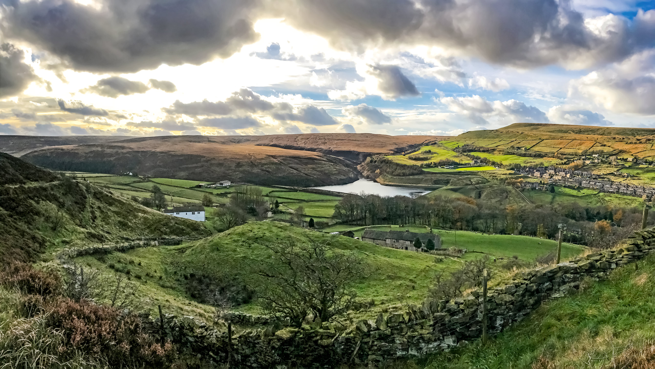
The Marsden Moor Walk is a 13.5km circuit that sets out from the town of Marsden and traverses the nearby moorland to the west. Along the walk, you will experience amazingly scenic views across the rolling green landscape and hike uphill along the rugged escarpment known as Standedge. This route isn’t overly challenging, but it does feature several bigger climbs that will keep things interesting for both casual and seasoned walkers alike.
Getting there
To reach the trailhead for the Marsden Moor Walk from Huddersfield, head west on Manchester Road/A62 for 6.6mi and turn right onto Peel Street. After 0.1mi, turn left onto Station Road and continue on for 0.2mi to arrive at the trailhead.

About
| When to do | March-November |
| Backcountry Campsites | No |
| Pets allowed | Yes - On Leash |
| Family friendly | Older Children only |
| Route Signage | Average |
| Crowd Levels | Moderate |
| Route Type | Circuit |
Marsden Moor Walk
Elevation Graph
Weather
Marsden Moor Walk Description
The Marsden Moor Walk is a breathtaking stroll through the countryside that begins in the town of Marsden and climbs uphill across the moor. Due to the route’s starting point, parking might be limited and you may need to park your vehicle alongside the road. Additionally, the stretch of trail atop the escarpment is fairly exposed to the elements and weather can change quickly. Make sure to come prepared with any gear you may need, including a proper wind/rain jacket.
This scenic walking route features a nice variety of terrain along the trail that will keep you engaged throughout and provide some amazing views of both West Yorkshire to the east and Greater Manchester to the west. Along the walk, you will pass through some urban areas in Marsden before crossing the moor on your way uphill to the lookout at Standedge. From here, the path will descend into the valley and briefly cut across a stretch of Peak District National Park before arriving back in town to wrap up the walk. There is a lot to do and see while out on this trail, so grab your walking boots and prepare for a great adventure through the English countryside.
Setting out from the trailhead next to the Marsden rail station, follow the trail west alongside the Huddersfield Narrow Canal. After 0.5mi, cross over the bridge spanning the canal, where you will see the Standedge Tunnel Visitor Centre on your left. Cross over the road and pick up the trail on the opposite side, making your way north along the car park and over Ainsley Lane. Continue onto the junction and turn left, following the path for 0.3mi, as it runs parallel to Waters Road and the River Colne.
Cross the bridge over the creek and continue on towards the west for 480ft, where you will come to a gate at the side of the road. Pass through the gate and turn right to follow along the road for 0.2mi before picking up the path to the left. Pass through the gate and make your way along the trail as it passes under the shade of some trees and follows closely alongside the river. 0.1mi beyond the gate, the path will cross a picturesque packhorse bridge known as Close Gate (Eastergate) Bridge that spans the River Colne. From here, pass through the gate and head left at the intersection to begin your walk across the moor.
Keep left at the initial junctions to make your way over Stone Lee Clough and continue along the path for 0.3mi, as it climbs uphill through the scenic moorland terrain and crosses Willykay Clough. From here, continue following the meandering path for 0.9mi as you gain elevation and take in the beautiful views of the rolling landscape. Upon arriving at a bridge, crossover to the other side and continue working your way uphill for 0.6mi, passing through any junctions to eventually arrive at the Pennine Way Car Park. Make your way over the bridge and take a sharp left turn along a path that will lead you back over another bridge to the southeast.
Keep straight through any junctions as you walk for 1.6mi along the escarpment known as Standedge. From here, you will have a breathtaking view of the surrounding landscape on the border of West Yorkshire and Greater Manchester. Weather atop the escarpment can change quickly, so exercise caution when walking near the edge and continue along the footpath. Reaching a fork in the trail, keep right and make your way over the stile. After a short distance, you will come to another stile at an intersection. Cross over this as well and keep right until you arrive at a third stile. Cross here as well and head to the left, following the lane until it meets up with the road.
Use the crosswalk to make your way over the road and pick up the trail on the eastern edge of the car park. Walk along the Pennine Way for 0.2mi, heading right at the fork to pass through a gate. From here, you will make your way across the moor and cross over another stile before arriving at a junction with the Standedge Trail. Take this to the left and follow it for 0.8mi, crossing over a series of streams and passing through an intersection until you arrive at the edge of Mount Road. Make your way across the road and onto Old Mount Road, following it for 175ft before taking the path to the left.
Keep left for 1.3mi to descend the hillside, where you will pass by several farms and make your way along a small wood to meet up with Manchester Road. From here, follow the road to the right for 0.3mi and turn left onto the trail. Make your way past the Church of St. Bartholomew on your right and cross over the River Colne to eventually arrive back at the rail station where you began. Upon concluding the Marsden Moor Walk, take some time to explore the charming town or pop into The Railway pub for some snacks and a drink before heading home.
Trail Highlights
Standedge
Located in the Pennine Hills of northern England, Standedge is a moorland escarpment nestled between the towns of Marsden in West Yorkshire and Diggle in Greater Manchester. The ridge has been a key crossing point for the moorland, dating back to the Roman occupation of Britain.
Eastergate Bridge
Officially known as Close Gate Bridge, this picturesque packhorse bridge crosses over the River Colne near the village of Marsden and was once the site of an old inn that was run in the early 1800s by a woman named Esther Schofield, hence the name Eastergate Bridge.
Find other amazing walks in Peak District National Park:
Insider Hints
The trail can be muddy and uneven in places. Wear proper walking boots.
The viewpoint atop Standedge is fairly exposed to the elements. Make sure to bring a wind/waterproof jacket.
The Railway pub at the start/end point of the walk is a great place for some post-walk refreshments.
Similar hikes to the Marsden Moor Walk hike

Valehouse Reservoir Circular
The Valehouse Reservoir Circular is a 3.1mi lollipop trail near Glossop that travels around the edge of the…

Three Edges Walk
The Three Edges Walk is a challenging circuit in Derbyshire that will take you along three escarpments that offer some…

Edale Rocky Ridges Walk
The Edale Rocky Ridges Walk is just that - an adventurous walk along a rugged ridgeline. While out on the…
Comments