Lose Hill Circular Walk
View Photos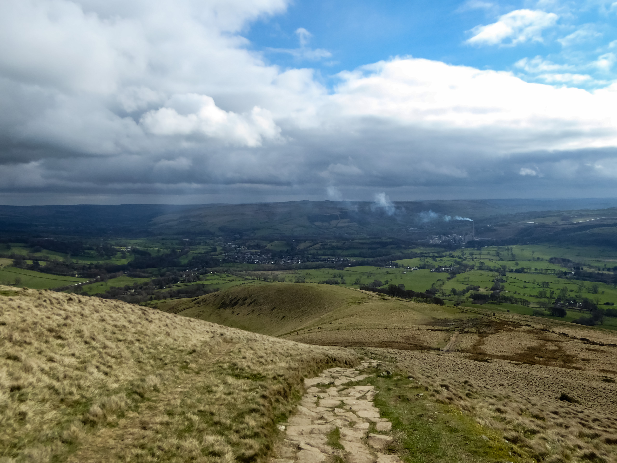
Lose Hill Circular Walk
Difficulty Rating:
The Lose Hill Circular Walk is a great adventure in the heart of the Peak District that will take you uphill over some rugged terrain for some breathtaking views of the surrounding landscape. While on the trail, walkers will summit the iconic Mam Tor, Hollins Cross, and Lose Hill before descending along the trail to walk through several charming villages. This walk can be fairly busy at times; however, the amazing views of the Derbyshire countryside are well worth the effort.
Getting there
To reach the trailhead for the Lose Hill Circular Walk from Hathersage, drive west along Main Road for 5.6mi and turn right onto Cross Street. Continue on for 0.4mi and turn left onto Arthurs Way. After 0.3mi, continue onto Winnats Pass and follow it for 0.9mi. Turn right and follow the road for 0.2mi, before turning left onto Sparrowpit Buxton/A623. After 0.2mi, you will find a layby on the left directly opposite to the trailhead.

About
| When to do | March-November |
| Backcountry Campsites | Castleton Caravan Club Site |
| Pets allowed | Yes - On Leash |
| Family friendly | Older Children only |
| Route Signage | Average |
| Crowd Levels | High |
| Route Type | Circuit |
Lose Hill Circular Walk
Elevation Graph
Weather
Lose Hill Circular Trail Description
Much of the Lose Hill Circular Walk follows along well-maintained paths that are easy to navigate; however, some of the uphill portions – like the ascent of Mam Tor – are fairly steep and might be difficult to traverse for some walkers. Make sure that you wear comfortable walking footwear for the journey, as the trail is fairly long and features many ups and downs along sometimes rugged terrain. Additionally, make sure to arrive early to secure parking, as this area sees many visitors.
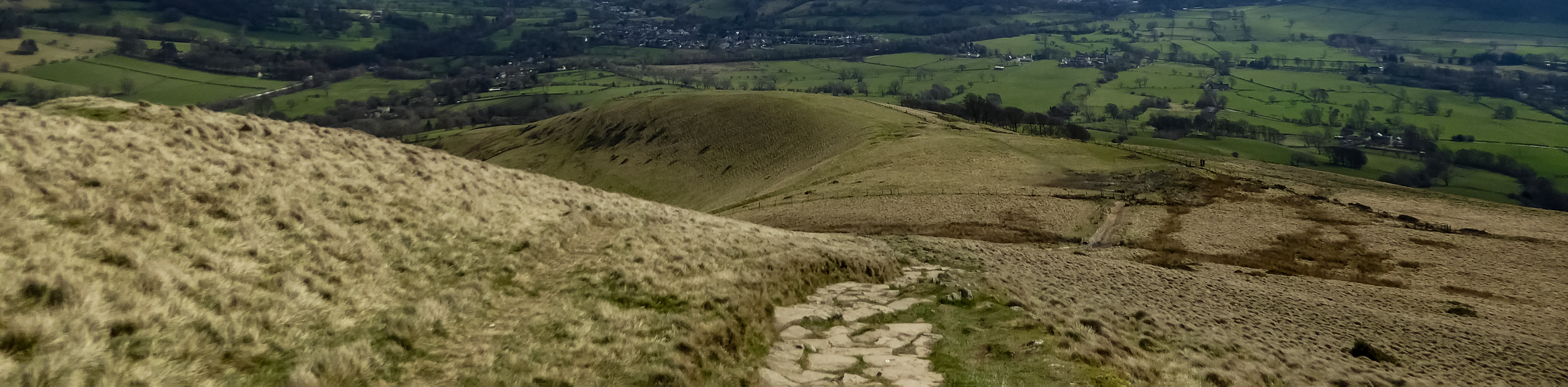
While the trail might be busy, especially in the area around Mam Tor, it is for good reason, as there are some truly spectacular views overlooking the Peak District that you won’t want to miss. The route climbs uphill to first summit Mam Tor before traversing The Great Ridge with stops at Hollins Cross and Lose Hill. After being spoiled with amazing views across the English countryside, walkers will descend the ridge to make their way through historic villages along the Hope Valley before arriving back at the car park. This trail is a great way to experience some of the beautiful terrain that the Peak District has to offer.
Setting out from the layby, make your way across the road to pick up the trail and pass through a gate. Keep right at the fork and continue straight to pass through another gate. From here, ascend the series of stairs and head right at the junction to pass through another gate. Continue working your way uphill alongside the road, keeping right at the next junction to set a courts to the northeast that will take you to the summit of Mam Tor. Once there, you can explore the summit and take in the breathtaking views that stretch out across the Peak District and include Kinder Scout to the northwest before continuing to the north to walk past the Bronze Age hill fort on your left.
From the fort, continue straight to traverse The Great Ridge, passing through one gate to eventually arrive at a trail junction at Hollins Cross. Pass straight through and continue on for the next 0.5mi, breathing in the fresh hilltop air and soaking in the sights before arriving at a fork in the path. Head left here and cross over the stile, followed by an immediate right to follow the trail up to the summit of Back Tor.
After taking in some more views across the Derbyshire countryside, continue heading east along the ridge until you arrive at the summit of Lose Hill. From here, you will have a panoramic view of the lush green farmland in all directions, stretching along the ridgeline behind you towards Ladybower Reservoir in the east. After taking in the sights, follow the trail east and keep to the left as it descends the ridge towards the River Noe below.
After passing through a series of stiles and gates to meet up with Lose Hill Lane, follow it to the right until you meet up with Edale Road. Turn right again, continuing on for 0.7mi into the heart of the historic village of Hope. There are a few options in the village for some mid-walk refreshments, but if you are keen to continue, make your way west along Castleton Road for the next 1.9mi to pass through that village as well.
Meeting up with a fork in the road, head right and continue along Buxton Road as it follows along the foot of a hill and passes by the Treak Cliff Cavern, one of several unique caves in the area where the Blue John mineral was once mined. After 1.1mi along the road, follow the path to the left as it turns toward the southwest on the final leg of the walk.
After 0.2mi, head through the gate and onto the road to pass by the car parks and the Blue John Cafe. Turn right onto the next road and follow it for 0.2mi to return to your vehicle, having completed the Lose Hill Circular Walk.
Other amazing walks in Peak District National Park
Check out our guides to Kinder Scout, Mam Tor, Stanage Edge, Dovedale, and Padley Gorge. Or see all of our Peak District walks on 10Adventures.
Insider Hints
This walk can be very busy. Arrive early to secure parking.
Uphill sections of this walk are fairly steep in places. Wear decent walking footwear for the best footing along the trail.
There are several spots to stops for mid-walk refreshments in the villages of Hope and Castleton if you are so inclined.
Similar hikes to the Lose Hill Circular Walk hike

Valehouse Reservoir Circular
The Valehouse Reservoir Circular is a 3.1mi lollipop trail near Glossop that travels around the edge of the…

Three Edges Walk
The Three Edges Walk is a challenging circuit in Derbyshire that will take you along three escarpments that offer some…

Edale Rocky Ridges Walk
The Edale Rocky Ridges Walk is just that - an adventurous walk along a rugged ridgeline. While out on the…
Comments