Kinder Scout Walk
View Photos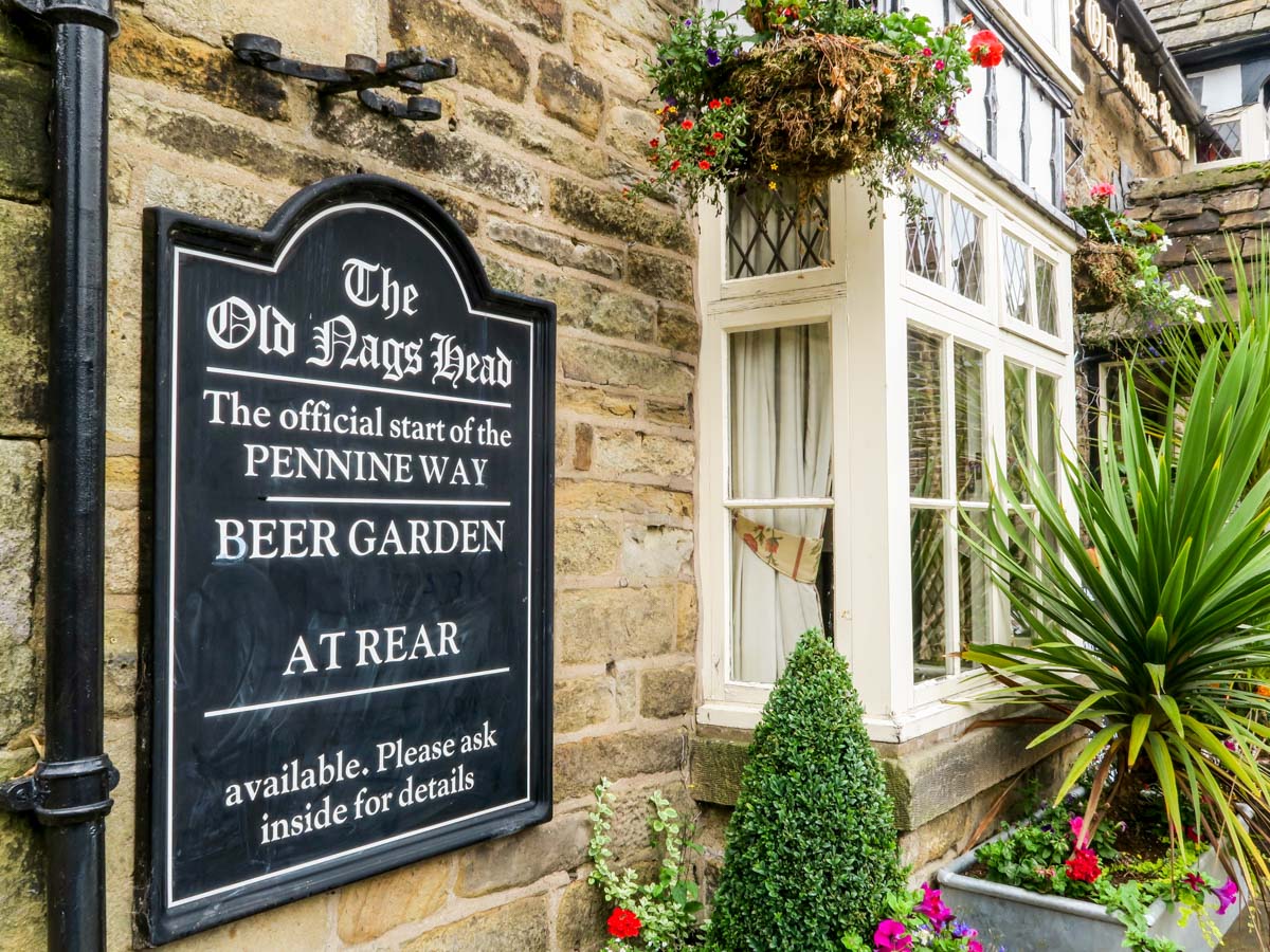
Kinder Scout Walk
Difficulty Rating:
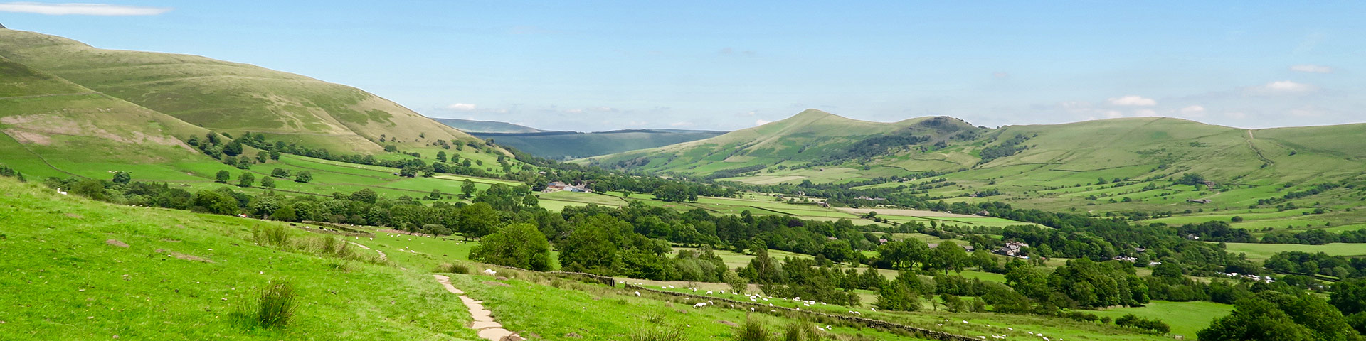
The Kinder Scout Walk is a great trail in the Peak District. Despite being the Dark Peaks' most physically demanding terrain the Kinder Plateau, with its deep cloughs, dramatic edges and peaty trails, has an alluring charm that brings walkers back again and again.
Getting there
To get to the start of The Kinder Scout Walk, find your way to Edale. The trailhead is by the Old Nags Head and marks the start of the famous Pennine Way. You can reach it by going left after exiting the station/car park to the village centre, passing the Ramblers Inn and continuing until you reach the Pennine Way starting point.

About
| When to do | All Year |
| Backcountry Campsites | Yes. Fieldhead Campsite Edale OR YHA Camping Barn Edale recommended |
| Toilets | At the trailhead |
| Family friendly | No |
| Route Signage | Poor |
| Crowd Levels | Moderate |
| Route Type | Circuit |
Kinder Scout Walk
Elevation Graph
Weather
Kinder Scout Walking Route
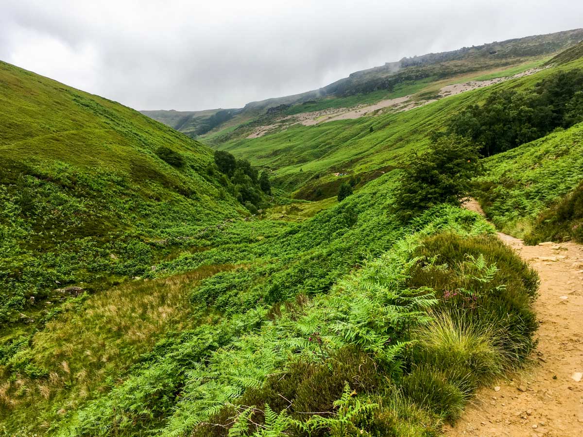
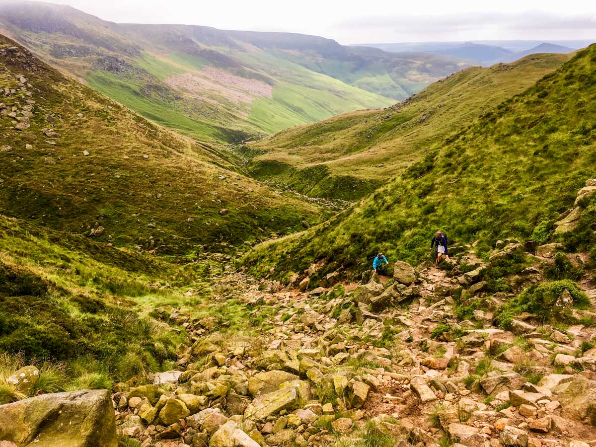
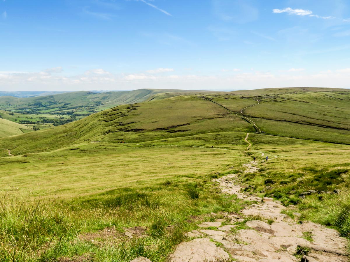
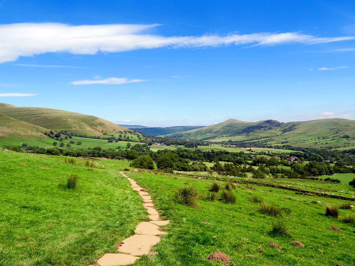
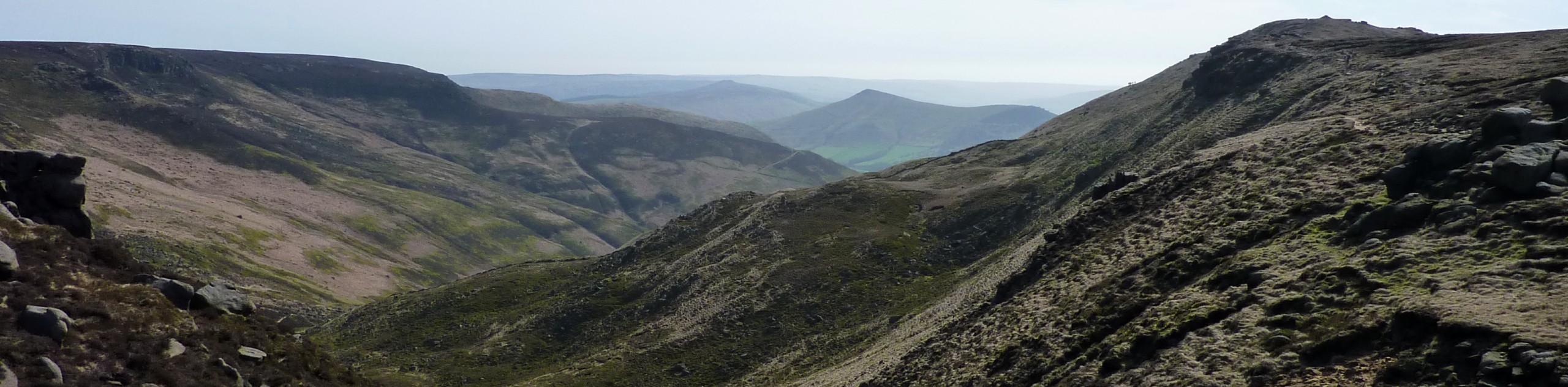
The Kinder Scout Walk starts past the Old Nags Head. Here, follow the road that goes left after exiting the station to its end where a sign will point you to the right, down to the wooded clough. Cross and join a well-defined route that follows the clough. The hard edge of the Kinder Plateau dominates the landscape. It is almost 1.9mi to the top of the Plateau from here, and the trail gets progressively steeper and rockier as you ascend.
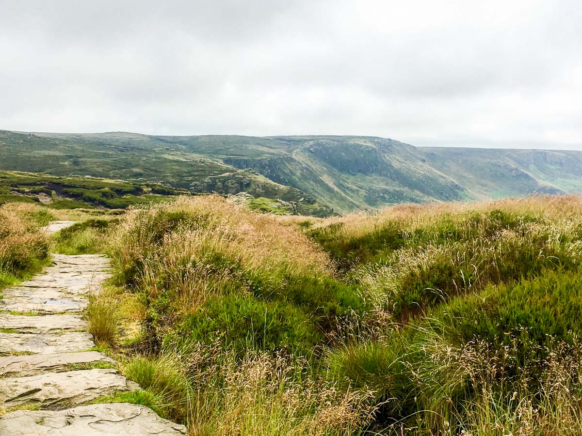
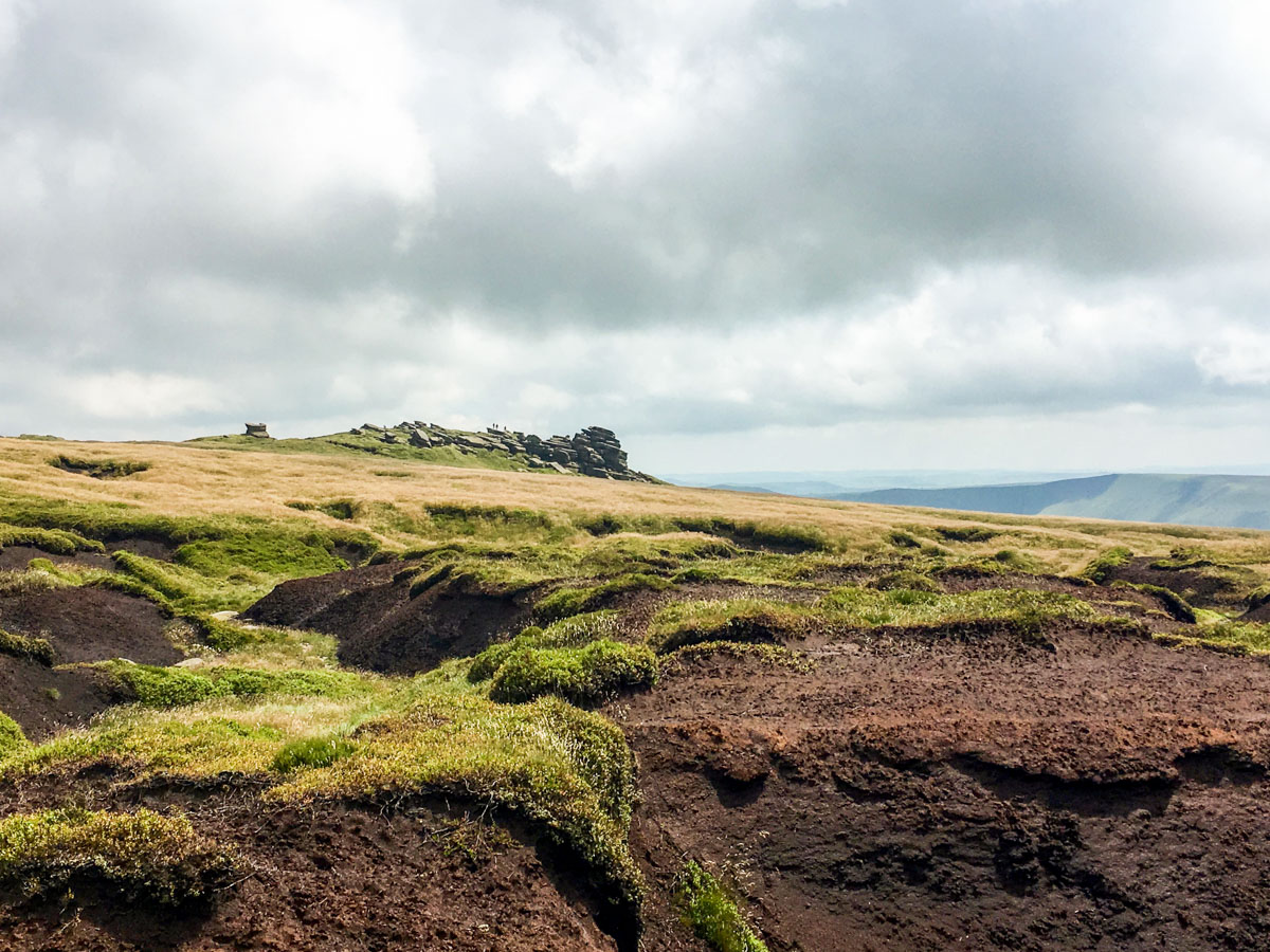
Keep left near the top of Grindsbrook Clough and join the flagstone path across the Plateau towards Kinder Downfall. The views are magnificent on a clear day. Not far along the path, you will come to Crowden Tower and a small downfall at the head of Crowden clough (see insiders tips for an alternative ascent).
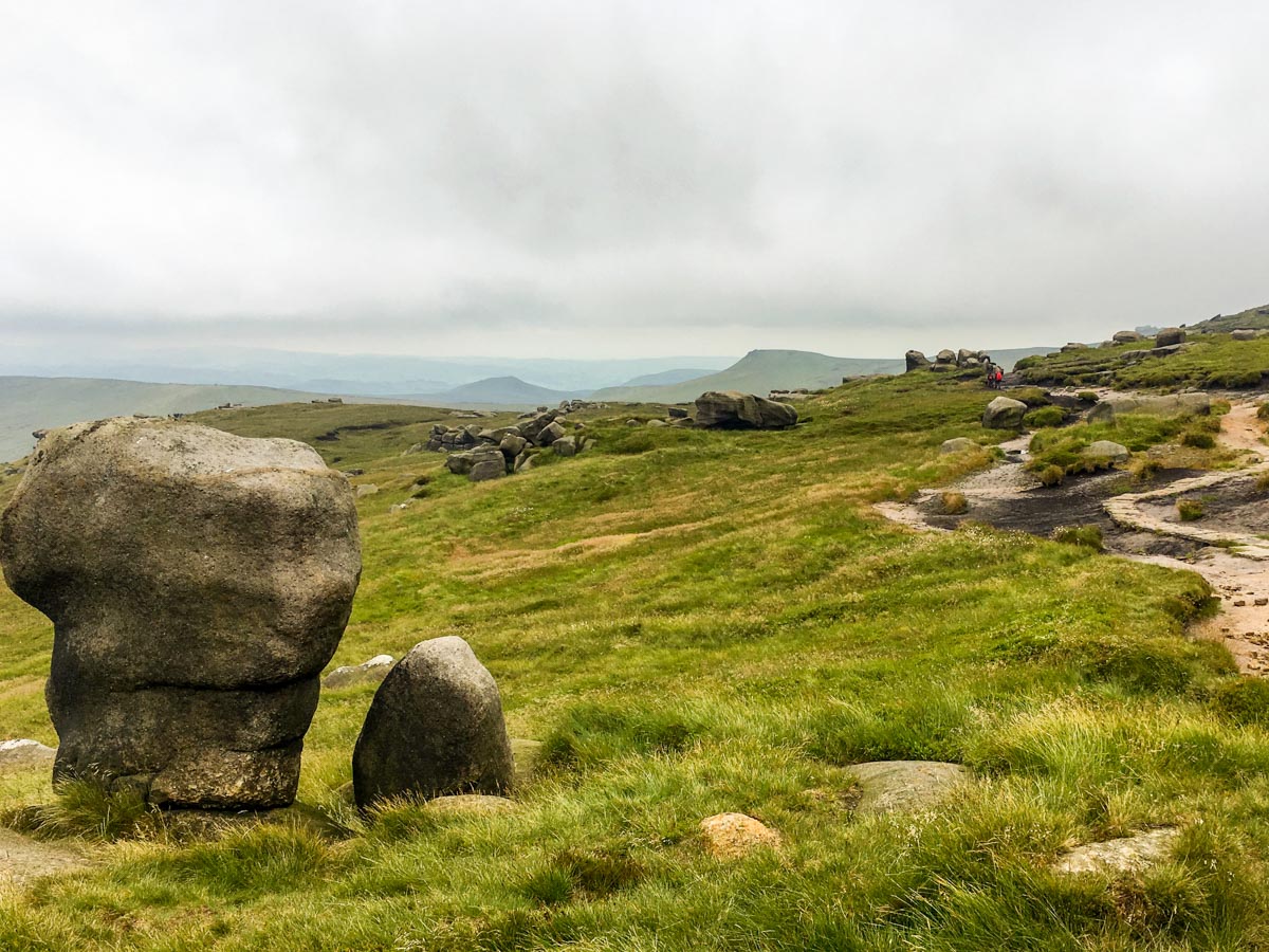
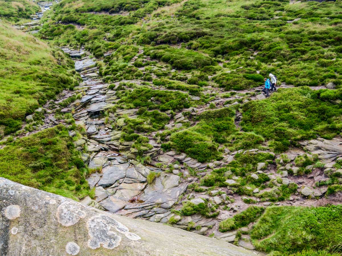
Instead of crossing the stream to reach the rocky outcrops on the far side, take a right and follow the watercourse (normally dry) upstream. This is a surreal section of the Kinder Scout Trail and you can often feel as if you are on another planet, walking through an undulating peat desert.
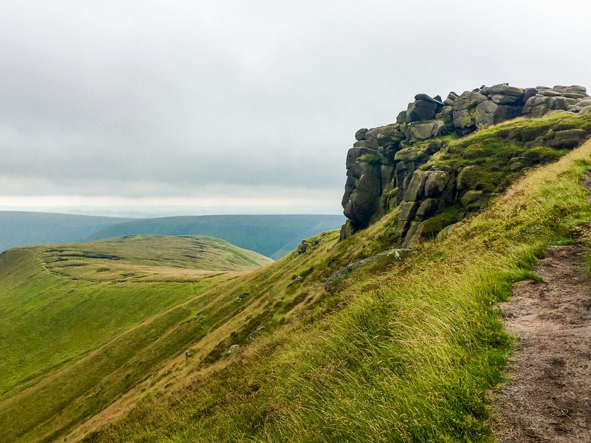
Ignore the cairn to your right for Crowden Head and keep heading north west across the moorland, following the path as it drops into another channel that feeds the River Kinder. Follow this trench-like path downstream as it widens and passes through Kinder Gates and arrives at Kinder Downfall, the other edge of the Plateau. It can get a bit wet between the rocky outcrops at Kinder Gates. There is a higher, less clearly-defined path if needed.
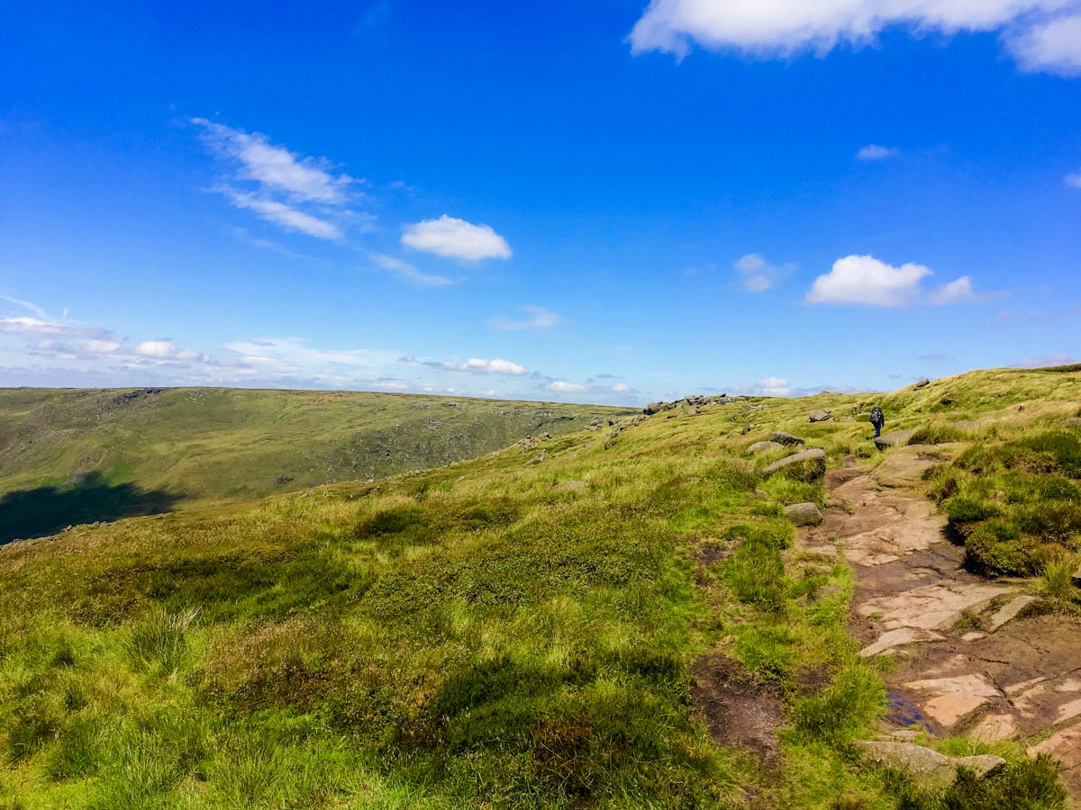
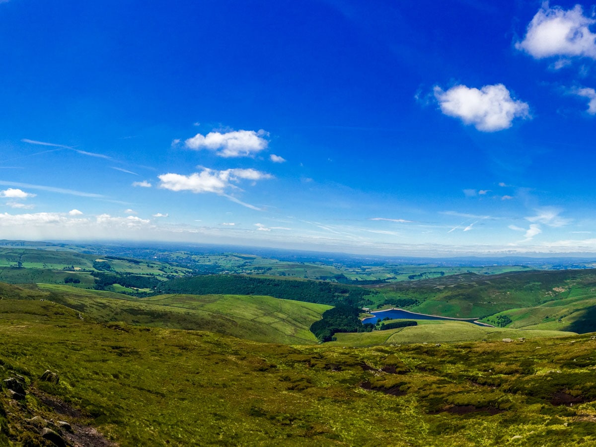
At Kinder Downfall the path intercepts the Pennine Way and you have spectacular views out across Kinder Reservoir, Hayfield, and Glossop below. Turn left and follow the Pennine Way south along the edge of the Plateau, enjoying the panoramas.
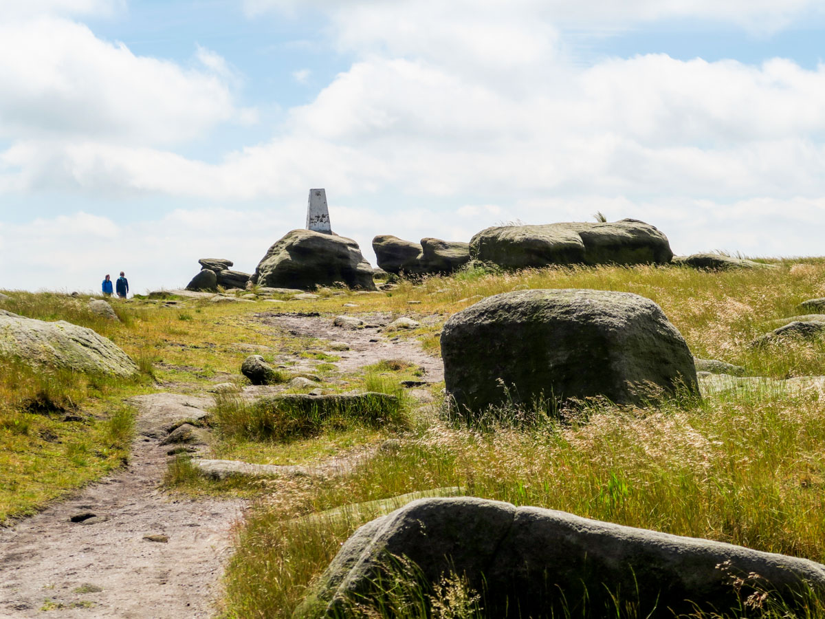
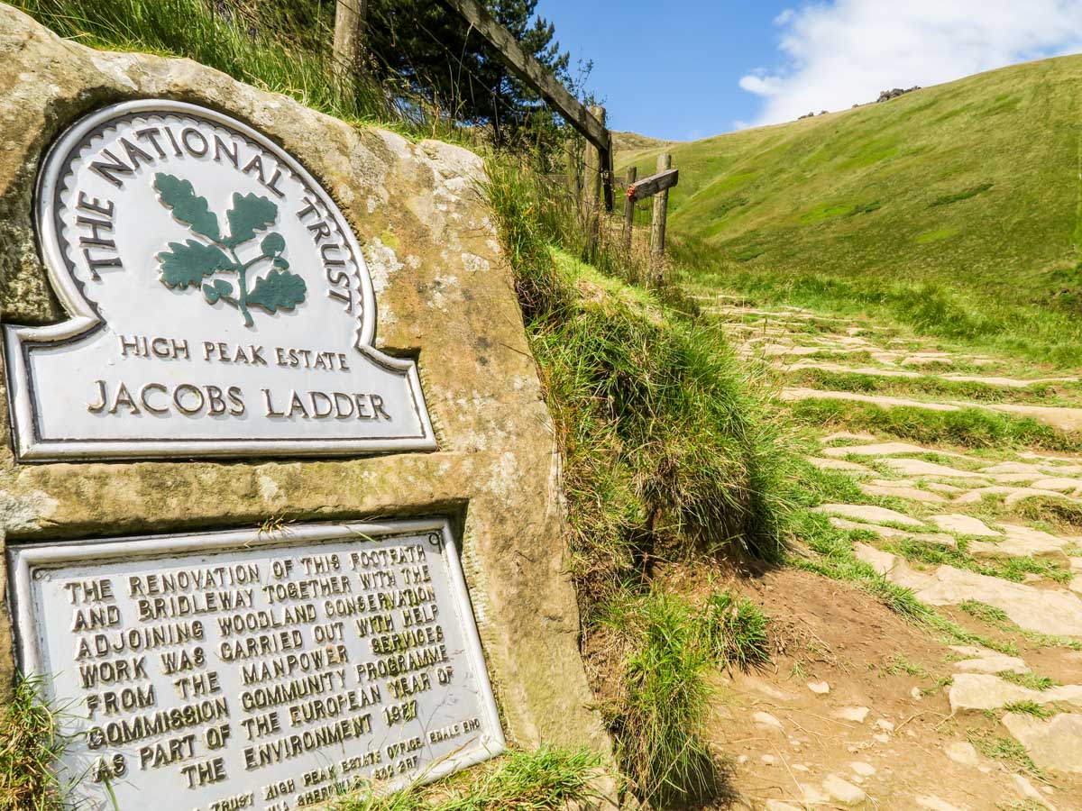
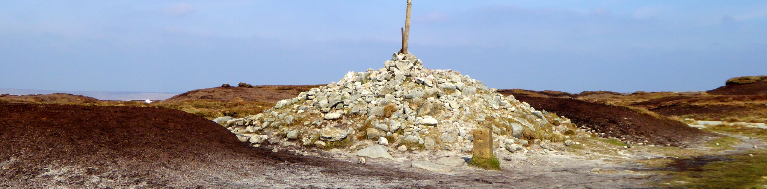
After 2.0mi you will reach the Kinder Low Trig Point. From this point you will begin your descent back to Edale via Edale and Jacob’s Ladder, a steep zigzagged series of steps parallel to the River Noe. At the foot of Jacob’s Ladder, you will pass over Youngate, a packhorse gate, and join a broad track towards Upper Booth. As you walk, the Great Ridge can be seen ahead of you.
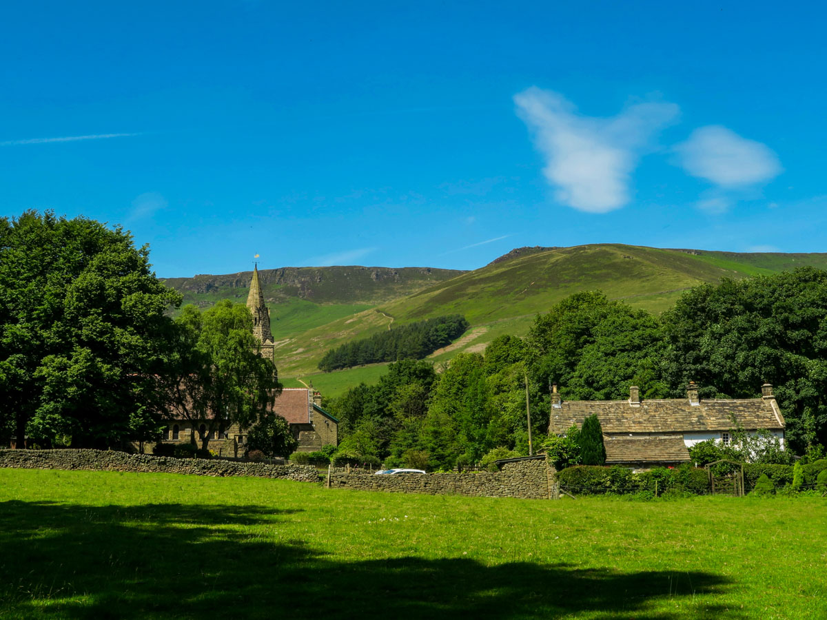
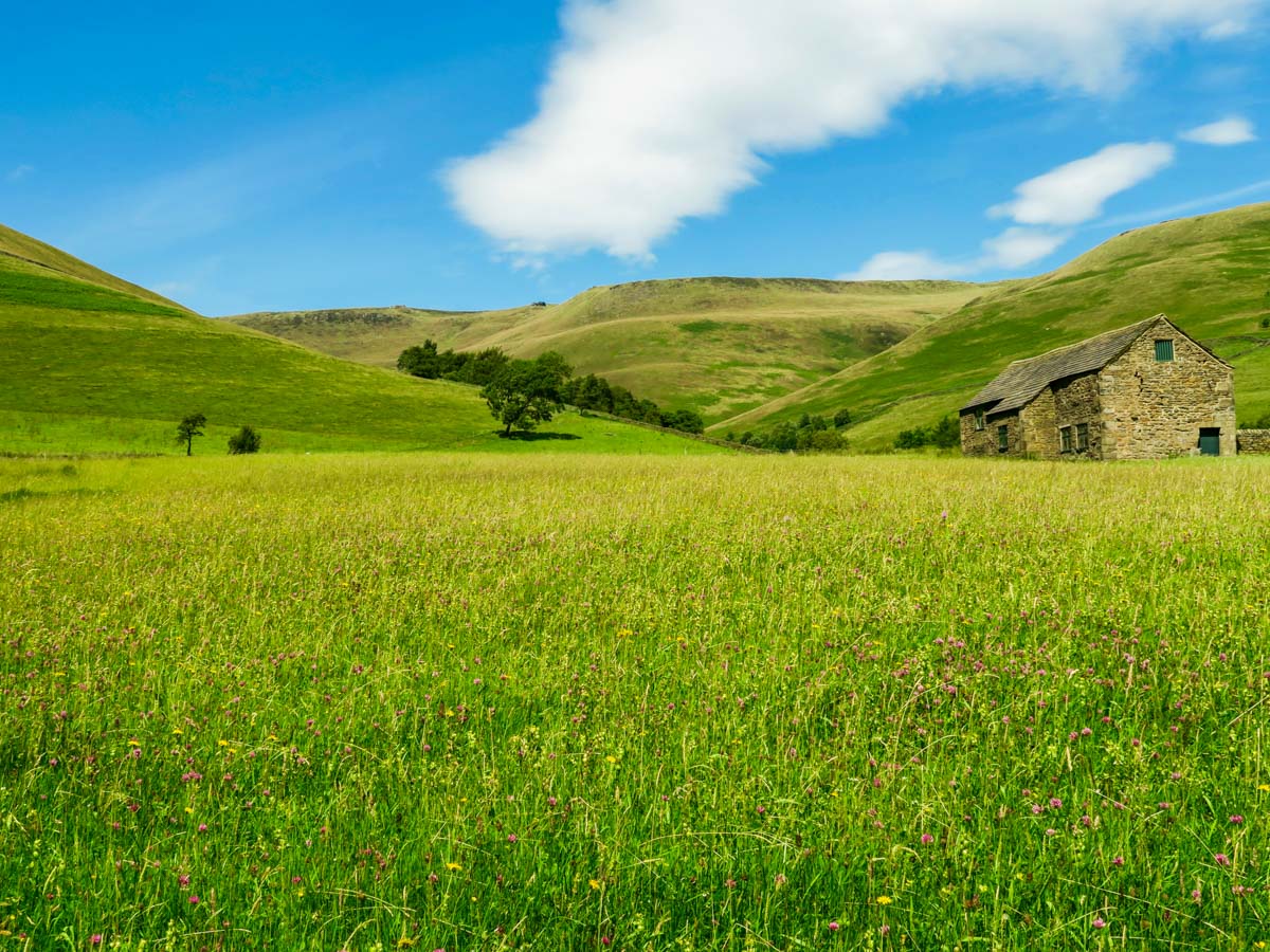
A Pennine Way signpost will guide you through the farmyard in Upper Booth and onto a section of grazing land beneath the Kinder escarpment. It is a flagstone path and easy to follow. Eventually, another signpost will appear and point you right through a gate and down a tree-shaded path emerging at the trailhead and the Old Nags Head.
Walk the Kinder Scout in 2024
In 2024, Kinder Scout in the Peak District has seen a significant expansion of its National Nature Reserve by 25%, an increase that translates to an additional 226 hectares. This expansion is part of efforts to enhance the area’s capability for scientific research, particularly focusing on climate change and peatland restoration.
Additionally, if you’re planning to visit Kinder Scout, consider taking advantage of guided walks offered through local adventure groups for the 2024 walking season.
This ongoing restoration work and the opportunity for guided exploration make Kinder Scout an increasingly appealing destination for hikers interested in both the natural environment and conservation efforts in 2024.
Walking Route Highlights
Kinder Scout
The moorland plateau of Kinder Scout stands as the highest point of the Peak District, at 2087ft above sea level. This wild peat moor is one of the most popular spots in England for hiking, and the gritstone cliffs of the plateau also offer plenty of treats for rock climbers. Located in the heart of the Dark Peaks, the area around Kinder Scout is steeped in myth and legend. Look out for the Mermaid’s Pool, a small tarn next to the Kinder Downfall, where a mysterious mermaid is said to grant immortality to passing walkers, provided they catch sight of her on the eve of Easter.
Kinder Scout is also the location of an important piece of Peak District, and English, history. This iconic moorland was the site of the 1932 Mass Trespass, when local residents staged a peaceful protest against plans to restrict access to the region. At that time the bulk of the Peak District was privately owned, but the protests gave rise to a change in legislation that permitted universal access to moorland in Britain. This important movement eventually led to the creation of the national parks in England, with the Peak District taking pride of place as the very first to be established. Today, we owe our right to enjoy this beautiful corner of the world to those people who protested on Kinder Scout almost a century ago.
In addition to the rolling moorland and glorious views, there are plenty of other attractions around Kinder Scout. You’ll find everything from Bronze Age barrows to medieval crosses, such as the famous Edale Cross, just south of Kinder Scout. This remarkable area of the Peak District is a true haven for lovers of history, legend, and the Great Outdoors.
Kinder Downfall
The ominously-named Kinder Downfall is a stunning waterfall on the River Kinder, plummeting 30m down over the gritstone cliffs. In fact, it’s this waterfall that gives Kinder Scout its name – the falls were originally known as Kinder Scut. It’s best to visit the waterfall in winter or spring, when the river has been fed by the rain and the flow is strong and gushing.
In very blustery weather the spray from the falls makes an impressive sight, and a wonderful opportunity for fans of photography. The cloud of water droplets can sometimes be seen for miles around. In winter the falls often freeze, creating a unique challenge for daring climbers.
Kinder Reservoir
The Kinder Reservoir is situated in a picturesque spot in the shadow of Kinder Scout. This large, serene reservoir covers 44 acres, and at the point of its construction in 1911, it was thought to be the largest earth dam in the world. The Kinder River flows down from the Kinder Plateau and straight into the reservoir.
The area around the Kinder Reservoir is ideal for walking and there are many trails that lead from its shores up to the summit of Kinder Scout. Don’t miss the pretty path at William Clough, which winds its way up the clough past heather-strewn moorland, gurgling streams, and miniature waterfalls. This picturesque spot is just a few miles from the Peak District village of Hayfield, a medieval settlement and the perfect spot for lunch or an overnight stay.
More Interesting Facts about Kinder Scout Walk
How long does it take to walk up Kinder Scout?
There are many routes up Kinder Scout, but the most popular is the classic trail from Edale. This route takes 4-5 hours to complete.
Is Kinder Scout a difficult walk?
Whichever route you choose, the ascent of Kinder Scout is a challenging walk, passing over varied, rough terrain and requiring some difficult uphill sections. The real challenge with this walk, however, is the weather. The Kinder Plateau is very exposed, so it’s best to dress in layers and be prepared for all weather eventualities!
Is Kinder Scout dangerous?
Although Kinder Scout is a challenging hike, it should be manageable for most fit walkers. However, even experienced hikers need to take care on the Kinder Plateau, particularly in wet and wild weather. The moorland can be disorientating for people who don’t know the paths well and it’s easy to lose your way. Always come well prepared, with warm, waterproof clothes, proper footwear, and some equipment in case of emergencies.
What does Kinder Scout mean?
Kinder Scout is derived from Kinder Scut, the former name of the Kinder Downfall. This beautiful waterfall flows from the Kinder Plateau over a gritstone ridge, and it is this that gave it its original name. Kinder Scut comes from the Old English ‘kyndwyr scut’, meaning ‘water over the edge’.
Is Kinder Scout boggy?
Despite improvements to the paths in recent years, the trails across Kinder Scout can often be waterlogged and boggy. Make sure you come equipped with waterproof clothing and good quality footwear (and bring a change of socks!).
Is there a trig point on Kinder Scout?
There is no trig point to mark the summit of Kinder Scout, but you will find one nearby at Kinder Low.
Is Kinder Scout classed as a mountain?
There is no universally accepted definition of a mountain, although some geographers classify any hill over 984ft in altitude as a mountain. Kinder Scout is 2087ft high, and is generally referred to as a Peak District mountain.
Can you see Snowdon from Kinder Scout?
On a clear day it is possible to see all the way over to Snowdonia from Kinder Scout, a distance of around 90.0mi. Although technically it’s possible to see Mount Snowdon itself, you would need very keen eyes to make out the hazy peak in the distance.
Want to find less challenging walks in the Peak District with amazing views? Check out the Stanage Edge Walk, Mam Tor Walk or the Dovedale Walk.
Insider Hints
The Kinder Plateau can be disorientating even in good weather and it can be easy to come off the path. Be sure to bring a compass and know how to use it.
For an even more challenging ascent consider the scramble up Crowden Clough to Crowden tower instead of going via Grindsbrook. This path can be accessed just off the Pennine Way from Upper Booth Farm.
Stop for a celebratory pint at the cosy Ramblers Inn before jumping on the train home.

Similar hikes to the Kinder Scout Walk hike

Three Edges Walk
The Three Edges Walk is a challenging circuit in Derbyshire that will take you along three escarpments that offer some…
Bleaklow Head via Torside Clough
The Bleaklow Head via Torside Clough walk is a tough but rewarding route that will take you up a steep…
Jacobs Ladder and Edale Circular Walk
Walking the Jacobs Ladder and Edale Circular is a fun, if exhausting experience that will take you to some of…
callumwalsh14 2 years ago
Ended up going a different route to get to the top, missed a few sights of the actual walk itself to reach the highest point. Would of rated higher, will definitly be attempting again on the correct route. Nice café at the bottom.
sooandjack@gmail.com 3 years ago
it was a very steep scramble up what seemed like a river in places. We were fine, but some other hikers had to turn back. At the top the path across the moor was in places extremely hard to follow and we actually turned back to follow the main path past the great rock formations, as we were stuck wallowing in great peat cracks in the ground with no obvious path.
Karl 3 years ago
Seriously good walk. Strongly suggest you only undertake it with good navigational skills as I went wrong at the top and in poor conditions you could find yourself in trouble. Top tip to save yourself some money, park at the free car park in Barber Booth and pick up the walk from there. This is a seriously popular area and parking is difficult.
ahossack91 4 years ago
Did this walk on a mild enough November day. Everything was great apart from the moorland which was extremely muddy and boggy! This slowed us down a lot trying to find a good path through. All fun none the least and back to Edale just before dark.
Cassie Saab 4 years ago
I think it is perfectly normal to get tired at some point, but we enjoyed it!
helenajones 4 years ago
helenajones 4 years ago
Gorgeous views, very windy at the top wind proof wear and something to cover your eyes and ears is recommended.
morro6590 4 years ago
Really enjoyed this one! Beautiful day, fun scramble up to the top of kinder plateau. Took me a little while to get my bearings through the moorlands mainly as I took bit of a detour and joined the route a little further down the line. Easy to see why you can get lost up there, very boggy and lots of little streams feeding through. Once you have the River Kinder on your right hand side the route is pretty straight forward to follow, leading you to Kinder Downfall and then looping round down to Jacob’s Ladder back into Edale.
Hunter156 4 years ago
Kinder Scout Walk is quite challenging because of the varied rough terrain but the view from the top is surely magnificent! I highly recommend this one.
Squarepants11 4 years ago
It was a great experience!