Holme Moss Walk
View Photos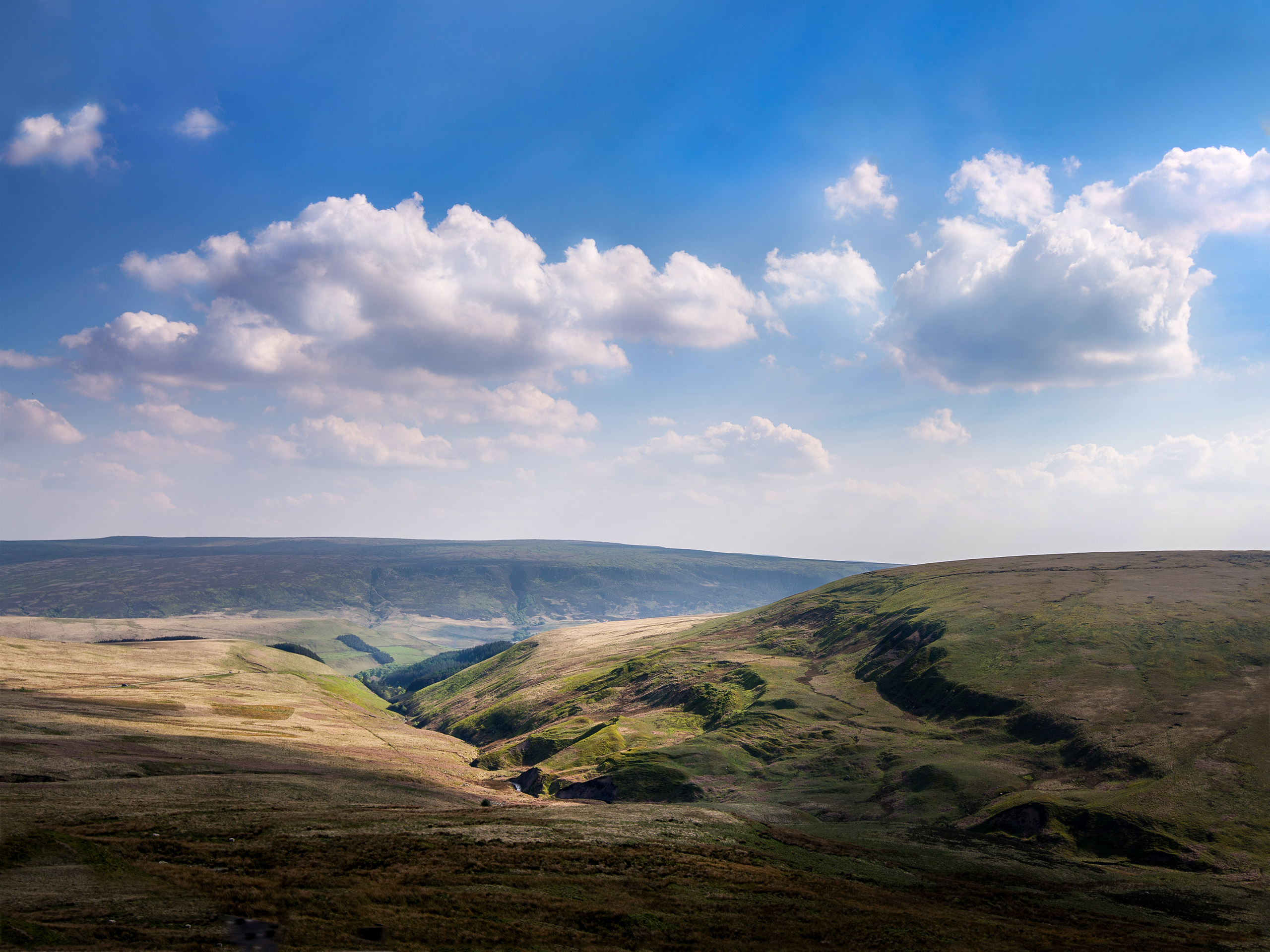
Holme Moss Walk
Difficulty Rating:
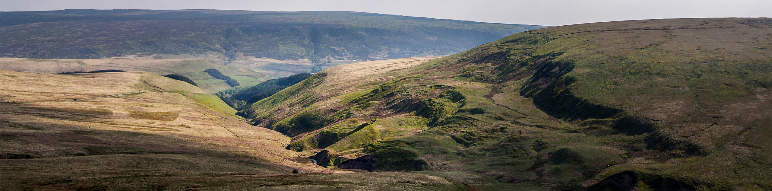
The Holme Moss Walk is a great long distance walk on the edge of the Peak District that will take you uphill to the summit of Black Hill. While out on the trail, you will experience the peaceful waterside atmosphere of the numerous reservoirs that can be found along the route, and make your way across the ruggedly beautiful terrain of the surrounding moorland. While not overly difficult or technical, this route is a bit longer than most and offers a good opportunity for casual walkers to build up their experience with longer distances.
Getting there
To get to the trailhead for the Holme Moss Walk from Holmfirth, drive southwest on Huddersfield Road/A6024 for 2.7mi to arrive at the trailhead in the centre of the village.

About
| When to do | March-October |
| Backcountry Campsites | No |
| Pets allowed | Yes - On Leash |
| Family friendly | Older Children only |
| Route Signage | Poor |
| Crowd Levels | Moderate |
| Route Type | Circuit |
Holme Moss Walk
Elevation Graph
Weather
Holme Moss Walk Description
The Holme Moss Walk is a nice longer distance walking route on the edge of the Peak District; however, trail conditions and some unclear pathways can make it a bit challenging in some areas. Make sure to bring a GPS or trail map in order to stay on the correct route, as certain points along the walk will see you stray from the main path. Additionally, there is a good portion of this walk that is fairly boggy, so make sure to wear proper walking footwear, ideally waterproof so that you can stay comfortable out on the trail.
Although the route can be a bit tricky in places, this is a fantastic walk that will allow you to explore the beauty of the Peak District along a trail that features a little more distance than most. Setting out from the village of Holme, you will make your way past the Digley and Bilberry reservoirs, before climbing uphill along the moor to visit the summit of Black Hill. From here, you will walk across the high plateau and make your descent along several scenic reservoirs to return to the village. Spectacular views across the hilly landscape of the moor await, so strap on your walking boots and get ready to explore the Peak District!
Setting out from the village of Holme, follow Meal Hill Road to the north for 375ft and take the path to the right to make your way between the buildings. Follow this north for 0.6mi to cut across several fields and arrive at a junction. Go left here and pass through a series of gates to make your way over the dam wall that separates the Digley and Bilberry reservoirs. Once you have reached the opposite side, continue along the path as it leads to a gate and arrives at a junction.
Follow the track to the left for 0.3mi, where you will come to an intersection. Head left here and keep straight along the track for 0.9mi, keeping Marsden Clough below you on the left as you gain some elevation through the countryside. Taking the path to the left, follow it down to a junction next to Marsden Clough, making sure to turn right to cross over the stream. Once you are on the other side, continue along the path for 1.0mi, as you climb uphill along the moor and cross over Hey CLough, before arriving at a junction with a track.
Turn right and follow this west for 0.4mi, turning left at the junction to continue climbing uphill on the ascent of Black Hill. Once there, take some time to explore the area and take in the amazing views that look out across the beautiful rolling hills of the peak district and the many farms, villages, and forests that make up its domain. After taking in the sights, follow the path to the east to begin making your way along the plateau. Keep left along the trail for 1.5mi, taking in the sights across the moor as you make your way down toward the edge of Woodhead Road. Follow this to the left for 0.2mi and cross over to the other side to pick up the trail as it passes through a car park next to a picnic area.
Continue east along the trail for another 1.6mi, enjoying the natural beauty of the rugged moorland terrain until you cross Ramsden Clough and arrive at a junction. Head left and keep straight along the trail for 1.3mi, passing over several small streams and some boggy terrain, before arriving at a junction with a track. Follow this to the left, where you will reach the southern tip of Crossley’s Plantation, a large wood that widens toward the north. Turn right and make your way along the western edge of a treeline that will be sparse at first but will very quickly become more dense.
Eventually, you will meet up with Ramsden Road and will need to turn left to follow along it for 0.3mi. Turn left here to follow the road for, keeping right as it descends the hillside towards the reservoirs. After 0.4mi, take the second path on the left to follow along the edge of the forest and arrive at the dam wall between the Ramsden and Brownhill reservoirs. Walk across the wall and follow along the path for 0.6mi, as it crosses over the Rake Dyke to arrive back at the village of Holme, where you began your journey. If you are looking to celebrate having completed the lengthy Holme Moss Walk, try heading into the Fleece Inn in the centre of the village for some post-walk refreshments.
Other amazing walks in Peak District National Park
Check out our guides to Kinder Scout, Mam Tor, Stanage Edge, Dovedale, and Padley Gorge. Or see all of our Peak District walks on 10Adventures.
Insider Hints
A decent portion of this walk is along the boggy terrain of the moor. Make sure to wear decent walking footwear that is ideally waterproof in order to stay comfortable on the trail.
Bring a trail map or GPS, as the route can be hard to discern in certain areas.
Pop into the Fleece Inn in the centre of the village for some post-walk drinks and food.
Similar hikes to the Holme Moss Walk hike

Valehouse Reservoir Circular
The Valehouse Reservoir Circular is a 3.1mi lollipop trail near Glossop that travels around the edge of the…

Three Edges Walk
The Three Edges Walk is a challenging circuit in Derbyshire that will take you along three escarpments that offer some…

Edale Rocky Ridges Walk
The Edale Rocky Ridges Walk is just that - an adventurous walk along a rugged ridgeline. While out on the…
Comments