Peak Forest Canal Walk: Marple to Whaley Bridge
View Photos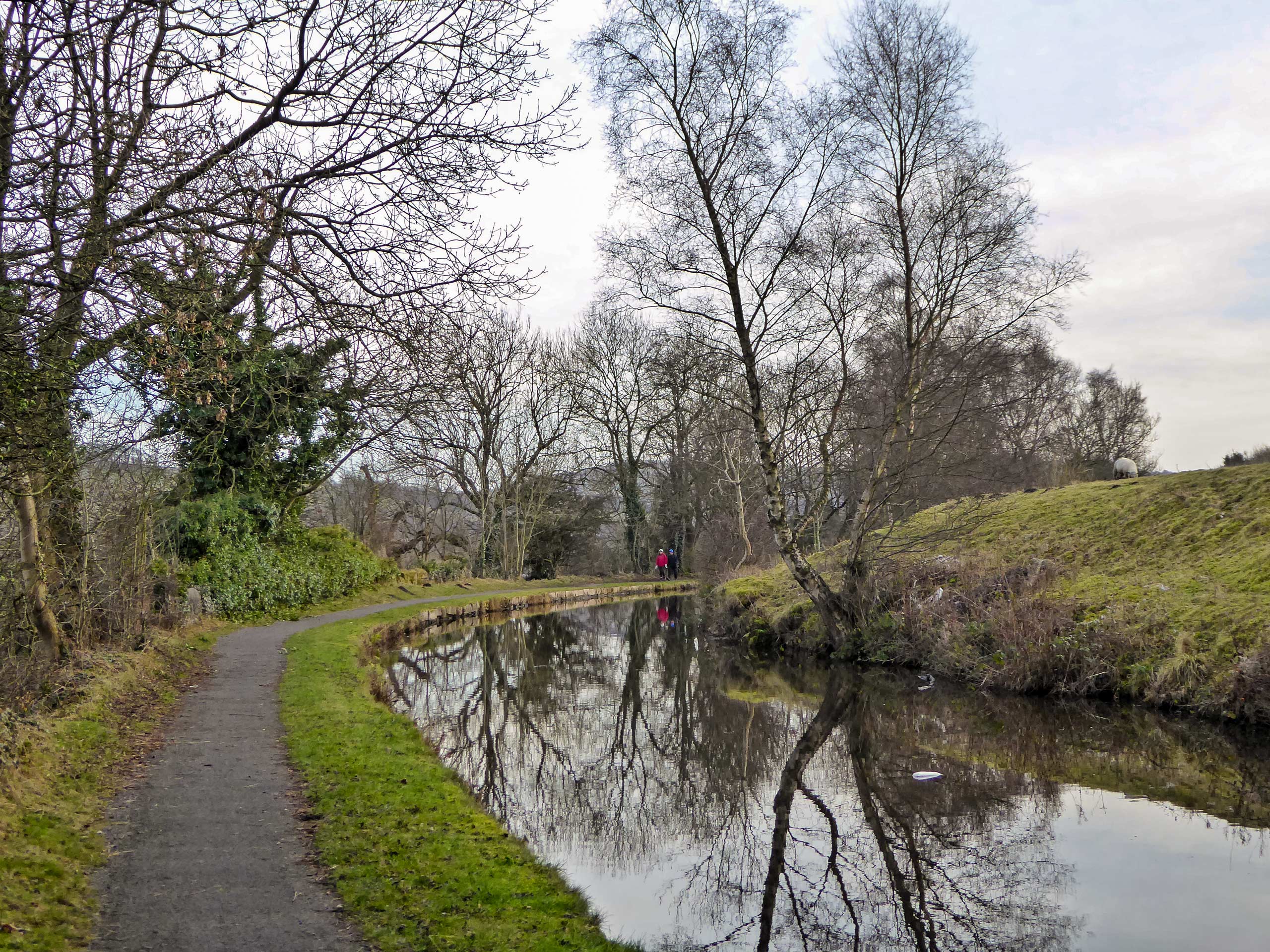
Peak Forest Canal Walk: Marple to Whaley Bridge
Difficulty Rating:
The Peak Forest Canal Walk is an easy-going walking route that will take you along the edge of a scenic canal from the town of Marple to Whaley Bridge. Along the walk you will experience a variety of scenery including uban, countryside, and waterside views that highlight the beauty of the area. The route is largely made up of paved and well-maintained gravel pathways that are relatively flat, making for a pleasant experience that can be enjoyed by walkers of every skill level.
Getting there
To reach the car park for the Peak Forest Canal Walk from Stockport, drive east on Hall Street/A626 for 3.7mi and turn left onto Station Road. In 0.7mi, turn left to enter the car park at the rail station.

About
| When to do | Year-Round |
| Backcountry Campsites | No |
| Pets allowed | Yes - On Leash |
| Family friendly | Older Children only |
| Route Signage | Average |
| Crowd Levels | Moderate |
| Route Type | One Way |
Peak Forest Canal Walk: Marple to Whaley Bridge
Elevation Graph
Weather
Peak Forest Canal Walk: Marple to Whaley Bridge Trail Description
The Peak Forest Canal Walk is a point-to-point trail, and while it can certainly be done as an out-and-back, the 19.0mi overall distance would be a lot for many people to handle. Luckily, this route starts and ends at each respective town’s railway station, making for a quick and easy return journey back to the starting point. Make sure to wear some comfortable footwear for the walk as much of the trail is hard pavement or gravel that can be a bit hard on the joints.
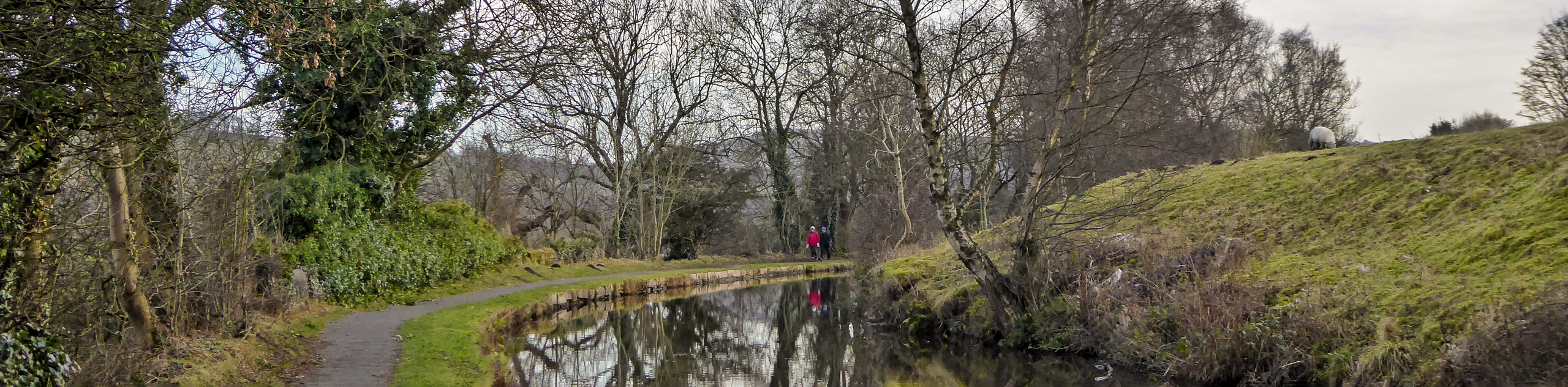
Just because this walking route passes through several urban areas, doesn’t mean that it can’t be an enjoyable experience packed with beautiful scenery. While out on the trail, you will meander along the edge of the canal and take in some intermittent views of the surrounding English countryside and historic buildings that dot the landscape. If you are looking for a leisurely stroll, then this walk is definitely for you.
Setting out from the car park at the Marple railway station, make your way to the road and turn right, following along it for 0.1mi to cross over the canal and access the trail on the south side of the road. Once there, follow along the edge of the water for 0.3mi, keeping Marple Memorial Park on your right until you pass under Strines Road. Continue along Lockside for 0.2mi, crossing the bridge over the Macclesfield Canal to pick up the trail on the left hand side. Continue along the edge of the canal for another 0.2mi to cross Brick Bridge, making your way down along the trail to once again reach the edge of the water.
Keep straight along the edge of the canal for the next 3.7mi, taking in the views of surrounding buildings, open fields, and stretches of woodland as you meander along the relaxing trail. When you have reached a junction in the trail branching off to the left to Victoria Street, follow it onto the road and continue north for 400ft to cross Albion Road and arrive at Grove Street. Turn left and follow the road for 0.2mi to pick up a trail on the right that will lead you through a forest and over the River Goyt.
Once you are across, turn right to follow Station Road for 430ft before picking up the trail on your right that will take you through Torrs Riverside Park. Enjoy the tranquil atmosphere of the park, as you stroll along the Millenium Walkway, taking in the sights of the Torr Vale Mill, beautiful arched bridges, and charming waterside landscape. After taking in the beauty of the park, follow the trail near Torrs Hydro that leads south and crosses over the River Sett.
After crossing the bridge, make your way along the River Goyt for 0.5mi and turn right at the junction. In 0.1mi, you will pass through a series of gates and cross over the flowing waters of the river. Keep left at the two successive junctions and make your way over the stile, following the path for 0.3mi until you pass by Carr Farm on your left and arrive back at the Peak Forest Canal. Follow the path along the eastern bank of the canal, enjoying the views of charming canal boats and heavy forest that characterize the landscape.
Continue your leisurely stroll along the edge of the water for 1.3mi and enjoy the changes in scenery as you approach a bridge over the canal where it meets up with the Goyt River. Pass straight through the junction and follow the trail east along the canal for 0.6mi to arrive at the Bugsworth Canal Basin, a historically busy throughway for the transportation of limestone along the water. After taking in the views of the historic buildings, head back along the trail to the junction and turn left to cross the bridge.
Once across, continue along the edge of the canal for the final stretch of the walk. After 0.4mi, make your way across another bridge and walk past the Whaley Bridge Wharf. Turn right on Canal Street and follow it around the bend. When you have come to the fork in the road, you will have reached the end of the Peak Forest Canal Walk. From here, you can either head to the left to pop into The Goyt Inn for some celebratory drinks, or go right to arrive at the railway station to make the quick journey back to Marple.
Other amazing walks in Peak District National Park
Check out our guides to Kinder Scout, Mam Tor, Stanage Edge, Dovedale, and Padley Gorge. Or see all of our Peak District walks on 10Adventures.
Insider Hints
Make sure to wear comfortable walking shoes for this flat, partially paved trail.
Walkers can either take the train back to the starting point in Marple or complete the route as a 19.0mi out-and-back journey.
Similar hikes to the Peak Forest Canal Walk: Marple to Whaley Bridge hike

Valehouse Reservoir Circular
The Valehouse Reservoir Circular is a 3.1mi lollipop trail near Glossop that travels around the edge of the…

Three Edges Walk
The Three Edges Walk is a challenging circuit in Derbyshire that will take you along three escarpments that offer some…

Edale Rocky Ridges Walk
The Edale Rocky Ridges Walk is just that - an adventurous walk along a rugged ridgeline. While out on the…
Comments