Errwood Reservoir Walk
View Photos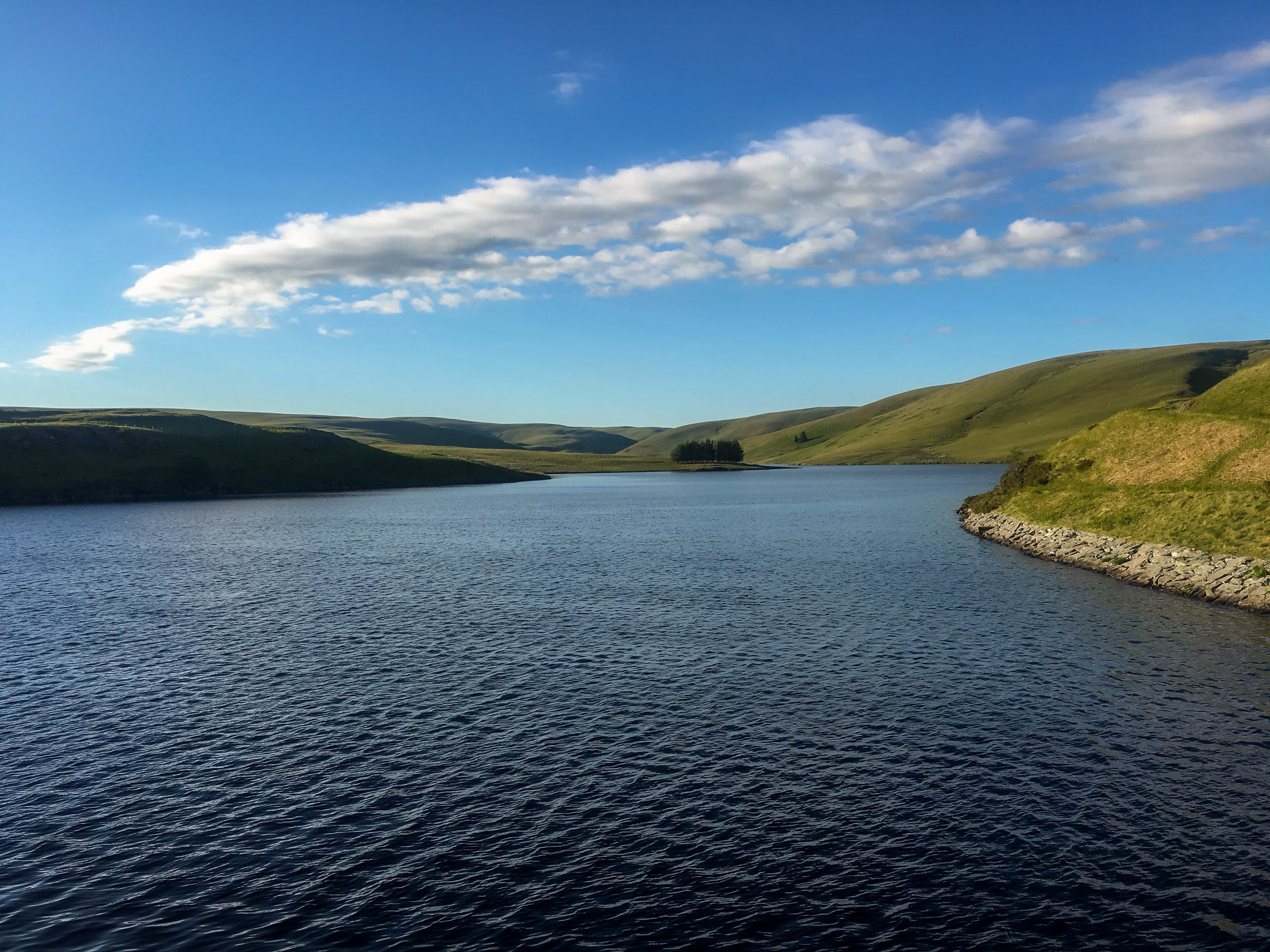
Errwood Reservoir Walk
Difficulty Rating:
Exploring the countryside along the Errwood Reservoir Walk is a fun experience that will allow you to discover historical sites and amazing views from the summit of two peaks. The walk climbs uphill along the moor to the vantage points atop Cats Tor and nearby Shining Tor before descending through the forest to visit the Ruin of Errwood Hall. With a return journey along the edge of the charming Errwood Reservoir, there is no shortage of beautiful sites to experience while out on this intermediate-length walk.
Getting there
To reach the car park for the Errwood Reservoir Walk from Buxton, drive northwest along Manchester Road/A5004 for 1.9mi and make a slight left onto Goyt’s Lane. After 1.6mi, turn left at The Street and you will find the car park on the right.

About
| When to do | March-September |
| Backcountry Campsites | No |
| Pets allowed | Yes - On Leash |
| Family friendly | Older Children only |
| Route Signage | Average |
| Crowd Levels | Moderate |
| Route Type | Circuit |
Errwood Reservoir Walk
Elevation Graph
Weather
Errwood Reservoir Walk Description
To reach the summit of the two peaks, the Errwood Reservoir Walk climbs uphill along terrain that can be fairly steep at times. Make sure to wear decent walking footwear in order to better handle the steep slope and somewhat wet terrain that can be found here during the spring/autumn seasons.
Trail conditions aside, this walk is a great way to explore the summit areas of both Cats Tor and Shining Tor, while taking in the breathtaking views of the surrounding landscape. In addition to the great views, walkers will also be able to explore the tranquil woodland terrain that can be found along the edge of the Errwood Reservoir, and explore some local history with a visit to the Ruin of Errwood Hall. There are a lot of highlights packed into this intermediate length walk, so what are you waiting for!
Setting out from the northern end of the car park, pick up the trail and follow it for 0.2mi until you arrive at the edge of the road. Crossover to the other side and follow the path to the left in order to walk through a beautiful stretch of wood that runs parallel to the road. From the junction, follow this path for 1.0mi as it climbs uphill to once again meet up with the road. Crossover to the opposite side and follow the way marker to pick up the trail for Shining Tor.
Pass through the gate and continue south along the trail, climbing uphill along the moor to eventually reach the summit of Cats Tor. Take in the amazing views of the surrounding landscape that includes the Errwood Reservoir and nearby forests to the east, as well as the rolling hills of the countryside to the west. From the summit, continue south along the path for 1.3mi, where you will find a trail branching off to the right leading to the Shining Tor viewpoint. Make your way over the stile along the stone wall for some more sweeping views over the nearby farms, woodlands, and villages, before heading back to the main trail and continuing south.
After 460ft, you will pass through the gate and follow the path as it bends toward the southeast and begins to descend the hill. Upon reaching another gate, pass through and turn left at the intersection in the trail, following the track as it runs parallel to a stone wall. In 0.7mi, keep right along the trail and follow it across a clearing that runs between two stretches of forest. Pass through the kissing gate and keep right at the next fork to eventually arrive at a four-way intersection in the trail.
Turn left here and make your way through the trees, passing straight through one junction and keeping left at the second to pass through a gate and make your way deeper into the serene forest, eventually arriving at the Ruins of Errwood Hall. Take some time to explore this once-grand building that was built in the 1830s and operated as the centre of a prominent estate, before being dismantled for the construction of the Fernilee Reservoir in 1934.
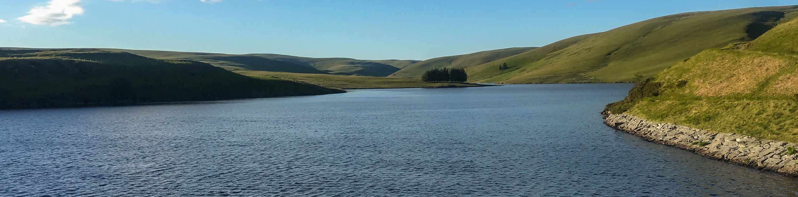
Follow the trail along the northern edge of the ruins for 0.2mi, turning right at the junction to traverse a series of steps. Keep straight through the next two junctions and once you reach the third, take the path to the right. From here, a short 0.2mi walk through the dense forest will bring you to the edge of the road. Go left and follow the road north until you arrive back at the car park, making sure to enjoy the scenic views across the calm blue water of the reservoir. After wrapping up the Errwood Reservoir Walk, you can either head straight home or find another nearby trail to further explore the beauty of the Peak District.
Other amazing walks in Peak District National Park
Check out our guides to Kinder Scout, Mam Tor, Stanage Edge, Dovedale, and Padley Gorge. Or see all of our Peak District walks on 10Adventures.
Insider Hints
The initial half of the route is a fairly steep uphill climb, so come prepared with proper walking shoes for the best footing.
If the car park is full, try parking a bit further south at Errwood Hall car park.
This trail can be wet and boggy at times, especially during the spring/autumn seasons.
Similar hikes to the Errwood Reservoir Walk hike

Valehouse Reservoir Circular
The Valehouse Reservoir Circular is a 3.1mi lollipop trail near Glossop that travels around the edge of the…

Three Edges Walk
The Three Edges Walk is a challenging circuit in Derbyshire that will take you along three escarpments that offer some…

Edale Rocky Ridges Walk
The Edale Rocky Ridges Walk is just that - an adventurous walk along a rugged ridgeline. While out on the…
Comments