Stanton Moor Walk
View Photos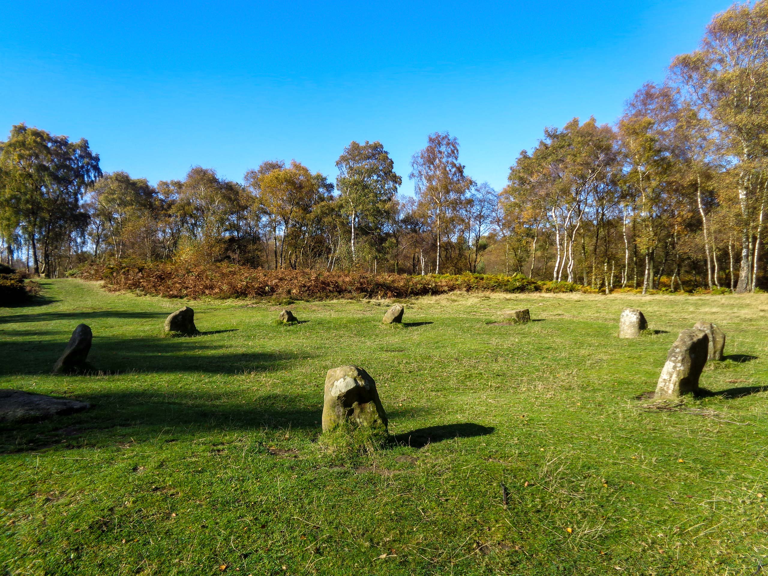
Stanton Moor Walk
Difficulty Rating:
The Stanton Moor Walk is a fun outdoor adventure in Derbyshire that will allow you to look out over the surrounding landscape and experience the beautiful scenery of the Peak District. The walk sets out from the charming village of Rowsley and climbs up the moor alongside the River Wye to provide some amazing views before descending the hillside and returning to the village along the winding waters of the River Derwent. There are a lot of unique places to visit in the village as well, so why not make it a full-day adventure and explore this lovely corner of Derbyshire!
Getting there
To reach the starting point for the Stanton Moor Walk from Bakewell, drive southeast on Matlock Street/A6 for 3.3mi and turn right onto Woodhouse Road. After 460ft, you will find the car park on the right. On foot, continue south along Woodhouse Road for a short distance until you reach Peaktor Lane. Turn right here to arrive at the trailhead.

About
| When to do | March-November |
| Backcountry Campsites | No |
| Pets allowed | Yes - On Leash |
| Family friendly | Older Children only |
| Route Signage | Average |
| Crowd Levels | Moderate |
| Route Type | Circuit |
Stanton Moor Walk
Elevation Graph
Weather
Stanton Moor Walk Description
While the Stanton Moor Walk in Peak District NP isn’t overly challenging or technical, there are a few steep sections of trail on the ascent of the moor, as well as some areas with uneven, rocky, and root-covered terrain. Make sure to wear proper walking footwear to stay comfortable and have the best footing along the trail. Additionally, if you are completing this walk with any canine companions, make sure to keep them on a lead as there will likely be free-roaming livestock in the area.
Moderately challenging terrain aside, this is an amazing walk that will allow you to fully experience the natural beauty and rolling green hills of the Derbyshire countryside. While out on the trail, you will walk alongside winding rivers, dense stretches of wood, and along the elevated moorland that will provide a sweeping view of the surrounding landscape. Combine this with the rest of your afternoon spent in the lovely village of Rowsley and you have an action-packed day that everyone in your walking party will enjoy.
Setting out from the starting point of the walk along Peaktor Lane, follow the road for 0.2mi alongside the winding River Wye and pass through the wooden gate that can be found on your right on the outside corner of the bend. From here, head through the field for 0.4mi, keeping right to make your way towards a gate in the corner of the field. Make your way through the gate to cut through a short stretch of forest, passing through two more wooden gates and crossing over a small stream. Keep on for 400ft, passing through an oft-boggy stretch of terrain to arrive at a stile.
Make your way over the stile and onto the track, passing by Dove House Farm on your right to meet up with Stantonhall Lane. Turn left here and follow the road for 0.2mi, where you will find a gated path on your right. Pass through the gate and continue on through the field for 0.2mi, passing through one gate and climbing a set of steps to arrive at a stile next to Pillough Lane. As you climb the steps, take a look back for some nice views across the Wye Valley before crossing the stile and turning right to follow the road for 0.1mi.
Turn left here and make your way along the edge of Sheepwalk Wood, keeping right for 0.3mi until you meet up with a gravel track that runs alongside a cricket pitch. Continue along the track and pass through the gate, where you will eventually meet up with Lees Road. Turn left here and follow the road for 0.2mi, before turning right to pass through a gate. Follow the path as it cuts across several fields and passes through a series of gates to eventually arrive at the edge of a large wood. Keep straight for 0.2mi, where you will come to a fork in the trail.
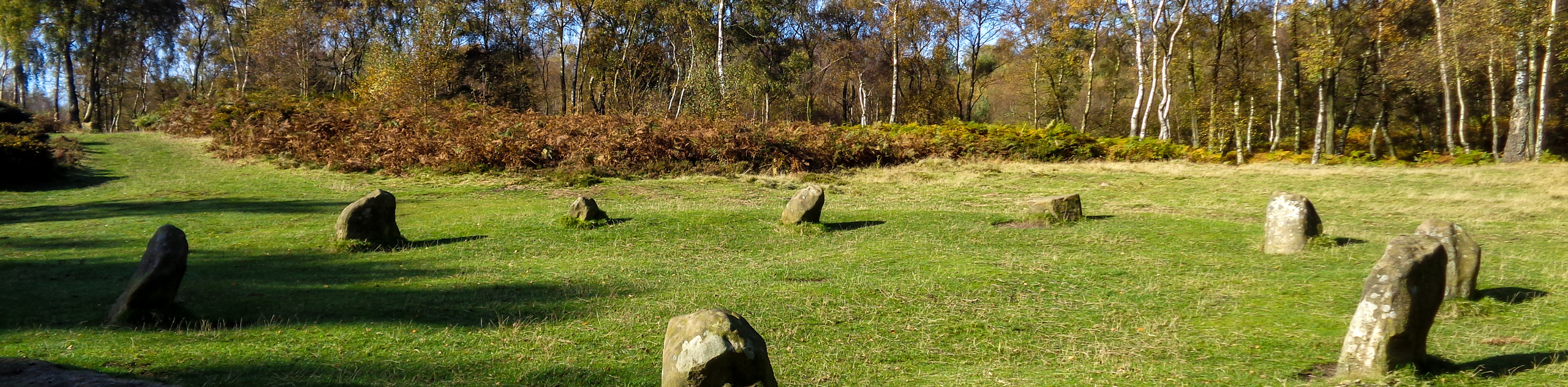
The area atop Stanton Moor features a strong network of interlacing paths that lead to several unique historical features including The Nine Ladies Stone Circle and the Earl Grey Tower. Take some time to explore the area if you wish to gain an insight into the complex historical past of the area, or continue along the trail by heading right at the fork. In 0.1mi, make a sharp left turn along the trail and continue on through the tree cover until you arrive at a gate. Pass through the gate and turn right, followed by an immediate left to continue along the path for 0.2mi. Turn left here to pass over a stile and exit the canopy of the forest on the way to meet back up with Lees Road.
Turn right along the road and keep on for 0.2mi, where you will make another right. Follow the road for another 0.2mi, where you will find a walking path branching off to the left. Take this and continue on for 0.5mi, passing through a series of gates to eventually arrive at Stanton Woodhouse. Make your way between the cottage buildings and along the lane, where you will find a trail on the left at the bend in the road. Take this and keep right at the fork to eventually pass through a kissing gate and meet back up with the lane. Follow the road left and continue on for 0.8mi as it winds through stretches of forest and open farmland, bringing you back to the starting point of the Stanton Moor Walk. After completing your journey, make your way into the village to explore some local history and grab a bite to eat before heading home.
Other amazing walks in Peak District National Park
Check out our guides to Kinder Scout, Mam Tor, Stanage Edge, Dovedale, and Padley Gorge. Or see all of our Peak District walks on 10Adventures.
Insider Hints
Pop into the historic Caudwell’s Mill after your walk to learn about local history and enjoy some refreshments at the cafe.
Sections of the trail are steep, uneven, and muddy, so make sure to wear proper walking footwear.
Keep your dogs on a lead, as livestock may be roaming around in some of the fields that the trail traverses.

Similar hikes to the Stanton Moor Walk hike

Valehouse Reservoir Circular
The Valehouse Reservoir Circular is a 3.1mi lollipop trail near Glossop that travels around the edge of the…

Three Edges Walk
The Three Edges Walk is a challenging circuit in Derbyshire that will take you along three escarpments that offer some…

Edale Rocky Ridges Walk
The Edale Rocky Ridges Walk is just that - an adventurous walk along a rugged ridgeline. While out on the…
PaulMcCafferty 3 years ago