
Grindleford to Hathersage Walk
View Photos
Grindleford to Hathersage Walk
Difficulty Rating:
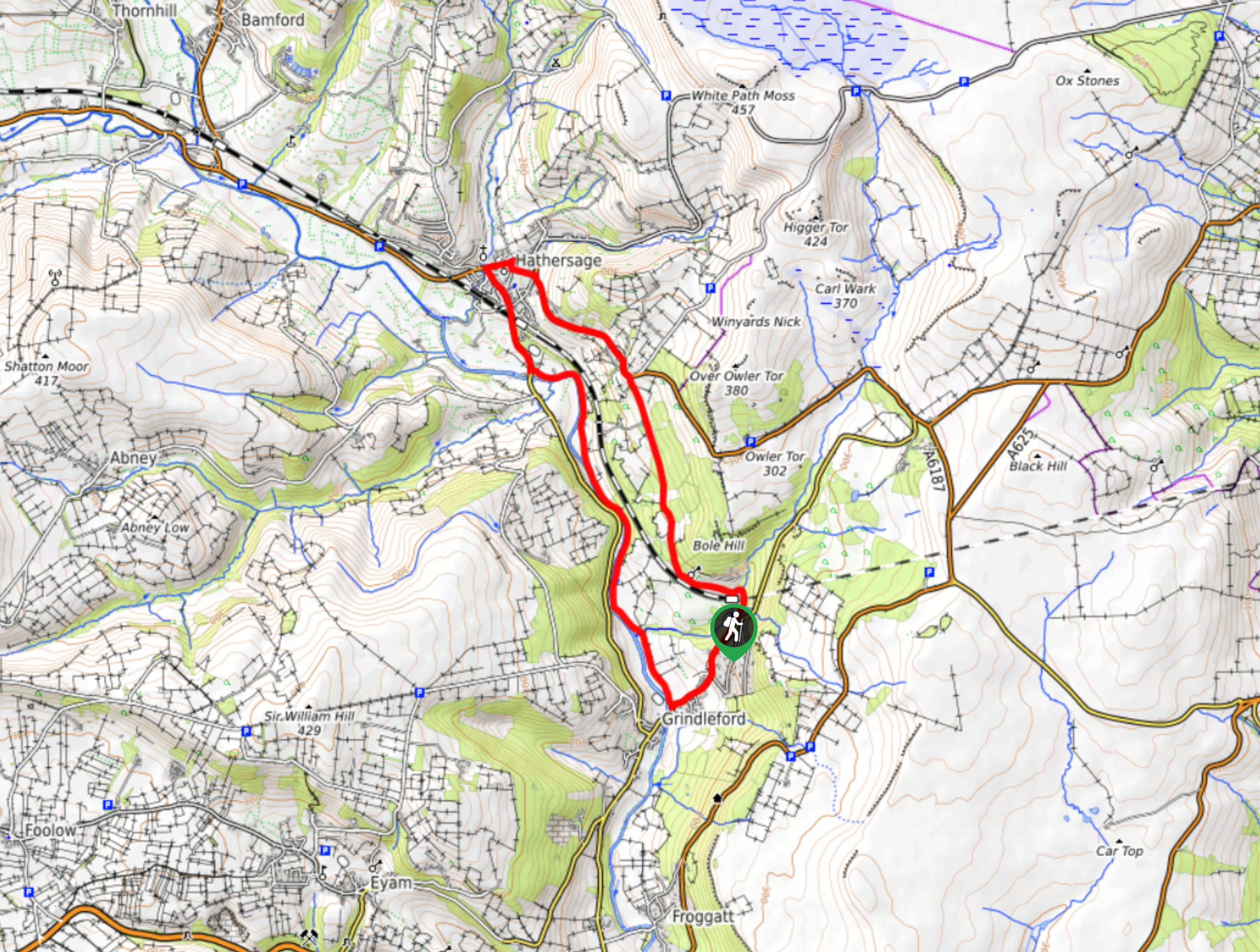
The walk from Grindleford to Hathersage is a 6.3mi circuit that will take you across the charming Peak District terrain that separates these two historic villages. While out on the trail, you will make your way through serene stretches of woodland and the wonderful waterside setting along the edge of the River Derwent. This easy-going walk is perfect for a pleasant weekend stroll through the Derbyshire countryside.
Getting there
To reach the parking area for the Grindleford to Hathersage Walk from Calver, drive northwest on Main Road/A625 for 0.2mi and continue straight onto Main Road/B6001 for another 2.2mi. Continue onto B6521 and follow it for 0.2mi before making a slight left onto Midland Cottages. You will find parking at the roadside in 0.1mi.

About
| When to do | March-November |
| Backcountry Campsites | No |
| Pets allowed | Yes - On Leash |
| Family friendly | Yes |
| Route Signage | Average |
| Crowd Levels | Moderate |
| Route Type | Circuit |
Grindleford to Hathersage Walk
Elevation Graph
Weather
Grindleford to Hathersage Walk Description
The Grindleford to Hathersage Walk is a popular family-friendly route due to its easy-to-navigate but varied terrain and scenic views across the Peak District landscape. The trail sets out near the Grindleford railway station and heads northwest through Bole Hill Wood, crossing a mix of forest and farmland terrain until you arrive in the charming village of Hathersage. Here, you can pop in and out of the shops or visit the grave site of Robin Hood’s companion Little John before continuing south along the trail. The return journey of the walk follows closely alongside the flowing waters of the River Derwent until you arrive back in Grindleford. At this point, you will need to traverse the woodlands to the northeast in order to return to the starting point of the walk.
Other amazing walks in Peak District National Park
Check out our guides to Kinder Scout, Mam Tor, Stanage Edge, Dovedale, and Padley Gorge. Or see all of our Peak District walks on 10Adventures.
Similar hikes to the Grindleford to Hathersage Walk hike

Valehouse Reservoir Circular
The Valehouse Reservoir Circular is a 3.1mi lollipop trail near Glossop that travels around the edge of the…

Three Edges Walk
The Three Edges Walk is a challenging circuit in Derbyshire that will take you along three escarpments that offer some…

Edale Rocky Ridges Walk
The Edale Rocky Ridges Walk is just that - an adventurous walk along a rugged ridgeline. While out on the…
Comments