
Ladybower and Lead Hill Walk
View PhotosLadybower and Lead Hill Walk
Difficulty Rating:
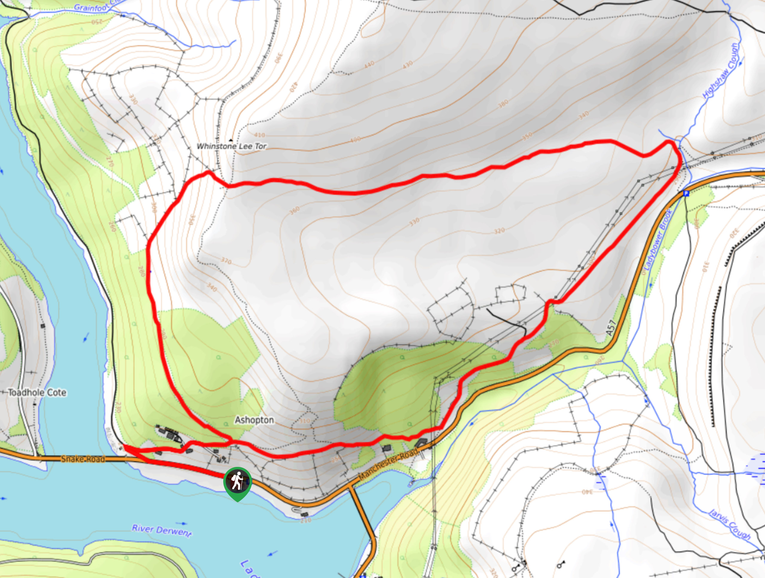
The Ladybower and Lead Hill Walk is a relatively short adventure in the Derwent Valley that will lead you uphill for some nice views overlooking the reservoir. While out on the trail, you will climb up Lead Hill along its steep western slope before circling around the hilltop to descend along the tranquil forests of the Priddock and Ladybower woods. This trail is well-maintained and easy to navigate, making for a pleasant stroll in the beautiful Peak District.
Getting there
To reach the car park for the Ladybower and Lead Hill Walk from Bamford, drive north on Main Road/A6013 for 2.0mi and turn left onto the A57. In 0.3mi, you will find roadside parking on the left.

About
| When to do | March-November |
| Backcountry Campsites | No |
| Pets allowed | Yes - On Leash |
| Family friendly | Yes |
| Route Signage | Average |
| Crowd Levels | Moderate |
| Route Type | Lollipop |
Ladybower and Lead Hill Walk
Elevation Graph
Weather
Ladybower and Lead Hill Walk Description
The Ladybower and Lead Hill Walk is a scenic adventure that can be found in the Derwent Valley, a popular destination for outdoor enthusiasts of varying degree, from walkers to cyclists and climbers. Setting out from the parking area at the side of the road, follow the road west toward the Ashopton Viaduct before turning north to begin climbing the steep slopes of Lead Hill. From here, you will loop around the hill and enjoy some beautiful views across the water of Ladybower Reservoir and the surrounding Peak District landscape before descending the backside of the hill through the serene woodland terrain of the Priddock and Ladybower woods. After a short walk along the lower slopes of the hill, you will arrive back at the side of the road where you began the walk.
Other amazing walks in Peak District National Park
Check out our guides to Kinder Scout, Mam Tor, Stanage Edge, Dovedale, and Padley Gorge. Or see all of our Peak District walks on 10Adventures.
Similar hikes to the Ladybower and Lead Hill Walk hike

Valehouse Reservoir Circular
The Valehouse Reservoir Circular is a 3.1mi lollipop trail near Glossop that travels around the edge of the…

Three Edges Walk
The Three Edges Walk is a challenging circuit in Derbyshire that will take you along three escarpments that offer some…

Edale Rocky Ridges Walk
The Edale Rocky Ridges Walk is just that - an adventurous walk along a rugged ridgeline. While out on the…
Comments