Skyline Trail: Cactus to Clouds
View Photos
Skyline Trail: Cactus to Clouds
Difficulty Rating:
The Skyline Trail: Cactus to Clouds ranks as one of the most strenuous hikes in the world! Yep—this hike will challenge you both mentally and physically. Therefore, training before attempting this crazy, rewarding adventure is essential. Luckily, once you've reached the peak, you can rest your legs and take the Palm Springs Aerial Tramway down the mountain.
Getting there
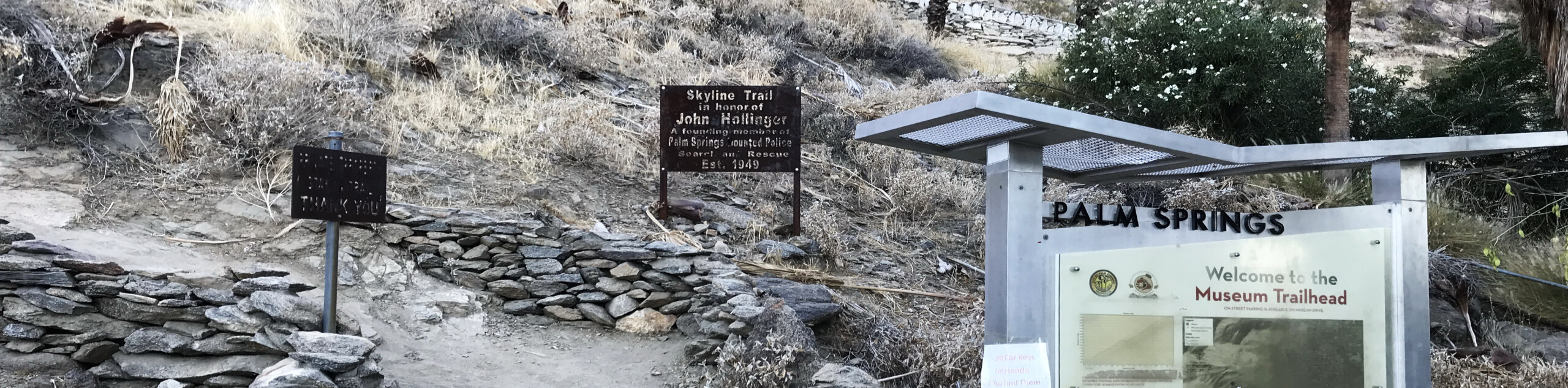
To get to the Skyline Trail: Cactus to Clouds, head to the Palm Springs Art Museum. You can park along the street. You can also take public transport to the museum. Do note that the Palm Springs Aerial Tramway will drop you off over 6.2mi away from the museum. You'll need to take a cab back to the museum to reach your car. If you're hiking with someone, one of you can park at the tramway at the Palm Springs Visitor Center, but it costs $10. Coachella Valley residents can park for free by showing proof of address.

About
| Backcountry Campground | Round Valley Campground |
| When to do | March-April; October-November |
| Pets allowed | No |
| Family friendly | No |
| Route Signage | Average |
| Crowd Levels | Moderate |
| Route Type | One Way |
Skyline Trail: Cactus to Clouds
Elevation Graph
Weather
Skyline Trail: Cactus to Clouds Description:
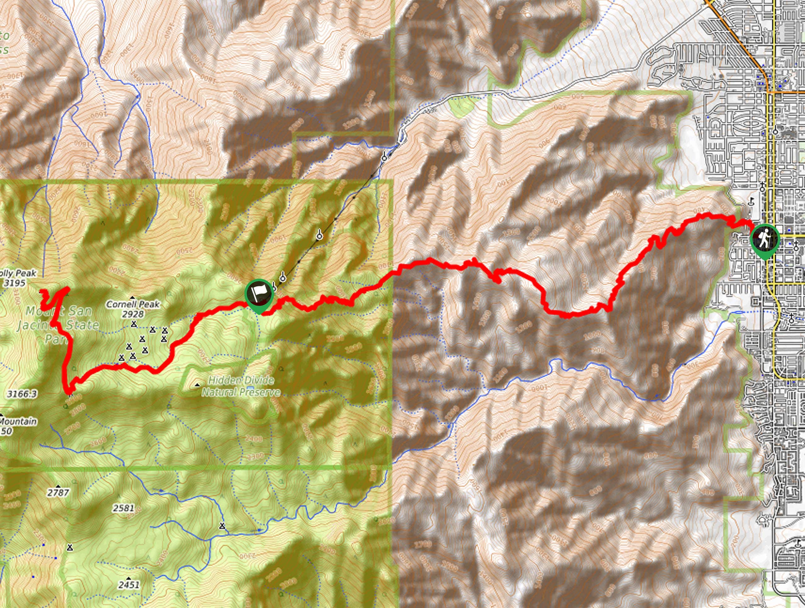
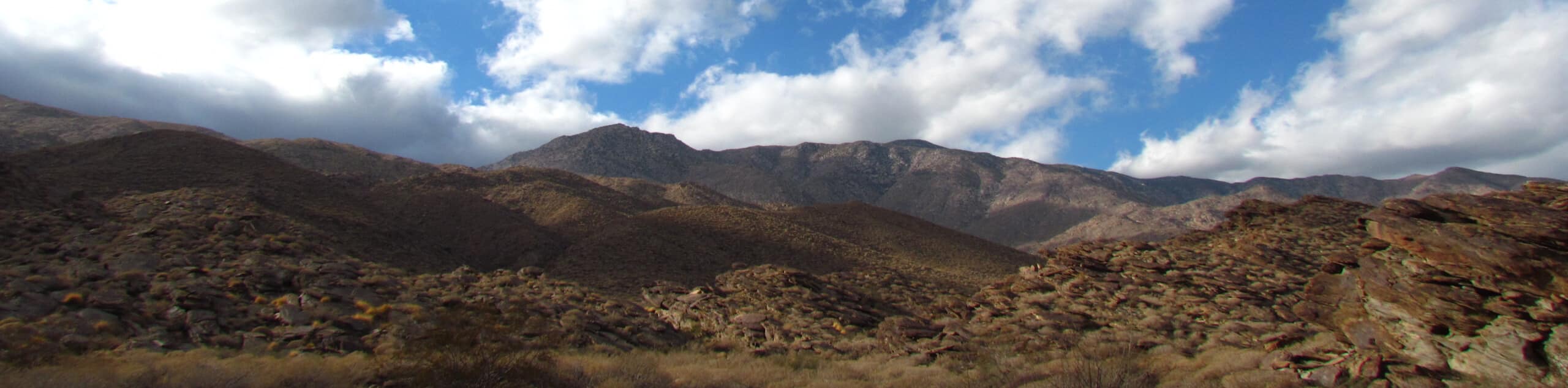
The Skyline Trail: Cactus to Clouds (C2C) is not for the faint of heart. It’s essential to train via other challenging routes with steep inclines before setting foot on this trail. Most hikers take around 13 hours to complete this adventure. Those physically unfit may increase the possibility of injury (or worse) if they attempt the Skyline Trail: Cactus to Clouds without training. Experience is a must! The first 11.8mi will push you through over 7874ft in elevation gain. Talk about exhausting! Remember that this is a one-way trail, but you can take the Palm Springs Aerial Tramway down the mountain, then book a cab for your 6.2mi ride back to the trailhead.
The trail can also be tricky to follow, especially if you’re starting in the early morning when it’s still dark. Do yourself a favor and download the GPS before going. If you find yourself suddenly dipping downhill, you’re probably off track. You’ll always be moving up along the C2C. This hike is also a compilation of several other trails, so there’s no “official” track to follow—another reason why the GPS is important!
The C2C Trail might tire you out and leave you sore for days afterward, but nothing beats the feeling of completing the most strenuous hiking trail in the United States (and possibly the world). That tram down the mountain will feel so good! So what do you need to know about the route? Let’s get into it.
Setting out along the Skyline Trail from the Palm Springs Art Museum, where you parked your car, you’ll follow an easy-to-follow path. However, a network of trails will soon pop up, potentially inducing confusion. (This is another reminder to download a GPS before going!) One way to check if you’re on track is to look for blazes and white dots.
The trail gets you on an incline almost immediately: surmounting 899ft in just over 0.9mi. At this point, you’ll reach a compilation of somewhat alarming signs. Some warn of rattlesnakes, ticks, scorpions, and the fact that there is no water for 8.0mi. If you’re huffing and puffing when you reach these signs with little water left, it might be best to bask in the view from the picnic tables, then turn around. It’s a pretty decent lookout!
After this, head up the ridge towards a marked junction. If you go left, the path will take you down to the desert, so don’t take this turn if you plan on sticking out the C2C trail. Most of the track is relatively straightforward to navigate from here on out, thankfully.
Soon, you’ll reach a climb that takes you northwest. Depending on the time of year, you should put on microspikes here. In general, it’s best to pack microspikes along.
Continue making your way up to Long Valley, where you’ll eventually meet a nice reprieve: a flat section. You’ll see picnic benches and a ranger station! You can fill your water up at the ranger station—yay! Be sure to register yourself here as well.
After replenishing with water, enjoy the maintained trails heading to the summit! Then, head back towards the tram, ensuring you catch the last ride before it shuts down for the night. Check out the tram schedule here.
Frequently Asked Questions
How long does the Skyline Trail: Cactus to Clouds hike take?
It takes around 13-16 hours for experienced hikers to complete.
When should I start the Skyline Trail: Cactus to Clouds hike?
Some hikers suggest starting as early as 1am. This allows you to beat the desert heat. However, it’s important to plan ahead and be flexible with your timing. For example, if one day is too hot, skip that day and wait for the temperatures to cool a bit before going.
What’s the best way to train for the Cactus to Clouds hike?
In general, the Cactus to Clouds hike can take around 13 hours to complete, so try to go on hikes that have you moving for a similar amount of time. Nothing will compare to the incline of this hike, so it’s a good idea to get out and hike super-long trails with steeper elevation gains to prepare.
Insider Hints
Bring layers for temperature changes throughout the hike.
You may encounter ice and snow along the hike, so bring microspikes and poles to help navigate these sections.
Pack a headlamp for traversing the initial section in the darker hours of the morning.
Bring loads of extra water and snacks!
Pack survival gear and figure out a way to prepare for any emergency—there have been fatalities on this trail, so do your research and come prepared!
Similar hikes to the Skyline Trail: Cactus to Clouds hike
North Lykken Trail to Palm Springs Art Museum
Looking for a good workout? North Lykken Trail to Palm Springs Art Museum takes you along a challenging trail to…
Murray Hill Loop Hike
The Murray Hill Loop Hike is an adventure tailored for experienced and fit hikers. This hike is not for the…
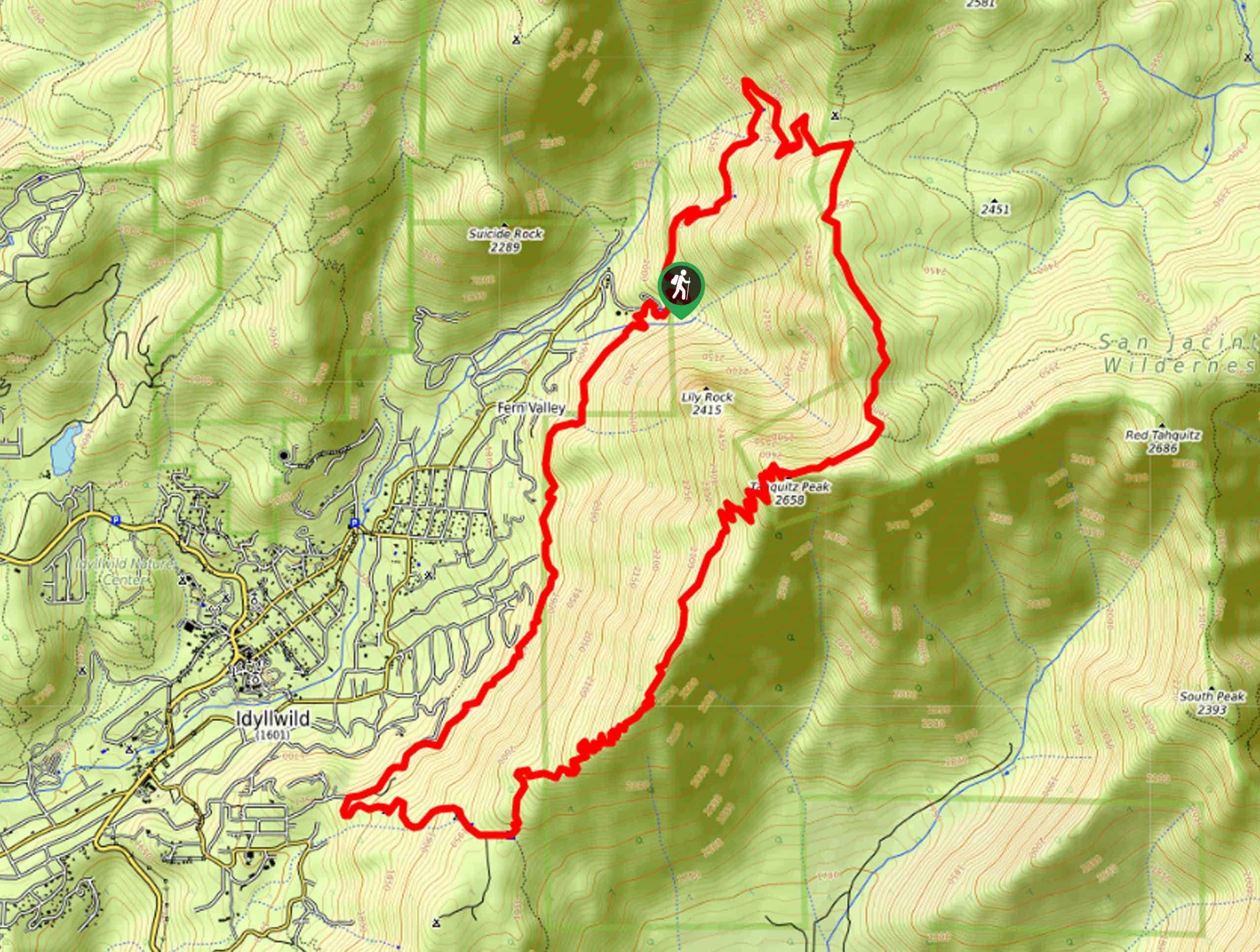
Tahquitz Peak Loop Hike
The Tahquitz Peak Loop Hike takes you along a strenuous, punishing path hugged by nature towards the ever-so-rewarding Tahquitz Peak…
Comments