
Warden to Simonburn Walk
View Photos
Warden to Simonburn Walk
Difficulty Rating:
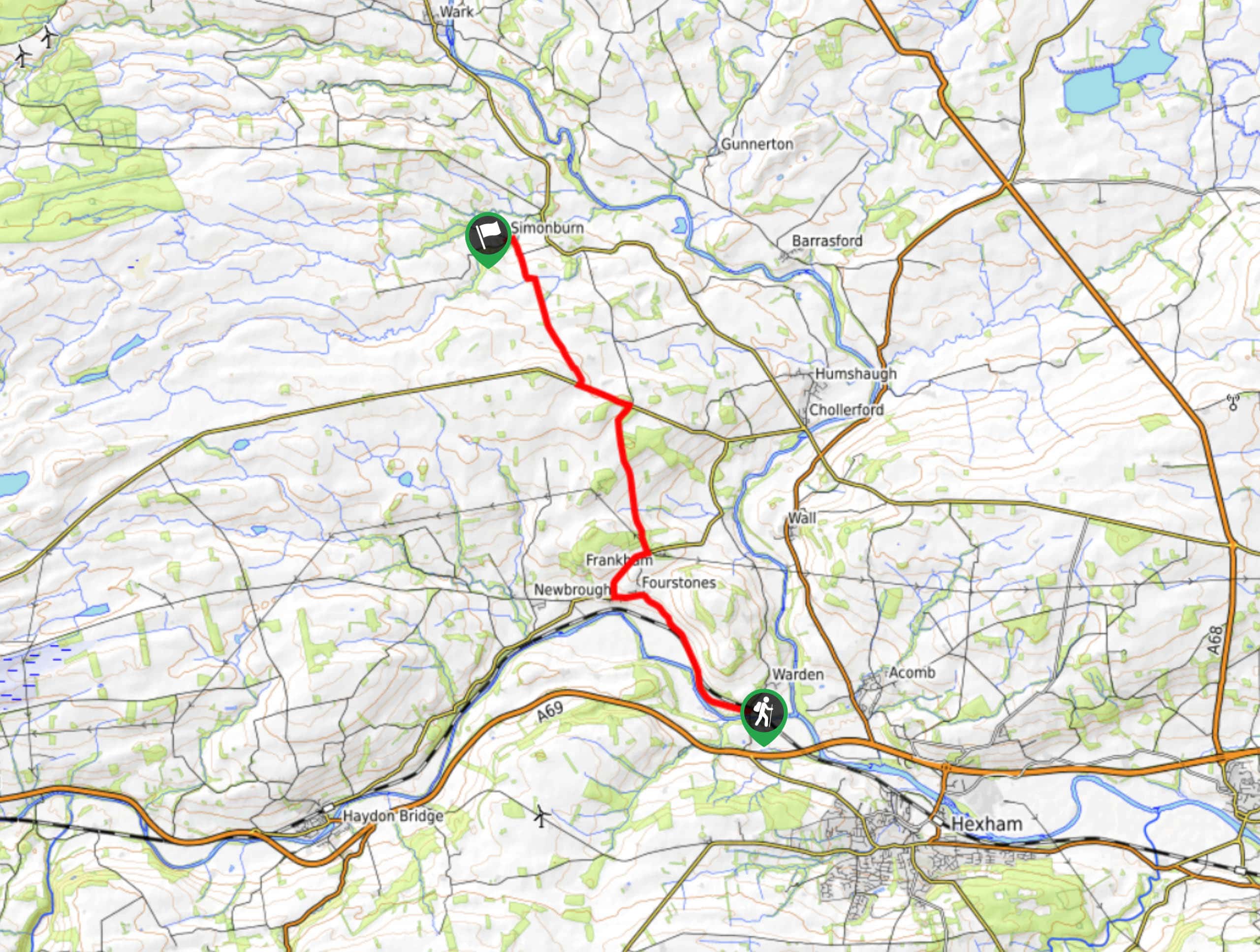
The Warden to Simonburn Walk is a pleasant journey through the Northumberland countryside that offers some nice views and passes by interesting historical sites. While out walking the trail, you will make your way along the banks of the River South Tyne and traverse the open farmland, before passing by Hadrian’s Wall on the way into Simonburn. Walkers should take note that this is a one-way trail, so you will need to either make travel arrangements or double the overall distance to return to the trailhead.
Getting there
The trailhead for the Warden to Simonburn Walk can be found next to the Boatside Inn, just southwest of Warden.

About
| Backcountry Campground | No |
| When to do | Year-Round |
| Pets allowed | Yes - On Leash |
| Family friendly | Yes |
| Route Signage | Average |
| Crowd Levels | Moderate |
| Route Type | One Way |
Warden to Simonburn Walk
Elevation Graph
Weather
Warden to Simonburn Walk Description
A mixture of charming riverside settings, picturesque Northumberland farmland, and ancient Roman historical sites await on the Warden to Simonburn Walk, making it a great option for a wide variety of outdoor enthusiasts looking to explore the natural and manmade beauty of Northern England.
Setting out from the trailhead next to the Boatside Inn, you will head to the northwest along the road as it runs parallel to banks of the River South Tyne. After arriving at the village of Fourstones, you will turn right onto B6319 and follow it north, climbing uphill across the countryside to eventually reach the edge of Military Road.
Turning left here, you will follow the road for a distance, before eventually picking up a trail on the right that will lead you past Hadrian’s Wall. Here, you will be able to check out the UNESCO World Heritage Site and the Black Carts Turret, one of the many fortified outposts along the ancient Roman fortification. From the wall, you will continue on to the northwest, traversing the open countryside on the way into the endpoint of the walk in Simonburn.
Similar hikes to the Warden to Simonburn Walk hike

Hadrian’s Wall: Steel Rigg to Lanercost
Walking Hadrian’s Wall: Steel Rigg to lanercost is a fantastic - albeit lengthy - adventure that will lead you across…

Hadrian’s Wall: Wallsend to Heddon on the Wall
Hadrian’s Wall: Wallsend to Heddon on the Wall is the first section of the long distance Hadrian’s Wall Path walking…

Scotch Gill Woods Walk
The Scotch Gill Woods Walk is a short and easy-going adventure in Morpeth, Northumberland that will take you through a…
Comments